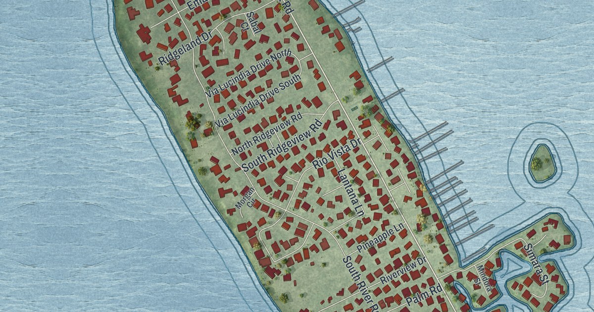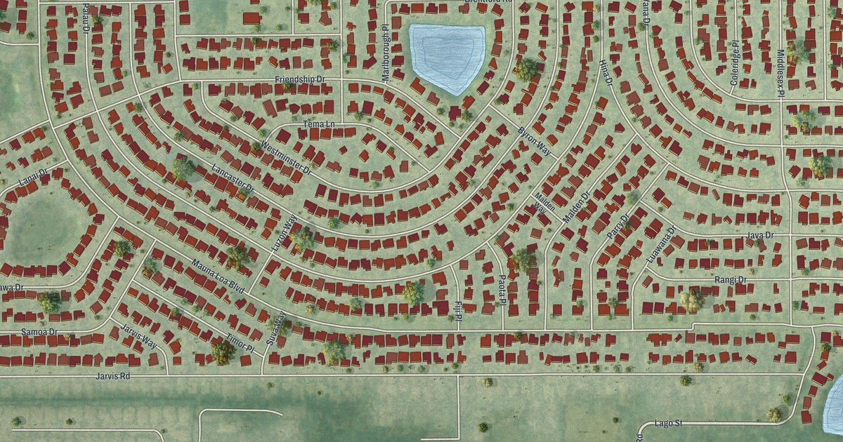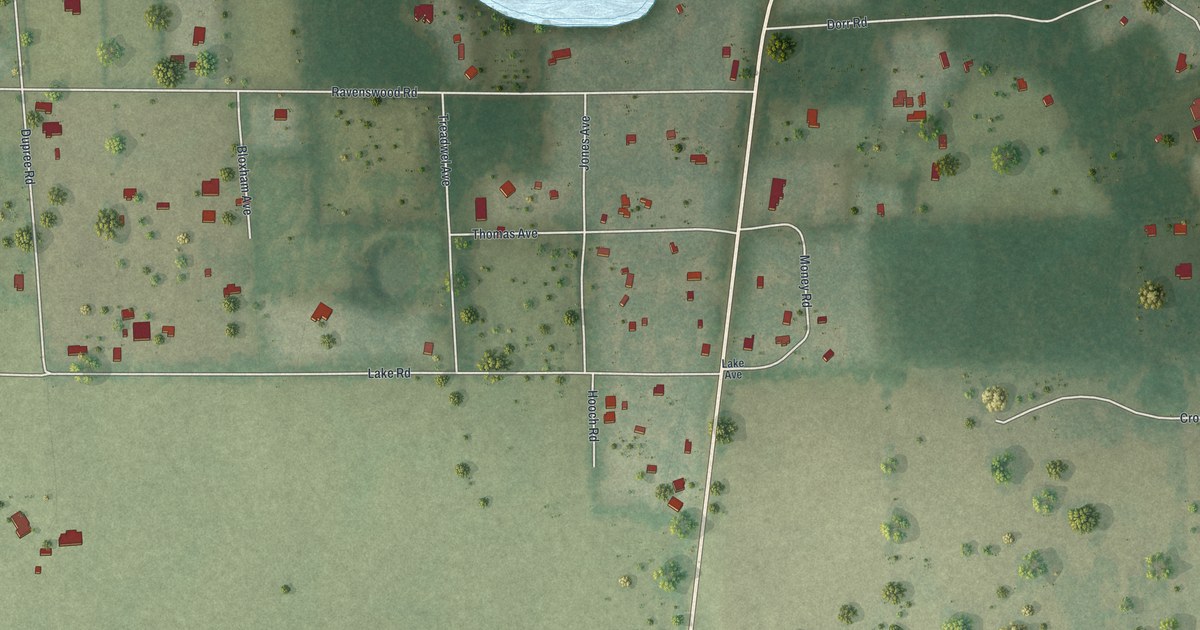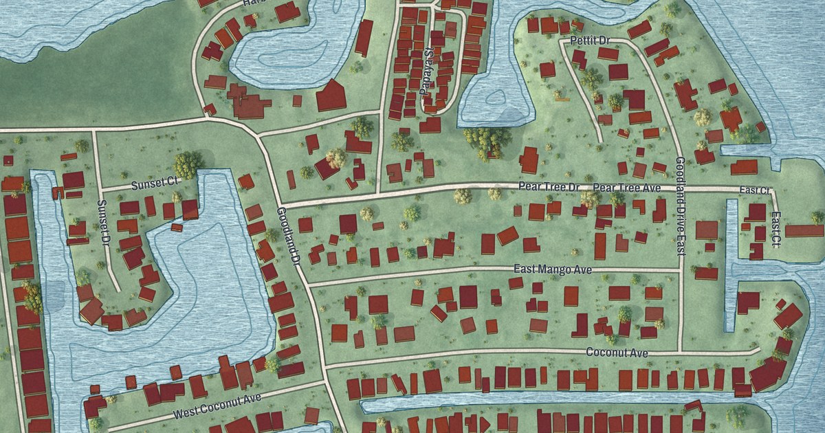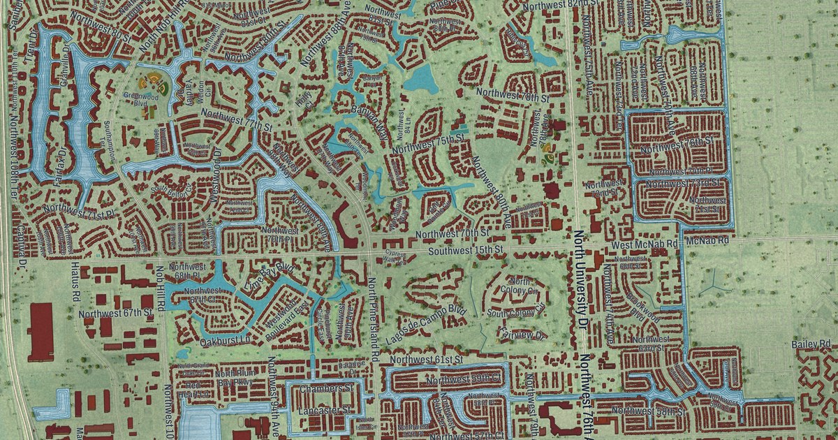
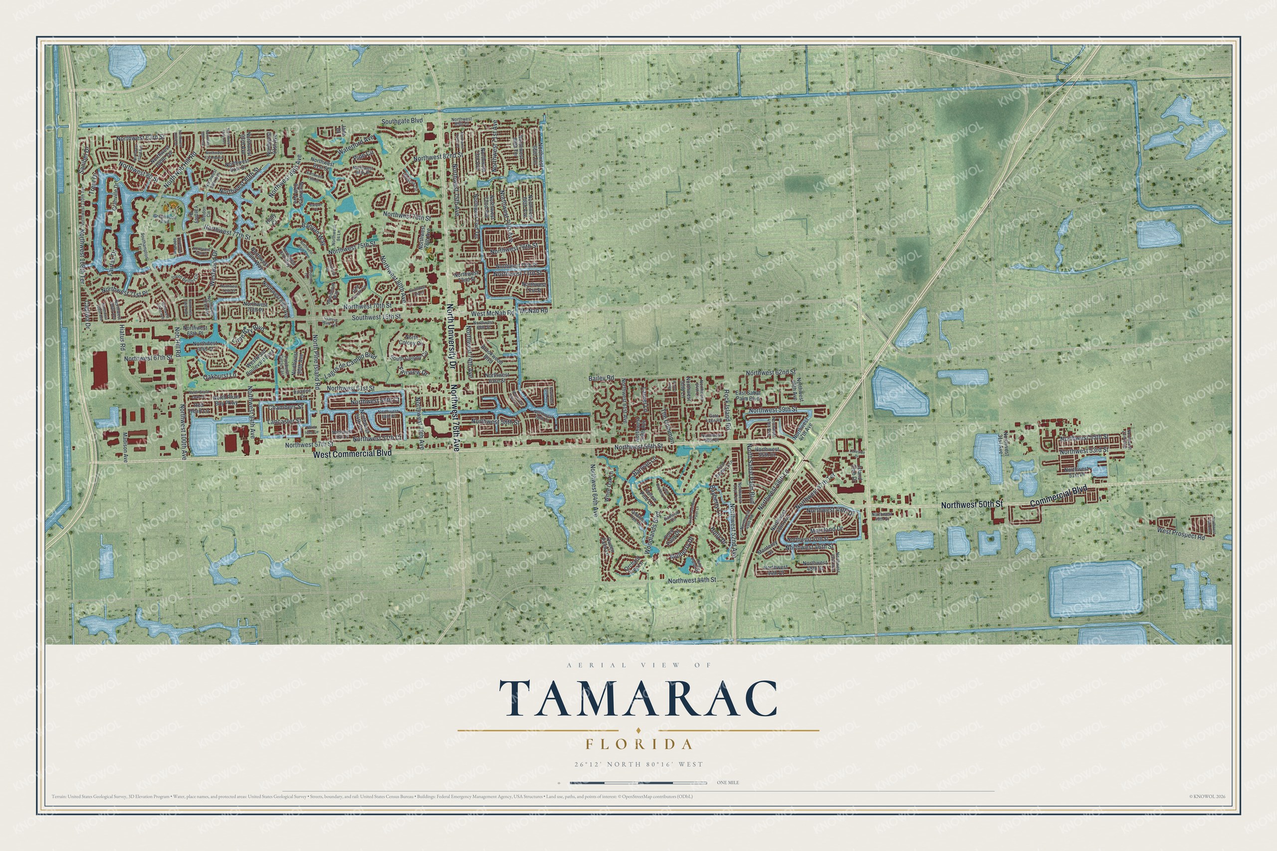
This beautifully detailed map of Tamarac, Florida was created in 2026 using aerial imagery combined with modern topographical, census, street and landmark data. It’s a one-of-a-kind view of Tamarac that combines accurate data with a vintage aesthetic. The map shows every building in its true location, many of the roads carry their names, and the shaded topographic relief shows the shape of the land.
Explore an aerial view of Tamarac, Florida
On the map you’ll find West Commercial Boulevard, North University Drive, Northwest 50th Street, Commercial Boulevard, Northwest 76th Avenue, West McNab Road, West Prospect Road, Northwest 44th Street, Nob Hill Road, Northwest 80th Street, North Nob Hill Road, Northwest 57th Court, and more. If you look closely you can even find your house accurately drawn in its correct location. Zoom in on the preview to look for yours.
Did You Know?
In the early 1960s, a young developer from the Midwest named Ken Behring bought land here. He built an active adult community of two-bedroom homes that needed no upkeep. He named his new city Tamarac, after the Tamarac Country Club in nearby Oakland Park.
Take a closer look at the Tamarac map
Names on this map
These names are printed on this map.
Streets and roads: West Commercial Boulevard, North University Drive, Northwest 50th Street, Commercial Boulevard, Northwest 76th Avenue, West McNab Road, West Prospect Road, Northwest 44th Street, Nob Hill Road, Northwest 80th Street, North Nob Hill Road, Northwest 57th Court.
More street names, A to Z
Ann Lee Lane, Bailey Road, Bamboo Circle, Banyan Court, Banyan Lane, Banyan Way, Bayberry Lane, Brookwood Boulevard, Captiva Drive, Chambers Street, Coco Palm Drive, Corkwood Terrace, Cypress Walk Terrace, East Bayberry Lane, East Sabal Palm Boulevard, Fairfax Drive, Fairview Drive, Gate Lake Road, Golf Pointe Circle, Granville Drive, Greenwood Boulevard, Hiatus Road, Hibiscus Circle, Holly Court, Holly Drive, Island Club Drive, Jade Drive, King Palm Drive, Lagos de Campo Boulevard, Lakeside Drive, Lancaster Street, Laurel Lane, Lime Bay Boulevard, Madison Avenue, Mainland Drive, McNab Road, Monterey Drive, Mulberry Drive, North Colony Circle, North Grand Duke Circle, North Isles Circle, North Pine Island Road, North Plum Bay Parkway, North Sabal Palm Boulevard, North Travelers Palm Lane, Northwest 16th Avenue, Northwest 22nd Avenue, Northwest 31st Avenue, Northwest 43rd Avenue, Northwest 44th Court, Northwest 45th Street, Northwest 46th Avenue, Northwest 46th Street, Northwest 47th Avenue, Northwest 47th Street, Northwest 47th Terrace, Northwest 48th Avenue, Northwest 48th Lane, Northwest 49th Avenue, Northwest 49th Drive, Northwest 49th Road, Northwest 49th Street, Northwest 51st Place, Northwest 51st Terrace, Northwest 52nd Avenue, Northwest 53rd Street, Northwest 54th Lane, Northwest 55th Court, Northwest 55th Lane, Northwest 55th Street, Northwest 56th Court, Northwest 56th Street, Northwest 57th Place, Northwest 57th Street, Northwest 58th Court, Northwest 58th Place, Northwest 58th Street, Northwest 59th Avenue, Northwest 59th Court, Northwest 59th Street, Northwest 61st Avenue, Northwest 61st Street, Northwest 62nd Street, Northwest 63rd Street, Northwest 64th Avenue, Northwest 66th Terrace, Northwest 67th Avenue, Northwest 67th Court, Northwest 67th Street, Northwest 68th Avenue, Northwest 68th Place, Northwest 68th Street, Northwest 68th Terrace, Northwest 69th Avenue, Northwest 70th Avenue, Northwest 70th Place, Northwest 70th Street, Northwest 71st Avenue, Northwest 71st Court, Northwest 71st Place, Northwest 71st Street, Northwest 72nd Avenue, Northwest 72nd Court, Northwest 72nd Street, Northwest 73rd Avenue, Northwest 73rd Street, Northwest 73rd Terrace, Northwest 74th Avenue, Northwest 74th Place, Northwest 74th Terrace, Northwest 75th Avenue, Northwest 75th Court, Northwest 75th Street, Northwest 76th Street, Northwest 77th Street, Northwest 78th Avenue, Northwest 78th Street, Northwest 79th Avenue, Northwest 79th Street, Northwest 80 Street, Northwest 80th Avenue, Northwest 80th Place, Northwest 81st Court, Northwest 81st Manor, Northwest 81st Street, Northwest 82nd Street, Northwest 83rd Street, Northwest 84 Lane, Northwest 84th Terrace, Northwest 85th Court, Northwest 86th Terrace, Northwest 87th Avenue, Northwest 87th Way, Northwest 88th Avenue, Northwest 88th Way, Northwest 89th Avenue, Northwest 90th Avenue, Northwest 91st Avenue, Northwest 93rd Avenue, Northwest 94th Avenue, Northwest 95th Avenue, Northwest 96th Avenue, Northwest 97th Avenue, Northwest 98th Avenue, Northwest 99th Avenue, Northwest 99th Way, Northwest 100th Avenue, Northwest 100th Drive, Northwest 100th Terrace, Northwest 101st Avenue, Northwest 103rd Avenue, Northwest 106th Avenue, Northwest 108th Avenue, Northwest 108th Terrace, Northwest 110th Terrace, Oakburst Lane, Orchard Tree Lane, Paradise Drive, Pine Circle, Pinehurst Circle East, Queen Palm Lane, Red Heart Lane, Rock Island Road, Sanibel Drive, Southampton Terrace, South Bayberry Lane, South Belfort Circle, South Colony Circle, Southgate Boulevard, Southwest 15th Street, The Common, Trent Drive, Umbrella Tree Lane, Waterford Avenue, Weldon Circle, Westwood Boulevard East, Westwood Drive, White Oak Lane, Woodlands Boulevard, Woodmont Terrace, Woodmont Way, Yardley Drive, Yellow Pine Lane.
See it on a wall
The Tamarac map as a framed print. Swipe for more.


This beautifully detailed map of Tamarac makes an attractive addition to your office, library, or den, and it can even be used to teach children the geography and history of the area. It also makes a great gift for anyone who grew up in Tamarac or moved away. When you’re done exploring, click here to get your copy of the Tamarac map.