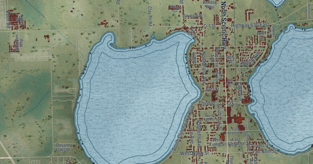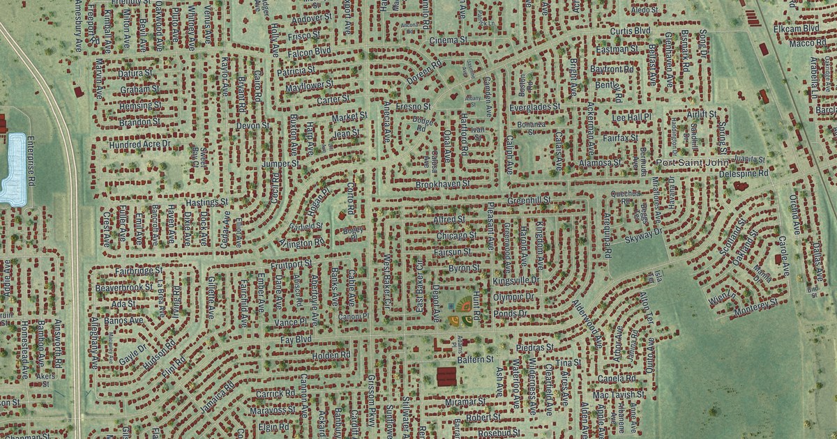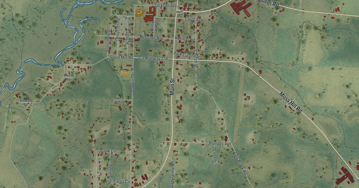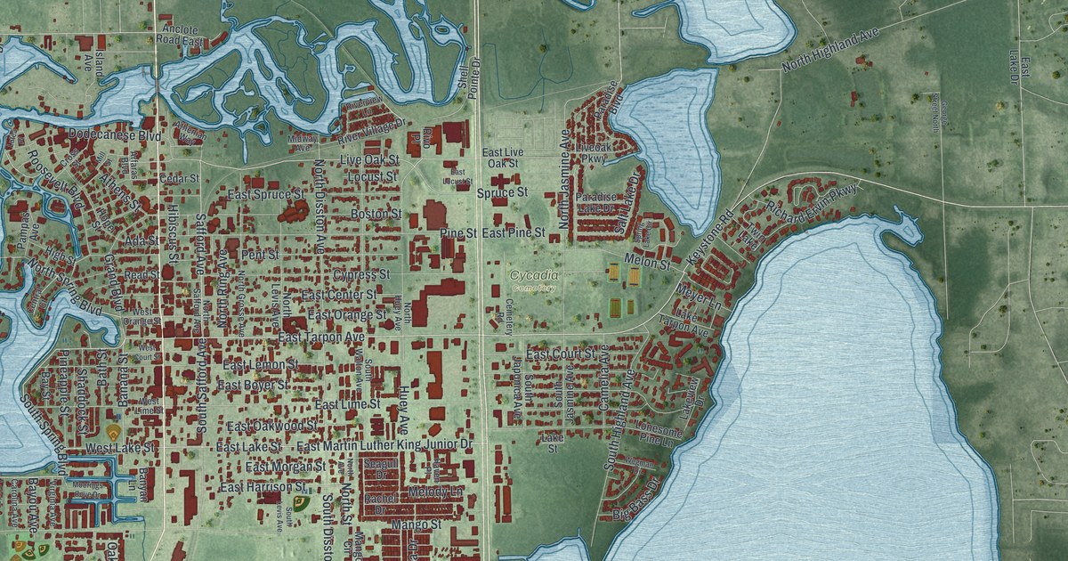
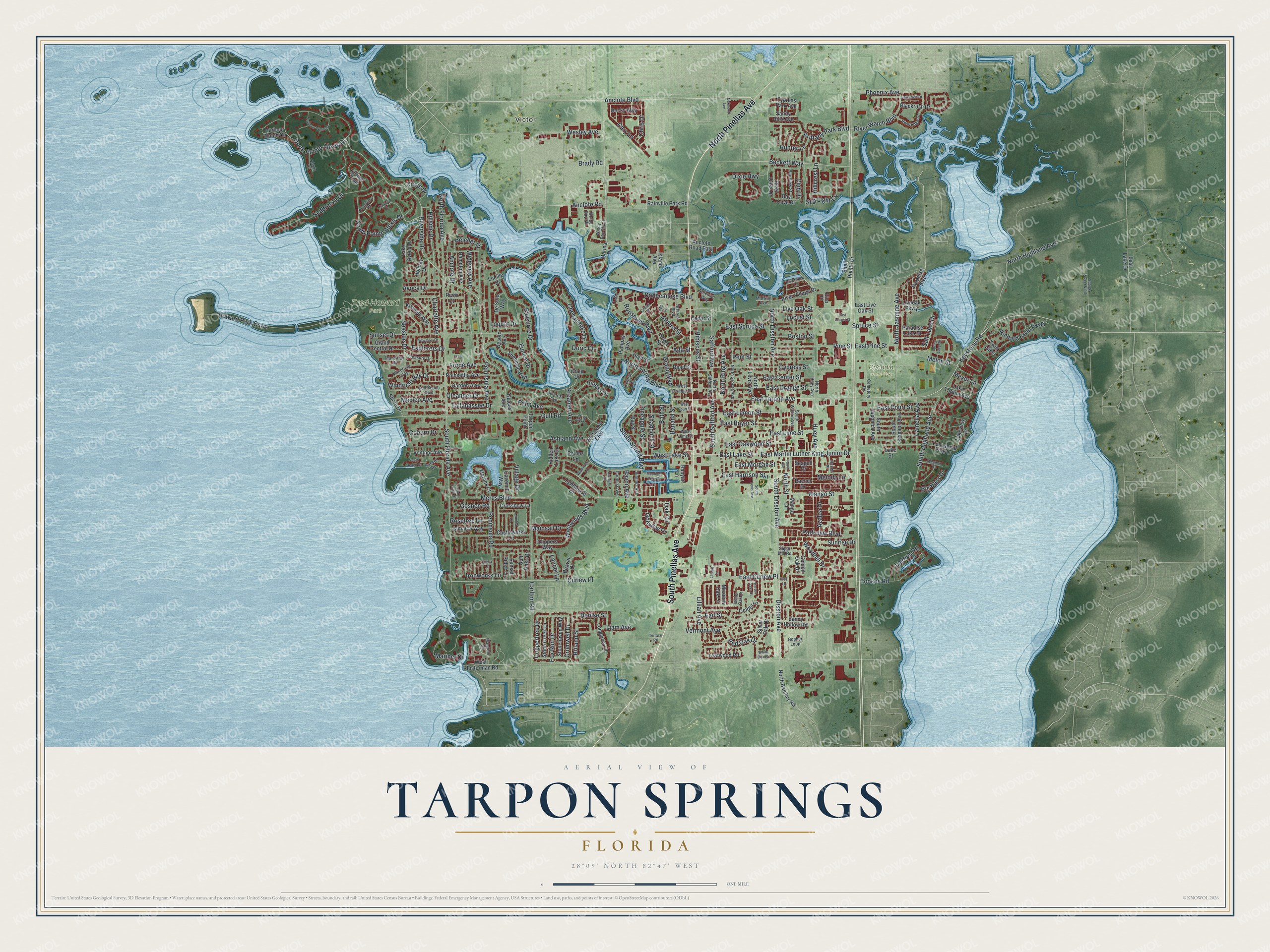
This beautifully detailed map of Tarpon Springs, Florida was created in 2026 using aerial imagery combined with modern topographical, census, street and landmark data. It’s a one-of-a-kind view of Tarpon Springs that combines accurate data with a vintage aesthetic. The map shows every building in its true location, many of the roads carry their names, and the shaded topographic relief shows the shape of the land.
Explore an aerial view of Tarpon Springs, Florida
On the map you’ll find Victor, Cycadia Cemetery, and Fred Howard Park, along with Pinellas Avenue, Riverside Drive, Tarpon Avenue, Spring Boulevard, Anclote Boulevard, and more. If you look closely you can even find your house accurately drawn in its correct location. Zoom in on the preview to look for yours.
Did You Know?
Tarpon Springs was founded in 1876. Settlers named it for the tarpon they believed spawned in Spring Bayou. They were mostly wrong. The fish splashing in the bayou, the river and the lagoons were mostly mullet. That’s from the 1939 WPA guide to Florida.
Take a closer look at the Tarpon Springs map
Names on this map
These names are printed on this map.
Places: Victor, Cycadia Cemetery, Fred Howard Park and Twin Lake.
Streets and roads: North Pinellas Avenue, South Pinellas Avenue, Riverside Drive, East Tarpon Avenue, South Spring Boulevard, North Spring Boulevard, Anclote Boulevard, Banana Street, Safford Avenue, Live Oak Street, Anclote Road, South Pointe Alexis Drive.
More street names, A to Z
Ada Street, Alexis Court, Anclote Drive, Anclote Road East, Arfaras Boulevard, Ashland Avenue, Athenian Way, Athens Street, Avoca Drive, Azalea Drive, Banyan Lane, Bath Street, Bay Cove Drive, Bayou Avenue, Bayshore Drive, Bay Street, Bay View Street, Beaver Drive, Beckett Way, Becky Way, Belcher Drive, Big Bass Drive, Blackrush Drive, Boston Street, Brady Road, Briland Street, Brittany Park Boulevard, Camelia Avenue, Caravel Court, Carlton Road, Carolina Avenue, Cary Lane, Castleworks Lane, Cavemill Way, Cedar Street, Cemetery Road, Central Court, Charlotte Avenue, Chesapeake Drive, Chris Drive, Circle Drive, Citrine Trail, Clippers Way, Club Drive, Coburn Drive, Colony South Drive, Coppertree Drive, Craig Drive, Cromwell Drive, Crossbow Lane, Cross Street, Curlew Place, Cypress Park Avenue, Cypress Street, Denise Street, Desoto Avenue, De Soto Way, Disston Avenue, Dixie Highway, Dodecanese Boulevard, Doric Court, Earl Street, East Boyer Street, East Center Street, East Court Street, East Curlew Place, East Harrison Street, East Lake Drive, East Lake Street, East Lemon Street, East Lime Street, East Live Oak Street, East Locust Street, East Martin Luther King Junior Drive, East Morgan Street, East Oakwood Street, East Orange Street, East Pine Street, East Spruce Street, Eunice Drive, Explorers Drive, Forde Avenue, Fox Run Drive, Garden Avenue, George Street North, Glades Avenue, Golden Oak Drive, Golfview Drive, Gopher Loop, Goshen Road, Grand Boulevard, Grand Central Drive, Gulf Beach Boulevard, Gulf Oaks Drive, Gulf Road, Hamilton Avenue, Harbor Oaks Court, Harbour Watch Circle, Harbour Watch Drive, Haven Place, Hibiscus Street, Hidden Lake Drive, High Street, Hillcrest Avenue, Hillcrest Lane, Hillside Drive, Holiday Drive, Hope Street, Howard Park Causeway, Huey Avenue, Hunter Lane, Inness Drive, Ironworks Lane, Island Avenue, Ivey Lane, Jamaica Way, Kenneth Way, Keystone Road, Kreamer Avenue, Lagoon Road, Lake Avoca Drive, Lake Street, Lake Tarpon Avenue, Lakeview Drive, Lancer Lane, Lansden Court, Lauren Lane, Leafwood Road, Liam Avenue, Lighthouse Drive, Lillian Avenue, Liveoak Parkway, Locust Street, Lonesome Pine Lane, Longview Lane, Loquat Drive, Lucille Drive, Lutea Place, Lynnlea Lane, Mainsail Drive, Manatee Circle, Mandalay Drive, Mango Circle, Mango Street, Marina Drive, Mariner Drive, Meadow Oak Lane, Melody Lane, Melon Street, Meres Boulevard, Merlins Court, Mexico Avenue, Meyer Lane, Midway Avenue, Mill Street, Moorings Cove Drive, North Avenue, North Belcher Road, North Disston Avenue, North Florida Avenue, North Grosse Avenue, North Highland Avenue, North Huey Avenue, North Jasmine Avenue, North Levis Avenue, North Pointe Alexis Drive, North Ring Avenue, North Safford Avenue, North Street, Oak Circle, Oakmont Avenue, Oleander Drive, Palm Avenue, Pampas Avenue, Paradise Boulevard, Paradise Lake Drive, Park Avenue, Parkview Boulevard, Peninsula Avenue, Peninsula Road, Pent Street, Phoenix Avenue, Pineapple Street, Pine Street, Poinsettia Avenue, Pondview Court, Poulos Lane, Rachel Drive, Rainville Park Road, Read Street, Red Oak Drive, Richard Ervin Parkway, River Court, Riveredge Drive, River Oaks Drive, Riverview Lane, River Village Drive, River Watch Boulevard, Rivo Place, Roosevelt Boulevard, Rosetree Lane, Salt Lake Drive, Sandy Hills Avenue, Sandy Hollow Road, Sawgrass Drive, Seabreeze Drive, Seagull Drive, Seaside Drive, Seminole Boulevard, Shaddock Street, Shell Pointe Drive, Shore Drive, Silver Oak Drive, South Beach Drive, South Disston Avenue, South Florida Avenue, South Highland Avenue, South Japonica Avenue, South Jasmine Avenue, South Levis Avenue, South Safford Avenue, South Walton Avenue, Spring Lake Circle, Spruce Street, Star Light Cv, Stone Creek Drive, Stonehaven Way, Sugar Mill Road, Sunrise Drive, Sunset Drive, Sunset Ridge Lane, Sunset Road, Tallahassee Drive, Tarpon Point, Terrace Road, Tiara Lane, Timber Lane, Tookes Road, Treasure Drive, Ventnor Avenue, Vermont Avenue, Village Drive, Virginia Avenue, Water Oak Drive, Waterview Lane, Wayfarer Drive, Wegman Drive, Wesley Avenue, West Court Street, West Klosterman Road, West Lake Street, West Lime Street, West Orange Street, Westwinds Boulevard, Whitcomb Boulevard, White Oak Drive, Wideview Avenue, Windrush Bay Drive, Windrush Loop, Windy Bay Shl, Windy Bay Shoal, Woodhill Drive.
See it on a wall
The Tarpon Springs map as a framed print. Swipe for more.


This beautifully detailed map of Tarpon Springs makes an attractive addition to your office, library, or den, and it can even be used to teach children the geography and history of the area. It also makes a great gift for anyone with Tarpon Springs roots. When you’re done exploring, click here to get your copy of the Tarpon Springs map.