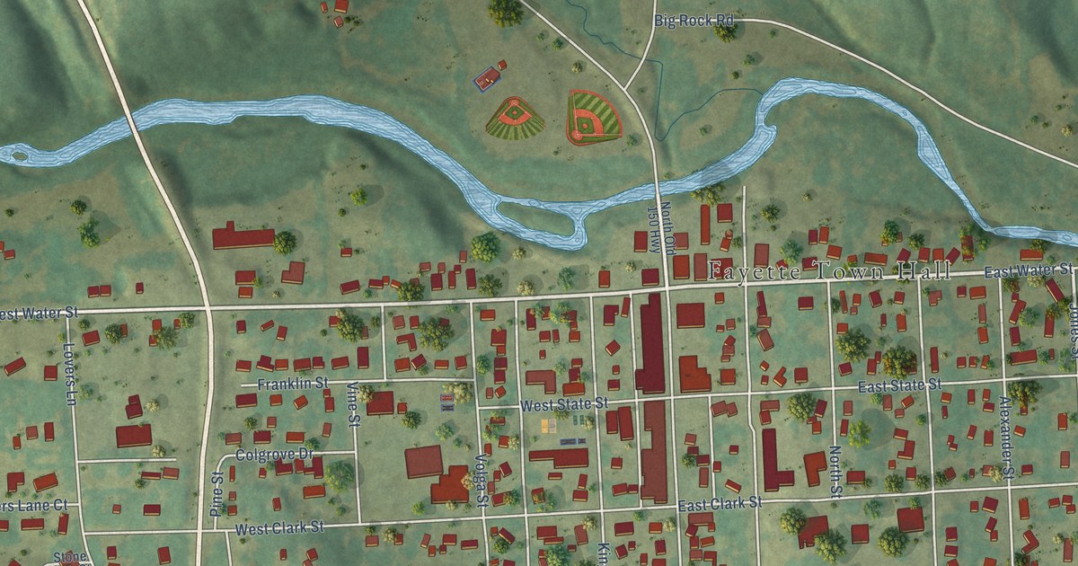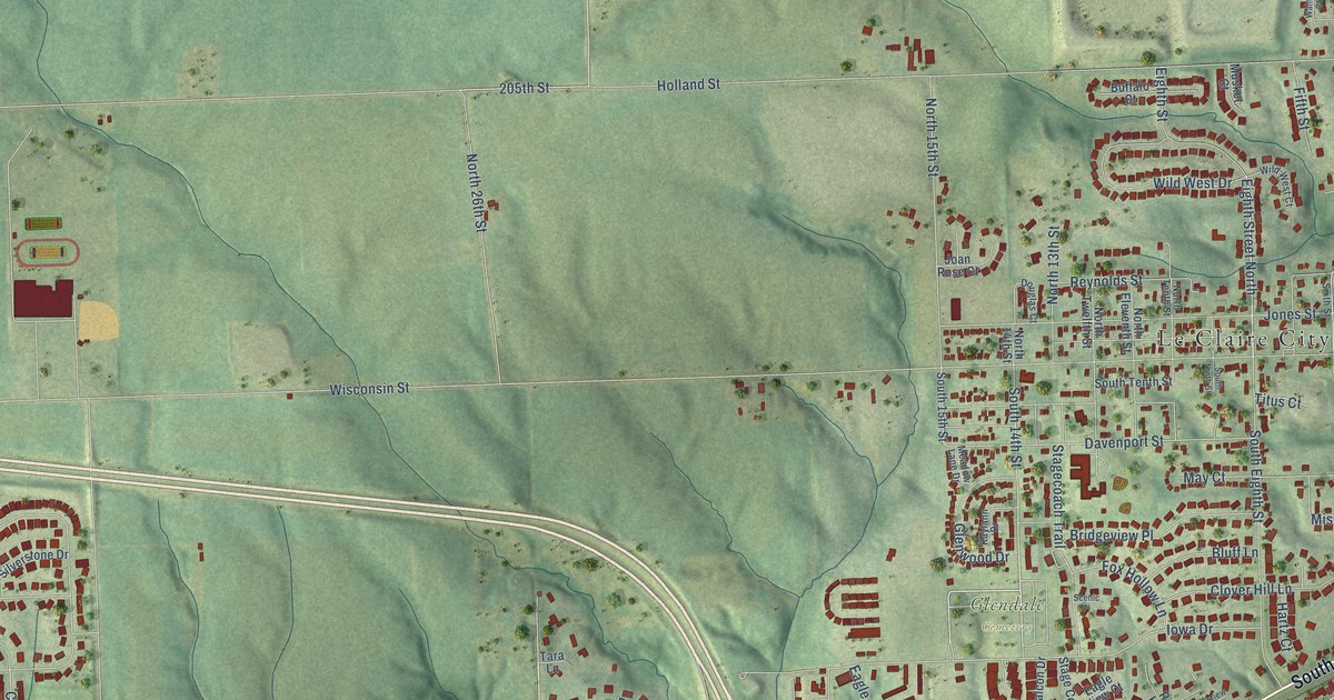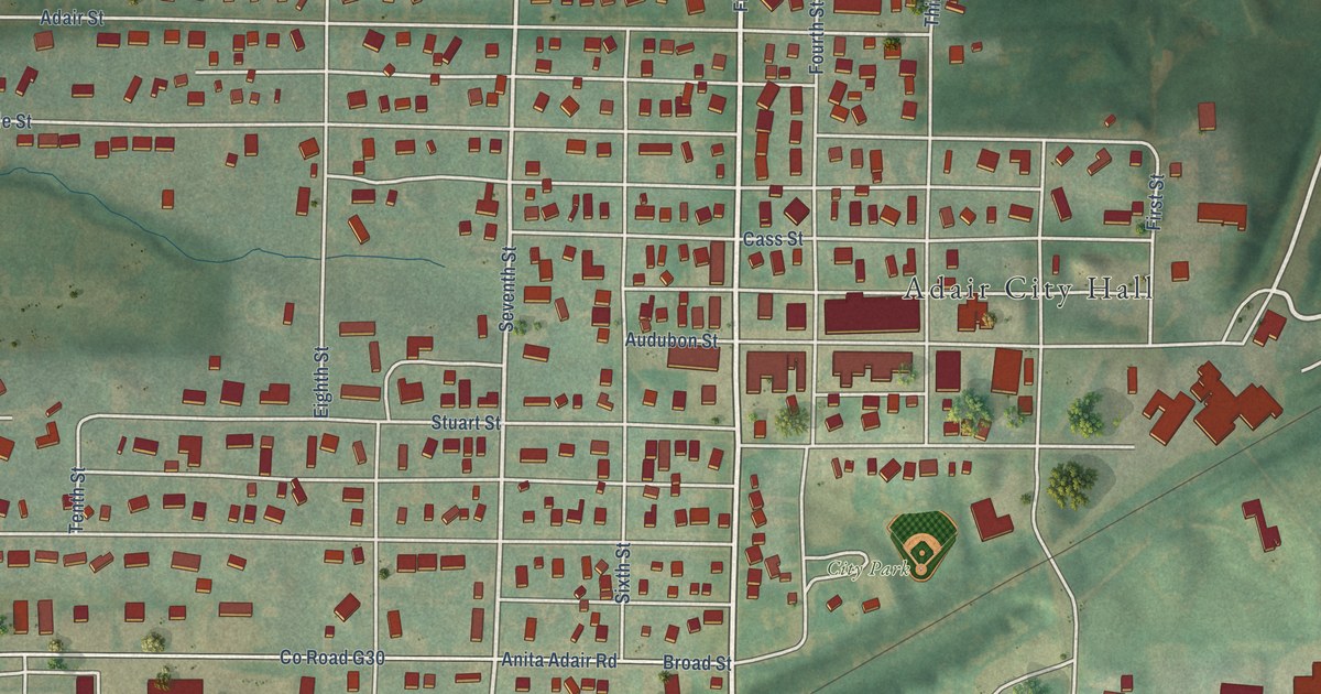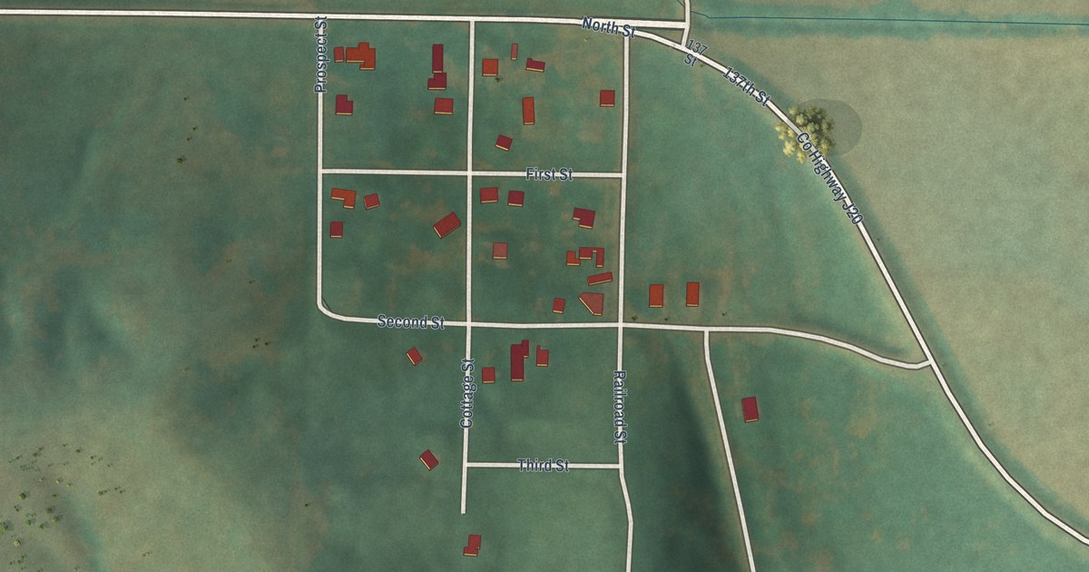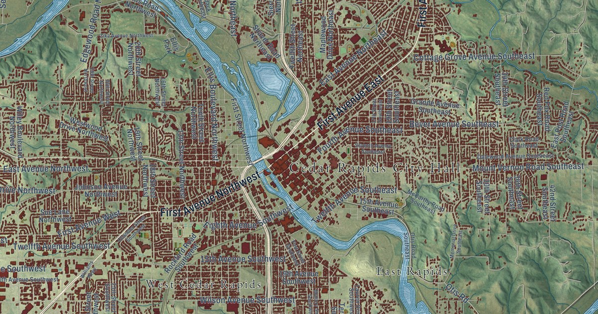
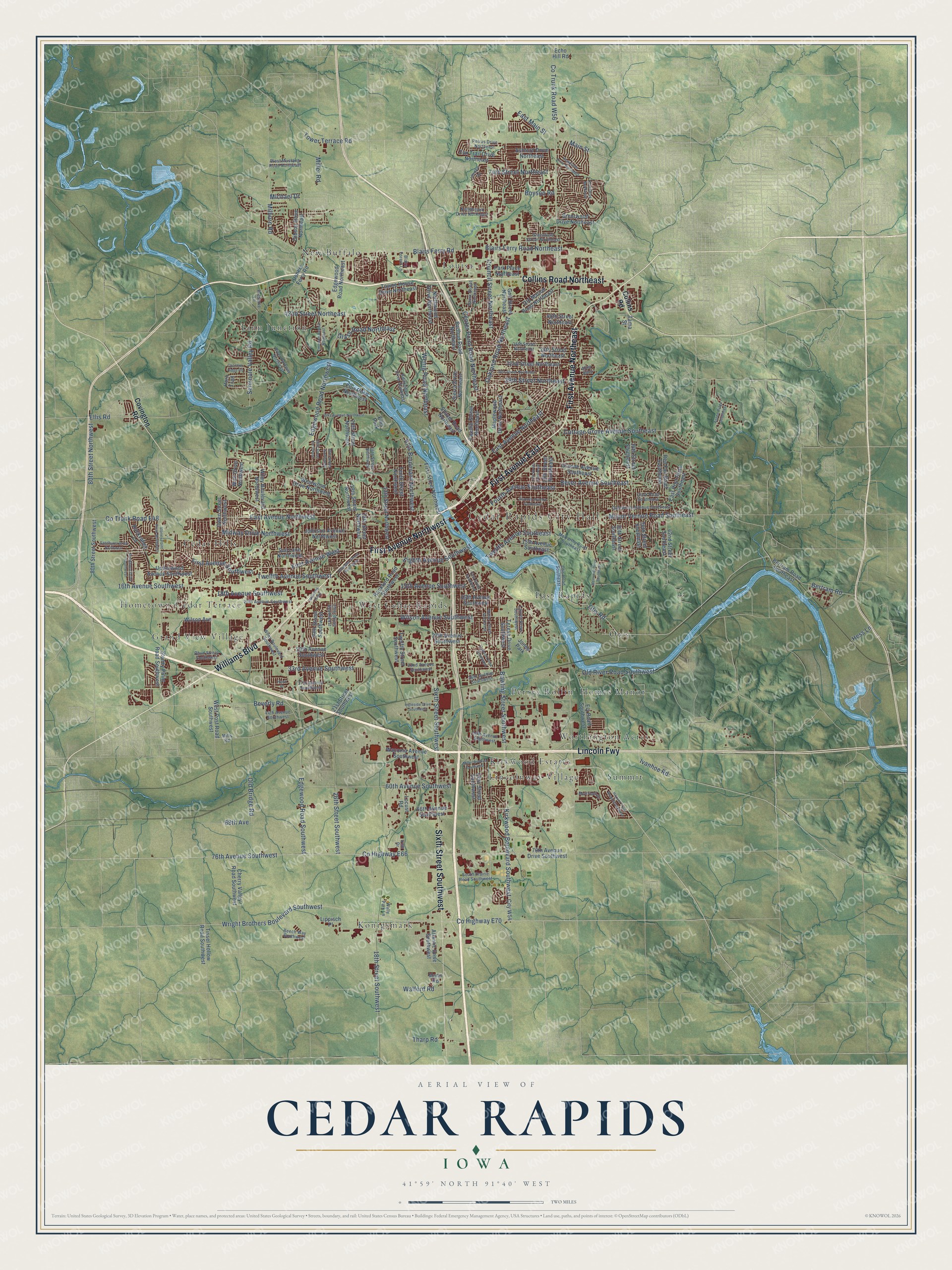
This beautifully detailed map of Cedar Rapids, Iowa was created in 2026 using aerial imagery combined with modern topographical, census, street and landmark data. It’s a one-of-a-kind view of Cedar Rapids that combines accurate data with a vintage aesthetic. The map shows every building in its true location, many of the roads carry their names, and the shaded topographic relief shows the shape of the land.
Explore an aerial view of Cedar Rapids, Iowa
On the map you’ll find Cedar Rapids City Hall, Cedar Hills, East Rapids, Grand View Village, Kirkwood Estates, Konigsmark, Lincolnway Village, Linn Junction, Louisa, New Buffalo, and Otis, along with Hometown-Cedar Terrace, and more. If you look closely you can even find your house accurately drawn in its correct location. Zoom in on the preview to look for yours.
Did you know this piece of Cedar Rapids, Iowa history?
From the Chicago and North Western Railway: "Cedar Rapids, Linn County, Iowa. Named from the rapids in Cedar River at this place. The river was named from the fact that in an early day the Juniperus Virginiana (red cedar) grew on its banks."
Take a closer look at the Cedar Rapids map
Street and place names on the Cedar Rapids, Iowa map
These names are printed on the map of Cedar Rapids, Iowa.
Places: Cedar Rapids City Hall, Cedar Hills, East Rapids, Grand View Village, Hometown-Cedar Terrace, Kirkwood Estates, Konigsmark, Lincolnway Village, Linn Junction, Louisa, New Buffalo, Otis, Perrys Rollin' Homes Manor, Summit, West Cedar Rapids, Worthington Acres, Ellis Park and Jones Park.
Streets and roads: Lincoln Fwy, First Avenue East, First Avenue Northeast, Williams Boulevard, First Avenue Northwest, Collins Road Northeast, Sixth Street Southwest, County Highway E70, 76th Avenue Southwest, County Highway E66, Kirkwood Boulevard Southwest, Bowling Street Southwest.
More street names, A to Z
13th Street Northwest, 15th Avenue Southeast, 15th Avenue Southwest, 16th Avenue Southwest, 16th Street Northwest, 17th Street Southeast, 18th Avenue Southwest, 18th Street Northwest, 18th Street Southwest, 19th Avenue Southwest, 19th Street Northwest, 19th Street Southeast, 20th Avenue Southwest, 20th Street Northwest, 21st Street Southwest, 25th Street Southwest, 26th Street Northwest, 26th Street Southwest, 27th Avenue Southwest, 29th Avenue Southwest, 29th Street Northeast, 29th Street Northwest, 29th Street Southwest, 30th Street Northeast, 30th Street Southeast, 32nd Avenue Southwest, 32nd Street Northeast, 33rd Avenue Southwest, 34th Street Northeast, 34th Street Southeast, 35th Street Northeast, 36th Avenue Southwest, 36th Street Southeast, 37th Avenue Southwest, 40th Street Northeast, 42nd Street Northeast, 42nd Street Southeast, 44th Avenue Southwest, 50th Avenue Southwest, 60th Avenue Southwest, 66th Avenue Southwest, 68th Avenue, 74th Street Northeast, 76th Avenue Drive Southwest, 80th Street Northwest, 80th Street Southwest, Adirondack Drive Northeast, Alley Alley, Ashford Drive Northeast, Aspen Ridge Southeast, Atlantic Drive Southwest, Beech Way Southwest, Bertram Road, Bertram Road Southeast, Bever Avenue Southeast, Beverly Road, Blairs Ferry Road, Blairs Ferry Road Northeast, Blairs Forest Lane, Boyson Road, Brentwood Drive Northeast, Center Point Road Northeast, Chandler Street Southwest, Cherry Valley Road Southwest, Choctaw Ridge Road, City W54, Clark Road Southeast, Collins Road, Co Trunk Road E48, Co Trunk Road W56, Cottage Grove Avenue Southeast, Council Street Northeast, Covington Road, Dalewood Avenue Southeast, East Avenue Northeast, East Avenue Northwest, East Main Street, East Post Road Southeast, Echo Hill Road, Edgewood Road Northeast, Edgewood Road Northwest, Edgewood Road Southwest, Eighth Avenue Southwest, Ellis Boulevard Northwest, Ellis Road, Ellis Road Northwest, Ely Road Southwest, Emerson Avenue Northeast, First Avenue Southwest, First Avenue West, First Street Northwest, First Street Southwest, Fourth Avenue Southeast, Fox Trail Drive Northeast, Gibson Drive Northeast, Glass Road Northeast, Golf Street Northeast, Grande Avenue Southeast, Greenfield Street Northeast, Hampshire Drive Northeast, Hawk Drive, Hess Lane, Hoover Trail Road Southwest, Horn Trail, Idledale Road, Ingleside Drive Southwest, Irish Drive, Ivanhoe Road, Johnson Avenue Northwest, Kent Drive Northeast, Lauren Drive Southwest, Lippisch Place, Locust Road, Main Street, Mallory Street Southwest, Mann Road, Maplewood Drive Northeast, McCarthy Road Southeast, Memorial Drive Southeast, Michael Drive, Midway Drive Northwest, Milburn Road, Miller Avenue Southwest, Miller Road, Mills Road, Mount Vernon Road Southeast, Muirfield Drive, Northbrook Drive Northeast, Northwood Drive Northeast, Oakland Road Northeast, Ohio Street Southwest, Old Bridge Road, Old Marion Road Northeast, Old River Road Southwest, Otis Road, Otis Road Southeast, Outlook Drive Southwest, Owen Street Northwest, Ozark Street Northeast, Park Place Northeast, Petrus Drive Northeast, Preserve Lane, Redbud Road Northeast, Red Fox Road Southeast, Rhud Street Southwest, River Parkway Northeast, Rockford Road Southwest, Rockhurst Drive Southwest, Rockvalley Lane, Sandhurst Drive Northwest, Seminole Valley Road, Seventh Avenue Southeast, Shaver Road Northeast, Sierra Drive Northeast, South Prairie Road Southwest, Stoney Point Road Northwest, Stoney Point Road Southwest, Sue Lane Northwest, Tama Street, Tenth Street Northwest, Teresa Drive Southwest, Tharp Road, Tissel Hollow Road Southwest, Tower Terrace Road, Towne House Drive Northeast, Twelfth Avenue Southeast, Twelfth Avenue Southwest, Twelfth Street Northeast, Twelfth Street Southwest, Underwood Avenue Southwest, Ushers Ferry Road, Waconia Avenue Southwest, Walford Road, Wally Park Lane, Wenig Road Northeast, West Mustang Road Northeast, West Post Road Southwest, Westwood Drive Northwest, Wiley Boulevard Northwest, Wiley Boulevard Southwest, Williams Parkway, Wilson Avenue, Wilson Avenue Southwest, Wolf Drive Northwest, Wright Brothers Boulevard Southwest, Zika Avenue Northwest.
See the Cedar Rapids, Iowa map on a wall
The Cedar Rapids map as an 18 x 24 inch print in a black frame.

This beautifully detailed map of Cedar Rapids makes an attractive addition to your office, library, or den, and it can even be used to teach children the geography and history of the area. It also makes a great gift for anyone who grew up in Cedar Rapids or moved away. When you’re done exploring, click here to get your copy of the Cedar Rapids map.