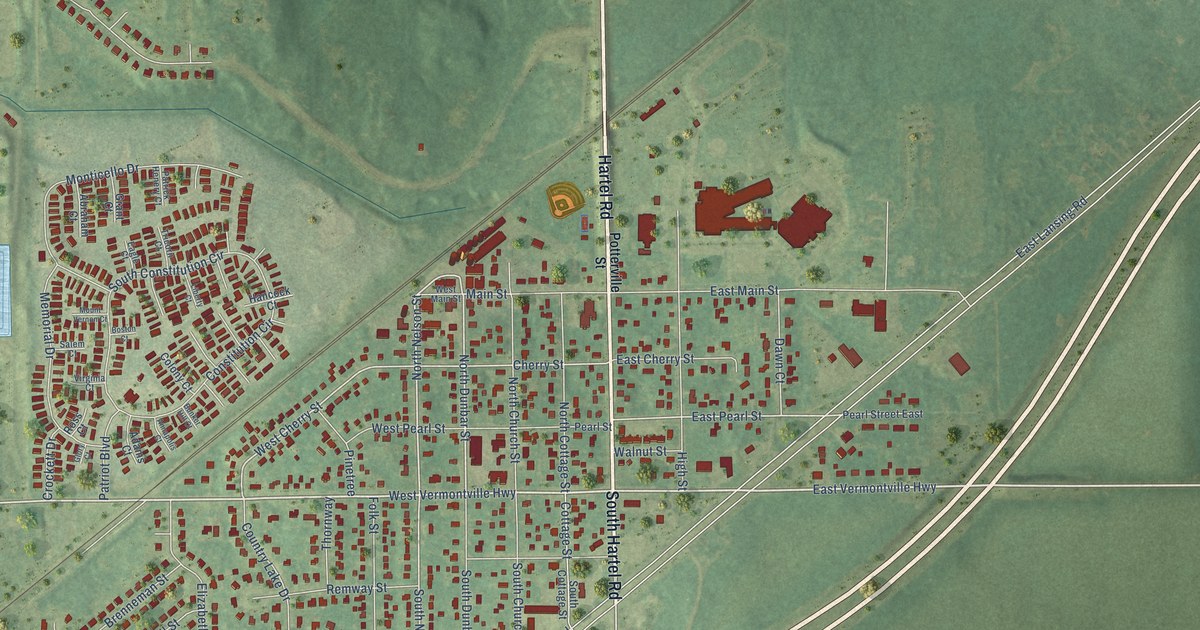
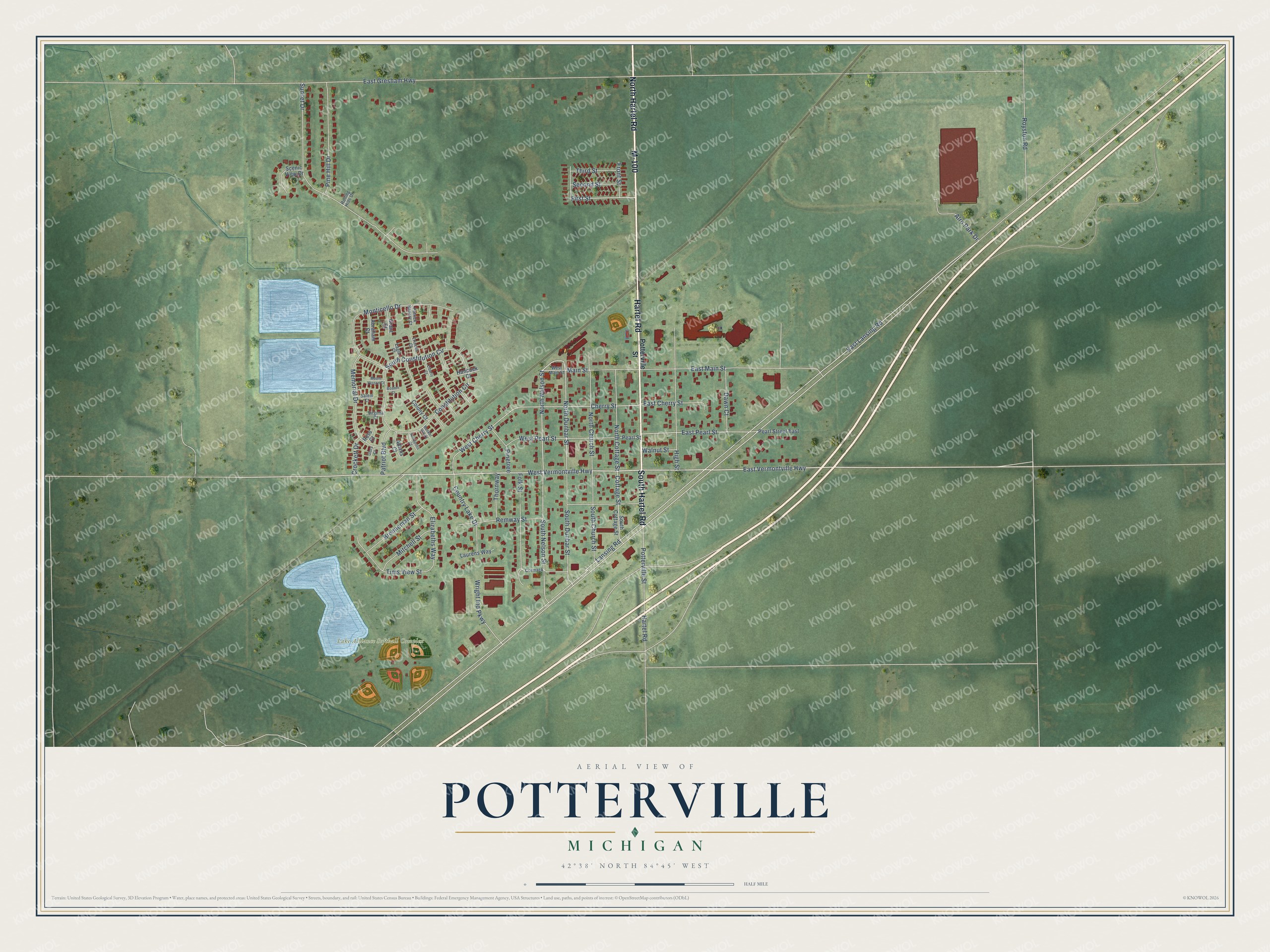
This beautifully detailed map of Potterville, Michigan was created in 2026 using aerial imagery combined with modern topographical, census, street and landmark data. It's a modern aerial view of Potterville in Eaton County, Michigan, that combines modern data with a vintage aesthetic. The roads feature printed names, and if you look closely you can find your exact house accurately shown in its correct location.
Explore an aerial view of Potterville, Michigan
On this map you'll find Lake Alliance Softball Complex, North Hartel Road, M-100, South Hartel Road, Hartel Road, East Vermontville Highway, West Vermontville Highway, First Street, Potterville Street, North Nelson Street, South Nelson Street, North Dunbar Street, and more. Each red shape is a building, so zoom in on the preview and look for yours.
Here is a piece of Potterville history, in the words of the record. The History of Ingham and Eaton Counties puts it this way: "Before the village of Potterville was in existence there was not a church, saw-mill, or blacksmith-shop in the township of Benton. At present the manufactories of the place have a capacity for working up 5,000,000 feet of hardwood lumber annually."
Potterville is a city in Eaton County. The Census Bureau counted 3,055 people here in 2020.
Take a closer look at the Potterville map
Names on this map
These names are printed on this map.
Places: Lake Alliance Softball Complex.
Streets and roads: North Hartel Road, M-100, South Hartel Road, Hartel Road, East Vermontville Highway, West Vermontville Highway, First Street, Potterville Street, North Nelson Street, South Nelson Street, North Dunbar Street, West Cherry Street.
More street names, A to Z
Abraham Court, Adams Court, Alro Park Drive, Annapolis Court, Boston Court, Brenneman Street, Bunker Hill Court, Cherry Street, Colony Court, Constitution Circle, Cormack, Cottage Street, Country Lake Drive, Crockett Drive, Dawn Court, Eagle Court, East Cherry Street, East Gresham Highway, East Lansing Road, East Main Street, East Pearl Street, Elizabeths Way, Folk Street, Front Street, Glory Court, Grant Court, Hancock Court, High Street, Lansing Road, Laurens Way, Liberty Court, Main Street, Memorial Drive, Mitchell Street, Monticello Drive, Mount Vernon Court, North Church Street, North Cottage Street, Patrick Henery Court, Patriot Boulevard, Pearl Street, Pearl Street East, Pine Hill Drive, Pinetree, Remway Street, Rolling Hills Drive, Ross Court, Royston Road, Salem Court, Scenic View Drive, Second Street, South Church Street, South Constitution Circle, South Cottage Street, South Dunbar Street, Sunset Drive, Third Street, Thornway, Tims View Street, Tricorn Court, Virginia Court, Walnut Street, West Main Street, West Pearl Street, Wright Ind Parkway.
Created by KNOWOL in 2026. The buildings are small red shapes, the roads carry their printed names, and shaded relief shows the shape of the land. The title panel reads "AERIAL VIEW OF POTTERVILLE, MICHIGAN" with 42°38' NORTH 84°45' WEST.
It suits a den, a classroom or a front hall, and it makes a gift for anyone with Potterville roots. Open the preview and find the block you know. See sizes and frames for the Potterville map.