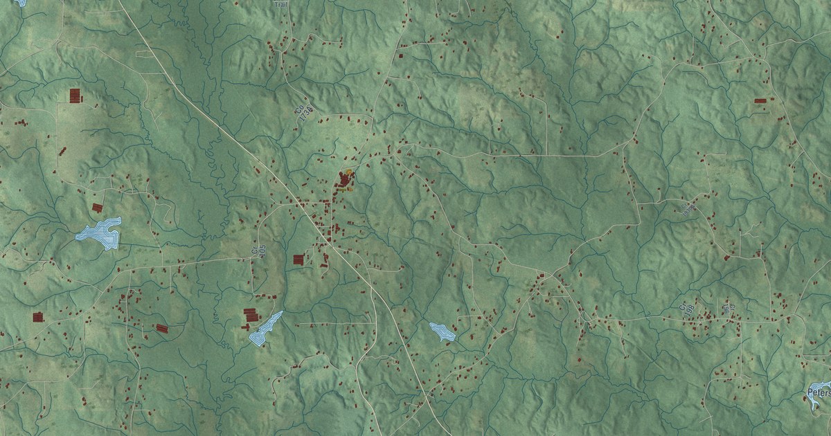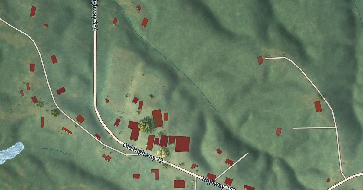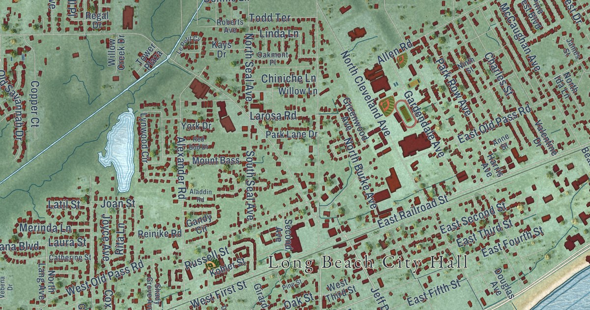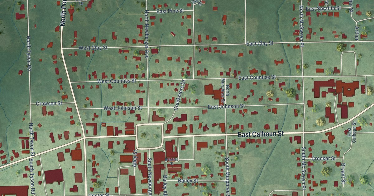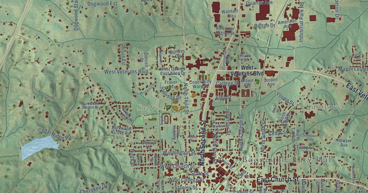
This beautifully detailed map of Booneville, Mississippi was created in 2026 using aerial imagery combined with modern topographical, census, street and landmark data. It’s a one-of-a-kind view of Booneville that combines accurate data with a vintage aesthetic. The map shows every building in its true location, many of the roads carry their names, and the shaded topographic relief shows the shape of the land.
Explore an aerial view of Booneville, Mississippi
On the map you’ll find Booneville City Hall, Gaston, Lake City, Sunflower, Forest, and Swift Park, along with South Second Street, East Church Street, Church Street, Ninth Street, West Chambers Drive, East Chambers Drive, and more. If you look closely you can even find your house accurately drawn in its correct location. Zoom in on the preview to look for yours.
Did you know this piece of Booneville, Mississippi history?
From Mississippiencyclopedia.org: "Citizens of Prentiss County later played important roles in remembering the Civil War, first when locals made the unique decision to rebury Confederate dead in a special cemetery in Booneville and later when women in Baldwyn organized one of Mississippi’s first chapters of the United Daughters of the Confederacy in 1894."
Take a closer look at the Booneville map
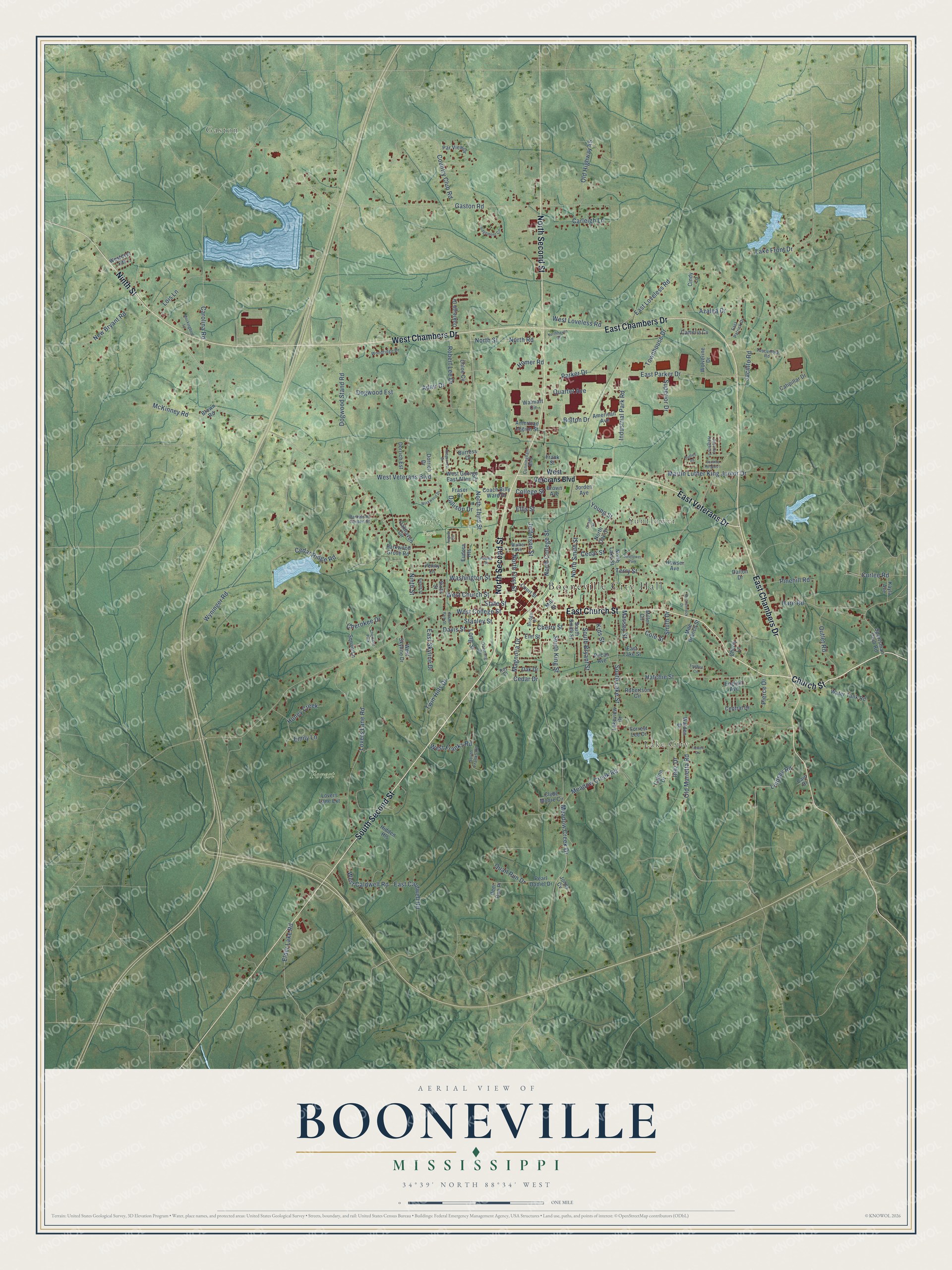
Street and place names on the Booneville, Mississippi map
These names are printed on the map of Booneville, Mississippi.
Places: Booneville City Hall, Gaston, Lake City, Sunflower, Forest, Swift Park, Cherokee Park and Sunflower Park.
Streets and roads: South Second Street, East Church Street, Church Street, Ninth Street, West Chambers Drive, East Chambers Drive, North Second Street, East Veterans Drive, West Church Street, Young Street, South King Street, North First Street.
More street names, A to Z
Adair Drive, Adams Street, American Avenue, American Legion Street, August Circle, Azalea Drive, Bolton Drive, Bridge Street, Brown Avenue, Brown Road, Burress Drive, Cain Drive, Calton Drive, Camelia Cv, Carleigh Lane, Carolina Road, Catipillar Drive, Cedar Drive, Cedar Ridge Road, Cedar Street, Central Drive, Cherokee Drive, Cherry Lane, Cherry Street, Chloe Cv, Cindy Lane, Clyde Moore Circle, Coach Billy Ward Drive, Cole Street, College Street, Country Club Road, Court Street, Cunningham Boulevard, Curlee Road, Dallison Drive, Dalton Drive, Davis Street, Deer Run Place, Dogwood Est, Dogwood Stand Road, Dorrich Drive, Dorrich Est, Downing Drive, Dudley Road, East Caldwell Road, East Lake Street, East Loveless Road, East Parker Drive, East Patrick Drive, East Skyline Drive, Eighth Street, Elder Lake Road, Ellis Street, Elm Street, Emily Lane, English Avenue, Eudora Heights, Forrest Lee Drive, Foster Park Street, Frank Street, Fraser Drive, Gaston Road, Hare Road, Hatchie Street, Hidden Hls, Homer Road, Honey Creek, Howser Avenue, Industrial Park Road, Inez Drive, Jacinto Heights 1, Jacinto Heights 5, Jacinto Road, Jefferson Street, Jones Cv, Jorden Avenue, Kayla Avenue, Kids Street, Lake Front Drive, Lakeview Drive, Lindsey Road, Lois Lane, Long Street, Lovers Lane Extension, Lovers Lane Road, Magnolia Drive, Martin Luther King Junior Drive, Massey Street, McClamrock Drive, McKinney Road, Meadow Creek Drive, Meadow Creek Road, Mile Branch Street, Miller Circle, Mill Street, Mockingbird Lane, New Bryant Road, North College Street, Northhaven Drive, North Lake Street, North Oak Street, North Road, North Smith Street, North Street, North Third Street, Oak Drive, Oakhaven Circle, Oakleigh Drive, Old Highway 45, Old Marietta Road, Oneal Street, Outlet Road, Parker Drive, Parkwood Garden Street, Parkwood Grove Road, Par View Drive, Pearl Daniel Drive, Pecan Avenue, Penny Lane, Pierce Drive, Pinehill Road, Quail Run Drive, Quartet Avenue, Ridgecrest Drive, Ridgemont Circle, Robert Lee Drive, Robertson Circle, Roy Drive, Sixth Street, Smith Drive, South Bryant Street, South Franks Road, South Lake Street, South Smith Street, Sportsman Club Road, Stanley Street, State Street, Superior Drive, Terry Street, Tidwell Drive, Towhee Circle, Townhouse Drive, Tuscumbia Road, Twin Hills Drive, Walden Drive, Walker Avenue, Walmart Circle, Washington Street, Water Tank Road, West Caldwell Road, West College Street, West Franks Road, West George East Allen Drive, West Loveless Road, Westover Heights, West Skyline Drive, West Veterans Boulevard, Wickwood Drive, Wolverine Drive, Woodridge Drive, Wyninger Road.
See the Booneville, Mississippi map on a wall
The Booneville map as an 18 x 24 inch print in a black frame.

This beautifully detailed map of Booneville makes an attractive addition to your office, library, or den, and it can even be used to teach children the geography and history of the area. It also makes a great gift for anyone who grew up in Booneville or moved away. When you’re done exploring, click here to get your copy of the Booneville map.