Mississippi Town Maps A to Z
All 461 town maps, from Abbeville to Yazoo City. Each one opens its own page with the whole map.
A
B
- Baldwyn
- Bassfield
- Batesville
- Baxterville
- Bay Springs
- Bay St. Louis
- Beaumont
- Beauregard
- Beechwood
- Belmont
- Belzoni
- Benndale
- Benoit
- Benton
- Bentonia
- Bethlehem
- Beulah
- Big Creek
- Big Point
- Biggersville
- Biloxi
- Blue Mountain
- Blue Springs
- Bobo
- Bogue Chitto, Lincoln County
- Bogue Chitto, Neshoba County
- Bolivar
- Bolton
- Bond
- Booneville
- Bovina
- Boyle
- Brandon
- Braxton
- Bridgetown
- Brookhaven
- Brooksville
- Bruce
- Buckatunna
- Bude
- Burnsville
- Byhalia
- Byram
C
D
E
F
G
H
I
J
K
L
M
- Maben
- Macon
- Madison
- Magee
- Magnolia
- Mannsdale
- Mantachie
- Mantee
- Marietta
- Marion
- Marks
- Mathiston
- Mayersville
- McAdams
- McComb
- McCool
- McLain
- Meadville
- Mendenhall
- Meridian
- Meridian Station
- Merigold
- Metcalfe
- Mississippi State
- Mississippi Valley State University
- Mize
- Monticello
- Montrose
- Mooreville
- Moorhead
- Morgan City
- Morgantown
- Morton
- Moselle
- Moss Point
- Mound Bayou
- Mount Olive
- Mount Pleasant
- Myrtle
N
O
P
Q
R
S
- Salem
- Sallis
- Saltillo
- Sandersville
- Sardis
- Sardis Lake
- Satartia
- Saucier
- Schlater
- Scooba
- Scott
- Sebastopol
- Seminary
- Senatobia
- Shannon
- Sharon
- Shaw
- Shelby
- Sherman
- Shubuta
- Shuqualak
- Sidon
- Silver City
- Silver Creek
- Skene
- Slate Springs
- Sledge
- Smithville
- Snow Lake Shores
- Soso
- Southaven
- St. Martin
- Standing Pine
- Starkville
- State Line
- Stewart
- Stoneville
- Stonewall
- Strayhorn
- Stringer
- Sturgis
- Summit
- Sumner
- Sumrall
- Sunflower
- Sylvarena
- Symonds
T
U
V
W
Y
Don’t see your town? Ask us to draw it.
About Mississippi
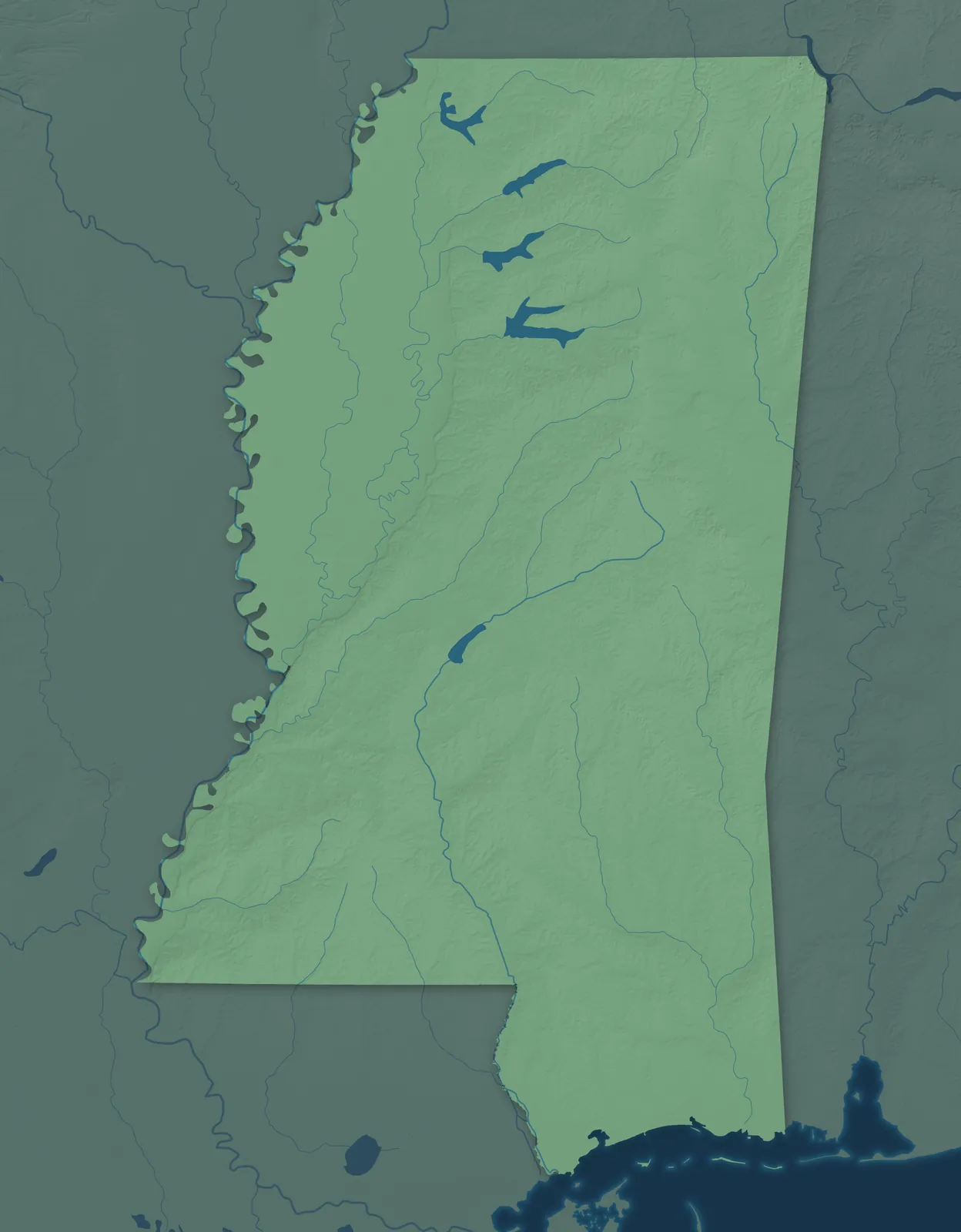
The Mississippi River forms most of the state's western border, and beside it in the northwest lies the flat, rich farmland of the Delta. To the east the land rolls through hills, prairie and pine forest down to the Gulf Coast. Mississippi became the 20th state on December 10, 1817, the same year the eastern half of the Mississippi Territory was split off as the Alabama Territory.
Jackson is the largest city, but more than half of Mississippians live in rural areas. Many towns began as river landings, cotton towns, railroad stops or sawmill towns. Mississippi's musicians helped create the blues, country music and rock and roll, and B.B. King, Jimmie Rodgers and Elvis Presley were all born here.
- Statehood
- December 10, 1817
- Capital
- Jackson
- Population
- 2,954,1602025 Census estimate
- Highest point
- Woodall Mountain, 807 feet
- Lowest point
- The Gulf coast, sea level
- Size
- 48,432 square miles, the 32nd largest state
The Mississippi Delta
The Delta is the flat, rich farmland between the Mississippi and Yazoo rivers, with Greenville, Clarksdale, Cleveland, Greenwood and Indianola as its main towns. The blues grew up here, and Clarksdale's Delta Blues Museum tells its story. Isaiah Montgomery and Benjamin Green, both born into slavery, founded Mound Bayou in 1887 as a self-governing Black town. Jim Henson spent his boyhood in Leland, where an exhibit honors him and Kermit the Frog.


The Hills of North Mississippi
North Mississippi's rolling hills take in Southaven and Olive Branch near Memphis, the college town of Oxford, and Tupelo and Corinth to the east. The University of Mississippi opened in Oxford in 1848, and William Faulkner's home there, Rowan Oak, is now a museum. In 1934 Tupelo became the first city to buy power from the Tennessee Valley Authority. Ida B. Wells, the journalist, was born in Holly Springs in 1862, and a museum there tells her story.


The Golden Triangle and East Mississippi
Columbus, Starkville and West Point form the Golden Triangle, and Meridian and Philadelphia lie to the south in hilly pine country. In 1884 Columbus became home to the first state college for women in the country, now Mississippi University for Women. Meridian grew up where two railroads crossed in 1860. Near Philadelphia, the Mississippi Band of Choctaw Indians holds the Choctaw Indian Fair each July.


Jackson and Central Mississippi
In 1821 the legislature chose a bluff on the Pearl River for a new capital and named it for Andrew Jackson. The Old Capitol, finished in 1839, still stands downtown as a museum, and Madison, Ridgeland, Brandon and Clinton surround the city. To the west, Vicksburg sits on high bluffs over the Mississippi River, and in 1894 a candy store there became the first place to bottle Coca-Cola.


Natchez and Southwest Mississippi
The French founded Natchez in 1716, which makes it one of the oldest towns on the Mississippi River. Many of its houses from before the Civil War still stand, and the Natchez Trace Parkway starts there and follows an old trail north to Nashville. McComb was founded in 1872 as a railroad shop town, and Brookhaven, Port Gibson and Woodville also sit in the region's rolling, wooded hills.


Hattiesburg and the Piney Woods
Hattiesburg, Laurel, Columbia and Waynesboro sit in the Piney Woods, the longleaf pine country that people here call the Pine Belt. William H. Hardy founded Hattiesburg in 1882 and named it for his wife, Hattie, and its railroads made it the Hub City. Laurel began the same year as a lumber camp, and its Lauren Rogers Museum of Art, opened in 1923, was Mississippi's first art museum.


The Mississippi Gulf Coast
Bay St. Louis, Gulfport, Biloxi, Ocean Springs and Pascagoula line the coast, with barrier islands offshore. In 1699 the French built Fort Maurepas at what is now Ocean Springs, and the cast iron Biloxi Lighthouse has stood since 1848. In Hancock County, NASA tested the first and second stages of the Saturn V moon rocket at what is now Stennis Space Center.


- 12 × 18 inPrint $39.99Framed $89.99
- 18 × 24 inPrint $49.99Framed $129.99
- 24 × 36 inPrint $89.99Framed $199.99

Sizes and Prices
Every map comes in three sizes on archival matte paper. Framed prints come in black or white wood.
How each map is made
It starts with the real place
Streets, buildings, terrain and water form the map, drawn the way Mississippi looks today.
Then the details
Local research and an old atlas style give each town its character.
Then it's yours
Look around the map, then pick a print to keep or give.