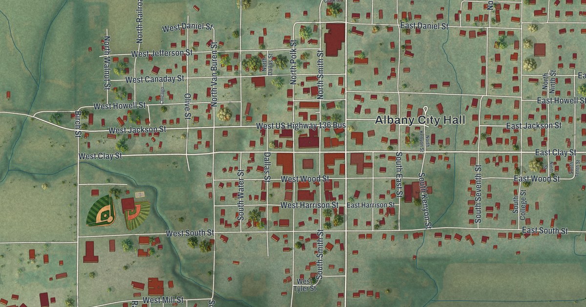
If you grew up in Albany, went to school here, or still have family in town, this map has plenty for you to find. It's a modern aerial view of Albany in Gentry County, Missouri, made from modern data with a vintage feel. More than 1,100 buildings are drawn in deep red on soft green hills. East US Highway 136 runs across the top of town. Creeks wind through the low ground, and a lake sits south of town, though neither one is labeled. Explore the print options for Albany.
Albany City Hall, Clay Street and North Hundley Street
Start at Albany City Hall, the one place named in the middle of the map. West US Highway 136 Bus runs past it, and West Clay and East Clay Streets cross town just below. Now head north on North Hundley Street toward East US Highway 136. Side streets such as East Daniel Street, North Street and Peery Street branch off along the way. On the east side, look for East Canaday Street, Jefferson Street, East Clark Street and North 13th Street. To the south, South Smith Street and South Polk Street lead down toward West Bethany Street and East Grove Street. Fairgrounds Road runs along the lower left, and 335th Street and East Stapleton Avenue head off to the east. Many of the roads are labeled, and each red shape is a building, so zoom in on the preview and look for yours.
Albany's first subscription school in 1845
A 1922 history of Daviess and Gentry counties says the first private subscription school in Albany was taught in the latter part of 1845. It names the teacher only as "a man by the name of Boston." The history doesn't say where his school stood, and the map doesn't mark it. Today Albany's homes spread from around East US Highway 136 on the north down to Fairgrounds Road.
Two Albany buildings on the National Register
Two Albany buildings are on the National Register of Historic Places. The Albany Carnegie Public Library, at 101 West Clay Street, was listed in 1990. The Samuel and Pauline Peery House, at 1105 North Hundley Street, was listed in 2005. Neither building is labeled on the map. But West Clay Street and North Hundley Street are both printed, so you can follow them to the blocks where these two buildings stand.
For anyone who grew up near North Hundley Street
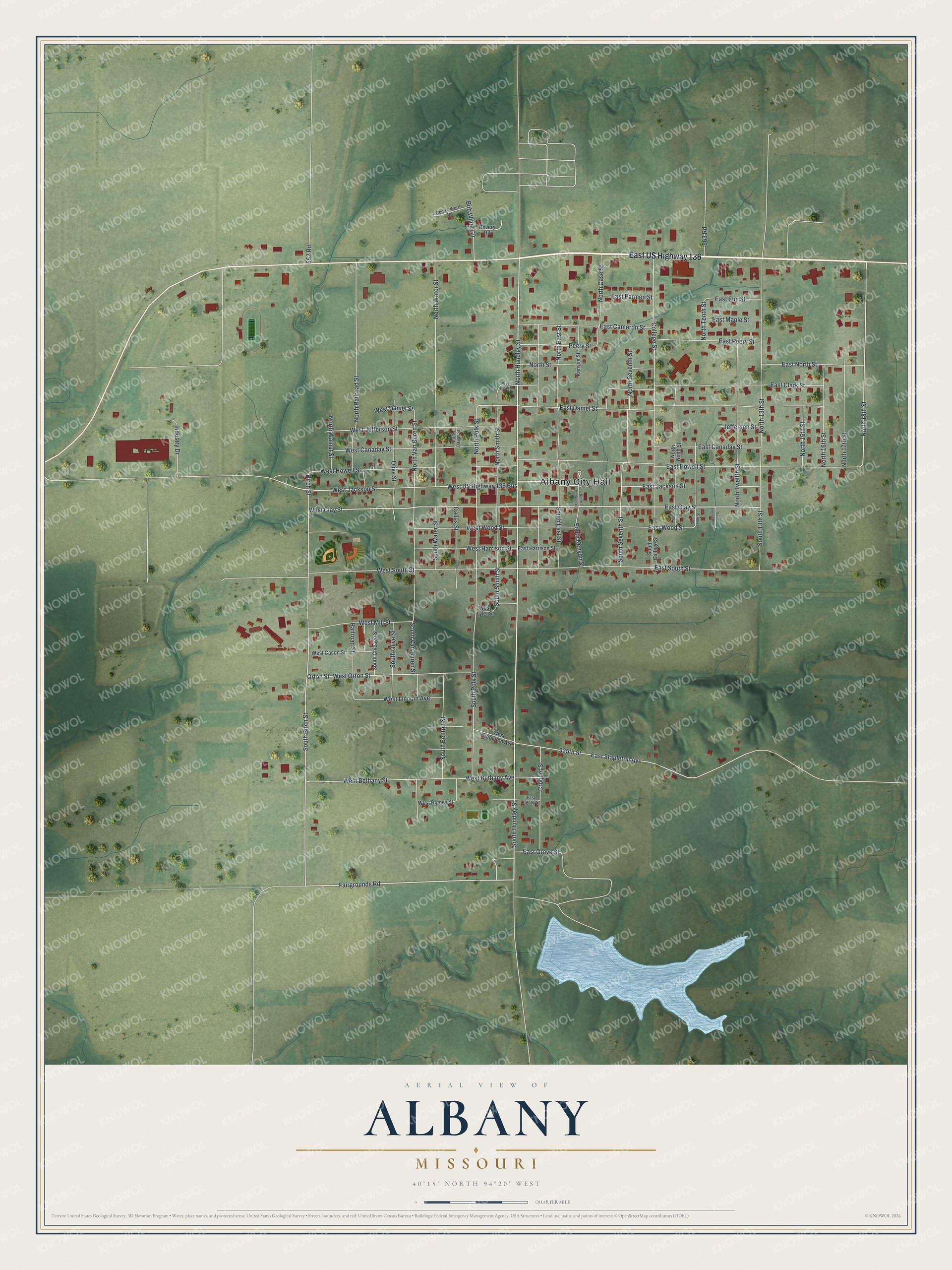
Created by KNOWOL in 2026, this Albany map shows the town's streets, buildings and shaded hills. The hills come from USGS elevation data, and the streets come from Census Bureau records. The title panel reads "Aerial View of Albany, Missouri" with 40°15' North, 94°20' West and a quarter-mile scale bar.
It fits a kitchen, a den or an office wall. It's also a good gift for someone who grew up in Albany and moved away, or for a family with roots in Gentry County. Open the preview, zoom in and find a street you know. Shop the Albany, Missouri map.