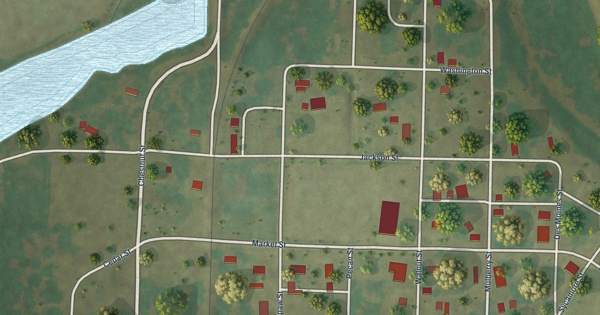
If you grew up in Alexandria, or you still have family on these streets, this map puts the whole town on one sheet. It's a modern aerial view of Alexandria in Clark County, Missouri, made from modern data and given a vintage printed look. More than 100 buildings are drawn in red on soft green land. Wide blue water fills the lower right of the sheet and runs up the east side, though it isn't labeled. Many of the streets are named, from Kentucky Street in the west to Pearl Street by the water. Explore the print options for Alexandria.
From Main Street down to Tilford Street
Start near the top of town, where Taylor Street and Franklin Street sit just above Main Street. Main Street runs east from there toward the water. Now head south. You'll cross Washington Street first, then Jackson Street and Market Street, which run east across the middle of town. Mulberry Street comes down from the north to meet them. On the east side, Sycamore Street, Des Moines Street and Pearl Street sit close to the riverbank. Back on the west side, Spruce Street runs north and south, and Clay Street heads east from there across town. At the bottom, Pecan Street runs down to Jassamine Street and Tilford Street. Each red shape is a building, so zoom in on the preview and look for yours.
Alexandria's first cabin and its 1833 ferry license
Alexandria's written history goes back to a ferry. According to an 1887 county history, a man was running a ferry there as early as 1832. He built the first cabin in Alexandria. In December 1833, a ferry license was granted.
The ferry and the cabin aren't marked on this map. But look at the east edge of the print, where Pearl Street and Des Moines Street reach toward the wide water. On the west side of the sheet, a long strip of water isn't labeled either. A rail line is drawn cutting across the sheet. At the 2020 census, 105 people lived in Alexandria.
For someone who knows Jackson Street and Pearl Street
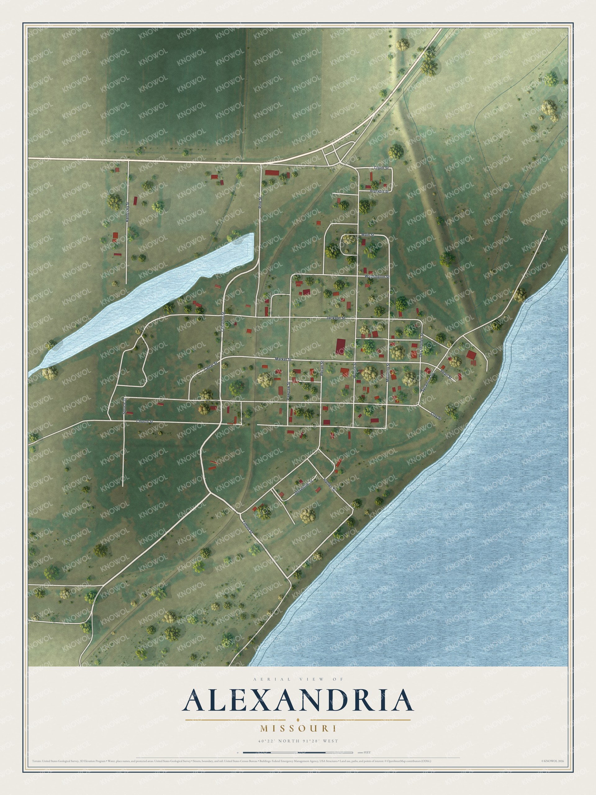
Created by KNOWOL in 2026, this map shows Alexandria in soft greens, with shaded land from USGS elevation data, blue water and red buildings. The title panel reads "Aerial View of Alexandria, Missouri" with the coordinates 40°22' North, 91°28' West.
It fits a kitchen, a den or a hallway where family walks by every day. It's a good gift for someone who grew up in Alexandria and moved away, or for a family with roots in Clark County. Open the preview, zoom in and find a street you know. Shop the Alexandria, Missouri map.