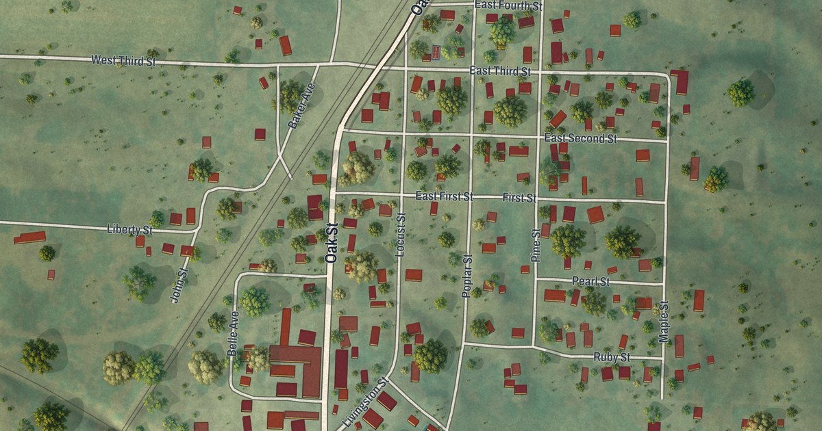
If you grew up in Bucklin, watched a game at Junior Long Field, or still have family near Oak Street, this map has your town on it. It's a new aerial view of Bucklin in Linn County, Missouri, built from modern data and given a vintage look. Green hills and farm fields wrap around the town. Buildings show up as small red shapes, and trees dot the pastures. A rail line runs through the middle of town, right by Bucklin City Hall.
From Junior Long Field down Oak Street to Bucklin City Hall
Start at Junior Long Baseball Park in the top right corner. Junior Long Field is printed right beside it. Just below the ballpark, Nolan Road runs into Oak Street. Follow Oak Street west, then bend south with it toward town. On your left, East Fifth, East Fourth and East Third Streets line up in a small, tidy grid. Bucklin Cemetery is printed above town, on the far side of the tracks.
Keep going down Oak Street to Bucklin City Hall. A set of tracks crosses just west of it. Here the road becomes Livingston Street and heads southwest to the bottom of the sheet. Hunt Street runs off to the southeast, and Lathrop Street heads south. West Front Street and Walnut Street branch off to the west. Santa Fe Avenue runs out toward the left edge. Many roads are labeled, and each red shape is a building, so zoom in on the preview and look for yours.
Bucklin's first days in a 1912 county history
George L. Joyce wrote the Bucklin section of a 1912 Linn County history. He wrote down the town's firsts. Martin Davenport was the first boy born in Bucklin, in December 1855. The first church services were held in a private home. The Reverend Mitchell led them. He was a Primitive Baptist minister.
By 1910, Bucklin had 790 people, split into two wards. It had its own post office. It also had its own paper, the Bucklin Herald, run by W. E. Windle. The 2020 census counted 413 people. Their homes still fill the blocks on both sides of the tracks. They reach from East Fifth Street down to West Washington Street and East Washington Street near the bottom of the map.
For someone who knows Oak Street and Livingston Street
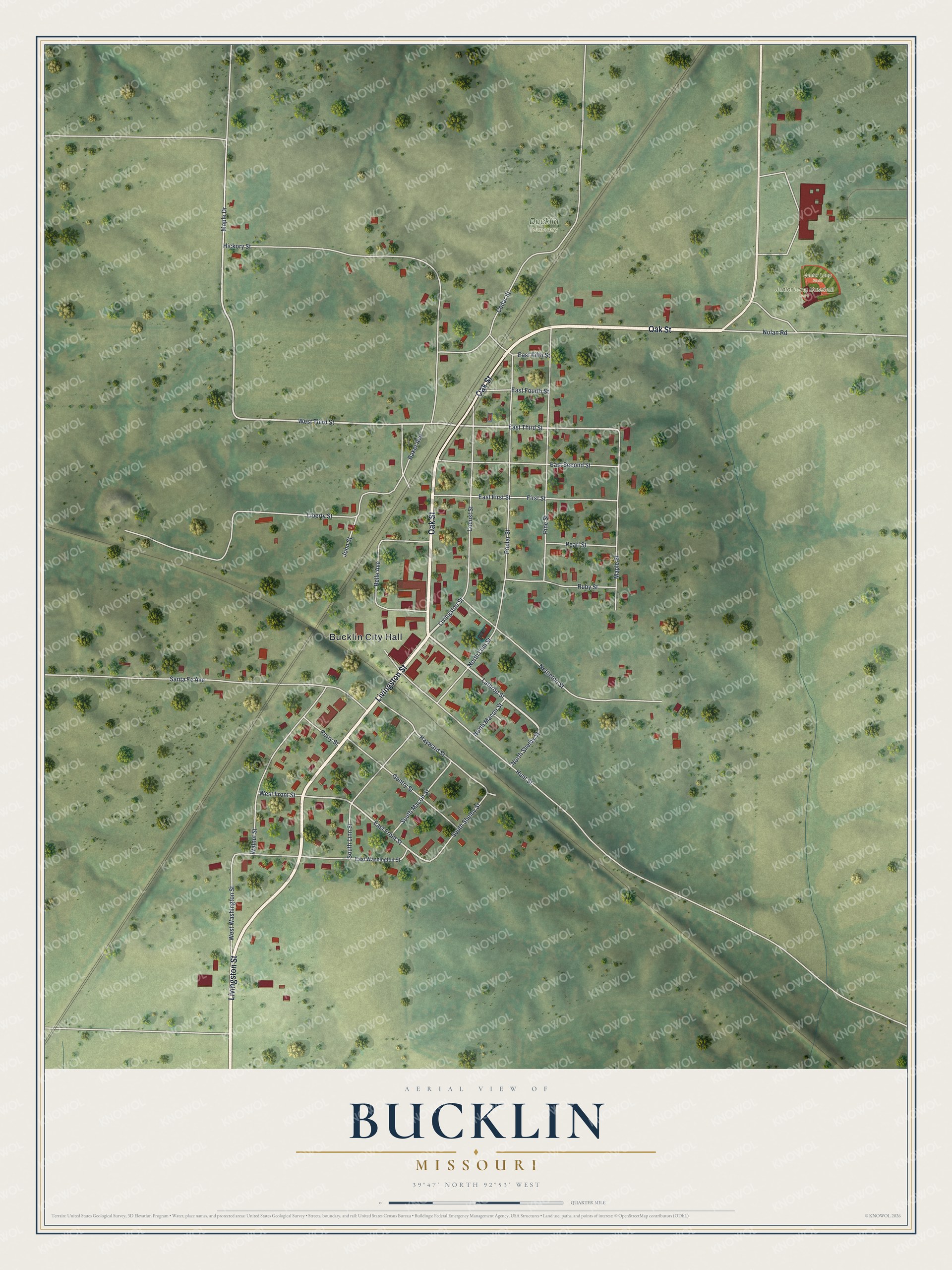
Created by KNOWOL in 2026, this Bucklin map shows the town and the farm country around it, with hills shaded from USGS elevation data. Zoom in and you can pick out the buildings along Oak Street and the ball diamond at Junior Long Field. The title panel reads "Aerial View of Bucklin, Missouri" with the coordinates 39°47' North 92°53' West and a quarter-mile scale bar.
It suits a kitchen, a den or a farmhouse office. It's a good gift for someone who grew up near Bucklin City Hall and moved away, or who played ball at Junior Long Field. Open the preview, zoom in and find the block you know. See sizes and frames for the Bucklin map.