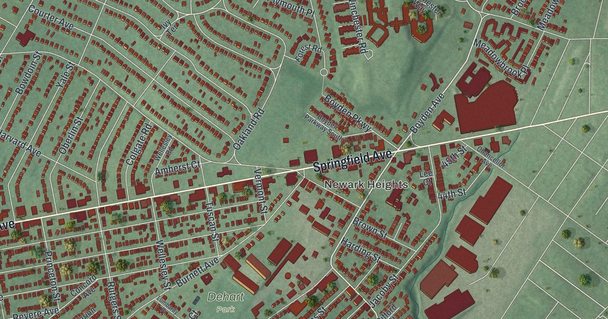
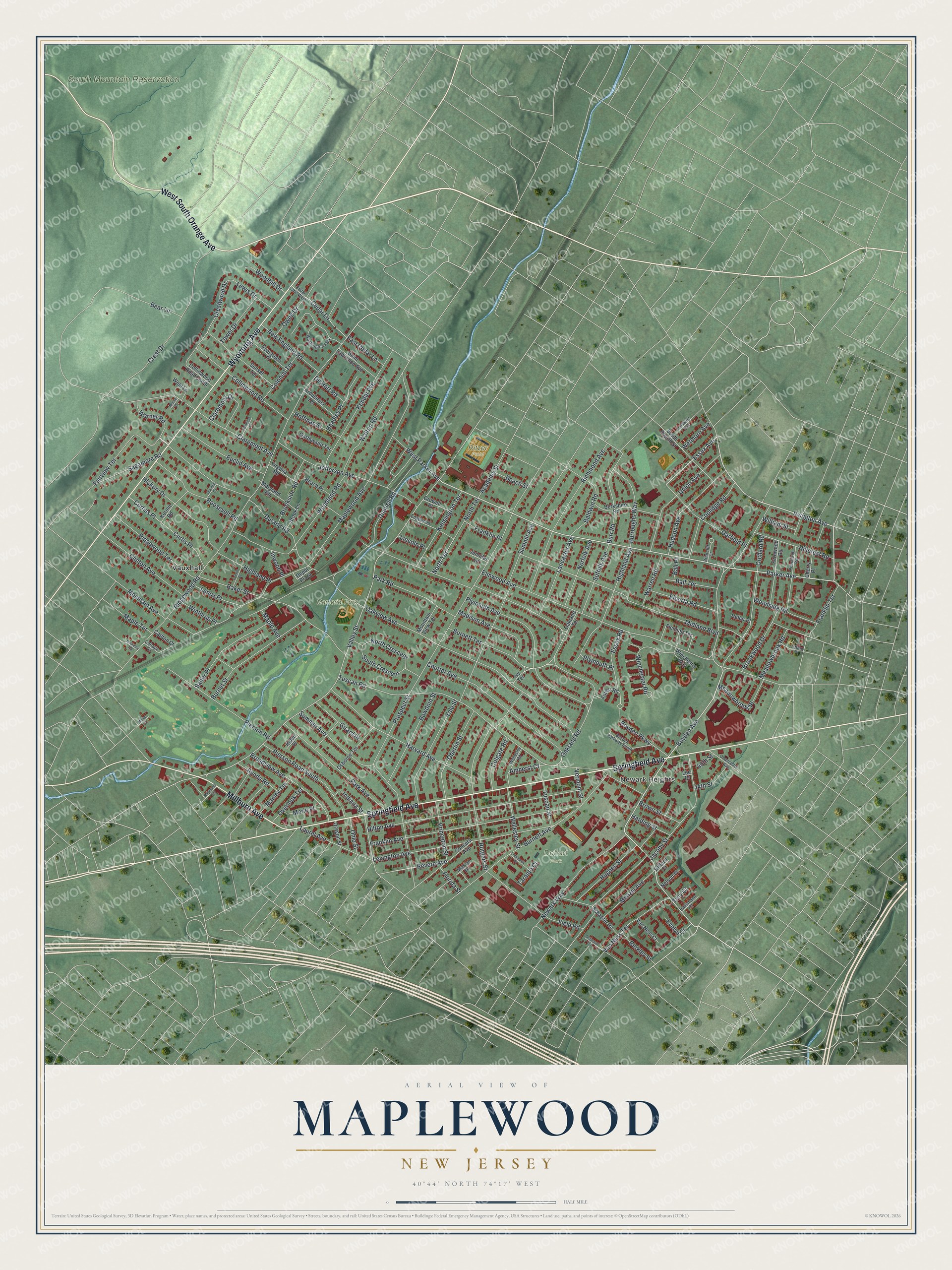
This beautifully detailed map of Maplewood, New Jersey was created in 2026 using aerial imagery combined with modern topographical, census, street and landmark data. It’s a one-of-a-kind view of Maplewood that combines accurate data with a vintage aesthetic. The map shows every building in its true location, many of the roads carry their names, and the shaded topographic relief shows the shape of the land.
Explore an aerial view of Maplewood, New Jersey
On the map you’ll find Newark Heights, Vauxhall, Memorial Park, and Dehart Park, along with Millburn Avenue, Springfield Avenue, Wyoming Avenue, South Orange Avenue, Boyden Avenue, and more. If you look closely you can even find your house accurately drawn in its correct location. Zoom in on the preview to look for yours.
Did You Know?
Seth Boyden moved to Middleville, now Maplewood, in 1855 to retire. Instead he developed a number of new farm products, especially berries. He also built and ran the first steam engines to serve the railroad through Maplewood.
Take a closer look at the Maplewood map
Names on this map
These names are printed on this map.
Places: Newark Heights, Memorial Park, South Mountain Reservation, Dehart Park, Ritzer Field, Vauxhall and Washington Park.
Streets and roads: Millburn Avenue, Springfield Avenue, Wyoming Avenue, West South Orange Avenue, Boyden Avenue, Parker Avenue, Irvington Avenue, Durand Road, Essex Avenue, Revere Avenue, Burnett Terrace, Valley Street.
More street names, A to Z
44th Street, 45th Street, Academy Street, Alden Place, Amherst Court, Arcularius Terrace, Baker Street, Baldwin Road, Ball Place, Ball Terrace, Beach Place, Beach Street, Bear Lane, Berkeley Road, Berkley Street, Berkshire Road, Bowdoin Street, Boyden Parkway, Boyden Parkway South, Briarcliff Court, Broadview Avenue, Brook Lane, Brookside Road, Brookwood Drive, Brown Street, Burnet Street, Burnett Avenue, Burroughs Way, Burr Road, Carlton Court, Cedar Lane, Cedar Lane West, Chancellor Avenue, Cherry Place, Claremont Avenue, Claremont Drive, Clinton Avenue, Colgate Road, Collinwood Road, Collinwood Road South, Colonial Terrace, Concord Avenue, Coolidge Road, Cottage Court, Courter Avenue, Crest Drive, Crestwood Drive, Crowell Place, Curtis Place, Curtiss Place, De Hart Road, Depot Plaza, Dunnell Road, East Cedar Lane, Edgewood Place, Elberta Road, Elmwood Avenue, Essex Road, Euclid Avenue, Evelyn Court, Evergreen Place, Everitt Place, Fairview Terrace, Fernwood Road, Field Road, Fleming Terrace, Florida Street, Forest Road, Franklin Avenue, Franklin Place, Franklin Terrace, Garfield Place, Garthwaite Terrace, Gifford Court, Girard Place, Harding Street, Harvard Avenue, Hausmann Court, Headley Place, Heller Place, Hemlock Court, Hickory Drive, Highland Avenue, Highland Place, Hillcrest Road, Hilton Avenue, Hoffman Street, Hudson Avenue, Hughes Street, Indiana Street, Inwood Place, Ivy Terrace, Jacoby Street, Jefferson Avenue, Jennifer Lane, Kendal Avenue, Kensington Terrace, Kermit Road, Lancaster Avenue, Laurel Avenue, Lee Court, Lenox Place, Lewis Drive, Lexington Avenue, Lincoln Place, Lindsley Avenue, Lombardy Place, Madison Avenue, Manley Terrace, Maple Avenue, Maple Terrace, Maplewood Avenue, Marie Place, Marion Place, Maryland Road, Meadowbrook Place, Meadowbrook Road, Menzel Avenue, Midland Boulevard, Milton Street, Morse Drive, Mountain Avenue, Mountain View Terrace, Nelson Place, Newark Way, New England Road, Norfolk Avenue, North Crescent, North Terrace, Oakland Road, Oakland Terrace, Oakview Avenue, Oberlin Street, Ohio Street, Orchard Road, Oregon Street, Osborne Terrace, Ostwood Terrace, Overlook Terrace, Owen Drive, Park Avenue, Park Road, Peachtree Road, Pierson Road, Pierson Road South, Plymouth Avenue, Plymouth Place, Princeton Street, Prospect Street, Quentin Court, Raymond Terrace, Richmond Avenue, Ridgewood Road, Ridgewood Terrace, Roosevelt Road, Rutgers Street, Rynda Road, Sagamore Road, Saint Lawrence Avenue, Salter Place, Schaefer Road, Sommer Avenue, South Crescent, South Fourth Street, Suffolk Avenue, Summit Avenue, Sunset Terrace, Taranto Court, Tiffany Place, Tower Drive, Troy Court, Tuscan Road, Tuscan Street, Union Avenue, Van Ness Court, Van Ness Terrace, Vermont Street, Virginia Road, Walton Road, Warner Road, Warren Road, Wellesley Road, Wellesley Street, West Lane, West Parker Avenue, Wetmore Avenue, William Street, Winchester Road, Winchester Way, Winthrop Place, Woodhill Drive, Woodland Road, Woodside Road, Yale Street.
See it on a wall
The Maplewood map as an 18 x 24 inch print in a black frame.

This beautifully detailed map of Maplewood makes an attractive addition to your office, library, or den, and it can even be used to teach children the geography and history of the area. It also makes a great gift for anyone with Maplewood roots. When you’re done exploring, click here to get your copy of the Maplewood map.