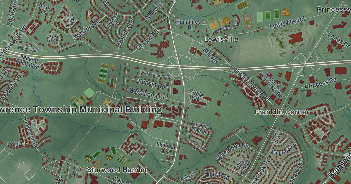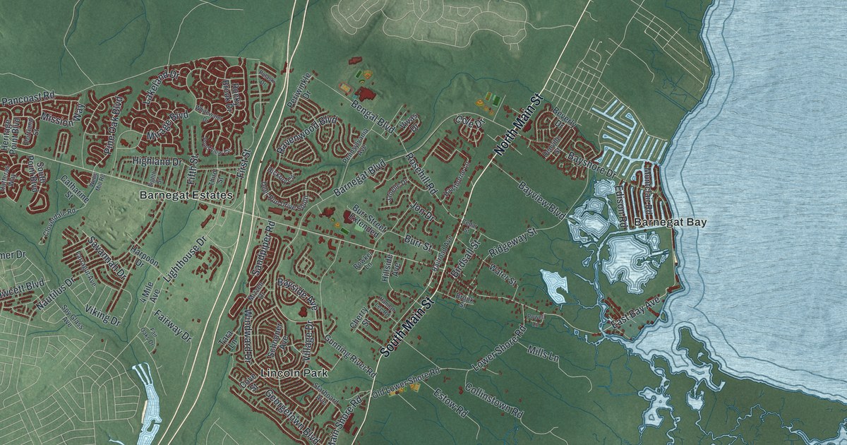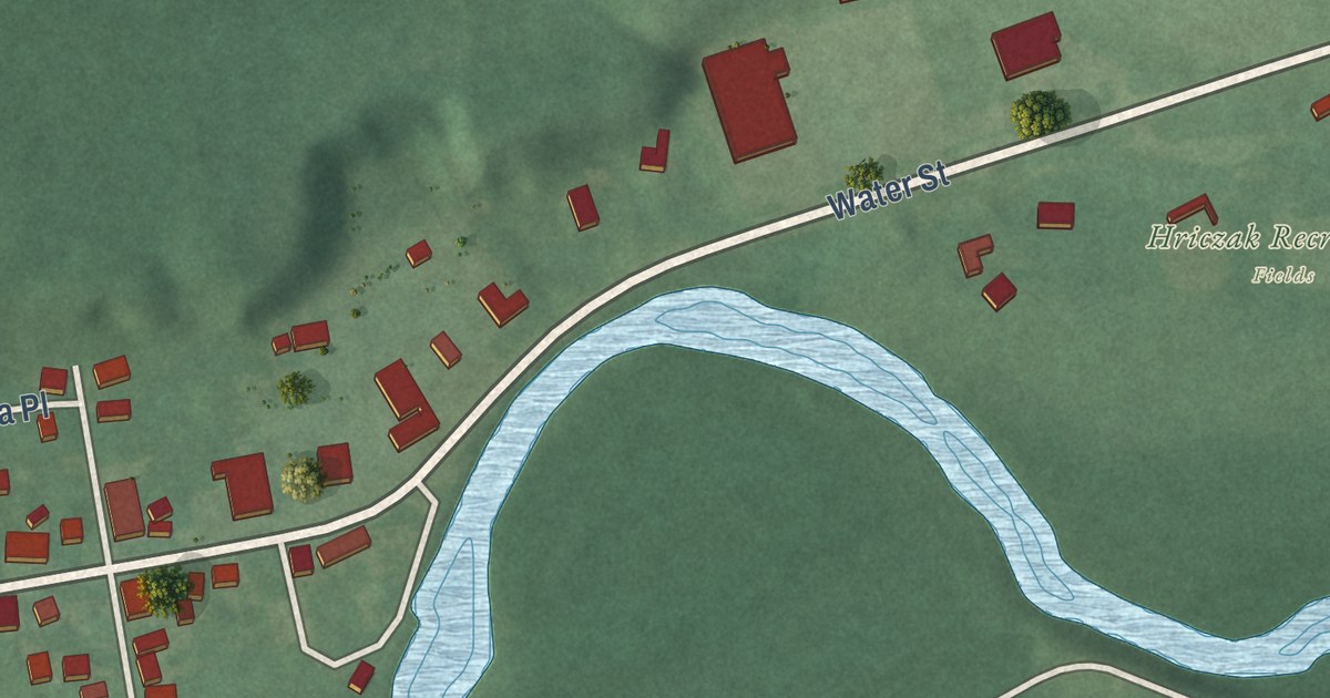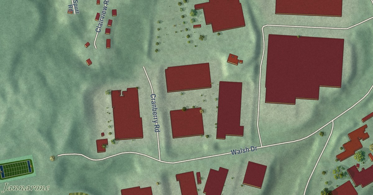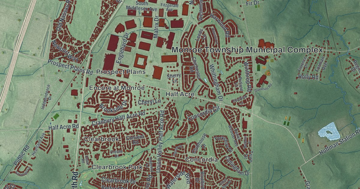
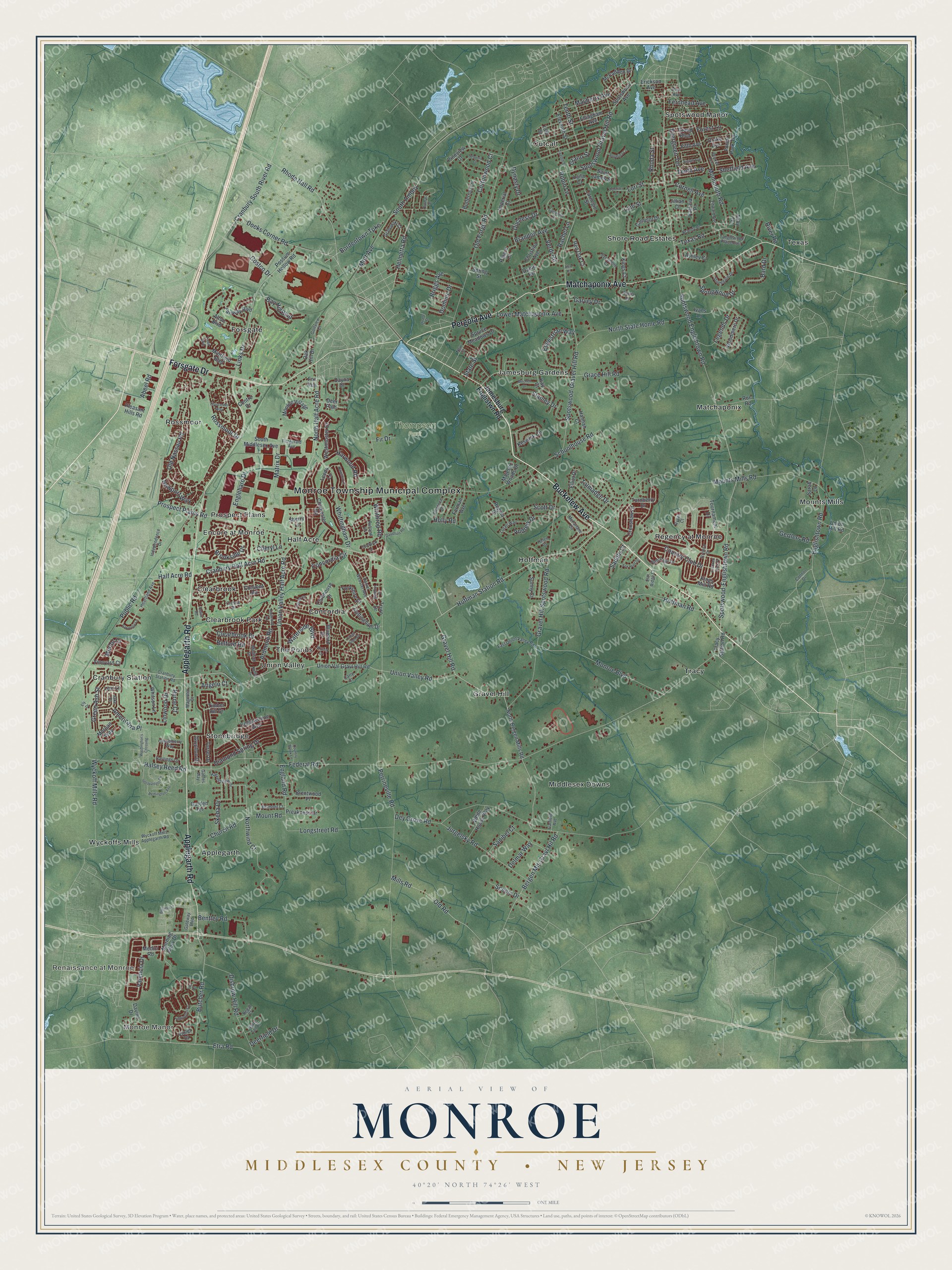
This beautifully detailed map of Monroe, Middlesex County, New Jersey was created in 2026 using aerial imagery combined with modern topographical, census, street and landmark data. It’s a one-of-a-kind view of Monroe that combines accurate data with a vintage aesthetic. The map shows every building in its true location, many of the roads carry their names, and the shaded topographic relief shows the shape of the land.
Explore an aerial view of Monroe, Middlesex County, New Jersey
On the map you’ll find Monroe Township Municipal Complex, Renaissance at Monroe, Applegarth, Clearbrook, Clearbrook Park, Concordia, and Thompson Park, along with Buckelew Avenue, Forsgate Drive, Pergola Avenue, Matchaponix Avenue, and more. If you look closely you can even find your house accurately drawn in its correct location. Zoom in on the preview to look for yours.
Did You Know?
Monroe Township was founded in April 1838. It honors James Monroe, the fifth president of the United States. For decades it was mostly farmland. Trains of the Camden and Amboy Rail Road came through as early as the 1830s. Later, Helmetta, Jamesburg and Spotswood grew into busier towns and split away.
Take a closer look at the Monroe, Middlesex County map
Names on this map
These names are printed on this map.
Places: Monroe Township Municipal Complex, Monroe Manor, Renaissance at Monroe, Thompson Park, Applegarth, Clearbrook, Clearbrook Park, Concordia, Cranbury Station, Encore at Monroe, Forsgate, Gravel Hill, Half Acre, Hoffman, Jamesburg Gardens, Matchaponix, Middlesex Downs, Mounts Mills, Outcalt, Prospect Plains, Regency at Monroe, Rossmoor, Shore Road Estates, Spotswood Manor, Stonebridge, Texas, The Ponds, Tracy, Union Valley and Wyckoffs Mills.
Streets and roads: Buckelew Avenue, Forsgate Drive, Pergola Avenue, Matchaponix Avenue, Applegarth Road, Hoffman Station Road, Federal Road, Bergen Mls Gravl Hil Road, Gravel Hill Road, Halsey Reed Road, Cranbury South River Road, Church Road.
More street names, A to Z
13th Street, Abeel Road, Alex Court, Alton Boulevard, Americana Place, Andrew Drive, Angelina Court, Angelo Court, Ardmore Road, Ashley Court, Bard Drive, Bay Hill Boulevard, Begonia Lane, Belford Road, Belmont Court, Bentley Road, Beth Page Drive, Bluebird Drive, Bordentown Turnpike, Brandon Avenue, Brandy Place, Brentwood Place, Briggs Avenue, Brookside Drive, Butcher Road, Butternut Lane, Byrne Court, Camelot Drive, Carly Court, Carnegie Street, Casselberry Way, Centre Drive, Chadwick Lane, Cheryl Lane, Chichester Road, Christina Avenue, Clearbrook Drive, Clubhouse Drive, Cobblestone Boulevard, Concordia Circle, Connor Drive, Convent Road, Cornell Avenue, Costco Drive, Cottingham Drive, Cottonwood Court, Country Brook Lane, Country Club Drive, Cranbury Half Acre Road, Cranbury Station Road, Crenshaw Court, Crooked Stick Place, Crosse Drive, Daniel Webster Avenue, Dante Road, Davidson Road, Davino Drive, Dawson Lane, Dayna Drive, Deerfield Drive, Deer Path, Delmar Way, Dey Grove Road, Diamond Spring Drive, Disbrow Hill Road, Docks Corner Road, Dominic Drive, Drake Avenue, Drexel Terrace, Duane Street, Duchess Drive, Dynasty Drive, East Union Valley Road, Eddington Lane, Edward Avenue, Eighth Avenue, Eleventh Street, Ellingham Avenue, Elliot Drive, Elm Ridge Court, Ely Drive, England Road, Englehard Drive, Englishtown Road, Equestrian Way, Erickson Avenue, Essex Road, Ethan Allen Drive, Etra Road, Evergreen Terrace, Fairway Boulevard, Fernhead Avenue, Fifth Avenue, Fir Drive, Fitzgerald Avenue, Florence Drive, Forest Lane, Forest Park Terrace, Forman Avenue, Fox Hunt Drive, Fox Run, Gables Way, Garden Terrace, Garfield Avenue, Garvey Drive, Gateway Boulevard, Gertlers Road, Gloria Lane, Gloucester Way, Golfview Court, Grabowski Court, Grace Hill Road, Grand Boulevard, Grano Street, Gravel Hill Spotswood Road, Green Ash Street, Gryphon Drive, Half Acre Road, Hannah Court, Harvestview Drive, Harwood Road, Hastings Lane, Heartland Avenue, Helen Court, Helmetta Road, Hoffman Road, Holly Road, Imperial Court, Independence Drive, Ingram Drive, Intravartolo Circle, Ivans Lane, Jake Place, Jamesburg Englistwn Road, Jennifer Drive, Jillian Court, Jurgelsky Road, Kay Court, Keswick Circle, Kings Court, Kings Mill Road, Laila Court, Lani Street, Leeds Lane, Legends Drive, Lexi Lane, Lily Court, Links Drive, Linwood Drive, Longstreet Road, Lorali Way, Lori Street, Lower Matchaponix Avenue, Madison Drive, Magnolia Court, Majestic Woods Drive, Matrix Drive, Mayberry Avenue, McFadden Drive, McFarlane Circle, Medici Road, Melborn Drive, Merlot Court, Mills Road, Mitchell Drive, Monmouth Road, Monroe Boulevard, Monroe Village, Morgan Way, Morning Glory Drive, Mott Avenue, Mount Road, Mounts Mills Road, Muirfield Boulevard, Newport Way, New Street, North Bergen Mills Road, North Half Acre Road, North State Home Road, Northwind Court, Nutley Drive, Oak Hill Drive, Old Forge Road, Old Nassau Road, Old Road, Palace Court, Park Avenue, Patricia Place, Perrineville Road, Pineview Court, Pleasant Hills Road, Possum Hollow Road, Preakness Drive, Prospect Plains Road, Public Road, Rachel Lane, Red Oak Court, Regal Court, Regina Drive, Remington Avenue, Rhoda Street, Rhode Hall Road, Ridgeway Road, River Road, Riviera Drive, Robin Lane, Rossmoor Drive, Rue Road, Rutland Lane, Ryder Court, Saddle Court, Saint James Street, Samantha Drive, Sanibel Court, Sarah Lane, Saratoga Lane, Scenic Drive, Schoolhouse Road, Scott Drive, Sequoia Court, Sheffield Avenue, Sherry Lane, Skeba Drive, Skylark Drive, South Amboy, South Middlesex Avenue, Spotswood-Englishtown Road, Spotswood-Gravel Hill Road, Spotswood Avenue, Spotswood Englishtown Road, Spotswood Gravel Hill Road, Spring Street, Springwood Drive, Spruce Meadows Drive, Stanley Drive, State Street, Stonegate Drive, Sunny Court, Sycamore Court, Talmadge Drive, Tanglewood Place East, Tenth Avenue, Tenth Street, Texas Road, Thomas Street, Timber Hill Drive, Toby Terrace, Tournament Drive, Tracy Station Road, Truro Drive, Tryall Boulevard, Turnberry Drive, Turret Drive, Twelfth Street, Union Hill Road, Union Val Gravl Hill Road, Union Valley Half Acre Road, Union Valley Road, Valencia Drive, Verdi Road, Vineyard Court, Violet Court, Washington's Crossing, Waterside Boulevard, Westminster Drive, White House Way, White Tail Lane, Whitson Lane, Whittingham Drive, Winthrop Road, Woodmere Drive, Wyckoff Mills Applegarth Road, Wyckoff Mills Road, Yorkshire Drive.
See it on a wall
The Monroe, Middlesex County map as an 18 x 24 inch print in a black frame.

This beautifully detailed map of Monroe, Middlesex County makes an attractive addition to your office, library, or den, and it can even be used to teach children the geography and history of the area. It also makes a great gift for anyone who grew up in Monroe or moved away. When you’re done exploring, click here to get your copy of the Monroe, Middlesex County map.