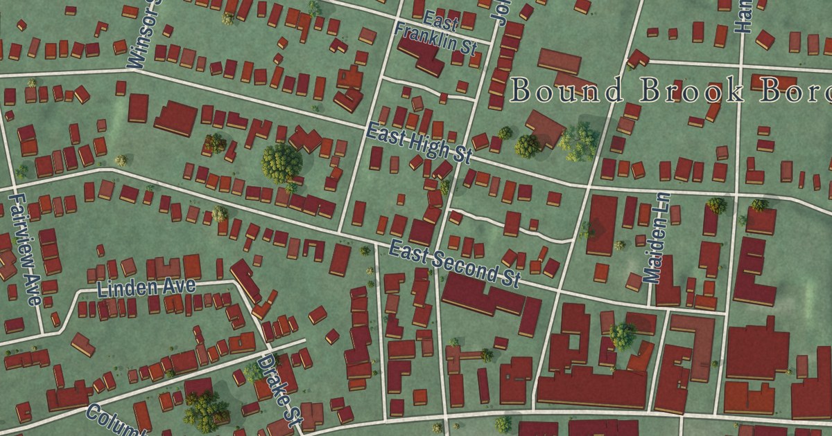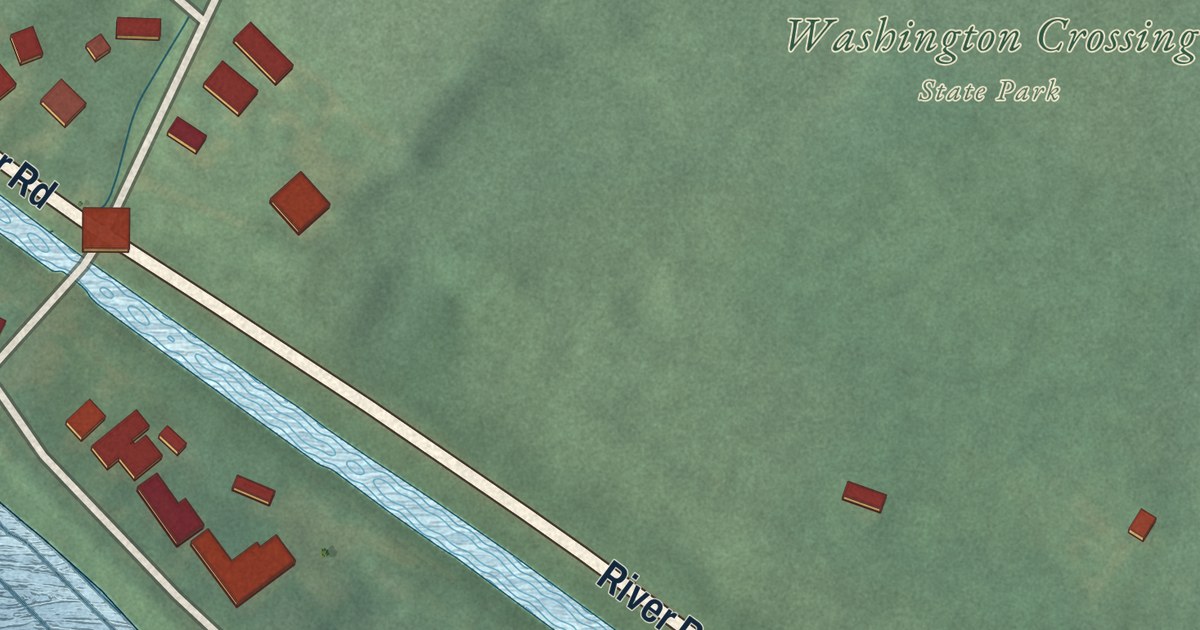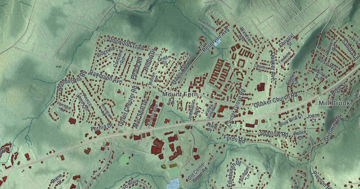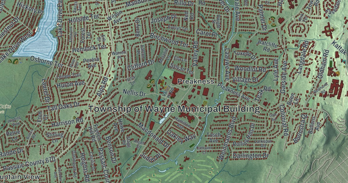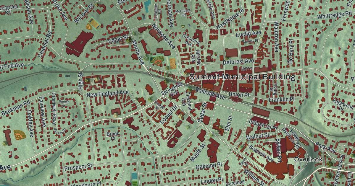
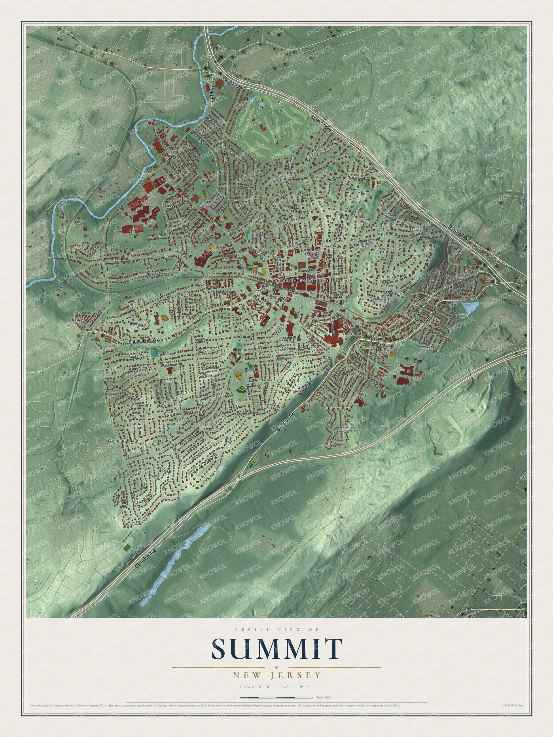
This beautifully detailed map of Summit, New Jersey was created in 2026 using aerial imagery combined with modern topographical, census, street and landmark data. It’s a one-of-a-kind view of Summit that combines accurate data with a vintage aesthetic. The map shows every building in its true location, many of the roads carry their names, and the shaded topographic relief shows the shape of the land.
Explore an aerial view of Summit, New Jersey
On the map you’ll find Summit Municipal Building, Woodland Park, Overlook, Tremont Park, and Briant Park, along with Glenside Avenue, Morris Avenue, Morris Turnpike, Springfield Avenue, and more. If you look closely you can even find your house accurately drawn in its correct location. Zoom in on the preview to look for yours.
Did You Know?
During the Revolution, the ridge at Summit helped block British troops from the hill country. A small cannon called Old Sow served there as an alarm gun. It warned Washington when British raiding parties came near. The cannon now sits at the Ford Mansion in Morristown, and a bronze tablet marks its old site. That’s from the 1939 WPA guide to New Jersey.
Take a closer look at the Summit map
Names on this map
These names are printed on this map.
Places: Summit Municipal Building, Woodland Park, Briant Park, Overlook and Tremont Park.
Streets and roads: Glenside Avenue, Morris Avenue, Morris Turnpike, Springfield Avenue, Jfk Parkway, Broad Street, Middle Avenue, Summit Avenue, Baltusrol Road, Elm Street, Larned Road, Huntley Road.
More street names, A to Z
100 Lane, Argyle Court, Ascot Way, Ashland Road, Ashwood Avenue, Aubrey Street, Badeau Avenue, Beacon Road, Beauvoir Avenue, Bedford Road, Beech Spring Drive, Beechwood Road, Beekman Road, Beekman Terrace, Bellevue Avenue, Beverly Road, Blackburn Place, Blackburn Road, Brainerd Road, Brantwood Drive, Briant Parkway, Brook Court, Butler Parkway, Caldwell Avenue, Canoe Brook Parkway, Canterbury Lane, Carleen Court, Cedar Street, Cedric Road, Chapel Street, Chatham Road, Chestnut Avenue, Clark Street, Club Drive, Colonial Road, Colony Drive, Colt Road, Constantine Place, Cottage Lane, Crescent Avenue, Crest Acre Court, Cromwell Parkway, Dale Drive, De Bary Place, Deforest Avenue, Devon Road, Division Avenue, Dogwood Drive, Dorchester Road, Doremus Street, Dorset Lane, Druid Hill Road, Drum Hill Drive, Dunnder Drive, Eaton Court, Edgar Street, Edgemont Avenue, Edgewood Drive, Edgewood Road, Edison Drive, Eggers Court, Elm Place, Essex Road, Euclid Avenue, Evergreen Road, Fairview Avenue, Fay Place, Fernwood Road, Franklin Place, Fremont Road, Friar Tuck Circle, Garden Road, Gary Road, Gates Avenue, George Street, Glen Avenue, Glendale Road, Glen Oaks Avenue, Greenbriar Drive, Greenbriar Road, Greenfield Avenue, Grove Street, Harrison Court, Hartley Road, Harvey Drive, Hawthorne Place, Henry Street, Hickory Road, Highland Drive, High Street, Hillcrest Avenue, Hillside Avenue, Hobart Avenue, Hobart Road, Hughes Place, Industrial Place, Iris Road, Irving Place, Joanna Way, John Street, Karen Way, Kenneth Court, Kent Place Boulevard, Kings Hill Court, Knob Hill Drive, Lafayette Avenue, Laurel Avenue, Lenox Road, Lewis Avenue, Lincoln Avenue, Linda Lane, Linden Place, Little Wolf Road, Llewelyn Road, Locust Drive, Londonderry Way, Lorraine Road, Lowell Avenue, Lower Overlook Road, Madison Avenue, Manor Hill Road, Maple Street, McGregor Road, Michigan Avenue, Midland Terrace, Miele Place, Milton Avenue, Montrose Avenue, Morris Court, Mountain Avenue, Mount Vernon Avenue, Myrtle Avenue, Nassau Drive, New England Avenue, New Providence Avenue, Newstead Road, North Street, Norwood Avenue, O'Shea Lane, Oak Knoll Road, Oakland Place, Oakley Avenue, Oak Ridge Avenue, Old Coach Road, Orchard Road, Oxbow Lane, Park Avenue, Park Place, Parkview Terrace, Parmley Place, Passaic Avenue, Pearl Street, Pembroke Road, Pine Grove Avenue, Pine Ridge Drive, Plain Street, Plymouth Road, Portland Road, Primrose Place, Prospect Hill Avenue, Prospect Street, Railroad Avenue, Ramsey Drive, Ridgedale Avenue, Ridge Road, Risk Avenue, River Road, Robin Hood Road, Rotary Drive, Rotary Lane, Rowan Road, Russell Place, Sayre Street, Shadyside Avenue, Sheffield Road, Sheridan Road, Sherman Avenue, Shunpike Road, Silver Lake Drive, South Street, Stacie Court, Stanley Avenue, Stiles Road, Stockton Road, Stony Hill Court, Sunset Drive, Surrey Road, Sweetbriar Road, Sylvan Road, Tanglewood Drive, Templar Way, Tulip Street, Twombly Drive, Union Place, Valemont Way, Valley View Avenue, Van Dyke Place, Wade Drive, Waldron Avenue, Wallace Road, Walnut Street, Warwick Road, Weaver Street, Webster Avenue, West End Avenue, West Lane, Westminster Road, Whittredge Road, William Street, Willow Road, Winchester Road, Windsor Road, Woodcroft Road, Woodfern Road, Woodland Avenue, Woodmere Drive, Yale Street.
See it on a wall
The Summit map as an 18 x 24 inch print in a black frame.

This beautifully detailed map of Summit makes an attractive addition to your office, library, or den, and it can even be used to teach children the geography and history of the area. It also makes a great gift for someone who left Summit and still calls it home. When you’re done exploring, click here to get your copy of the Summit map.