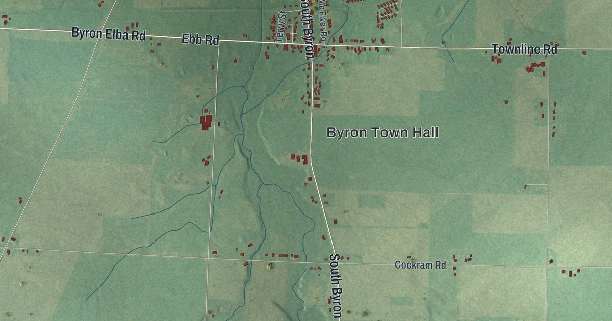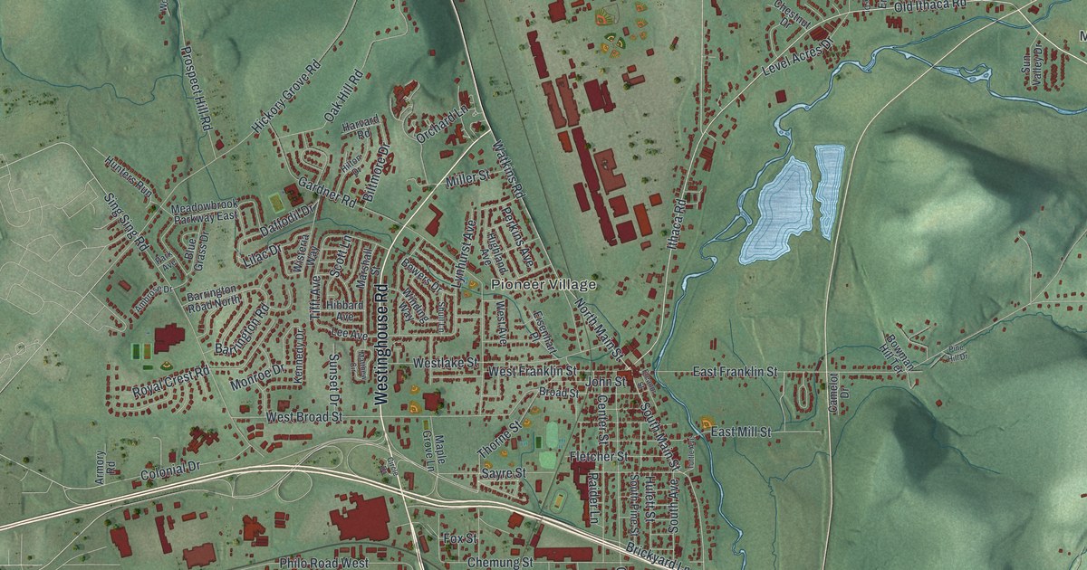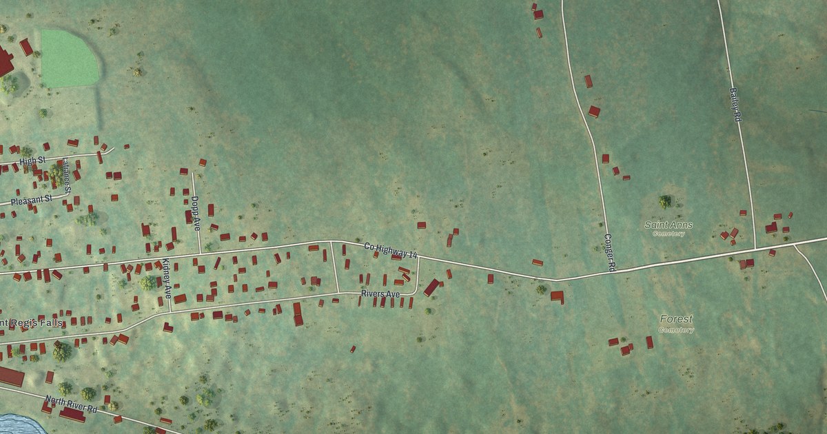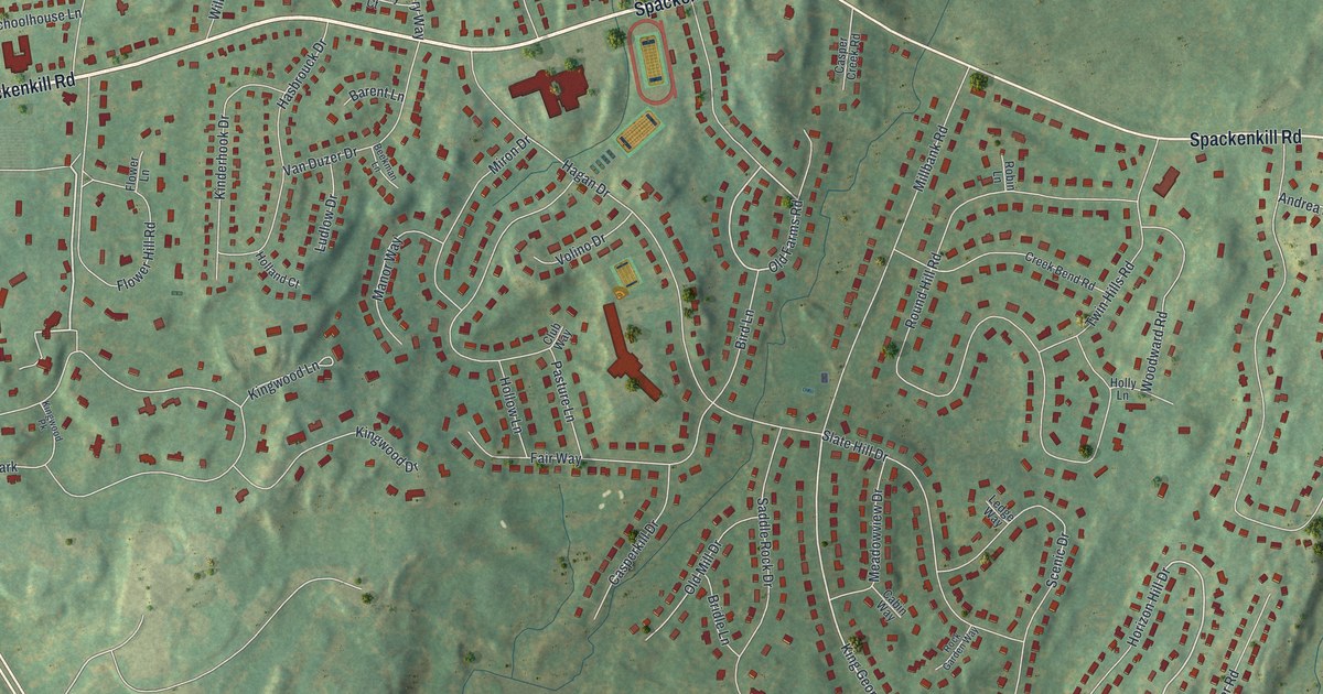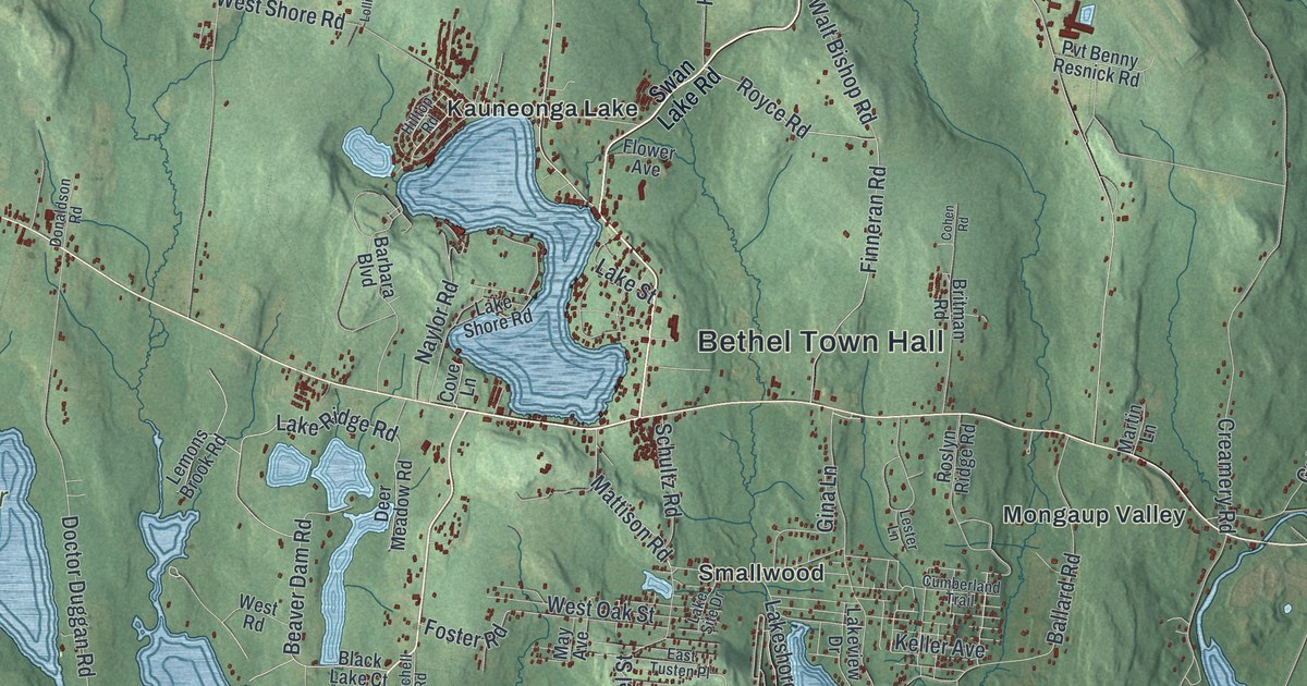
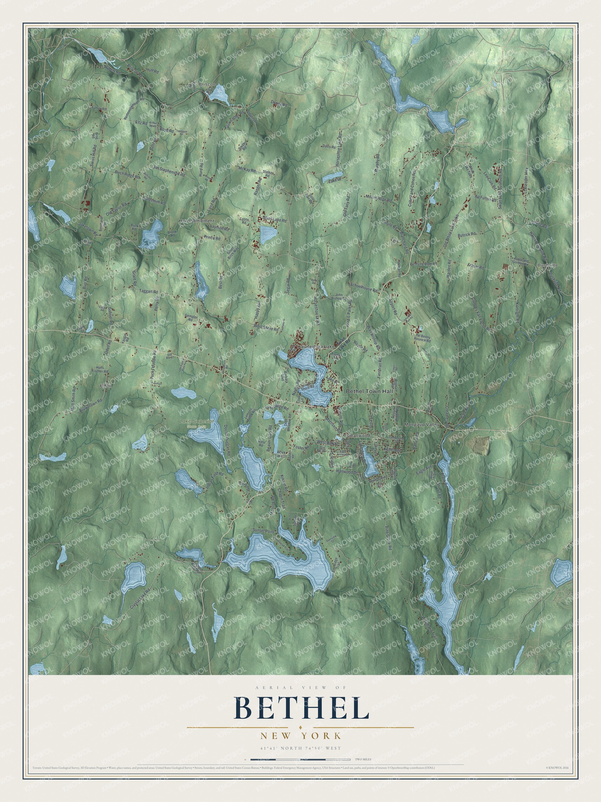
This beautifully detailed map of Bethel, New York was created in 2026 using aerial imagery combined with modern topographical, census, street and landmark data. It’s a one-of-a-kind view of Bethel that combines accurate data with a vintage aesthetic. The map shows every building in its true location, many of the roads carry their names, and the shaded topographic relief shows the shape of the land.
Explore an aerial view of Bethel, New York
On the map you’ll find Bethel Town Hall, Bushville, Briscoe, Hurd Settlement, Kauneonga Lake, Mongaup Valley, and Lake Superior State Park, along with Swan Lake Road, Horseshoe Lake Road, Horseshoe Lk Road, Ap Fulton Road, and more. If you look closely you can even find your house accurately drawn in its correct location. Zoom in on the preview to look for yours.
Did You Know?
Bethel drew worldwide attention in 1969 as the home of the Woodstock festival. Organizers had first planned the event for Wallkill, New York. When Wallkill withdrew, the festival moved to Bethel instead. The town itself was formed in 1809 from part of Lumberland.
Take a closer look at the Bethel map
Names on this map
These names are printed on this map.
Places: Bethel Town Hall, Bushville, Briscoe, Lake Superior State Park, Hurd Settlement, Kauneonga Lake, Mongaup Valley, Odell and Smallwood.
Streets and roads: Horseshoe Lake Road, Horseshoe Lk Road, Ap Fulton Road, Lt Brender Highway, Old White Lake Turnpike, Naylor Road, Foster Road, Hurd Road, Pucky Huddle Road, Creamery Road, West Shore Road, Pine Grove Road.
More street names, A to Z
Airport Road, Apple and Gordon Road, Arthur South, Ballard Road, Balms Road, Barbara Boulevard, Beaver Dam Road, Behr Road, Bernhardt Road, Best Road, Bettino Road, Birch Ridge Road, Black Lake Court, Blanchard Road, Boyd Road, Briscoe Road, Britman Road, Brog Road, Brook Road, Browntown Road, Buck Road, Burr Road, Bushville Road, Butrick Road, Chapin Trail, Cliff Street, Cohen and Cohen Road, Cohen Road, Cove Lane, Crumley Van Vactor Road, Crystal Lake Road, Cumberland Trail, Davis Road, Deer Meadow Road, Deppa Road, Doctor Duggan Road, Donaldson Road, Dove Trail, Eagle Avenue, East Tusten Place, Eltz Road, Fairweather Road, Finneran Road, Fisher Road, Fittkau Road, Flower Avenue, Frank Street, Fraser Road, Fuhrer Road, Gabriel Road, Gabriel Street, Gale Road, Gempler Road, Gina Lane, Gold Dan Road, Goldsmith Road, Grant Road, Hans Fischer Road, Happy Avenue, Harden Road, Harris Bushville Road, Hartwood Drive, Hilltop Road, Homestead Trail, Hubert Road, Huff Road, Hurd & Parks Road, Indian Field Road, Industrial Park Road, Iroquois Trail, Jaketown Road, Jim Stephenson Road, John Bishop Road, Keller Avenue, Kilcoin Road, Kortright Road, Laird Road, Lake Drive, Lake Ridge Road, Lakeshore Drive, Lake Shore Road, Lake Site Drive, Lake Street, Lakeview Drive, Laymon Road, Lee Cole Road, Lemons Brook Road, Lester Lane, Lollipop Lane, Lynn Drive, Lyons Road, Martin Lane, Mattison Road, Matt Smith Road, May Avenue, McKay Road, Michel Road, Misty Lane, Mitchell Road, Moscoe Road, Mount Hope Road, Murphy Road, Odell Road, Old Route 17, Old Tacy Road, Old Taylor Road, Orange Avenue, Overview Court, Oxford Drive, Perry Road, Pine Hi Road, Pine Street, Pioneer Drive, Plank Road, Popoff Lane, Prince Road, Pvt Benny Resnick Road, Pvt Irving Blum Road, Ranger Road, Remenschneider Road, Roslyn Ridge Road, Royce Road, Schoolhouse Road, Schultz Road, Segar Road, Silver Birch Way, Silver Lake Road, Smith Road, Soule Road, Stalker Road, Star Lite Drive, Stevenson Road, Stewart Road, Strong Road, Strout Road, Sunrise Point, Sunset Point, Swan Lake Bushville Road, Swan Lake Road, Swiss Hill Road, Taggart Road, Top Ridge Trail, Toronto Pond Road, Townsend Road, Walt Bishop Road, Wayne Drive, West Oak Street, West Road, White Lake Turnpike, Willi Hill Road, Woodland Trail, Yasgur Road.
See it on a wall
The Bethel map as a framed print. Swipe for more.


This beautifully detailed map of Bethel makes an attractive addition to your office, library, or den, and it can even be used to teach children the geography and history of the area. It also makes a great gift for anyone who grew up in Bethel or moved away. When you’re done exploring, click here to get your copy of the Bethel map.