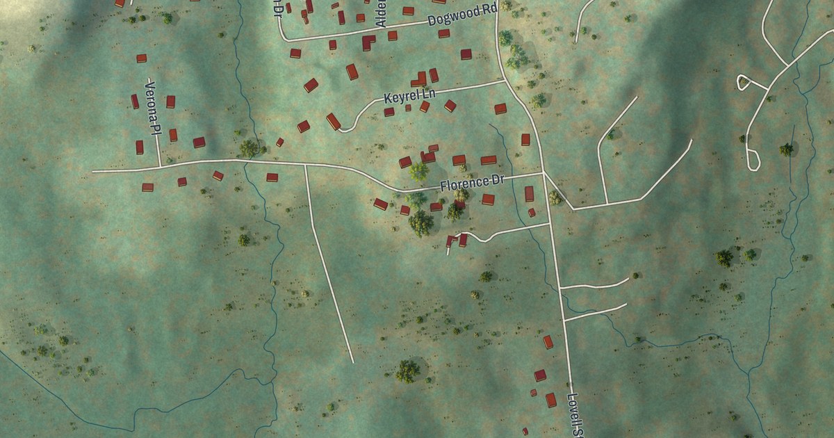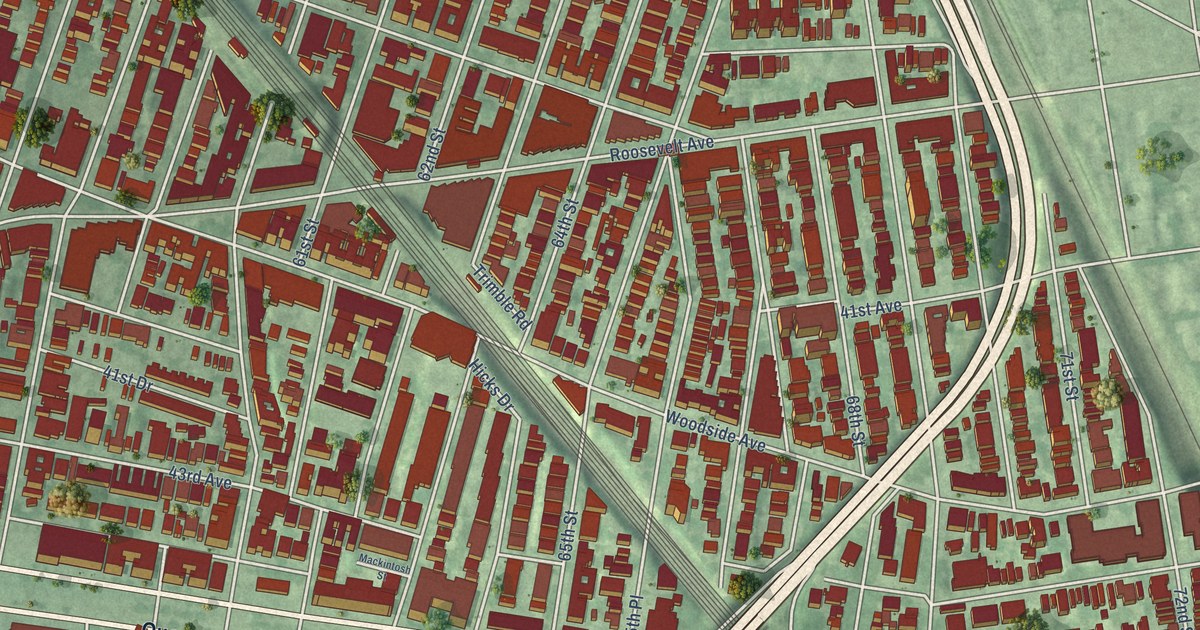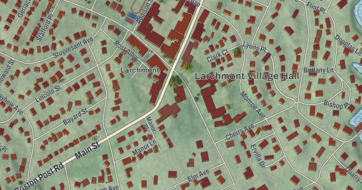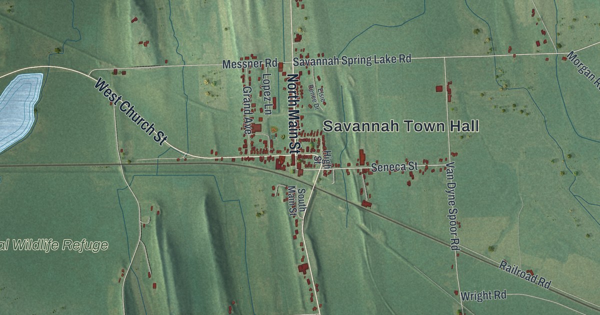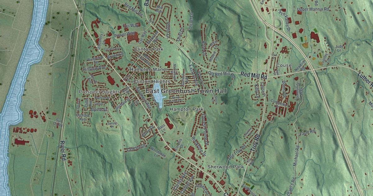
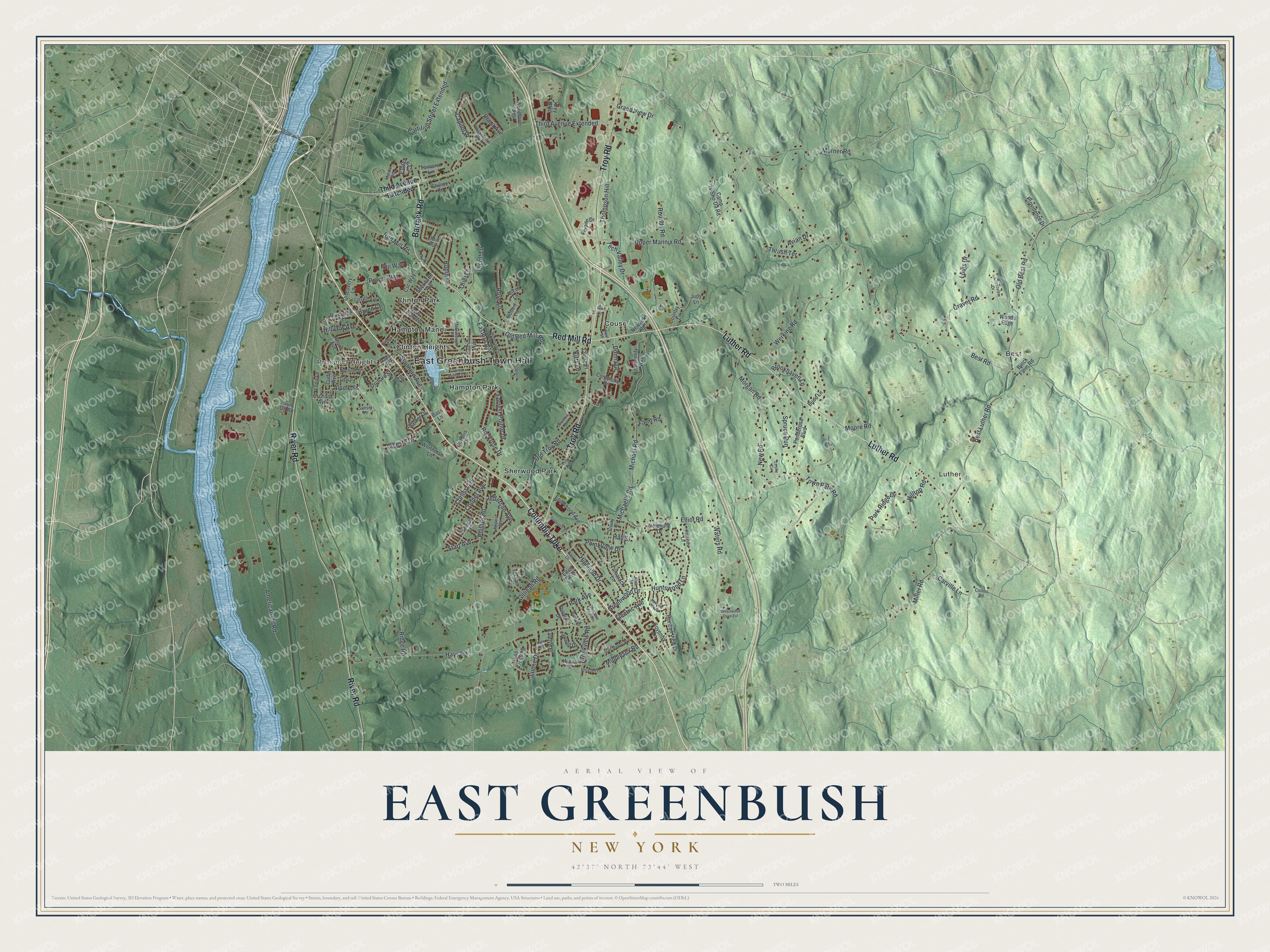
This beautifully detailed map of East Greenbush, New York was created in 2026 using aerial imagery combined with modern topographical, census, street and landmark data. It’s a one-of-a-kind view of East Greenbush that combines accurate data with a vintage aesthetic. The map shows every building in its true location, many of the roads carry their names, and the shaded topographic relief shows the shape of the land.
Explore an aerial view of East Greenbush, New York
On the map you’ll find East Greenbush Town Hall, Best, Luther, Prospect Heights, Clinton Heights, and Clinton Park, along with Columbia Turnpike, Barrack Road, Red Mill Road, Luther Road, and more. If you look closely you can even find your house accurately drawn in its correct location. Zoom in on the preview to look for yours.
Did You Know?
The name Greenbush comes from the Dutch words het groen bosch. They described the pine woods that once covered the land. Tenants of the patroon Kiliaen van Rensselaer made the first settlement here around 1630. The town was formed as Clinton in 1855 and became East Greenbush in 1858.
Take a closer look at the East Greenbush map
Names on this map
These names are printed on this map.
Places: East Greenbush Town Hall, Best, Luther, Prospect Heights, Clinton Heights, Clinton Park, Couse, Hampton Manor, Hampton Park and Sherwood Park.
Streets and roads: Columbia Turnpike, Barrack Road, Red Mill Road, Luther Road, Troy Road, River Road, Point View Drive, Miller Road, Best Road, Elliot Road, Ridge Road, American Oil Road.
More street names, A to Z
Acorn Avenue, Adams Avenue, Albany Place, Alice Lane, Alpine Street, Alva Street, Avian Drive, Barber Drive, Bass Lane, Best Luther Road, Binck Farm Road, Brookhaven Lane, Brookview Road, Bruen Court, Budd Lane, Camp Is-Sho-Da Road, Capitol Place, Carville Lane, Catskill Avenue, Celeste Drive, Cliffe Avenue, Cliffe Street, Clinton Street, Collins Road, Columbia Drive, Commons Drive, Community Way, Cooper Avenue, Corellis Drive, Corliss Avenue, Country Lane, Couse Place, Coventry Lane, Craver Road, Crestview Drive, Csc Way, Delehunt Drive, Discovery Lane, Donna Drive, Donnelly Drive, Eastern Avenue, Electric Avenue, Elliot Avenue, Empire Circle, Empire Drive, Englewood Avenue, Farm Road, Flora Circle, Forrest Pointe Drive, Fuji Way, Gilligan Road, Glaz Street, Grand View Drive, Greenwood Drive, Greenwood Drive Extension, Hall Street, Hays Road, Highland Drive, Hill Avenue, Hill Street, Hilltop Road, Hillview Avenue, Horizion View Drive, Horizon View Drive, Huntswood Lane, Hydor Drive, Iroquois Place, Janine Drive, Jefferson Avenue, Jennell Drive, Judy Lane, Katelyn Place, Kitty Lane, Krey Boulevard, Kriss Krossing, Lake Shore Drive, Leslie Circle, Lona Lane, Lori Drive, Louis Drive, Malibu Hill, Maple Street, McCullough Place, McDonald Lane, Michael's Road, Michael Road, Middlesex Road, Mill Run, Moore Road, Morgan Road, Morner Road, Mountain View Avenue, Neptune Street, Newkirk Road, New Road, New York Avenue, Olcott Lane, Old Best Road, Old Red Mill Road, Old Troy Road, Orchard Avenue, Orchard Street, Oriel Lane, Park Avenue, Park Drive, Park Ridge Drive, Partition Street Extended, Pauline Court, Paul Street, Petalas Drive, Pheasant Lane, Phillips Road, Pineview Lane, Plaza Avenue, Ponderosa Boulevard, Power Way, Providence Drive, Riverview Terrace, Robert Lane, Robin Lane, Rockefeller Boulevard, Rockrose Drive, Rose Lane, Rounds Road, Rugby Road, Sherwood Avenue, Southern Avenue, Spring Avenue East, Spruce Run, Start Avenue, Stock Lane, Summit Avenue, Sun Oil Road, Sunset Lane, Tamarack Lane, Tanners Lane, Tech Valley Drive, Ternan Avenue, Third Avenue Extended, Thompson Hill, Thrush Terrace, Town Park Road, Upper Mannix Road, Van Buren Avenue, Waters Road, Werking Road, Woodlawn Avenue, Woods Edge, Worthman Lane.
See it on a wall
The East Greenbush map as a framed print. Swipe for more.


This beautifully detailed map of East Greenbush makes an attractive addition to your office, library, or den, and it can even be used to teach children the geography and history of the area. It also makes a great gift for anyone who grew up in East Greenbush or moved away. When you’re done exploring, click here to get your copy of the East Greenbush map.