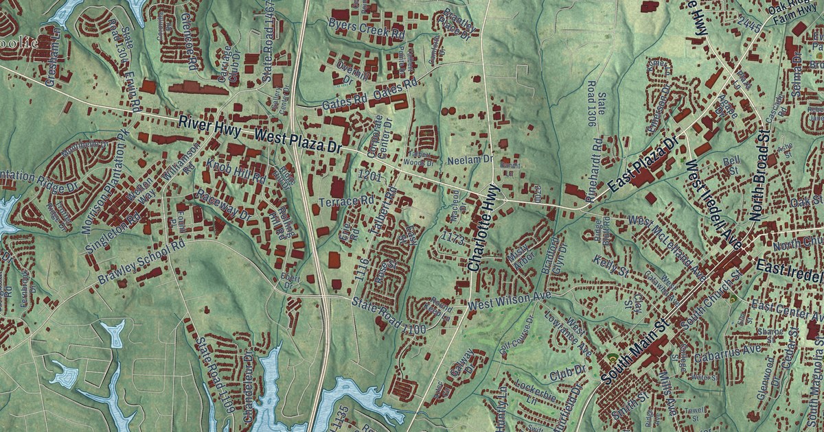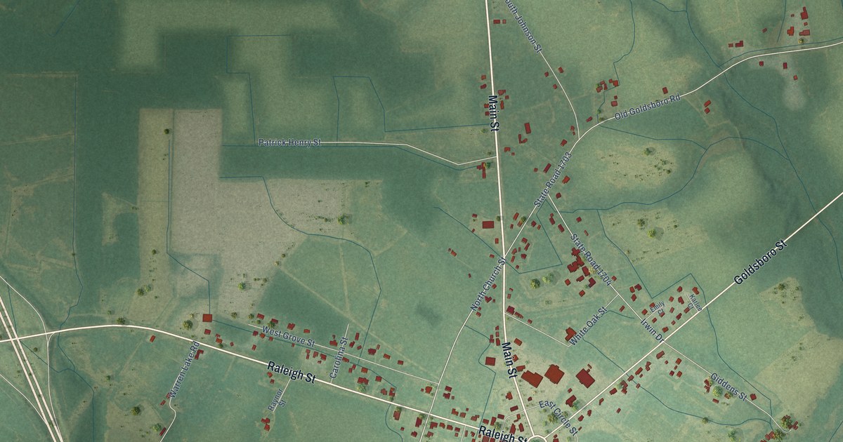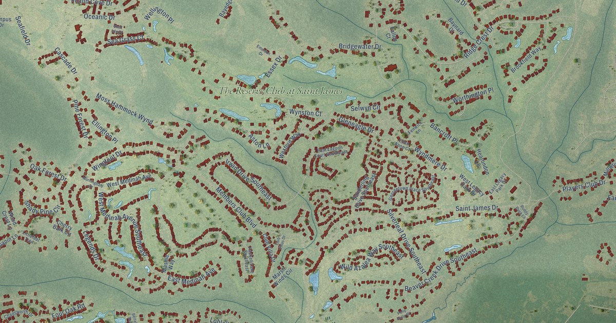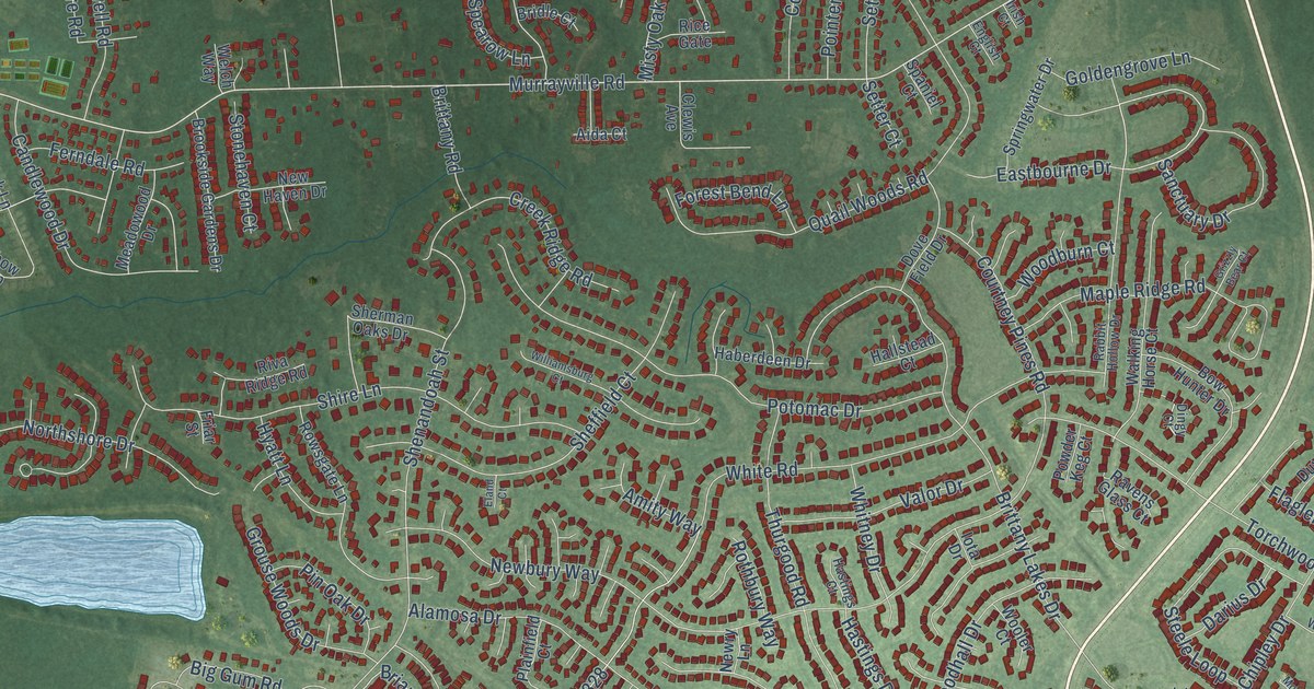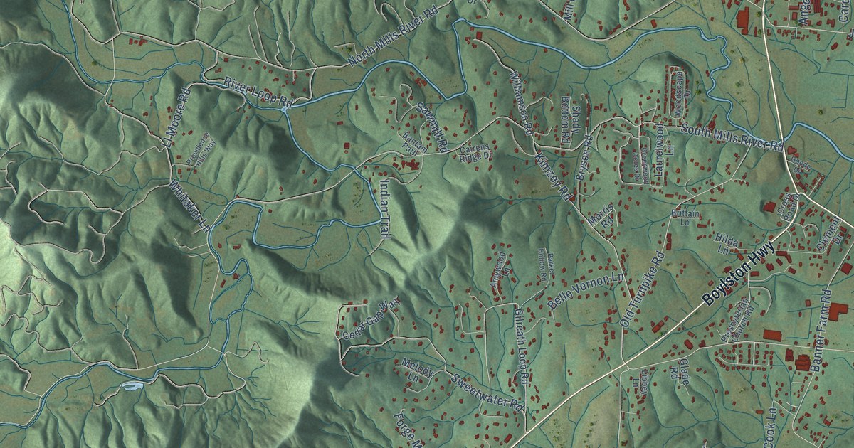
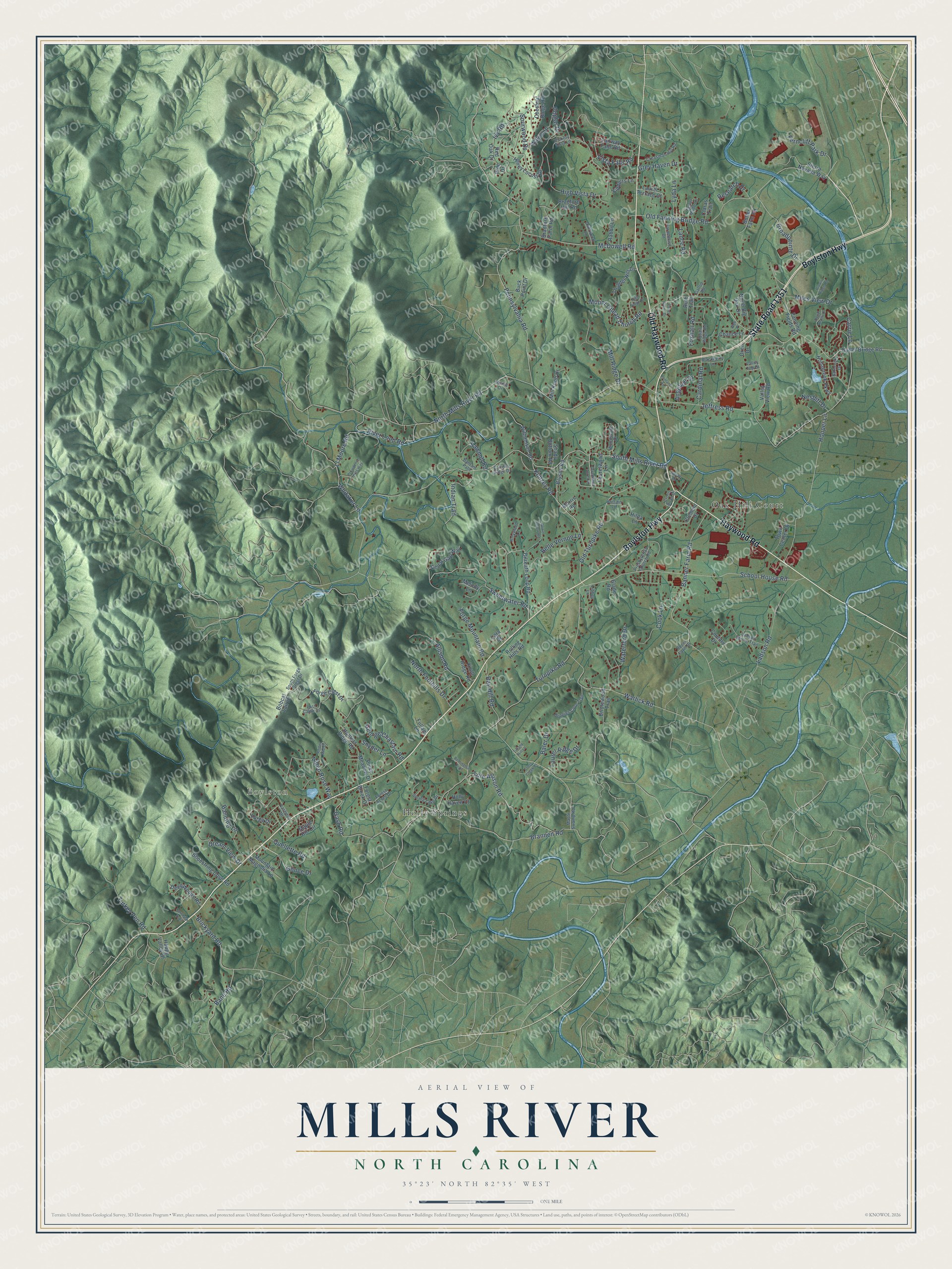
This beautifully detailed map of Mills River, North Carolina was created in 2026 using aerial imagery combined with modern topographical, census, street and landmark data. It's a modern aerial view of Mills River in Henderson County, North Carolina, that combines modern data with a vintage aesthetic. The roads feature printed names, and if you look closely you can find your exact house accurately shown in its correct location.
Explore an aerial view of Mills River, North Carolina
On this map you'll find Boylston, Holly Springs, Oak Hill Court, Boylston Highway, Old Haywood Road, Haywood Road, State Road 1351, Old Fanning Bridge Road, Vista Falls Road, North Mills River Road, South Mills River Road, Pennsylvania Road, and more. Each red shape is a building, so zoom in on the preview and look for yours.
Here is a piece of Mills River history, in the words of the record. The record at dncr.nc.gov puts it this way: "Iron works set up four mi. W. by Philip Sitton after 1804. Source for manufacture of rifles by Philip Gillespie. Both operated to 1860s."
Mills River is a town in Henderson County. The Census Bureau counted 7,078 people here in 2020.
Take a closer look at the Mills River map
Names on this map
These names are printed on this map.
Places: Boylston, Holly Springs and Oak Hill Court.
Streets and roads: Boylston Highway, Old Haywood Road, Haywood Road, State Road 1351, Old Fanning Bridge Road, Vista Falls Road, North Mills River Road, South Mills River Road, Pennsylvania Road, Turnpike Road, Jeffress Road, School House Road.
More street names, A to Z
Allison Road, Alpen Rose Way, Amber Mist Drive, Amywood Lane, Angeline Drive, Baler Drive, Bane Road, Banner Farm Road, Banning Lane, Bantam Path, Barnrock Drive, Belle Vernon Lane, Blackberry Lane, Bobcat Lair Drive, Bonnies Cove Trail, Bradford Farm Road, Bradford Hill Road, Brannon Road, Brickyard Road, Bridlewood Trail, Brittain Lane, Broadpointe Drive, Brown Ridge Road, Bryson Road, Buck Point Drive, Butler Bridge Road, Butler Farm Road, Cairens Ridge Drive, Cardinal Road, Carrie Lane, Cashdon Drive, Cedar Gap Way, Chance Lane, Chestnut Ridge Road, Claras Trail, Clement Drive, Cook Lane, Cornhusk Trail, Country Drive, Creasman Hill Road, Cross Creek Court, Cross Road Drive, Deep Woods Road, Dream View Drive, Driftwood Lane, Fairway Falls Road, Fanning Fields Road, Farmhouse Drive, Ferncliff Park Drive, Fiddlers Lane, Forest Acres Drive, Forest Brook Drive, Forge Crest Drive, Forge Drive, Forge Mountain Road, Foxhall Road, Fullam Lane, Gallup Road, Gash Road, George Chastain Road, Gilreath Loop Road, Glade Road, Gonce Drive, Goode Drive, Greenwood Acres Drive, Grey Haven Drive, Happy Valley Drive, Hickory Vista Lane, High Ridge Drive, High Vista Drive, Hilda Lane, Hollabrook Parkway, Holly Haven Court, Honey Locust Drive, Hooper Lane, Hunters Ridge Road, Indian Trail, Ivy Road, Kimzey Road, Knoll Ridge Road, Ladson Road, Ladson Spring Trail, Lance Road, Lara Drive, Laurel Ridge Drive, Laurel Terrace Court, Laurelwood Lane, Libbey Lane, Ll Moore Road, Lost Cabin Drive, Lyda Lane, Maple Hill Circle, Maple Swamp Road, McDowell Road, Melody Lane, Miles View Drive, Mill Knob Drive, Mill Ridge Drive, Mirika Drive, Morris Road, Mountain Magnolia Lane, Mount Gilead Church Road, Nesbitt Drive, North Big Oak Drive, North Foothills Drive, Old Turnpike Road, Oren Drive, Parker Hollow Road, Penland Road, Pine Drive, Piney Meadow Drive, Poplar Drive, Posey Glenn Drive, Presbyterian Church Road, Providence Hills Way, Quail Ridge Road, Quellette Road, Rabbit Lane, Ray Hill Road, Red Oak Drive, Regal Knolls Drive, Remington Trail, Research Drive, River Loop Road, Rolling Hills Road, Roper Farm Drive, Ruth Trail, Sawmill Road, Shady Bottom Road, Shoestring Cove Road, Sierra Nevada Way, Snyder Lane, Sourwood Drive, South Forge Crest Drive, Spring Lake Drive, Sweetwater Road, Taylor Made Lane, Thunder Hill Lane, Tiffany Hill Lane, Tole Allison Road, Town Center Drive, Turkey Pen Road, Valley Top Drive, Valley View Road, Walnut Drive, Warlick Road, Waterford Drive, Web Place, Whitaker Lane, Williamson Road, Woodscape Drive.
Created by KNOWOL in 2026. The buildings are small red shapes, the roads carry their printed names, and shaded relief shows the shape of the land. The title panel reads "AERIAL VIEW OF MILLS RIVER NORTH CAROLINA" with 35°23' NORTH 82°35' WEST.
It suits a den, a classroom or a front hall, and it makes a gift for anyone with Mills River roots. Open the preview and find the block you know. See sizes and frames for the Mills River map.