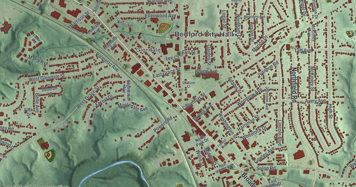
If you grew up in Bedford, walked Broadway to the square, or still have family here, this map gives you plenty to find. It's a modern aerial view of Bedford in Cuyahoga County, Ohio, made from modern data and finished with a vintage feel. More than 14,000 buildings are marked in deep red on soft green hills. A blue creek winds across the middle of the sheet, and the wooded valley of Bedford Reservation opens up to the lower left. Explore the print options for Bedford.
Broadway Avenue, Bedford City Hall and Taft Park
Start at Bedford City Hall, printed near the middle of the sheet. Center Road runs past it from the north. Just west, Glendale is named beside Broadway Avenue. Broadway is the long road that crosses the whole map on a slant. Follow it northwest and you'll pass Old Rockside before it meets Rockside Road near the top left. Now go back and follow Broadway southeast. Past Columbus Street and Taylor Road, it crosses the creek. Bedford Chagrin Parkway branches off to the east, and Broadway keeps going to Forbes Road in the bottom right corner. Northfield Road is the other big road. It runs north and south on the right side, from Rockside Road down to Forbes Road. East of it, look for Taft Park near Archer Road and Park Place. On the left side, Turney Road and Lee Road sit just above the Bedford Reservation label. Many of the roads are labeled, and each red shape is a building, so zoom in on the preview and look for yours.
Broadway is older than the town around it. A state marker from the Ohio History Connection says the road began as part of the Mahoning Indian Trail. Later it was called Turnpike Road. Stagecoaches stopped in Bedford on the way from Cleveland to Pittsburgh. By 1895 the road was called Main Street, and the Akron, Bedford and Cleveland Railway ran electric cars right down the middle of it. The marker calls that line "America's first high speed long distance electric interurban." Its cars went faster than 60 miles per hour. Main Street later became Broadway.
The same marker names two early settlers, Hezekiah and Clarissa Dunham. They gave the land for Bedford Public Square. In 1832 they built one of the area's first homes. It still stands at 729 Broadway, with the letters H & D above the door. The National Register lists that house, along with Bedford Baptist Church and the Holsey Gates House on the same stretch of Broadway. The square and those buildings aren't labeled on the map. They sit on Broadway near Columbus Street, below the Bedford City Hall label. The marker also says settlers came for a large waterfall that could run mills. The creek isn't labeled either, but the National Register lists an old Cleveland and Pittsburgh Railroad bridge over Tinker's Creek in Bedford.
For anyone who knows Broadway and Northfield Road
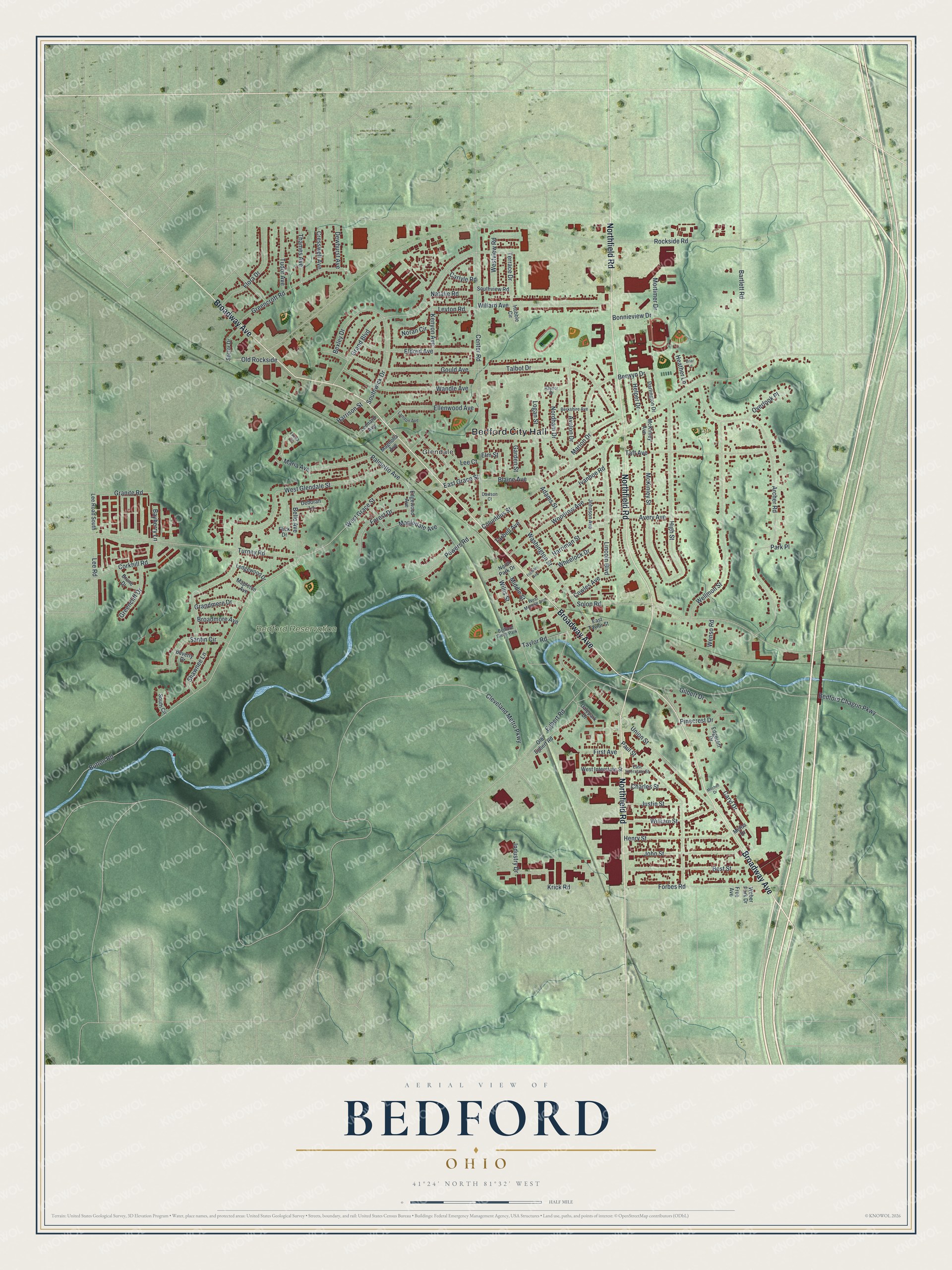
Created by KNOWOL in 2026, this Bedford map shades the hills and creek valleys in soft green, with USGS elevation data behind the terrain and the buildings drawn in deep red. The title panel reads "Aerial View of Bedford, Ohio," with the coordinates 41°24' North, 81°32' West and a half-mile scale bar.
It suits a kitchen, a den or a home office. It's a good gift for someone who grew up in Bedford and moved away, or for family who still live off Broadway or Northfield Road. Open the preview, zoom in and find the street you know. Shop the Bedford, Ohio map.