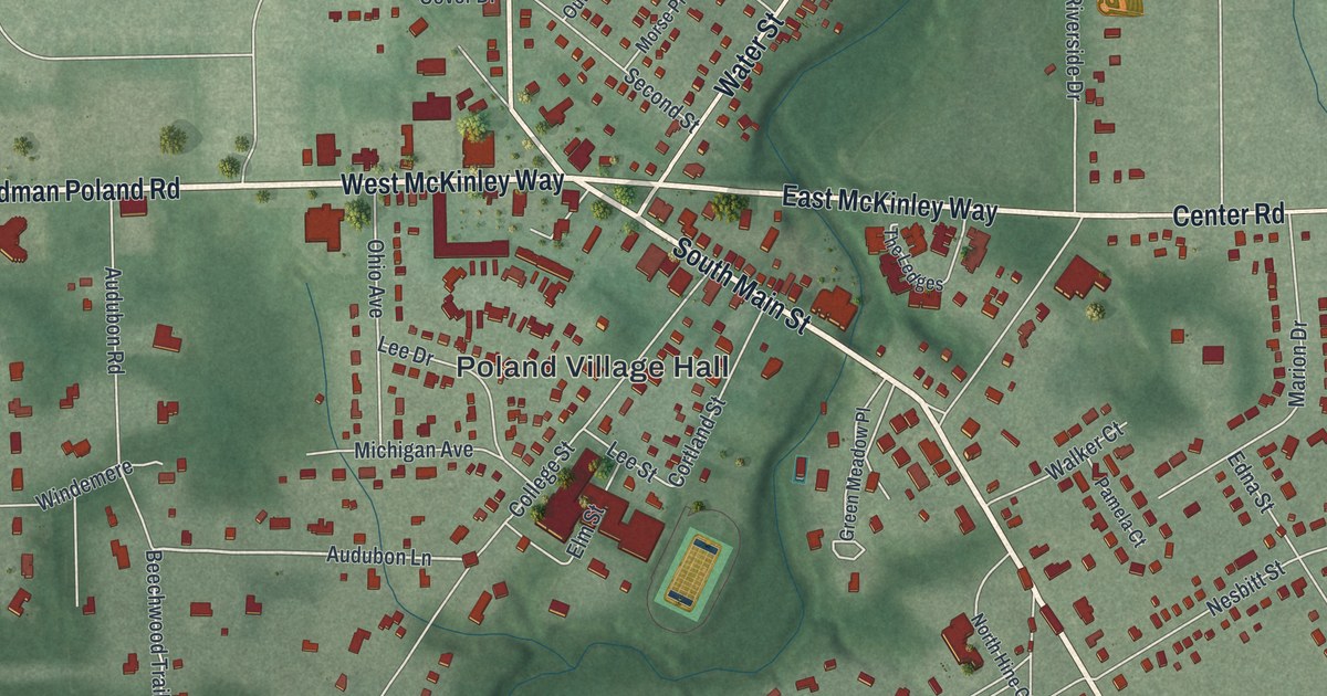
If you grew up in Poland, went to school on College Street, or still have family near South Main Street, this map gives you a lot to find. It's a new aerial view of the village of Poland in Mahoning County, Ohio, made from modern data and finished with a vintage look. Soft green hills and deep creek valleys wrap around the village, and each red shape is a building. North Main Street, West McKinley Way and South Main Street meet in the middle, and Poland Municipal Forest spreads across the lower left.
North Main Street, McKinley Way and Poland Village Hall
Start at the crossroads in the middle of the sheet. Boardman Poland Road comes in from the west and turns into West McKinley Way. Past the crossroads it becomes East McKinley Way, then Center Road. North Main Street runs straight up from here. Water Street angles off to the northeast, and South Main Street heads down to the southeast. Just below West McKinley Way, you'll find Poland Village Hall. College Street, Cortland Street and Lee Drive fill the blocks around it.
Now go back to North Main Street and head north. Island Drive, Delaware Avenue and Massachusetts Avenue branch off to the west, and Sheridan Road runs along the top left. Renwick Drive and Hamilton Avenue sit near the top on the east side. From Water Street, follow Orchard Drive north to Centennial Drive. To the east, Center Road meets Diana Drive. Evergreen Drive is farther south, off Diana Drive. In the lower left, Poland Municipal Forest covers the deep green ground. The village started the forest in 1938. Many roads are named, and each red shape is a building, so zoom in on the preview and look for yours.
William McKinley's boyhood in Poland
William McKinley, the 25th president, grew up in Poland. His family moved here in 1852, when he was nine, so the children could go to its good schools. He swam in nearby Yellow Creek. When the Civil War began in 1861, he joined the Poland Guard as a private. He was sworn into the Union Army from the front porch of the Old Stone Tavern. Jonathan Fowler, one of the village founders, built the tavern in 1804. It was his home, his store, a tavern and a hotel, and a stagecoach stop between Pittsburgh and Cleveland. McKinley came home in 1865 as a brevet major. Markers from the Ohio History Connection tell his story around the village.
McKinley studied at Poland Academy, which started on College Street in 1830. He graduated in 1859. In 1862 the school became Poland Seminary, one of the first schools in northeast Ohio to admit girls on an equal basis. Ida Tarbell, who later became a well-known journalist, worked there from 1880 to 1882. For the tavern and McKinley's boyhood home, follow South Main Street southeast from the crossroads. The Poland Academy marker is on College Street. The Old Stone Tavern is at 121 South Main Street. McKinley's boyhood home stood at the corner of South Main Street and College Street, just a short walk from Poland Village Hall.
For anyone who knows South Main Street and College Street
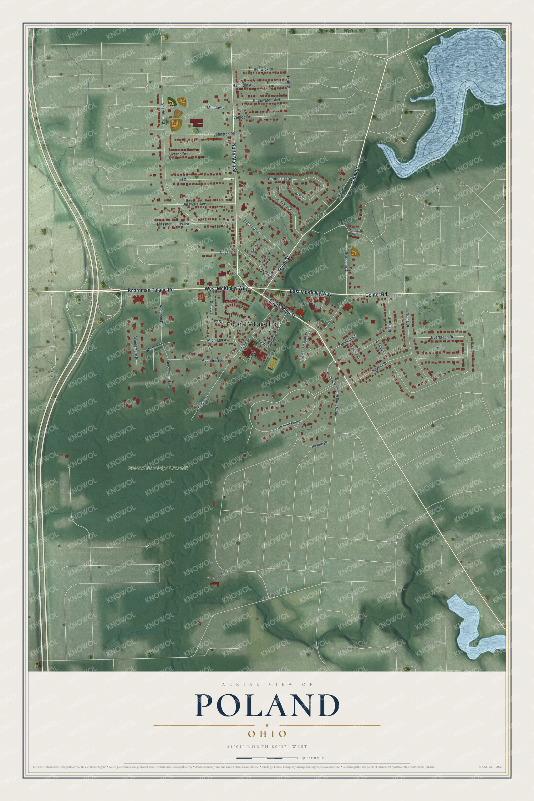
Created by KNOWOL in 2026, this map of Poland shows more than 4,700 buildings in deep red over soft green hills. Poland Village Hall is labeled near the center, and Poland Municipal Forest is labeled at the lower left. The title panel reads "Aerial View of Poland, Ohio," with the coordinates 41°01' North, 80°37' West and a quarter-mile scale bar.
It suits a den, a home office or a family room. It's a thoughtful gift for someone who went to school on College Street, grew up near the village green, or moved away and still has family in Poland. Open the preview, zoom in and find your street. See sizes and frames for the Poland map.