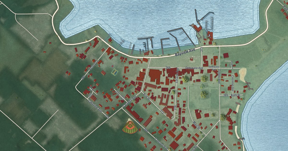
If you've ever stepped off the boat at Put-in-Bay and walked along Bayview Avenue, this map will look familiar. It's a new aerial view of Put-in-Bay in Ottawa County, Ohio, made from modern data and given a vintage look. You can see the docks reaching into the bay, the busy blocks of the village, and the long green fields of the island around it. Blue lake water wraps around three sides, and a small island sits out in the bay.
Joseph de Rivera and DeRivera Park
On this map you'll find DeRivera Park, Bayview Avenue, Delaware Avenue, Catawba Avenue, Toledo Avenue, Loraine Avenue, Concord Avenue, Erie Street, Bath Street, Park Avenue, Columbus Avenue, Langram Road, Chapman Road, Sybil Boulevard, and more. Each red shape is a building, so zoom in on the preview and look for yours.
The park by the docks is named for Joseph de Rivera. He was born in Barcelona, Spain. He built an import business in New York City. In 1854, he bought six Lake Erie islands. He had South Bass Island mapped out and split into ten-acre lots. At first, he ran Put-in-Bay as a sheep farm. Then he helped German families buy land to plant vineyards, and the island's wine business grew. He gave five acres for the park on the water. He also gave land for the first school, the first church and the island's cemetery. To bring in visitors, he opened the island's largest cave to tourists. He's buried in that cemetery, on land he gave. That's the story told on the state marker in the park. On the map, DeRivera Park sits in the middle of the village, just below Bayview Avenue and the docks.
The first ship-to-shore radio message at Put-in-Bay
Radio history was made at these docks too. On July 18, 1907, Dr. Lee deForest sent the first ship-to-shore radio message. He sent it from the steam yacht Thelma during a big sailing race. The message gave fast race results. His helper, Frank E. Butler, got it in the pavilion at Fox's Dock. Today that's the Jet Express Dock. deForest didn't like the word "wireless," so he picked a new name: "radio." A marker at the Jet Express landing on Bayview Avenue tells the story.
Bayview Avenue and the bay, ready for your wall
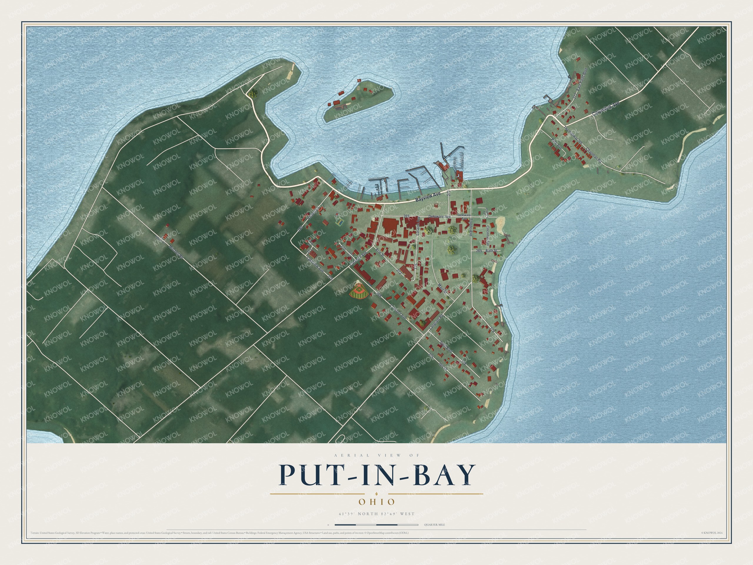
Created by KNOWOL in 2026, this print shows Put-in-Bay from above in soft greens and lake blues, with buildings in red. The title panel reads "Aerial View of Put-in-Bay, Ohio" with the coordinates 41°39' North 82°49' West.
It suits a cottage, a kitchen, a den or a hallway. It's a good gift for someone who spent summers near DeRivera Park, or for family who moved away from the island. Open the preview and find the docks, the park and your own street. See sizes and frames for the Put-in-Bay map.