If you grew up in Darby, still have family near Main Street, or moved away and miss the old borough, this map has a lot of home on it. It's a modern aerial view of Darby Borough in Delaware County, Pennsylvania, made from modern data with a vintage artistic feel. Rows of red buildings fill the town between two creeks, and green shaded hills rise on both sides. The sheet runs from Holy Cross Cemetery at the top down to Colwyn in the bottom right corner. Explore the print options for the Borough of Darby, Delaware County.
Main Street, Macdade Boulevard and Holy Cross Cemetery
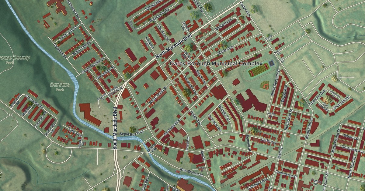
Start at the Darby Borough Municipal Complex, printed near the middle of the sheet beside a sports field. North Macdade Boulevard runs past it toward the upper right, where Cedar Avenue comes in. Go the other way and South Macdade Boulevard drops down the left side of town. Main Street crosses the whole borough. It starts at the top left, passes the complex, and heads out to Colwyn at the bottom right. Chester Pike leaves the center for the bottom left corner. West of town, across the blue line of Darby Creek, Bartram Park and Delaware County Park sit side by side along Springfield Road. The creek itself isn't labeled. South of the center, Pine Street, Walnut Street and Chestnut Street run east through tight rows of buildings. Up top, Holy Cross Cemetery is named near Wycombe Avenue and Golf Road. Many of the roads are labeled, and each red shape is a building, so zoom in on the preview and look for yours.
On October 17, 1773, Sarah Eve was riding back from a visit to Chester. It rained hard until she was near Darby. In her journal she called Darby "a town of mud." Then she wrote, "Foolish creatures to build a town in such a hole and have such delightful hills on each side of them, but who knows the reason." Her words were printed in the 1884 History of Delaware County, Pennsylvania. The same book says that by 1836 Darby had a Friends' meeting-house, four public-houses, three stores, a cotton-factory and about sixty houses. Darby became a borough on May 3, 1853.
Look at the shading on the map and you can see the hole she meant. The town sits low along the creek, and the green hills climb away on both sides. Main Street is where the old town still shows. The Darby Meeting house at 1017 Main Street is listed on the National Register. A state marker says the Darby Friends Burial Ground, also on Main Street, has been in use since 1682. Neither one is labeled on the map, but Main Street is. The book lists a John Verlenden on the first borough council in 1853. That name is printed on this map too, as Verlenden Avenue, a short street off Fern Street and Darby Terrace.
For anyone who knows Main Street in Darby
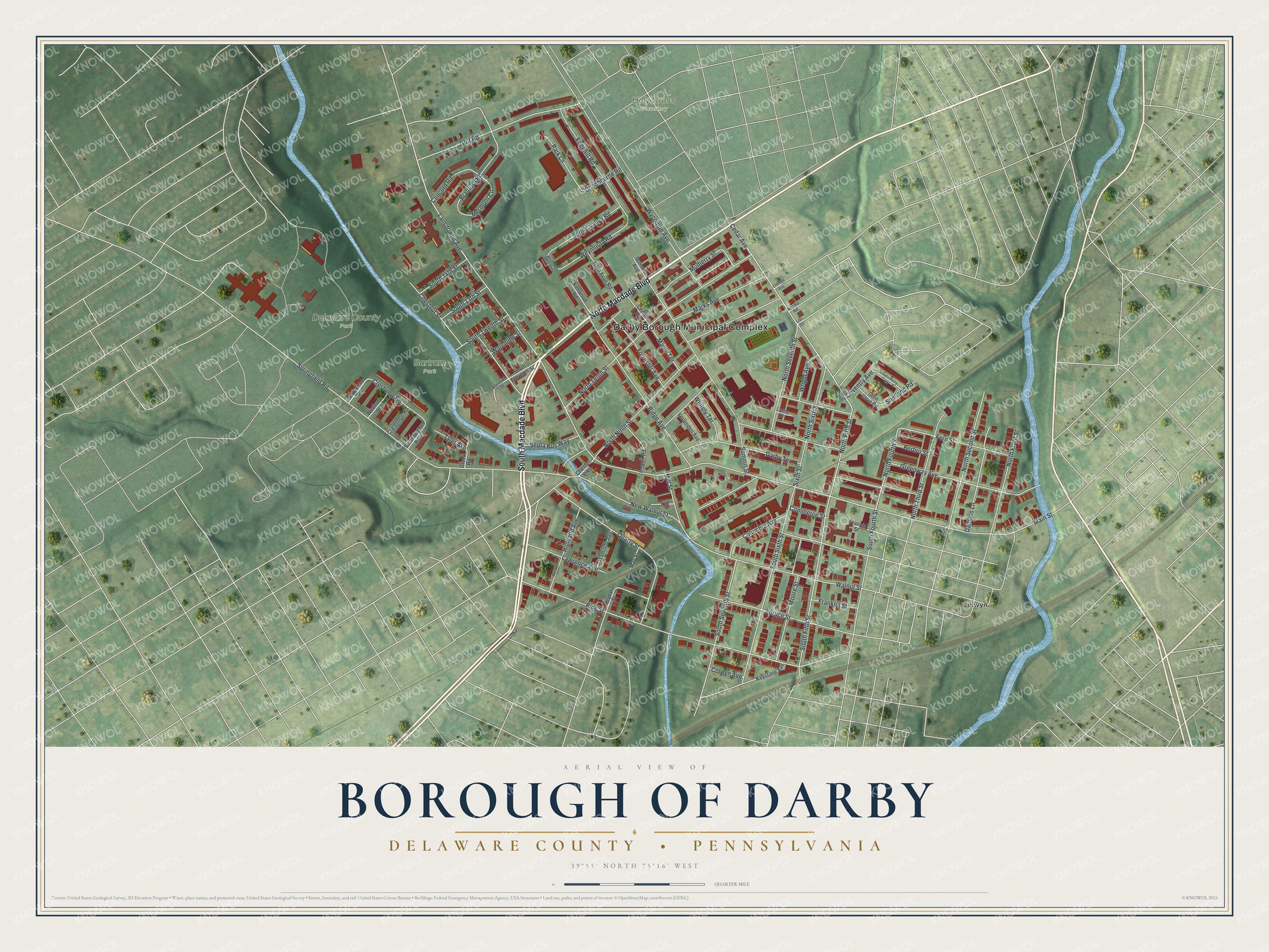
Created by KNOWOL in 2026 from geographic records of roads, buildings and terrain, this Darby map shows the borough in deep red on soft green. The hills are shaded from USGS elevation data, so you can see how the town sits down by the creek. The title panel reads "Aerial View of Borough of Darby" over "Delaware County • Pennsylvania," with the coordinates 39°55' North, 75°16' West and a quarter-mile scale bar.
It suits a living room, a kitchen or a home office. It's a thoughtful gift for someone who grew up in Darby and moved away, or for a family with deep roots in Delaware County. Open the preview, find Main Street and follow it to the block you know. Shop the Borough of Darby, Delaware County, Pennsylvania map.