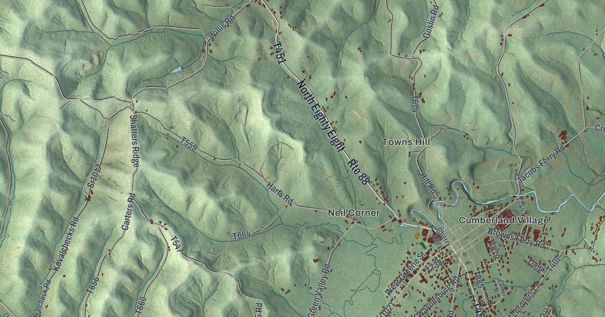
If you grew up along Rte 88, or have family out near Crucible, Nemacolin or Ceylon, this map has your roads on it. It's a modern aerial view of Cumberland Township in Greene County, Pennsylvania, made from modern data with a vintage artistic feel. The hills are shaded in deep green folds, and more than 8,000 buildings are marked in red. The Monongahela River curves down the right side, though it isn't labeled. Small places like Stringtown, Paisley, Live Easy and Khedive are printed by name. Explore the print options for Cumberland, Greene County.
Rte 88, Browns Ferry Road and how Muddy Creek got its name
Start at Neil Corner, near the middle of the sheet, where Rte 88 passes. Follow Rte 88 north, where it's printed as North Eighty Eight. Towns Hill sits just to the east. Near the top, Crucible Road branches off and runs out to Crucible, in the big bend of the river at the top right. Back in the middle, the thickest knot of buildings is Carmichaels, a separate borough that isn't labeled. Cumberland Village is printed at its upper edge. From there, Browns Ferry Road heads east toward the river, and Stringtown Road branches north to Stringtown. Just south, Nemacolin Road runs through Fairdale to Pershing Boulevard and Nemacolin, right by the water. Now follow South Eighty Eight Road south. You'll reach Paisley, Live Easy and Little Chicago, with Ceylon just to the west. Many roads are labeled, and each red shape is a building, so zoom in on the preview and look for yours.
Cumberland was probably one of the first settled townships in Greene County. The 1888 History of Greene County says John Swan chose land in the valley of Pumpkin Run as early as 1767. He marked it by cutting blazes into the trees all around it. People called this a tomahawk improvement. It gave him no legal right, but rival settlers knew it wasn't safe to cross. The same book tells how Muddy Creek got its name. Swan and Thomas Hughes, two of the first settlers, were crossing the stream. Swan's horse stumbled and threw him into the water. He got up, shook the dirty water off his clothes, and grumbled that it was "a muddy little brook anyhow." People often teased him about it, and the name stuck.
Muddy Creek isn't labeled on the map, but South Branch Muddy Creek Road is, down in the lower left. Pumpkin Run Road is printed near the top, just off Rte 88. The 1888 book also says five ferries linked the township to Fayette County across the Monongahela. Two of them were Flenniken's, near the mouth of Muddy Creek, and Brown's. Browns Ferry Road and Flenniken Road are both printed on the right side of the sheet. The National Register lists the Carmichaels Covered Bridge over Muddy Creek, just east of Carmichaels. It isn't marked on the print.
For someone who knows Crucible, Ceylon or Nemacolin
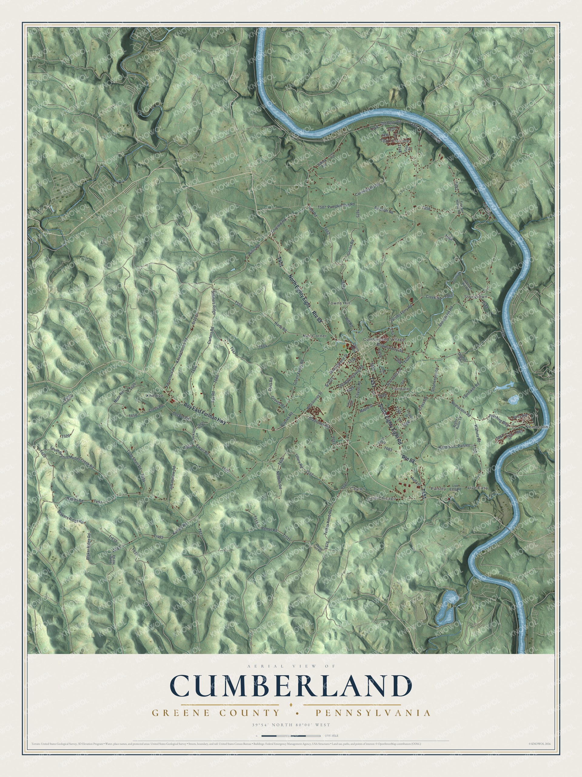
Created by KNOWOL in 2026, this Cumberland Township map shades the hills from USGS elevation data and marks each building in red. You can follow Rte 88 from the top of the sheet down past Neil Corner and the center of town. The title panel reads "Aerial View of Cumberland, Greene County, Pennsylvania," with the coordinates 39°54' North, 80°00' West and a one-mile scale bar.
It suits an office, a den or a kitchen wall. It's a good gift for someone who grew up near Carmichaels, has family out along Rte 88, or moved away from Greene County. Open the preview, find Browns Ferry Road or your own road, and choose your print on the product page. Shop the Cumberland, Greene County, Pennsylvania map.