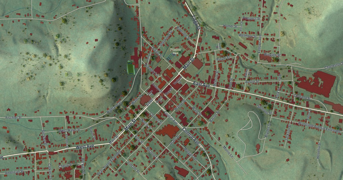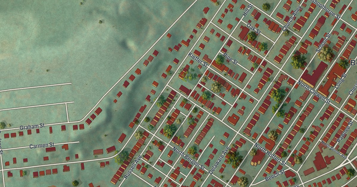
If you grew up in Fountain Hill, or still have family near Broadway and Delaware Avenue, there's a lot on this map to find. It's a modern aerial view of Fountain Hill in Lehigh County, Pennsylvania, made from modern data and given a vintage look. The borough climbs its hill in a tight grid of streets, and more than 2,000 buildings are drawn in red across the sheet. The Lehigh River curves along the top, though it isn't labeled, and Lehigh Mountain Park is printed just below it. On the left side, the ball fields of the Stanley Avenue Recreation Area stand out against the green hills. Explore the print options for Fountain Hill.
Broadway, Cherokee Street and Lehigh Mountain Park
Start at the Borough Hall label, just right of center. Broadway runs past it on a long slant, from the lower left of the sheet up to the upper right. Nearby, short Fiot Street links Broadway with Cherokee Street and Pawnee Street. Follow Cherokee Street up the sheet to Mohican Street in the top right corner. Seneca Street and Delaware Avenue reach Mohican there too. Higher up, Brighton Street runs past Lehigh Mountain Park near the top. Now go back to Broadway and head down and to the left. West of the grid, Jeter Avenue and Graham Street run out to Dodson Street, and the ball fields sit just below them. In the lower left, Moravia, Cherry and Sioux Streets run side by side. Many roads are labeled, and each red shape is a building, so zoom in on the preview and look for yours.
Augustus Fiot and his villa, Fountainbleu
In 1850, a retired Philadelphia music dealer named Augustus Fiot bought a farm on this hill from C. C. Tombler, who'd built a new farmhouse there. Fiot was born in France. As a young man he'd lived near Fontainebleau, so he gave his new home that name, spelled Fountainbleu. He added a third story to the house. The grounds had old trees, flowers and fountains. The 1914 History of Lehigh County says that for years it was the most beautiful spot around Bethlehem. Fiot died in 1866 with no children, and Tinsley Jeter bought the whole place, 146 acres in all.
How Jeter's streets kept Cherokee, Pawnee and Seneca
Jeter laid out streets across his land. Three Philadelphia men who owned a nearby farm had already given their streets Native American names, like Cherokee, Pawnee and Seneca. Jeter carried those streets on across his own ground and kept the names. The new cross streets were named for people who'd helped the place grow, such as Fiot. The history says the name Fountain Hill was first used about this time, because the owners wanted a name of their own. Jeter offered Fountainbleu for a girls' school, and it opened as Bishopthorpe in 1868. Bishop Stevens picked the name after staying at a country house in England called Bishopthorpe. The map prints Fiot Street, Jeter Avenue and Tombler Street, all names from this story, along with North Bishopthorpe Street.
One more thing to look for. A state marker at Ostrum and Bishopthorpe Streets says the writer Stephen Vincent Benét was born there in 1898. He wrote the poem "John Brown's Body." The marker isn't shown on the map, but Ostrum Street is, running up toward Lehigh Mountain Park.
For anyone who grew up along Broadway or Seneca Street
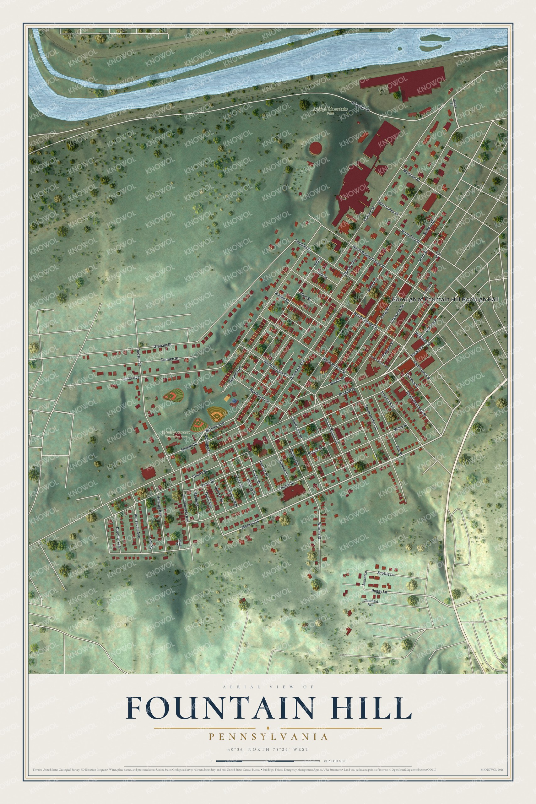
Created by KNOWOL in 2026 from modern records of roads, buildings and terrain, this Fountain Hill map suits a living room, a home office or a kitchen wall. The hills are shaded from USGS elevation data, so you can see how the streets climb away from Broadway. The title panel reads "Aerial View of Fountain Hill, Pennsylvania" with the coordinates 40°36' North, 75°24' West and a quarter-mile scale bar.
It's a thoughtful gift for someone who grew up in Fountain Hill and moved away, or for a family with roots on Cherokee, Pawnee or Seneca Street. Open the preview, find Broadway, and follow it to a street you know. Shop the Fountain Hill, Pennsylvania map.