If you've spent time at Sizerville State Park, driven Ridge Road or have family near Costello, this map covers the hills you know. It shows Portage Township in Potter County, Pennsylvania as a modern aerial view, built from modern data with a vintage artistic feel. Steep ridges fill the sheet in soft green and tan, with deep shaded hollows between them. Thin blue creeks run along the valley floors. Costello sits in the valley on the right, and Sizerville State Park is on the left. Elk State Forest and Susquehannock State Forest are both named near the middle. Explore the print options for Portage, Potter County.
Portage Road from Sizerville State Park to Costello
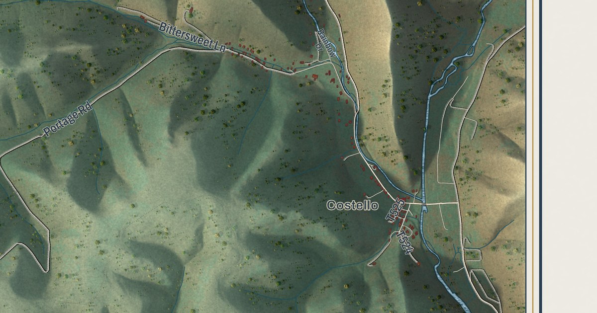
Start at Sizerville State Park, on the left side of the sheet. Portage Road heads east from there, and it's also printed as T511. Near the middle of the map it meets Ridge Road, close to the Elk State Forest and Susquehannock State Forest labels. Turn north on Ridge Road and follow it to the top of the sheet. Up there, Cowley Hill Road comes in from the left. Fox Mountain Drive and Fox Mount Fire Tower Road sit toward the top left. Now go back to the middle and follow Ridge Road south. It runs all the way to the bottom right, where Hunts Run Road and Bailey Run Road meet it. Steam Mill Road takes its own way down the center. Back on Portage Road, keep going east past Bittersweet Lane toward Costello. From there, Costello Road follows the valley up to the top right corner. Many of the roads are labeled, and each red shape is a building, so zoom in on the preview and look for yours.
Costello once had another name. An 1890 county history says the Sinnemahoning at Costello was made a boundary line. Back then, Costello was called North Wharton. The same history says the settled part of the old township went to the new Cameron County in 1860. In 1871, part of Sylvania was added to Portage, and the township was organized again. Then there's the tax list for 1876. E.O. Austin was the assessor that year, and he signed off on a list of 24 resident taxpayers. They included six Everetts, three Austins and three Brownlees, with a sawmill noted beside John Brownlee's name. But the history adds that a geological report by Andrew Sherwood said only two families were known to live there that year.
The 2020 census counted 162 people in Portage Township. Most of the sheet is steep hills and state forest, and the buildings gather along the valley roads. Look along Costello Road and around Costello, where the red marks sit closest together. The creek in that valley isn't labeled.
For someone who knows Ridge Road and Costello
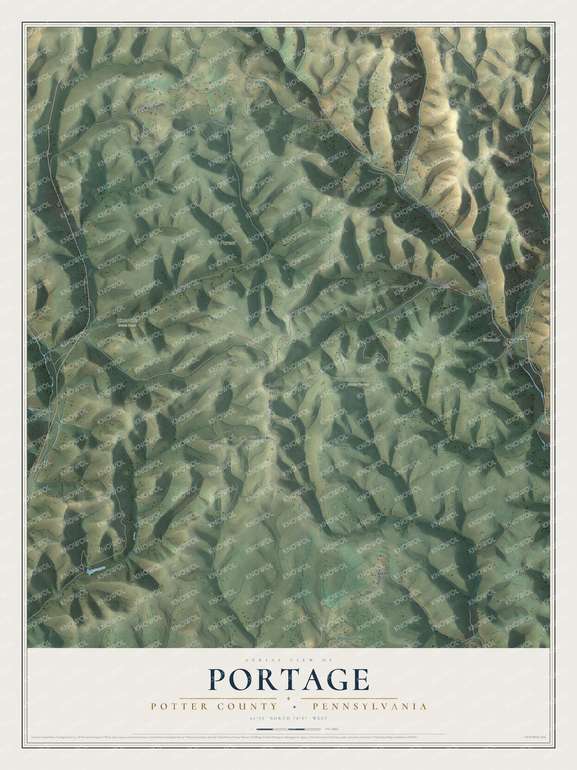
Created by KNOWOL in 2026, this Portage map shows steep hills in soft green and tan, with shaded hollows and thin blue creeks. The hills are shaded from USGS elevation data, and the roads come from Census Bureau records. The title panel reads "Aerial View of Portage, Potter County, Pennsylvania," with the coordinates 41°35' North, 78°07' West and a one-mile scale bar.
It suits a cabin wall, a den or an office. It's a good gift for someone who grew up near Costello, or for family who moved away from Potter County. Open the preview, zoom in on Costello Road or Ridge Road, and find the place you know. Shop the Portage, Potter County, Pennsylvania map.