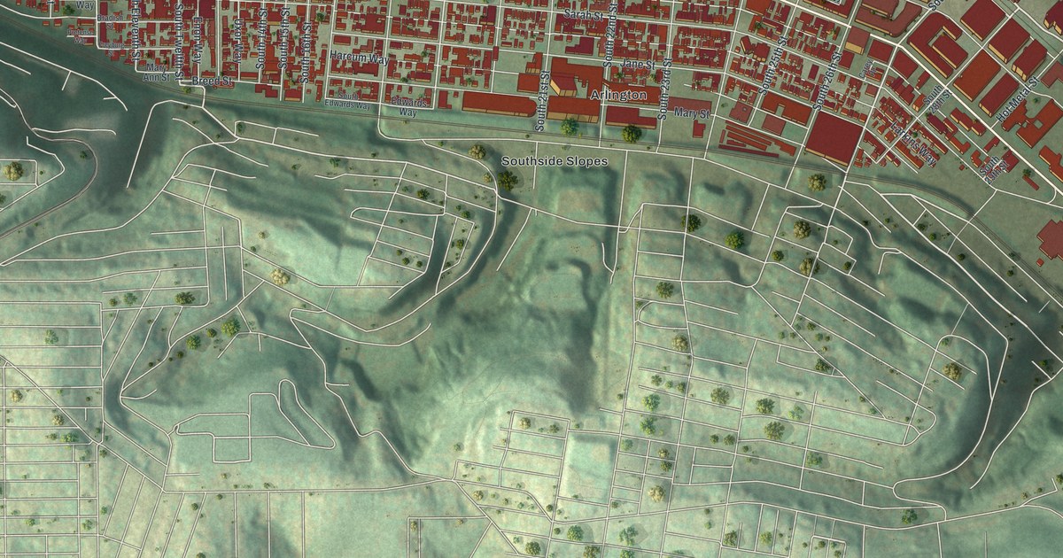
If you grew up on the South Side, or still have family on one of its numbered streets, this map shows the blocks you know. It's a new aerial view of South Side Flats in Allegheny County, Pennsylvania, made from modern data and given a vintage look. Thousands of red buildings crowd the flat land beside a wide blue river. East Carson Street is printed right through the middle. Green hills rise behind the flats, with Southside Slopes and Allentown named on the high ground.
The Polish Falcons Hall on South 18th Street
On this map you'll find East Carson Street, Sarah Street, Bingham Street, Jane Street, Mary Street, Sidney Street, Muriel Street, South 18th Street, South Tenth Street, Hot Metal Street, the Birmingham Bridge, the Liberty Bridge, Bedford Square, Southside Slopes, and more. Each red shape is a building, so zoom in on the preview and look for yours.
On April 3, 1917, a hall stood at 97 South 18th Street. That day, I. J. Paderewski gave a speech there. He spoke to delegates at a convention of the Polish Falcons. His speech began a movement to recruit a Polish army in the United States. That army would fight in Europe with the Allies. The goal was an independent Poland. A state historical marker at the site tells the story. On the map, find South 18th Street among the numbered streets of the flats.
The South Side Market Building at 12th and Bingham
The flats hold other old buildings with their own records. The South Side Market Building, at 12th and Bingham streets, joined the National Register of Historic Places in 1976. Four schools here were added in 1986: South Side High School on East Carson Street, Bedford School on Bingham Street, Birmingham Public School on South 15th Street, and the Samuel F. B. Morse School on Sarah Street. The old Duquesne Brewing Company buildings, between South 21st and South 23rd streets, were listed in 2015.
Keeping East Carson Street Close
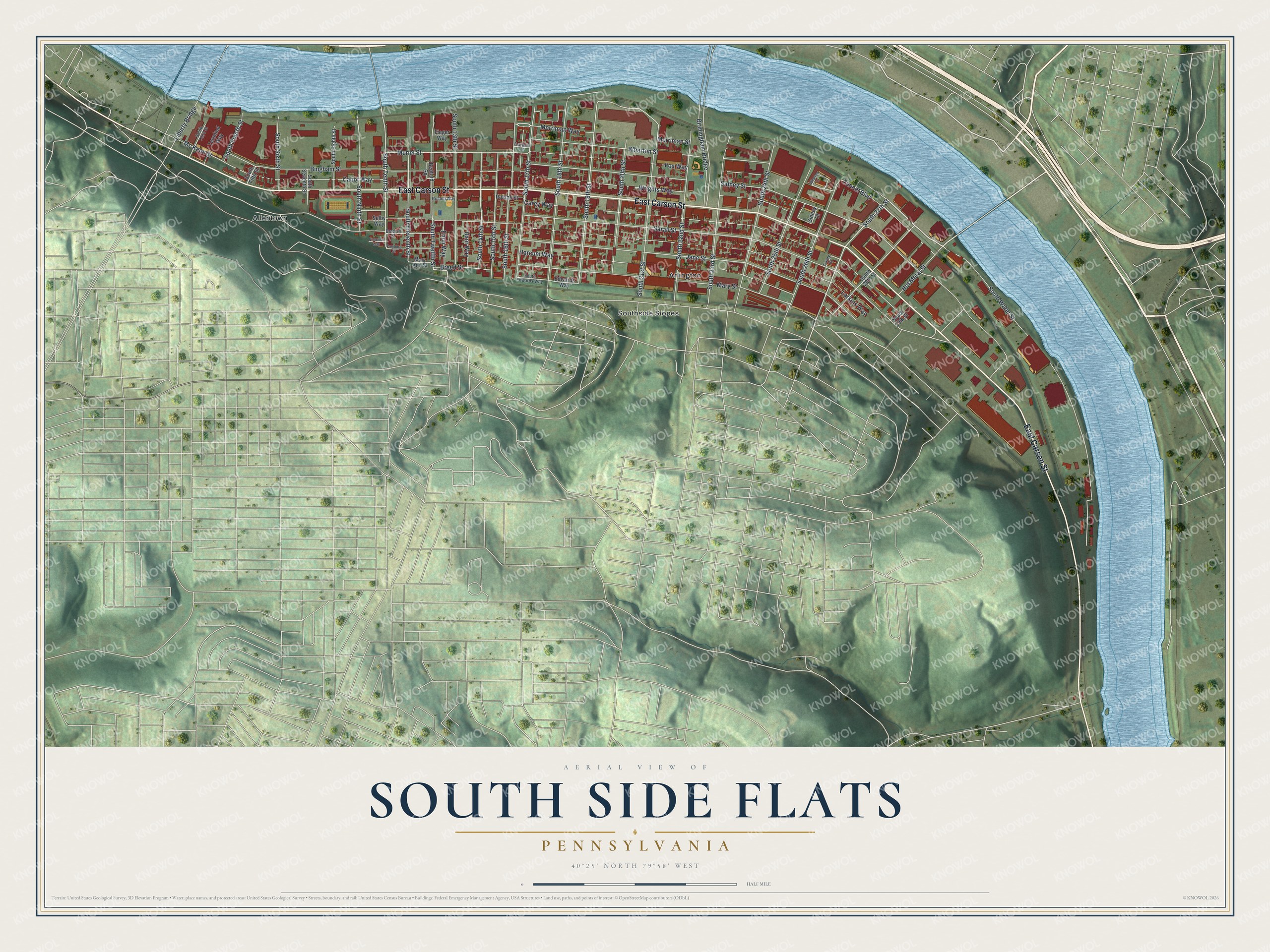
Created by KNOWOL in 2026, the print shows the South Side from above. Red buildings fill the flats, a wide blue river curves along the top and right side, and shaded green hills fill the lower half. The title panel reads "Aerial View of South Side Flats, Pennsylvania" with the coordinates 40°25' North 79°58' West.
It fits well in a living room, a kitchen or a home office. It's a kind gift for a South Side High School graduate, or for anyone who once lived a few blocks from East Carson Street. Open the preview and look for your street. See sizes and frames for the South Side Flats map.