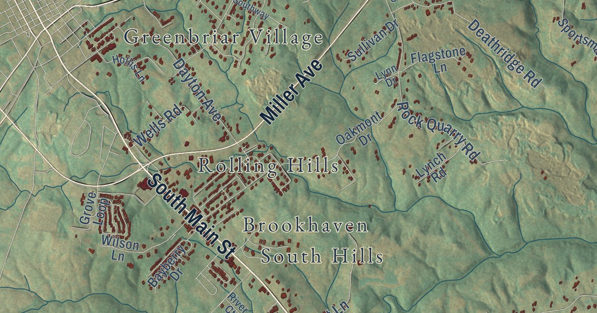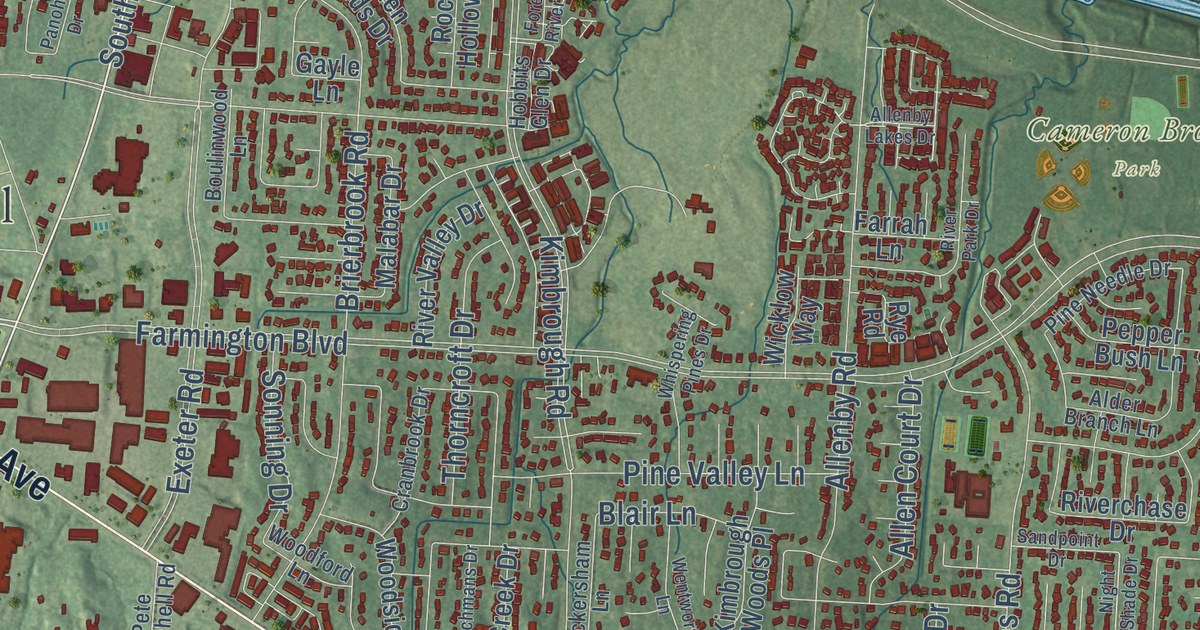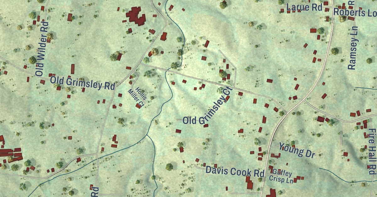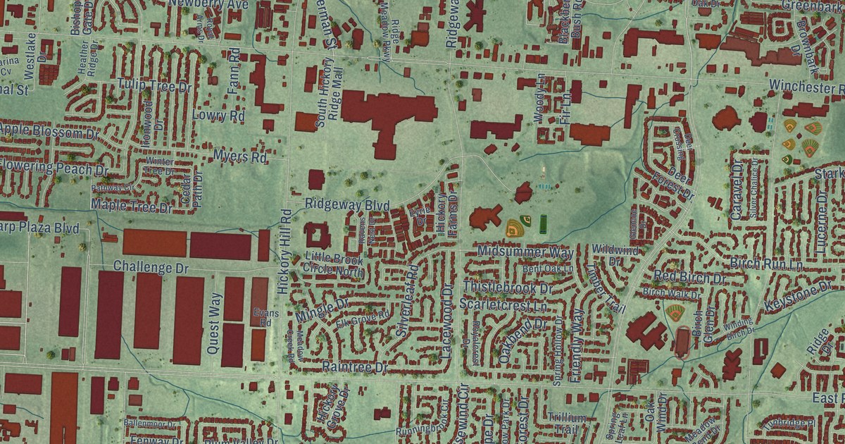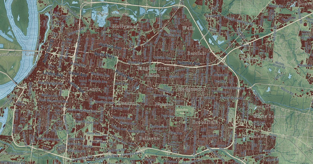
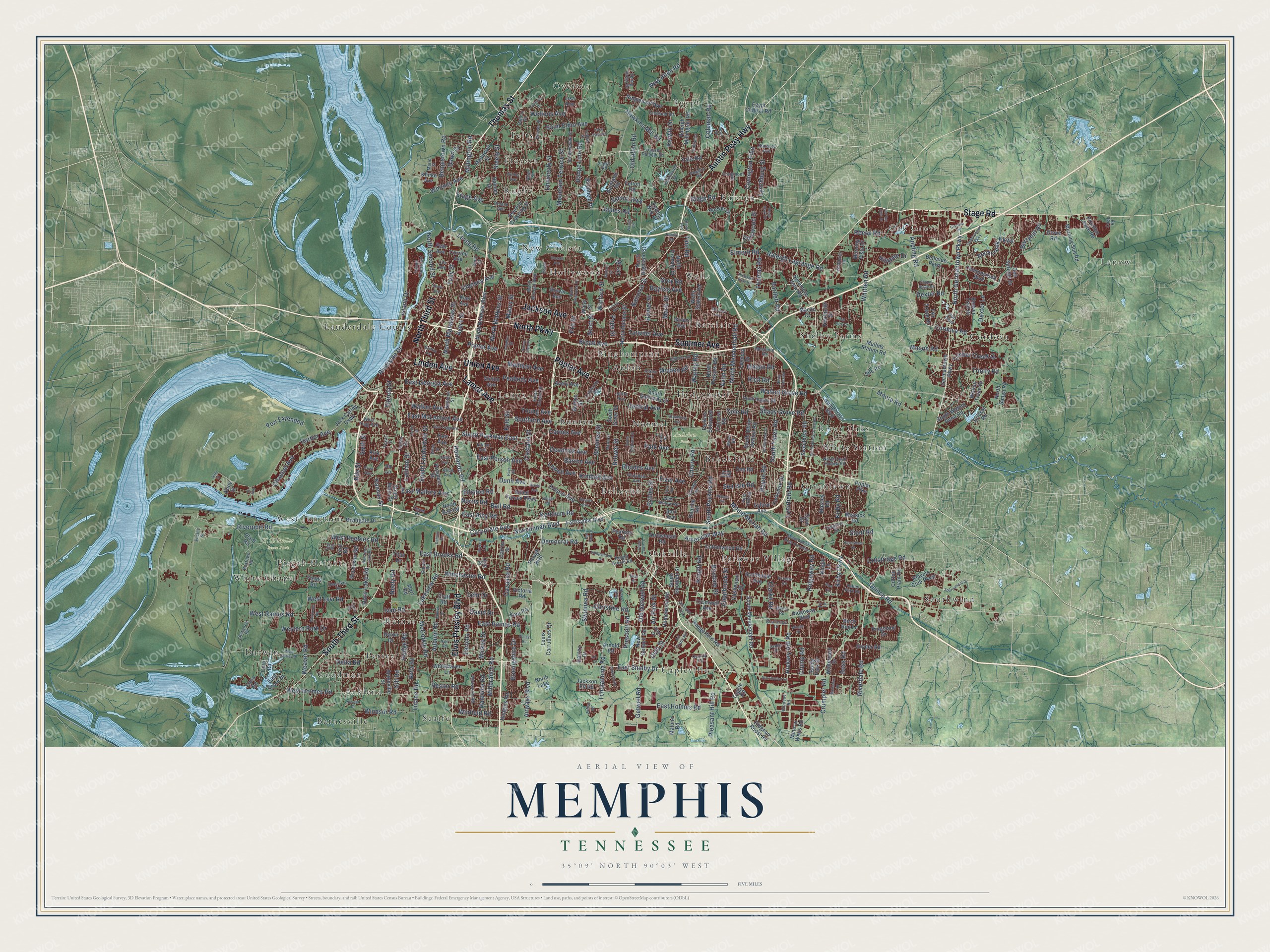
This beautifully detailed map of Memphis, Tennessee was created in 2026 using aerial imagery combined with modern topographical, census, street and landmark data. It’s a one-of-a-kind view of Memphis that combines accurate data with a vintage aesthetic. The map shows every building in its true location, many of the roads carry their names, and the shaded topographic relief shows the shape of the land.
Explore an aerial view of Memphis, Tennessee
On the map you’ll find Audubon Park, Acklena, Aulon, Barnesville, Bellevue, Berclair, Binghampton, Brookfield, Buntyn, Capleville, Cordova, Darwin, and more. If you look closely you can even find your house accurately drawn in its correct location. Zoom in on the preview to look for yours.
Did you know this piece of Memphis, Tennessee history?
John Overton, James Winchester and Andrew Jackson founded Memphis in 1819. The city stood on the high Chickasaw Bluffs, safe from Mississippi River floods. River traffic and cotton made it one of the largest cities in the South before the Civil War.
Take a closer look at the Memphis map
Street and place names on the Memphis, Tennessee map
These names are printed on the map of Memphis, Tennessee.
Places: Audubon Park, T.O. Fuller State Park, Acklena, Aulon, Barnesville, Bellevue, Berclair, Binghampton, Brookfield, Buntyn, Capleville, Cordova, Darwin, Egypt, Felts, Frayser, Goodman, Greenlawn, Hedgemoor, Hollywood, Lauderdale Courts, Lenow, Lenox, New Chelsea, Normal, Oak Grove, Oakville, Overton, Parkway Village, Persey, Pisgah Heights, Raines, Raleigh, River Oaks, Rugby, Scaife, Shelby Farms, Southwind, Wells, West Junction, White Chapel, White Station and North Lake.
Streets and roads: Lamar Avenue, Jackson Avenue, South Third Street, Thomas Street, Poplar Avenue, Summer Avenue, Elvis Presley Boulevard, Stage Road, North Parkway, Union Avenue, Austin Peay Highway, Linden Avenue.
More street names, A to Z
Aden Street, Air Park Street, Air Trans Road, Airways Boulevard, Alice Avenue, Allied Forces Parkway, American Way, Amersham Drive, Angelus Street, Appleville Street, Appling Road, Arnold Road, Arrowhead Road, Art Drive, Auburn Road, Avery Avenue, Avon Road, Ayers Street, Balfour Street, Ball Road, Banbury Avenue, Barkshire Drive, Barr Avenue, Barron Avenue, Bartlett Road, Bayliss Avenue, Beaver Trail Drive, Bellevue Parkway, Benjestown Road, Berryhill Road, Berta Road, Birchfield Drive, Birch Run Lane, Bledsoe Road, Boeingshire Drive, Boxdale Street, Boxtown Road, Brewer Avenue, Broad Avenue, Brookmeade Street, Brower Street, Brown Avenue, Buena Vista Place, Buntyn Street, Buoy Street, Bus Park Drive, Byron Drive, Cana Road, Carnes Avenue, Carrier Street, Castalia Street, Castleman Street, Cazassa Road, Central Avenue, Challenge Drive, Channel Avenue, Chapel Ridge Drive, Chelsea Avenue, Cherry Road, Cheryl Drive, Chevron Road, Chimneyrock Boulevard, Chiswood Street, Christine Road, Clarke Road, Clearbrook Street, Club Parkway, Cobb Road, Coleman Road, Cole Road, Colonial Road, Cordova Road, Coro Road, Corporate Avenue, Corrine Avenue, Cotton Plant Road, Cottonwood Road, Countrywood Parkway, Coventry Drive, Covington Pike, Craft Road, Craigmont Drive, Crestridge Road, Cromwell Avenue, Crump Avenue, Crumpler Road, Crump Road, Datsun Drive, David Drive, Dawn Drive, Deadrick Avenue, Dearing Road, Dee Road, Deerskin Drive, Delano Avenue, Delp Street, Delta Road, Democrat Road, Denver Street, Dexter Lane, Dexter Road, Distribution Drive, Dunn Avenue, Dwight Road, East Alcy Road, East Brooks Road, East Georgia Avenue, East Holmes Road, East Mallory Avenue, East McLemore Avenue, East Person Avenue, East Raines Road, East Shelby Drive, East Shore Drive, East Trigg Avenue, Echles Street, Egypt Central Road, Elliston Road, Elmore Road, Ensley Street, Epping Way Drive, Ericson Road, Ethlyn Avenue, Eva Street, Faronia Road, Farrisview Boulevard, Felton Road, Fields Road, Finley Road, Fir Lane, First Avenue, Fizer Avenue, Flamingo Road, Florida Street, Ford Road, Foxdale Road, Fox Trace Drive, Frayser Raleigh Road, Frisco Avenue, Galaxy Drive, Germantown Parkway, Getwell Road, Giacosa Place, Gill Road, Given Avenue, Goldbrier Lane, Grandview Avenue, Graves Road, Grey Road, Grove Road, Hale Road, Haleville Road, Hanna Drive, Harbor Avenue, Hawkins Mill Road, Hayne Road, Hays Road, Heathcliff Drive, Helene Road, Henry Avenue, Hernando Road, Hester Road, Heyde Avenue, Hickory Hill Road, Hilldale Avenue, Hillshire Drive, Hodge Road, Homer Street, Homewood Drive, Homewood Road, Hoover Drive, Horn Lake Road, Houston Levee Road, Hudgins Road, Humphreys Boulevard, Hungerford Road, Ila Lane, Independent Drive, Island Drive, Island Place East, Ivan Road, Ivy Road, Jack Carley Causeway, Jackson Pit Road, James Road, Jardin Place, Jetty Street, Joffre Avenue, Joyce Lane, Julius Lewis Drive, Kansas Street, Keel Avenue, Kent Road, Kerr Avenue, Kerwin Drive, Ketchum Road, Kimball Avenue, Kingsland Drive, Kirby Parkway, Kirby Road, Kirk Avenue, Klinke Avenue, Kney Street, Knight Arnold Road, Knight Lane, Knight Road, Kyle Street, Ladue Street, Lake Park Road, Lakeview Road, Latham Street, Leech Road, Lehr Drive, Leonora Drive, Levee Road, Life Avenue, Lisa Avenue, Loeb Street, Lombardy Road, Louis Carruthers Drive, Lowell Avenue, Lyford Avenue, Lynchburg Street, Lynnfield Road, Macon Cv, Macon Road, Madewell Street, Madison Avenue, Malone Road, Maria Street, Mario Street, Mart Road, Mason Road, Massey Road, Maury Street, Maxey Street, May Street, McCorkle Road, McCrory Avenue, Mesquite Road, Messick Road, Miac Drive, Mickey Drive, Millbranch Road, Millington Road, Minden Road, Mineral Wells Road, Mingle Drive, Monroe Avenue, Moore Road, Morning Sun Road, Morning Vista Drive, Moss Road, Mountain Terrace Street, Mount Moriah Road, Mount Moriah Road Extended, Mullins Station Road, Myers Road, National Street, Neely Road, Neptune Street, New Allen Road, New Getwell Road, New Horn Lake Road, New Willow Road, Nicolet Drive, Nonconnah Boulevard, Norris Road, North Ball Road, North Bellevue Boulevard, North Germantown Parkway, North Graham Street, North Highland Street, North Hollywood Street, North Holmes Street, North Manassas Street, North McLean Boulevard, North Mendenhall Road, North Perkins Road, North Quail Hollow Road, North Sanga Road, North Second Street, North Third Street, North Watkins Street, North Yates Road, Oakley Avenue, Oak Park Drive, Oak Springs Drive, Old Allen Road, Old Getwell Road, Old Lamar Avenue, One Place, Orr Street, Otter Drive, Overton Crossing Street, Palm Avenue, Park Avenue, Park Lake Drive, Patton Street, Peabody Avenue, Pear Avenue, Pearson Road, Peggy Road, Perkins Extended, Philsdale Avenue, Pidgeon Roost Road, Pier Street, Pilot Drive, Pine Circle, Plant Road, Players Club Parkway, Pleasant Hill Road, Pleasant View Road, Plough Boulevard, Pope Street, Poplar Pike, Port Extended, Powers Road, Prescott Road, Prospect Street, Quality Drive, Quince Road, Rainier Drive, Raleigh Lagrange Road, Raleigh Millington Road, Range Line Road, Reese Road, Rhodes Avenue, Rich Road, Ridgemont Avenue, Ridgeway Boulevard, Ridgeway Road, Rile Street, Riverdale Road, Rivergate Drive, Riverport Road, Riverside Drive, Rochester Road, Rockcreek Parkway, Ronnie Road, Ross Road, Saint Elmo Avenue, Sandy Park Drive, Sardis Street, Sax Road, Scenic Highway, Scotland Road, Scottsdale Avenue, Scott Street, Sea Isle Road, Semmes Street, Sewanee Road, Shady Grove Road, Silo Road, Snyder Road, South Angela Road, South Cooper Street, Southern Avenue, South Galloway Drive, South Goodlett Street, South Greer Street, South Highland Street, South Lauderdale Street, South Main Street, South Mendenhall Road, South Parkway East, South Perkins Road, South Shady Grove Road, South Walnut Bend Road, South White Station Road, South Yates Road, Spring Valley Drive, Stage Avenue, Stage Park Drive, Steele Street, Stout Road, Stovall Avenue, Sulgrave Drive, Sunset Street, Sweetbriar Road, Swift Street, Swinnea Road, Sycamore View Road, Syon Drive, Tampa Avenue, Tant Road, Tchulahoma Road, Tessland Road, Texas Drive, Texas Street, Thomas Road, Timber Creek Drive, Titan Drive, Titus Road, Tournament Drive, Trinity Road, Tuggle Road, Tulane Road, Tully Street, Tutwiler Avenue, University Street, Valleybrook Drive, Valley Park Drive, Van Der Veer Drive, Vera Cruz Street, Victoria Road, Vinton Avenue, Walker Avenue, Walnut Grove Road, Walnut Road, Walnut Trace Drive, Warford Street, Waring Road, Warner Avenue, Water Street, Weaver Road, Webb Street, Wellons Avenue, Wells Station Road, Western Park Drive, West Holmes Road, West Levi Road, Westmont Road, West Peebles Road, West Raines Road, West Shelby Drive, West Trigg Avenue, Whitehaven Lane, Whitney Avenue, Whitten Road, Whitworth Road, Winchester Road, Windsor Road, Winfield Road, Winterpark Drive, Yale Road, Yorkshire Drive, Young Avenue, Zodiac Road.
See the Memphis, Tennessee map on a wall
The Memphis map as an 18 x 24 inch print in a black frame.

This beautifully detailed map of Memphis makes an attractive addition to your office, library, or den, and it can even be used to teach children the geography and history of the area. It also makes a great gift for anyone who grew up in Memphis or moved away. When you’re done exploring, click here to get your copy of the Memphis map.