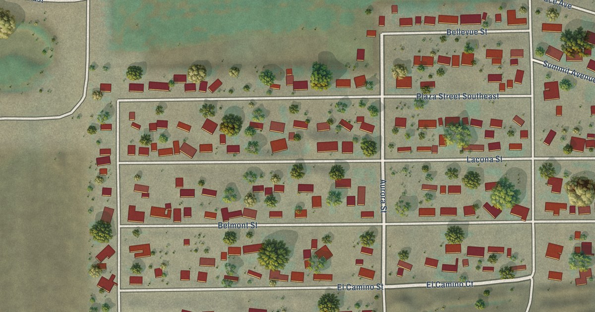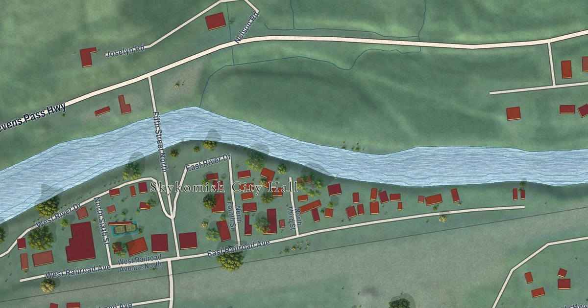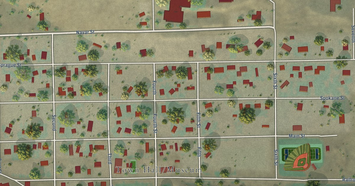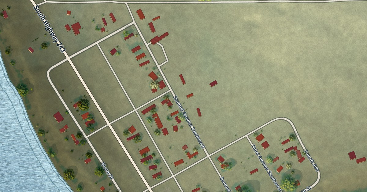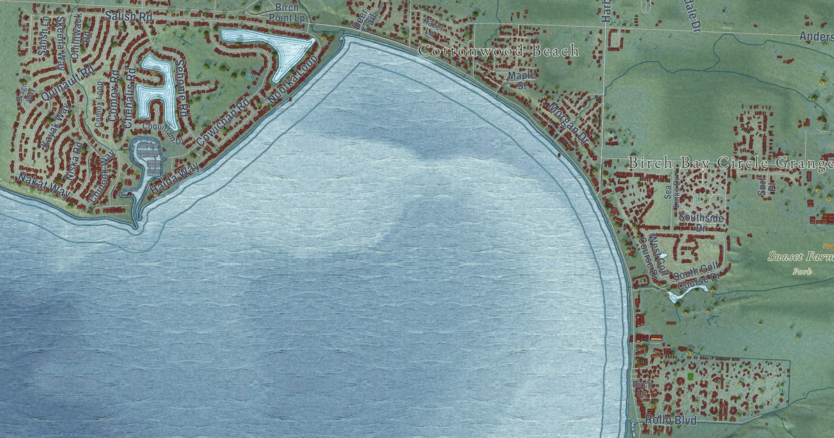
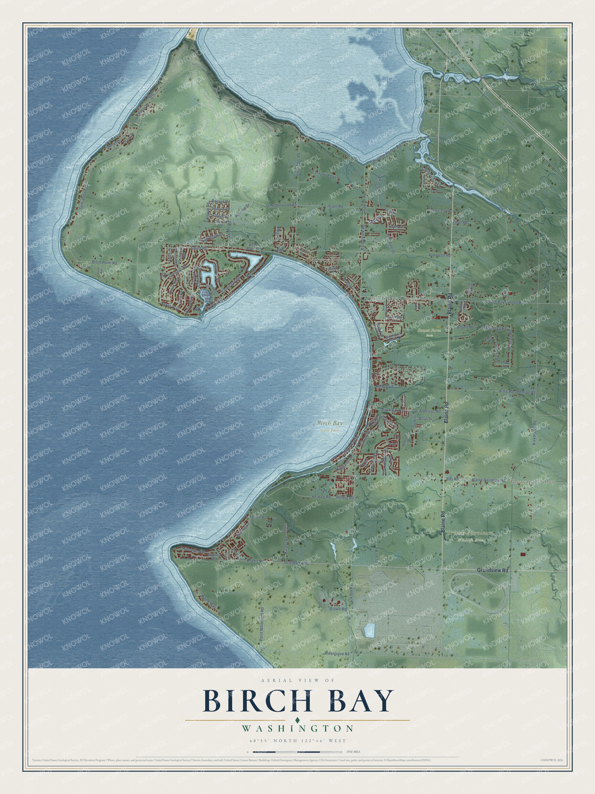
This beautifully detailed map of Birch Bay, Washington was created in 2026 using aerial imagery combined with modern topographical, census, street and landmark data. It's a modern aerial view of Birch Bay in Whatcom County, Washington, that combines modern data with a vintage aesthetic. The roads feature printed names, and if you look closely you can find your exact house accurately shown in its correct location.
Explore an aerial view of Birch Bay, Washington
On this map you'll find Pleasant Valley, Cottonwood Beach, Birch Bay Circle Grange, Birch Bay State Park, British Petroleum Wildlife Area, Sunset Farm Park, fir, Blaine Road, Grandview Road, Salish Road, Bayvue Road, Maple Way, and more. Each red shape is a building, so zoom in on the preview and look for yours.
Every town has a first chapter, and Birch Bay is no exception. Captain George Vancouver anchored his ships in Birch Bay in 1792 and set up an observatory on shore to test his chronometers. Black birch grew there in such abundance that the bay was named Birch Bay. That's from the journal of Captain George Vancouver.
Birch Bay is a community in Whatcom County. The Census Bureau counted 10,115 people here in 2020.
Take a closer look at the Birch Bay map
Names on this map
These names are printed on this map.
Places: Pleasant Valley, Cottonwood Beach, Birch Bay Circle Grange, Birch Bay State Park, British Petroleum Wildlife Area and Sunset Farm Park.
Streets and roads: Blaine Road, Grandview Road, Salish Road, Bayvue Road, Maple Way, Treevue Road, Birch Bay Drive, Kickerville Road, Birch Point Road, Jackson Road, Drayton Road, Semiahmoo Drive.
More street names, A to Z
Aldergrove Road, Alderson Road, Anchor Parkway, Anderson Road, Arnie Road, Atlas Street, Bay Ridge Drive, Bay Road, Bayshore Drive, Birch Bay Lynden Road, Birch Bay Road, Birch Lane, Birch Point Lp, Blaine-Ferndale Road, Boone Road, Bridger Road, Brown Road, California Trail, Carson Road, Charel Drive, Chehalis Road, Chilliwack Road, Chinook Way, Clamdigger Drive, Cody Road, Comox Loop, Comox Road, Coquitlam Drive, Cowichan Road, Crockett Road, Deer Trail, Drayton Harbor Road, Drayton View Lane, Fleet Road, Gemini Street, Glendale Drive, Haida Way, Halibut Drive, Harbor Drive, Harborview Road, Hazel Lane, Helweg Lane, Helweg Road, Helwig Road, Highland Drive, Hillvue Road, Hogan Drive, Holeman Avenue, Horizon Drive, Johnson Road, Karber Road, Karper Road, Kayak Way, Koehn Road, Leaf Lane, Leeside Drive, Lincoln Road, Loft Lane, Loomis Trail Road, Malibu Drive, Maple Street, Masterson Road, Morgan Drive, Nakat Way, Niska Road, Nootka Loop, Normar Place, Oertel Drive, Parkland Drive, Paton Avenue, Petticoat Lane, Pheasant Drive, Plaza Park Drive, Point Whitehorn Road, Quinault Road, Redstone Street, Rollo Boulevard, Rowan Street, Safsten Road, Salish Lane, Sandcastle Drive, Seafair Drive, Sea Links Drive, Seashell Way, Seavue Road, Sehome Road, Selder Road, Semiahmoo Parkway, Shintaffer Road, Skagit Way, Skeena Way, Skyvue Road, Sole Drive, South Golf Course Drive, Southside Drive, Starfish Lane, Sunset Drive, Surf Place, Terrell Road, Tracy Place, Twilight Place, West 42nd Place, West Golf Course Drive, Whitehorn Way, Woolridge Avenue.
See it on a wall
The Birch Bay map as a framed print. Swipe for more.


Created by KNOWOL in 2026. The buildings are small red shapes, the roads carry their printed names, and shaded relief shows the shape of the land. The title panel reads "AERIAL VIEW OF BIRCH BAY, WASHINGTON" with 48°55' NORTH 122°44' WEST.
Hang it in the hallway, the office or the cabin, or give it to someone who left Birch Bay and still calls it home. Open the preview and look for a street you know. See sizes and frames for the Birch Bay map.