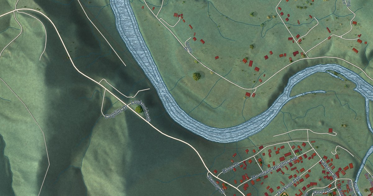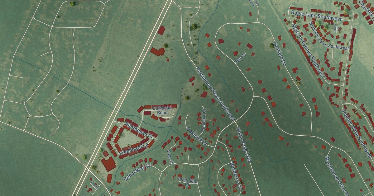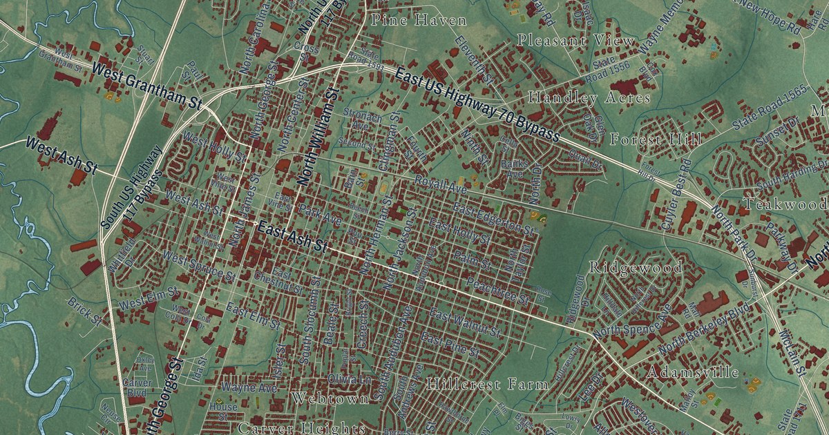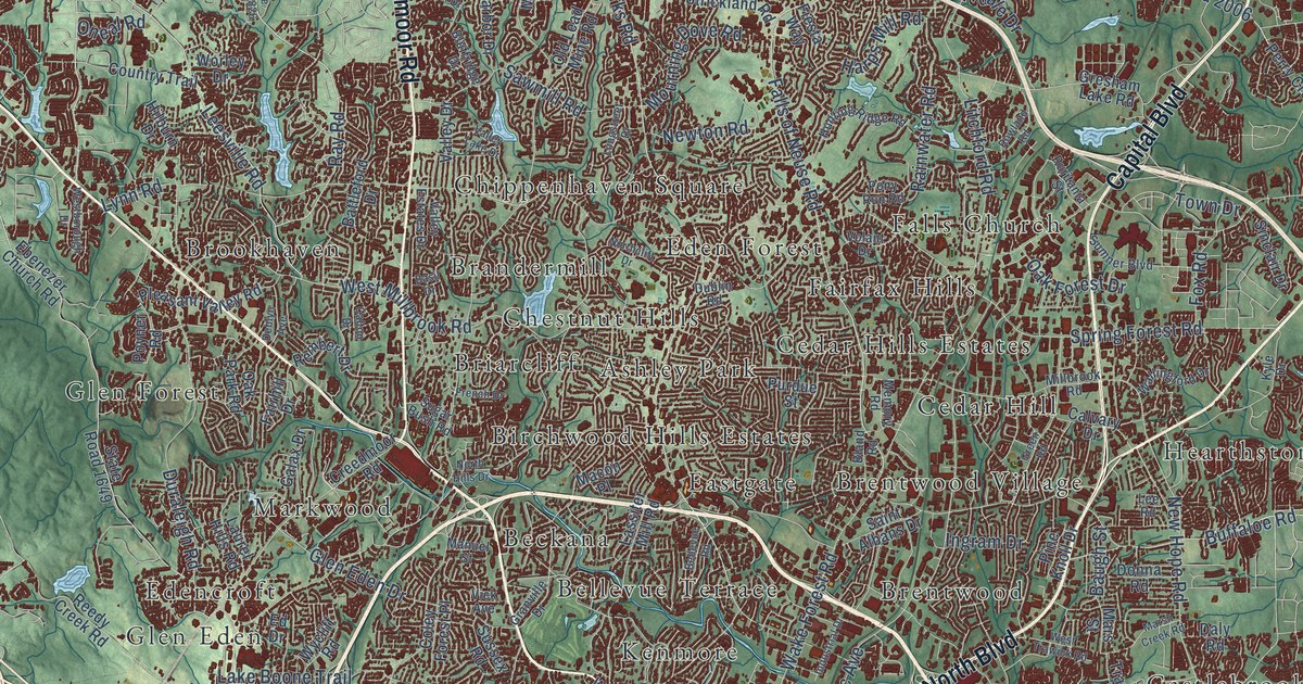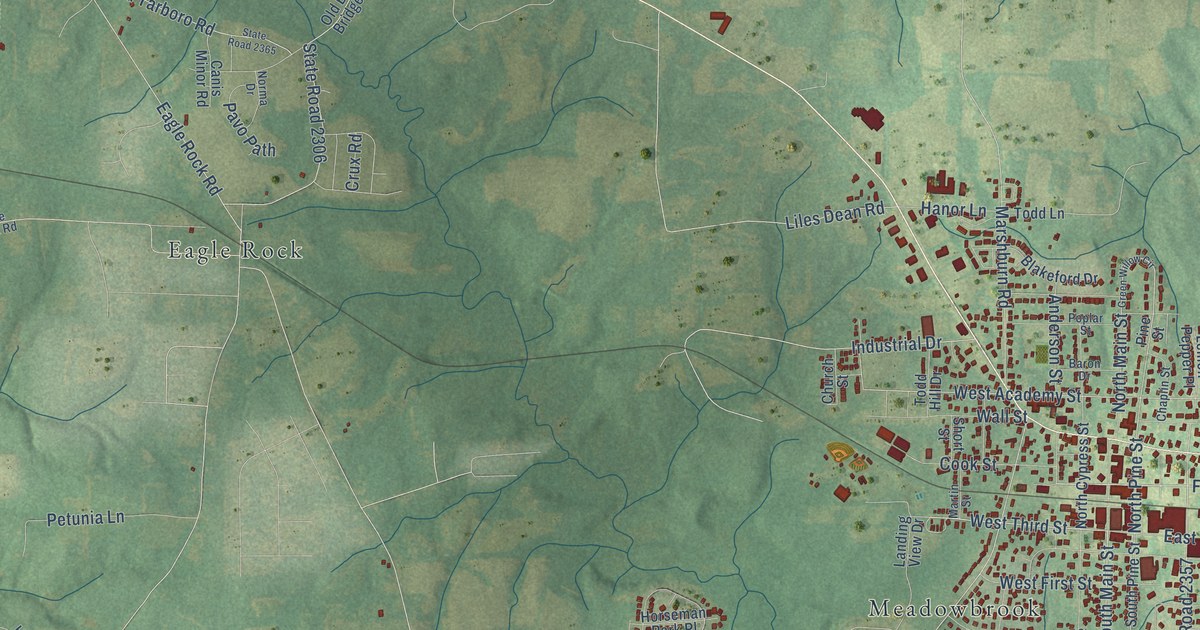
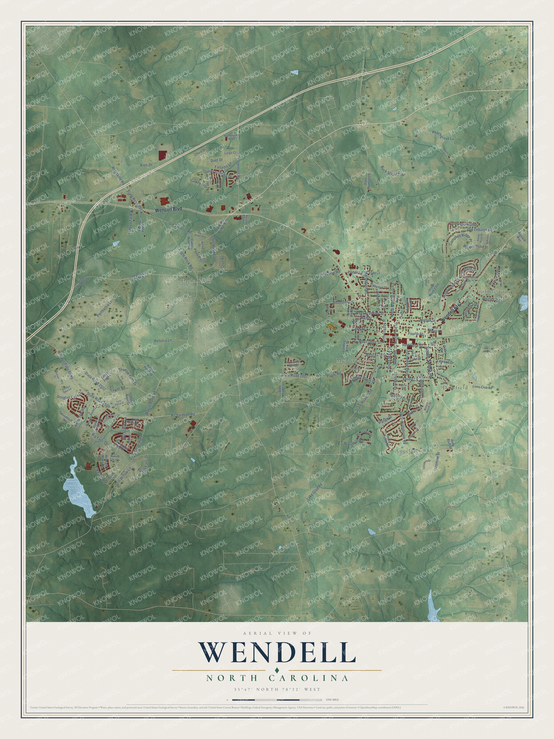
This beautifully detailed map of Wendell, North Carolina was created in 2026 using aerial imagery combined with modern topographical, census, street and landmark data. It's a modern aerial view of Wendell in Wake County, North Carolina, that combines modern data with a vintage aesthetic. The roads feature printed names, and if you look closely you can find your exact house accurately shown in its correct location.
Explore an aerial view of Wendell, North Carolina
On this map you'll find Angelview, Cobblestone, Deerfield, Eagle Rock, Meadowbrook, Wendell Boulevard, South Selma Road, Fowlkes Street, West Third Street, South Main Street, Fourth Street, Peachgrove Lane, and more. Each red shape is a building, so zoom in on the preview and look for yours.
Wendell has a story worth telling. The Town of Wendell puts it this way: "The people in this area needed a name for their little town. They asked their schoolteacher, M.A. Griffin, to come up with a name for this area. Mr. Griffin loved the poet Oliver Wendell Holmes. He suggested that they call their town Wendell after the poet."
Wendell is a town in Wake County. The Census Bureau counted 9,793 people here in 2020.
Take a closer look at the Wendell map
Names on this map
These names are printed on this map.
Places: Angelview, Cobblestone, Deerfield, Eagle Rock and Meadowbrook.
Streets and roads: Wendell Boulevard, South Selma Road, Fowlkes Street, West Third Street, South Main Street, Fourth Street, Peachgrove Lane, West Academy Street, State Road 2504, North Pine Street, Wendell Falls Parkway, Mill Station Lane.
More street names, A to Z
Anderson Street, Banners Place, Baron Drive, Big Falls Drive, Blair Hills Road, Blakeford Drive, Buck Stage Trail, Campbell Ridge Place, Canis Minor Road, Caroline Drive, Cascade Falls Lane, Cedarmere Drive, Chaplin Street, Chord Drive, Church Street, Commander Drive, Cook Street, Cottonsprings Drive, Crux Road, Cypress Cove Drive, Dallas Rose Drive, Daniel Ridge Road, Darecrest Lane, Deer Lake Trail, Douglas Falls Drive, Drift Falls Lane, Dry Canyon Drive, Duet Drive, Eagle Rock Road, East Third Street, Edgemont Road, Elk Falls Road, Falsetto Lane, Forest Lane, Gaslight Trail, Golden Spur Lane, Grange Drive, Grassy Falls Lane, Green Willow Circle, Griffin Drive, Groveview Wynd, Hallelujah Boulevard, Hall Street, Hanor Lane, Harris Street, Hidden Pond Road, Holly Bluff Street, Holly Pointe Drive, Horseman Park Place, Ibis Walk Drive, Industrial Drive, Jasmine Street, Jo Jo Drive, Jones Market Square, Kioti Drive, Kirkhill Drive, Knightdale Eagle Rock Road, Lahoya Farm Road, Lake Drive, Lake Glad Road, Lakewood Drive, Landing Place Drive, Landing View Drive, Largo Court, Lavatera Drive, Lawson Drive, Lemon Pepper Place, Liberty Star Road, Liles Dean Road, Lions Club Road, Lone Prairie Drive, Longdeer Drive, Lu Tom Lane, Mallard Trace Drive, Marshburn Road, Martin Pond Road, Martin Street, Mattox Street, Mayors Lane, McKenzie Park Terrace, Midnight Moon Drive, Norma Drive, North Cypress Street, North Main Street, Northwinds North Drive, Old Battle Bridge Road, Old Oak Tree Road, Old Tarboro Road, Old Wilson Road, Old Zebulon Road, Osprey Landing Drive, Paula Court, Pavo Path, Peach Grove Lane, Petunia Lane, Pine Street, Poinsettia Lane, Poole Road, Poplar Street, Raven Falls Drive, Redberry Court, Rhodes Pond Street, Richardson Road, Riguard Way, Rockbank Loop, Rolesville Road, Rolling Pines Lane, Sandpiper Farm Lane, Shadow Falls Drive, Short Street, South Hollybrook Road, South Pine Street, State Road 1003, State Road 1007, State Road 2306, State Road 2329, State Road 2357, State Road 2358, State Road 2359, State Road 2360, State Road 2365, State Road 2501, State Road 2502, State Road 2503, Still Willow Lane, Taylor Road, Timber Drive, Todd Hill Drive, Todd Lane, Towne Square Road, Trumpet Vine Court, Tumbling River Drive, Turkey Trot Road, Vintage Point Lane, Wall Street, Walnut Street, West First Street, West Haywood Street, Whitley Way, Willard Woods Drive, Woodbluff Drive, Wood Green Drive.
Created by KNOWOL in 2026. The buildings are small red shapes, the roads carry their printed names, and shaded relief shows the shape of the land. The title panel reads "AERIAL VIEW OF WENDELL NORTH CAROLINA" with 35°47' NORTH 78°22' WEST.
It looks right in a kitchen, an office or a den, and it's a gift for anyone who grew up in Wendell or moved away. Open the preview and find your street. See sizes and frames for the Wendell map.