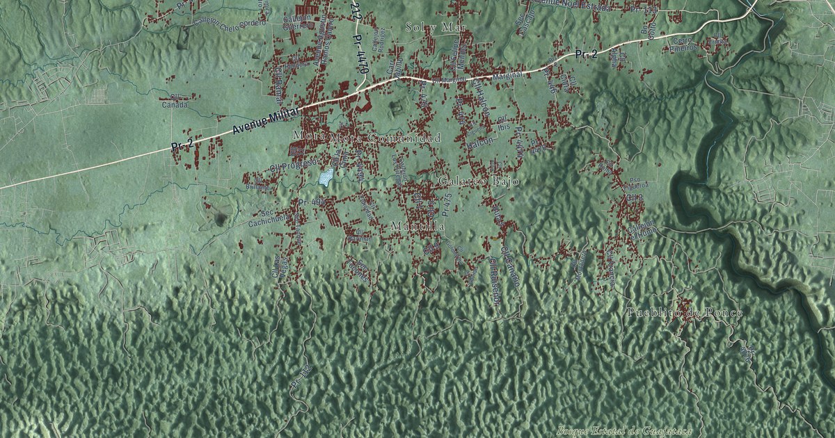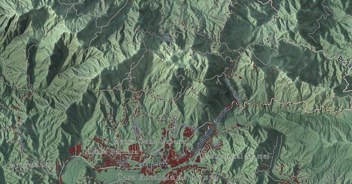
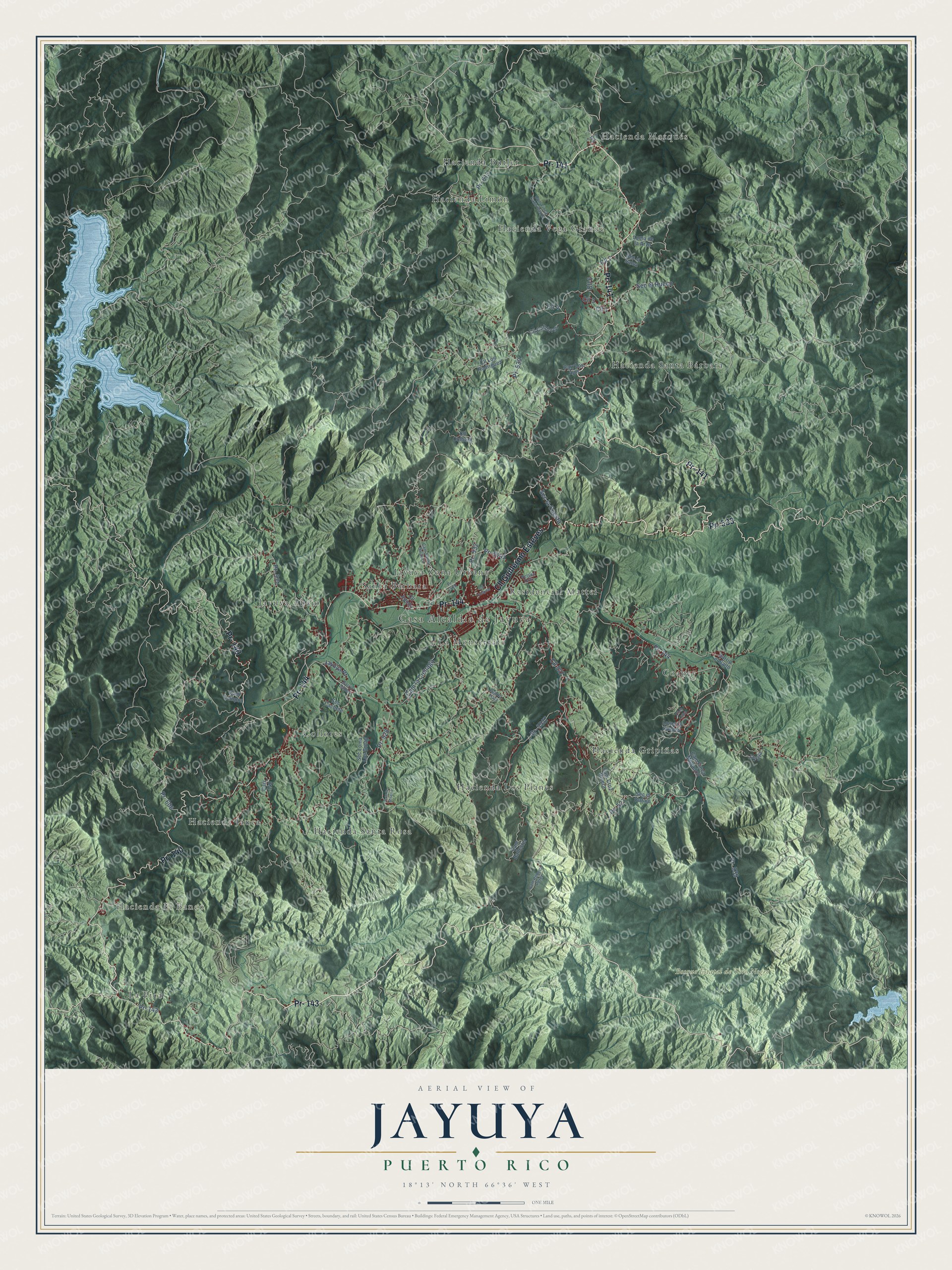
This beautifully detailed map of Jayuya, Puerto Rico was created in 2026 using aerial imagery combined with modern topographical, census, street and landmark data. It's a modern aerial view of the municipio of Jayuya, Puerto Rico, that combines modern data with a vintage aesthetic. The roads feature printed names, and if you look closely you can find your exact house accurately shown in its correct location.
Explore an aerial view of Jayuya, Puerto Rico
On this map you'll find Casa Alcaldía de Jayuya, Hacienda El Banco, Bosque Estatal de Toro Negro, Coabey, Collores, Hacienda Butler, Hacienda Gripiñas, Hacienda Jauca, Hacienda Limón, Hacienda Los Planes, Hacienda Marqués, Hacienda Santa Bárbara, and more. Each red shape is a building, so zoom in on the preview and look for yours.
Jayuya has a story worth telling. The 1923 Book of Porto Rico puts it this way: "In 1534 the idea was conceived of importing stallions from Andalucía (descendants of Arabian horses) for a big remount station located in the vicinity of Jayuya."
Jayuya is one of the 78 municipios of Puerto Rico. The Census Bureau counted 14,779 people here in 2020.
Take a closer look at the Jayuya map
Names on this map
These names are printed on this map.
Places: Casa Alcaldía de Jayuya, Hacienda El Banco, Bosque Estatal de Toro Negro, Coabey, Collores, Hacienda Butler, Hacienda Gripiñas, Hacienda Jauca, Hacienda Limón, Hacienda Los Planes, Hacienda Marqués, Hacienda Santa Bárbara, Hacienda Santa Rosa, Hacienda Vega Grande, Jayuya Abajo, Jayuya Zona Urbana, La Monserrate, La Pica, Residencial Mattei and Santa Bárbara.
Streets and roads: Pr- 141, Cll Guillermo Esteves, Pr- 144, Pr- 143, Pr- 140, Pr- 533, Pr- 532, Pr- 613, Pr- 5141, Cll 527, Pr- 539, Cll 1.
More street names, A to Z
Barrio el Salto, Barrio Zamas, Cam Ballester, Cam Cruz Rivera, Cam Finca Cano Bauza, Cam Finca Miguelon, Cam la Cienaga, Cam la Miseria, Cam Lampon, Cam Rebeca Perez, Cam Santa Barbara, Carr 140, Carr Los Ajos, Cll 3, Cll 4, Cll 6, Cll 7, Cll Apollo, Cll Cahdores, Cll Colberg, Cll Hospital, Cll la Loma, Cll Los Rodriguez, Jayuya, Jayuya Pr, Loma de la Arza, Loma la Cocora, Nelson Ortiz, Pr- 527, Pr- 528, Pr- 530, Pr- 531, Pr- 606, Pr- 5527, Puerto Plata, Sec Cachete, Sec el Carajo, Sec el Hueco, Sec la Cuesta, Sec la Salsa, Sec Loma Los Gotay.
See it on a wall
The Jayuya map as a framed print. Swipe for more.


Created by KNOWOL in 2026. The buildings are small red shapes, the roads carry their printed names, and shaded relief shows the shape of the land. The title panel reads "AERIAL VIEW OF JAYUYA, PUERTO RICO" with 18°13' NORTH 66°36' WEST.
It looks right in a kitchen, an office or a den, and it's a gift for anyone who grew up in Jayuya or moved away. Open the preview and find your street. See sizes and frames for the Jayuya map.