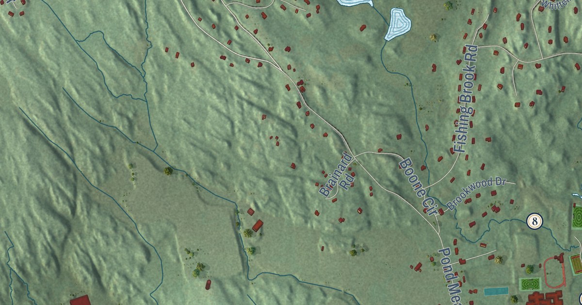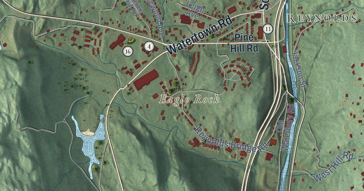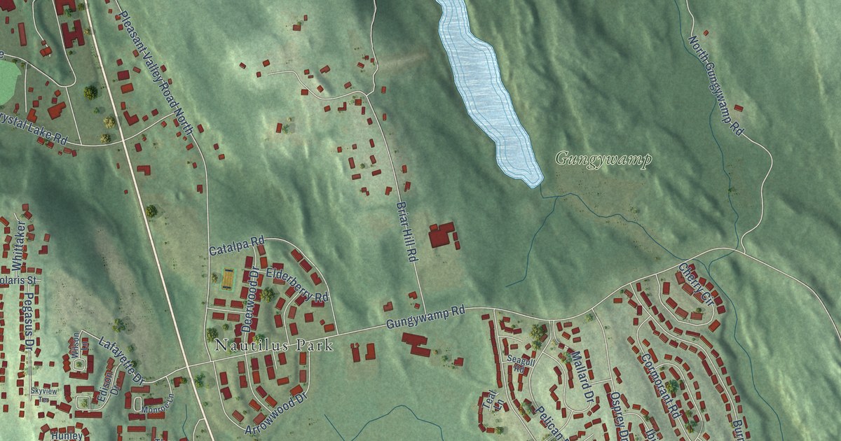
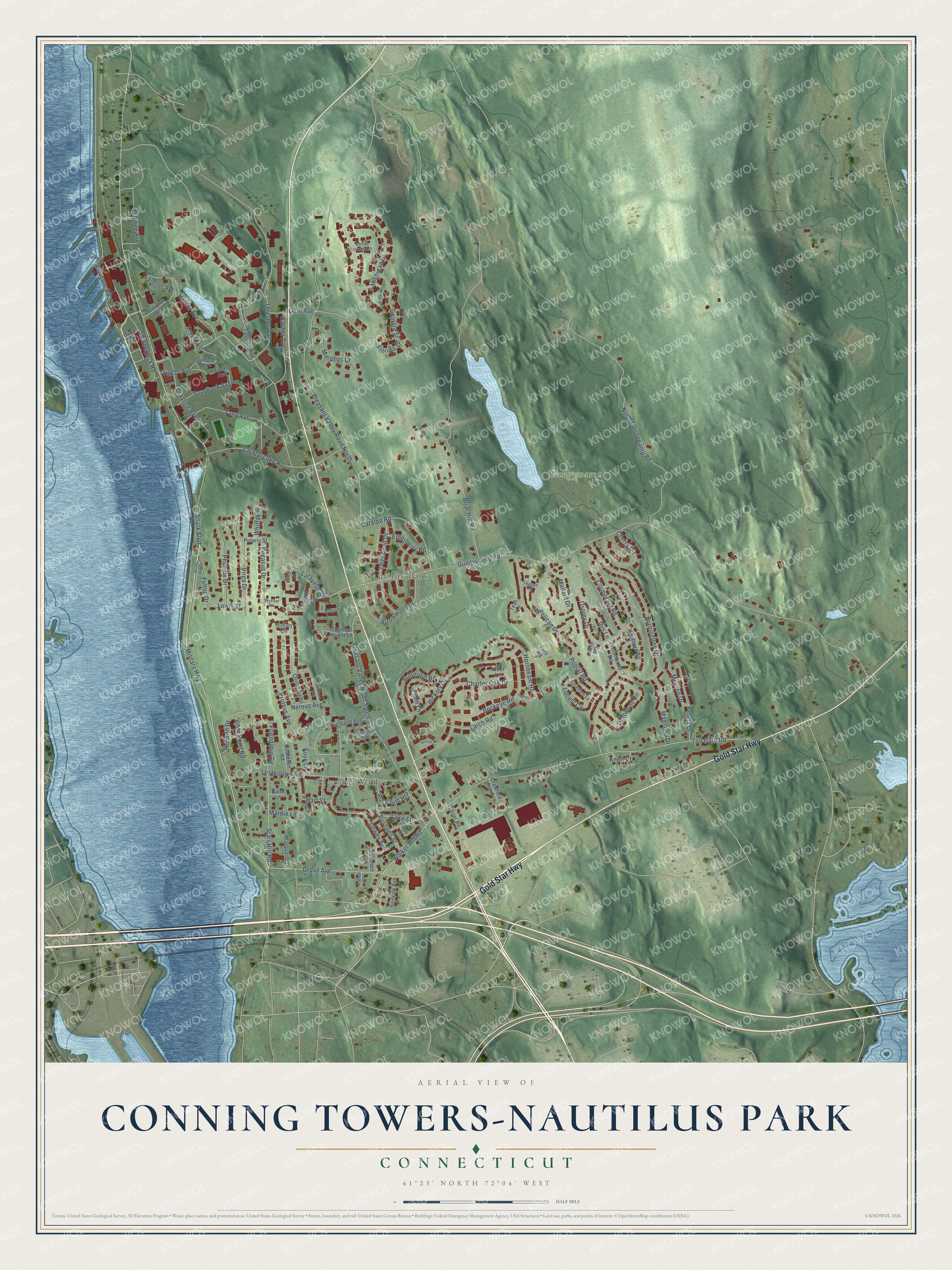
This beautifully detailed map of Conning Towers-Nautilus Park, Connecticut was created in 2026 using aerial imagery combined with modern topographical, census, street and landmark data. It's a modern aerial view of Conning Towers-Nautilus Park in Southeastern Connecticut Planning Region, Connecticut, that combines modern data with a vintage aesthetic. The roads feature printed names, and if you look closely you can find your exact house accurately shown in its correct location.
Explore an aerial view of Conning Towers-Nautilus Park, Connecticut
On this map you'll find Gungywamp, Starr Cemetery, Nautilus Park, Pleasant Valley, Gold Star Highway, Starr Hill Road, Harder Avenue, Military Highway, Shark Boulevard, Walker Hill Road, Tautog Avenue, Grove Avenue, and more. Each red shape is a building, so zoom in on the preview and look for yours.
Conning Towers-Nautilus Park is a community in Southeastern Connecticut Planning Region. The Census Bureau counted 8,870 people here in 2020. Conning Towers-Nautilus Park sits about 2 miles southeast of Gales Ferry, 3 miles north of Long Hill and 4 miles west of Old Mystic. The map prints the town name in its title panel, with the coordinates below it.
Take a closer look at the Conning Towers-Nautilus Park map
Names on this map
These names are printed on this map.
Places: Gungywamp, Starr Cemetery, Nautilus Park and Pleasant Valley.
Streets and roads: Gold Star Highway, Starr Hill Road, Harder Avenue, Military Highway, Shark Boulevard, Walker Hill Road, Tautog Avenue, Grove Avenue, Trout Avenue, Lafayette Drive, Pelican Drive, Tullibee Avenue.
More street names, A to Z
Albacore Road, Alder Lane, Amberjack Road, Arrowwood Drive, Bailey Hill Road, Baird Lane, Boardsen Road, Briar Hill Road, Buckeye Road, Burningtree Drive, Bushnell Street, Butternut Road, Carter Road, Catalpa Road, Charter Oak Drive, Cherry Circle, Cormorant Road, Cottonwood Road, Crane Road, Crawford Lane, Crystal Lake Road, Cypress Lane, Day Street, Deerwood Drive, Dewey Avenue, Driftwood Circle, Edison Drive, Elderberry Road, Flasher Avenue, Florida Street, Foye Lane, Friendship Circle, Fulton Drive, Gales Ferry Road, Georgia Street, Golet Avenue, Grayback Avenue, Grayling Avenue, Gudgeon Avenue, Gungywamp Road, Hart Street, Hawthorn Road, Heartwell Drive, Hickory Drive, Highland Avenue, Holland Avenue, Horizon Drive, Hornbeam Road, Hunley Circle, Ibis Lane, Knoll Drive, Lake Street, Larch Road, Lestertown Road, Lewis Street, Locust Circle, Magnolia Drive, Mallard Drive, Mardie Lane, Marquardt Lane, Merlino Drive, Michigan Drive, Monroe Lane, Murphys Drive, Nereus Avenue, North Gungywamp Road, Ohio Avenue, Orion Avenue, Osco Road, Osprey Drive, Patton Court, Pegasus Drive, Peters Drive, Phoenix Drive, Pleasant Valley Road North, Pleasant Valley Road South, Plum Lane, Polaris Street, Poplar Road, Proteus Avenue, Rasher Avenue, Rhode Island Lane, Russ Sim Heights, Scorpion Avenue, Seagull Road, Senkow Avenue, Shannon Lane, Skyview Terrace, Spruce Lane, Sycamore Lane, Tang Avenue, Teal Lane, Tern Road, Thames Height Lane, Thresher Avenue, Toll Gate Road, Trigger Avenue, Virgo Drive, Vista Point Road, Whittaker, Wilson Lane.
See it on a wall
The Conning Towers-Nautilus Park map as a framed print. Swipe for more.


Created by KNOWOL in 2026. The buildings are small red shapes, the roads carry their printed names, and shaded relief shows the shape of the land. The title panel reads "AERIAL VIEW OF CONNING TOWERS-NAUTILUS PARK, CONNECTICUT" with 41°23' NORTH 72°04' WEST.
It looks right in a kitchen, an office or a den, and it's a gift for anyone who grew up in Conning Towers-Nautilus Park or moved away. Open the preview and find your street. See sizes and frames for the Conning Towers-Nautilus Park map.