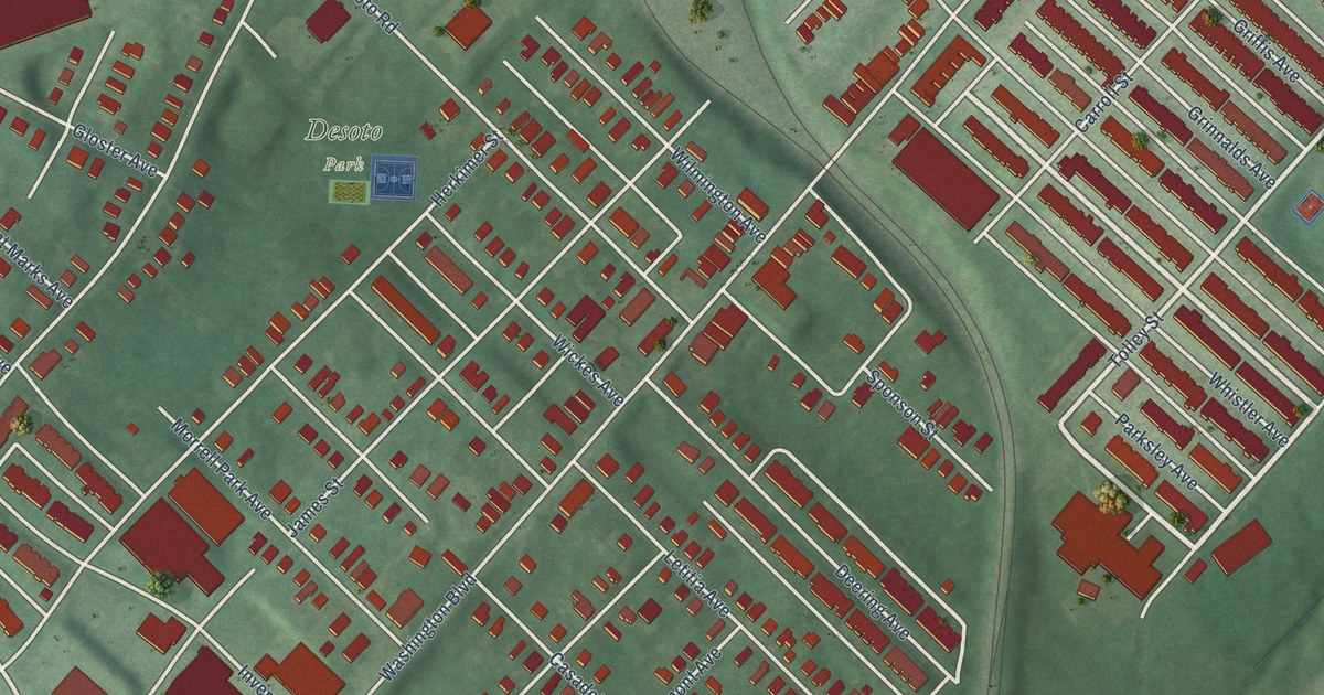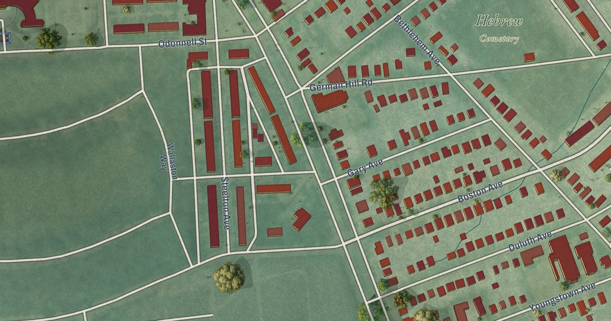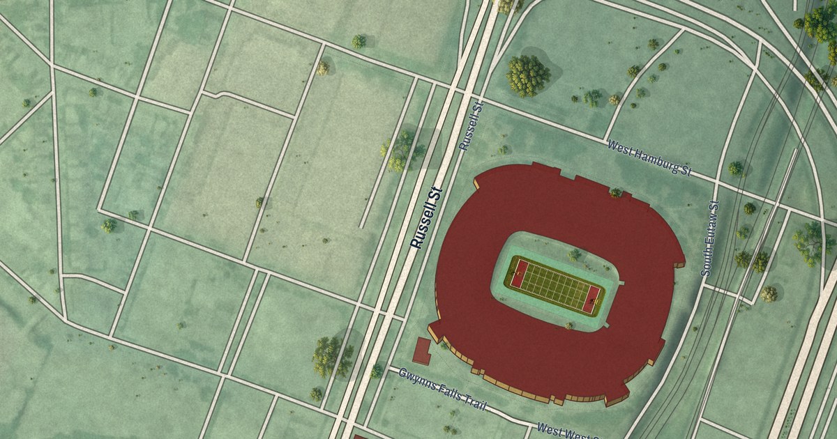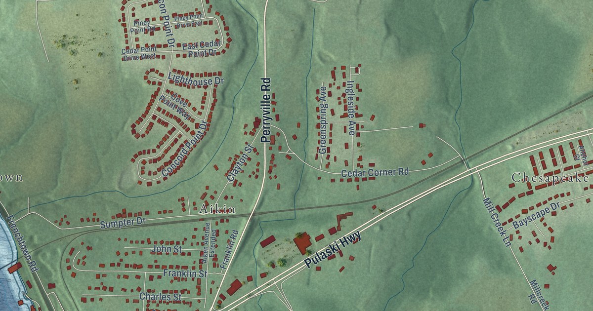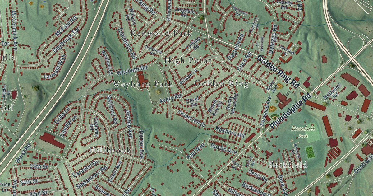
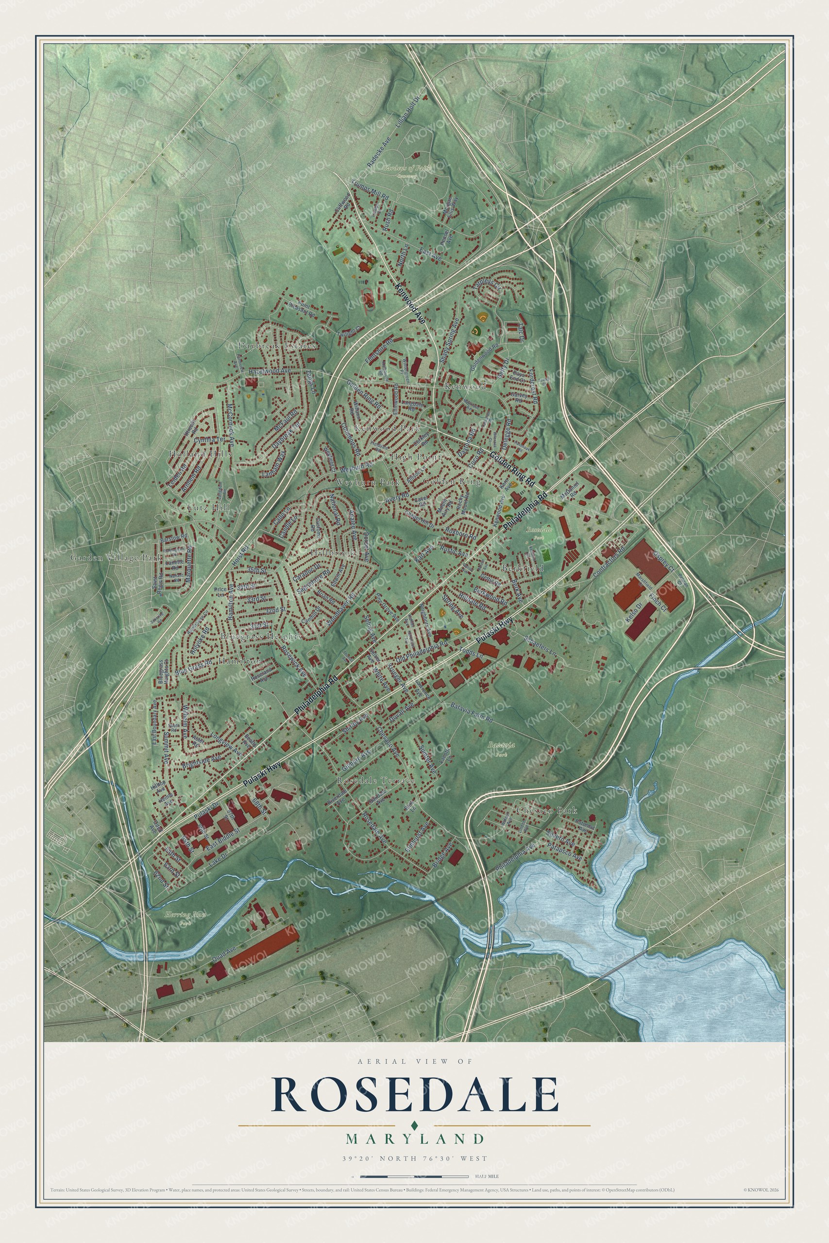
This beautifully detailed map of Rosedale, Maryland was created in 2026 using aerial imagery combined with modern topographical, census, street and landmark data. It's a modern aerial view of Rosedale in Baltimore County, Maryland, that combines modern data with a vintage aesthetic. The roads feature printed names, and if you look closely you can find your exact house accurately shown in its correct location.
Explore an aerial view of Rosedale, Maryland
On this map you'll find Batavia Park, Gardens of Faith Cemetery, Herring Run Park, Rosedale Park, Holland Hills, Bluegrass Heights, Daybreak Estates, Rosedale Terrace, Kenwood, Hillbrook, High Point, Weyburn Park, and more. Each red shape is a building, so zoom in on the preview and look for yours.
Here is a piece of Rosedale history. Rosedale began as a farming community. German, Polish and English immigrants settled here in the late 1800s and grew fruits and vegetables to sell at markets in Baltimore, while others worked in the local iron mines or ran a tavern. In 1927 the Rosedale Community Improvement Association won the community its own post office named Rosedale. That's from the Maryland Historical Trust.
Rosedale is a community in Baltimore County. The Census Bureau counted 19,961 people here in 2020.
Take a closer look at the Rosedale map
Names on this map
These names are printed on this map.
Places: Batavia Park, Gardens of Faith Cemetery, Herring Run Park, Rosedale Park, Holland Hills, Bluegrass Heights, Daybreak Estates, Rosedale Terrace, Kenwood, Hillbrook, High Point, Weyburn Park, Garden Village Park, Berkfield, Kenwood Park, Lutz Hill, Golden Ring, Chesaco Park and Hamilton.
Streets and roads: Golden Ring Road, Kenwood Avenue, Philadelphia Road, Pulaski Highway, Rosedale Avenue, Hamilton Avenue, Hazelwood Avenue, East Biddle Street, 35th Street, Woodhaven Road, 62nd Street, Chesaco Avenue.
More street names, A to Z
31st Street, 32nd Street, 33rd Street, 34th Street, 63rd Street, 64th Street, 65th Street, 66th Street, 67th Street, 68th Street, Allison Lane, Analee Avenue, Arnhem Road, Aster Road, Avery Road, Barstow Road, Batavia Farm Road, Beatty Avenue, Berk Avenue, Berk Lane, Berkwood Road, Bluegrass Heights Court, Blue Grass Road, Brian Road, Bridge Avenue, Brightside Avenue, Callo Lane, Camhill Drive, Candle Lane, Caradoc Drive, Cavel Road, Chapel Hill Drive, Cliffwood Road, Coco Road, Commons Road, Contractors Road, Corkley Road, Customs Road, Cynthia Terrace, Dalton Avenue, Daybreak Terrace, Days End Court, Daytona Road, Delegge Road, Dorset Avenue, Duvall Avenue, East Avenue, East Boundary Avenue, Edwill Avenue, Ellinwood Road, Elmhurst Avenue, Farmview Avenue, Fieldvale Road, Finch Court, Flintshire Road, Fordcrest Road, Framingham Road, Garvey Road, Gettig Road, Getty Drive, Gilmore Avenue, Goldenwood Road, Hamiltowne Circle, Havenoak Road, Heinle Avenue, Hensel Avenue, Hilldale Road, Hilltop Avenue, Holyoke Road, Horst Road, Kahler Avenue, Karl Avenue, Kelbourne Road, Kelso Drive, Kendrick Road, Kern Avenue, Krueger Avenue, Lacotti Lane, Lake Drive, Lanette Road, Langdale Road, Langdon Lane, Lanham Way, Lawrence Avenue, Leiden Road, Lillian Holt Drive, Linden Avenue, Longview Avenue, Marquette Road, Marshfield Court, Martinque Road, McCormick Avenue, McDaniel Road, McFaul Road, Morgan Ellis Way, Mount Airy Road, Nahant Road, Narcissus Avenue, National Road, Neighbors Avenue, North Lane, Oakdale Avenue, Odell Avenue, Old Philadelphia Road, Osprey Court, Patapsco Avenue, Pelican Court, Philadelphia Avenue, Pine Grove Avenue, Point Pleasant Road, Potomac Avenue, Price Lane, Pulaski Drive, Quad Avenue, Radecke Avenue, Riverdale Avenue, Rocky Mount Road, Roferd Avenue, Roseland Avenue, Rosewick Avenue, Roxboro Road, Rush Road, Rustic Avenue, Sagramore Road, Saint Regis Road, Schaefers Lane, Schering Road, Seling Avenue, Sellier Avenue, Severn Avenue, Shady Spring Avenue, Shirley Avenue, South Road, Spring Avenue, Summit Avenue, Sumter Avenue, Talc Drive, Tameron Place, Tarpleys Circle, Thomas Avenue, Todds Lane, Towns Court, Trumps Court, Trumps Mill Road, Twilight Court, Utrecht Road, Walnut Avenue, Weyburn Road, Weyfield Court, White Avenue, Wilenoak Court, Wilhelm Avenue, Willann Road, Wintergreen Place, Zangs Lane.
See it on a wall
The Rosedale map as a framed print. Swipe for more.


Created by KNOWOL in 2026. The buildings are small red shapes, the roads carry their printed names, and shaded relief shows the shape of the land. The title panel reads "AERIAL VIEW OF ROSEDALE, MARYLAND" with 39°20' NORTH 76°30' WEST.
It suits a den, a classroom or a front hall, and it makes a gift for anyone with Rosedale roots. Open the preview and find the block you know. See sizes and frames for the Rosedale map.