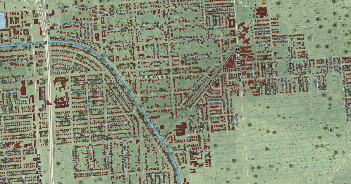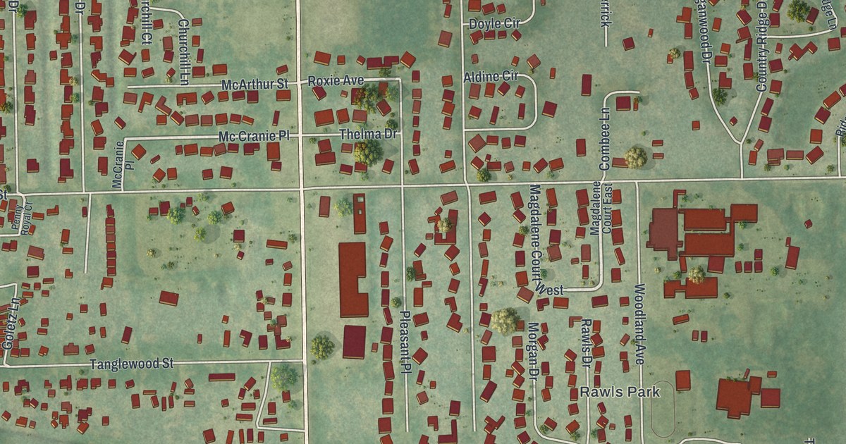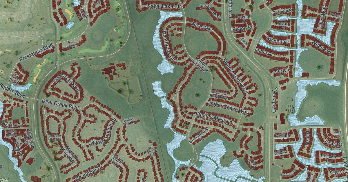
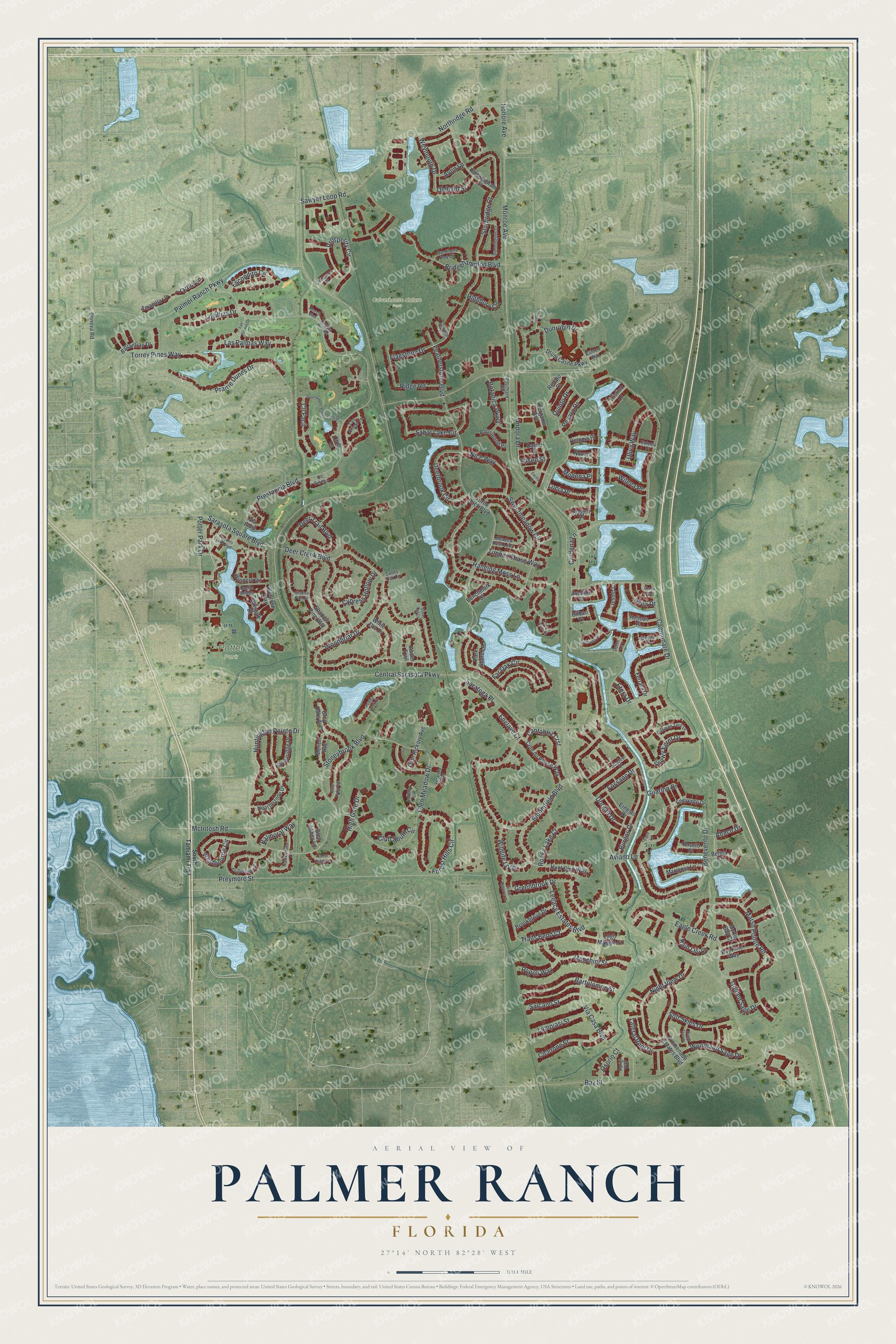
This beautifully detailed map of Palmer Ranch, Florida was created in 2026 using aerial imagery combined with modern topographical, census, street and landmark data. It's a modern aerial view of Palmer Ranch in Sarasota County, Florida, that combines modern data with a vintage aesthetic. The roads feature printed names, and if you look closely you can find your exact house accurately shown in its correct location.
Explore an aerial view of Palmer Ranch, Florida
On this map you'll find Culverhouse Nature Park, Potter Park, Northridge Road, High Gate Drive, Eliseo Street, Prestancia Boulevard, Stoneybrook Boulevard, Huntington Pointe Drive, Sabal Lake Circle, Honore Avenue, Camminare Drive, McIntosh Road, and more. Each red shape is a building, so zoom in on the preview and look for yours.
Palmer Ranch has a story worth telling. In the 1930s Honore and Grace Palmer, Bertha Palmer's son and daughter-in-law, began a cattle ranch south of Clark Road. They brought in purebred Santa Gertrudis stock to improve a herd of 1,000 to 1,500 head, and their prize-winning cattle were widely known. Bertha Palmer's family began buying thousands of acres in the region after her visit to Sarasota in 1910, and Palmer Ranch includes part of that land. That's from the Historical Marker Database.
Palmer Ranch is a community in Sarasota County. The Census Bureau counted 14,966 people here in 2020.
Take a closer look at the Palmer Ranch map
Names on this map
These names are printed on this map.
Places: Culverhouse Nature Park and Potter Park.
Streets and roads: Northridge Road, High Gate Drive, Eliseo Street, Prestancia Boulevard, Stoneybrook Boulevard, Huntington Pointe Drive, Sabal Lake Circle, Honore Avenue, Camminare Drive, McIntosh Road, Palmer Ranch Parkway, Central Sarasota Parkway.
More street names, A to Z
Abaco Drive, Amapola Lane, Andora Drive, Antler Trail, Avellino Place, Aviano Lane, Avon Lane, Ballantrae Drive, Balmoral Way, Bartolomeo Street, Bay Pine Way, Bay Street, Belina Court, Benchmark Court, Beneva Road, Benevento Drive, Bergamo Avenue, Bilbao Place, Bloomfield Boulevard, Botanica Parkway, Bouchard Circle, Bridgehampton Boulevard, Brookgrove Drive, Buckingham Street, Burgos Drive, Canary Palm Court, Cantabria Crst, Cardena Lane, Carmona Place, Caspian Tern Drive, Castle Bridge, Cedar Ridge Lane, Cicerone Street, Cinnamon Drive, Cll Facil, Cll Serena, Club Lane, Clubside Circle, Club South Circle, Cote du Rhone Way, Crockers Lake Boulevard, Cypress Hollow Drive, Davini Street, Deerbrook Circle, Deer Creek Boulevard, Deer Trail Boulevard, Dolce Lane, Donnington Court, Dorgali Drive, Dove Tail Court, Drum Castle Parkway, Dunrobin Drive, Dusty Trail Drive, Eagle Creek Road, Enclave Court, Enevento Drive, Ernesto Drive, Escondito Circle, Etera Drive, Farina Court, Far Oak Circle, Featherstone Boulevard, Ferrara Drive, Fiore Lane, Flagstone Drive, Forest Hills Circle, Fossano Drive, Gardiners Bay Circle, Girona Place, Glen Abbey Lane, Glen Meadow Drive, Glenrose Way, Golden Sage Drive, Gray Oaks Avenue, Greenbrook Drive, Grey Oaks Avenue, Guarino Drive, Hanging Moss Lane, Havenridge Drive, Hawksmoor Lane, Hearthstone Drive, Helicon Place, Highbury Circle, Hunt Club Way, Ithaca Way, Ivrea Drive, Jardin Lane, Jesolo Lane, Kilmory Way, Knightsbridge Circle, Kosteli Place, Lago Maggio Street, Lampiasi Street, Las Brisas Lane, Las Palmas Drive, Las Palmas Way, Lateral Root Drive, Legacy Estates Boulevard, Losillias Drive, Lucia Place, Manchini Street, Mariposa Lane, Marsh Pointe Road, Meadow Rush Loop, Merion Avenue, Modena Place, Monroe Avenue, Murcia Boulevard, Myrtle Bay Court, Nice Way, Night View Drive, Novara Place, Octonia Place, Olde Hickory Avenue, Oldham Street, Osorio Court, Parigi Way, Parisienne Place, Park Shore Lane, Pebble Creek Lane, Pesaro Drive, Popoli Way, Potter Park Drive, Prairie Dunes Drive, Preymore Street, Promenade Estates Boulevard, Prosperity Circle, Quinto Drive, Rain Lily Court, Regina Royale, Renato Court, Ridge Road, Rocky Lake Court, Roseto Place, Salcano Street, Sandy Oak Lane, Sarasota Square Boulevard, Saratoga Place, Sawyer Loop Road, Shadow Pine Circle, Shadow Pine Way, Snowy Egret Drive, Soft Skies Drive, South Tamiami Trail, Stanhope Court, Sturbridge Court, Sundew Drive, Sweetmeadow Circle, Tantallon Court, Timber Chase Way, Torrey Pines Way, Tournament Players Clb Drive, Trails Bend Court, Trails Reserve Court, Tristino Lane, Turtle Rock Boulevard, Uliva Way, Valente Place, Veranda Way, Via Casa Boulevard, Via Fiore, Westbourne Circle, Weymouth Drive, White Tail Lane, Wildlife Loop, Wilena Place, Wingate Drive, Winners Circle, Woodbriar Drive, Woodland Sage Drive.
See it on a wall
The Palmer Ranch map as a framed print. Swipe for more.


Created by KNOWOL in 2026. The buildings are small red shapes, the roads carry their printed names, and shaded relief shows the shape of the land. The title panel reads "AERIAL VIEW OF PALMER RANCH, FLORIDA" with 27°14' NORTH 82°28' WEST.
It looks right in a kitchen, an office or a den, and it's a gift for anyone who grew up in Palmer Ranch or moved away. Open the preview and find your street. See sizes and frames for the Palmer Ranch map.