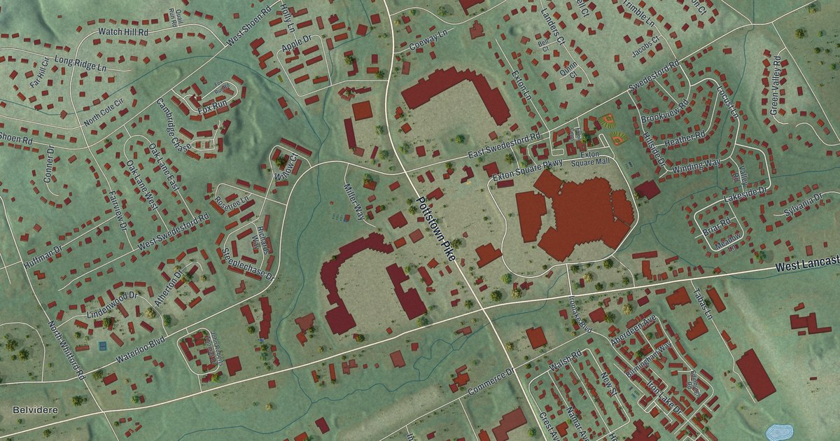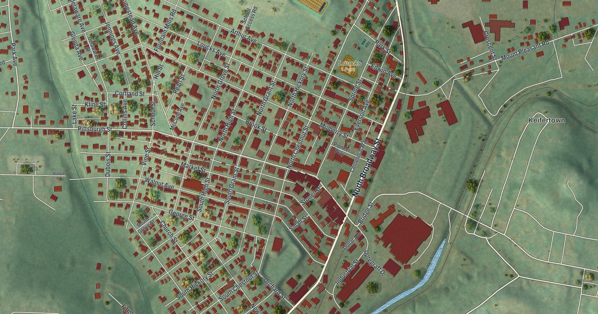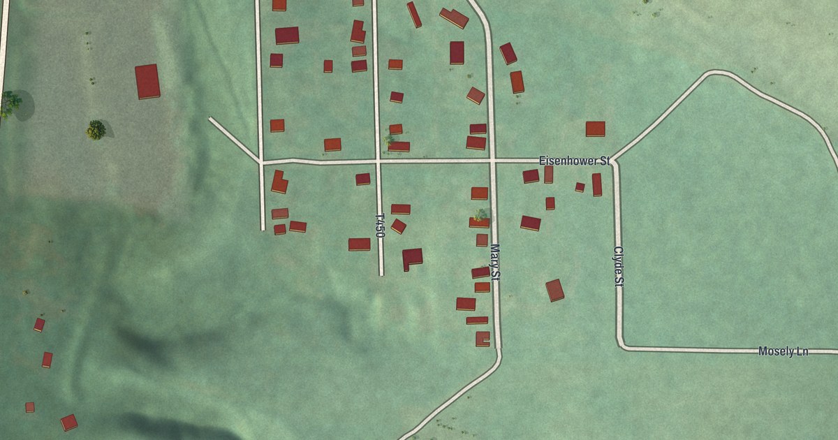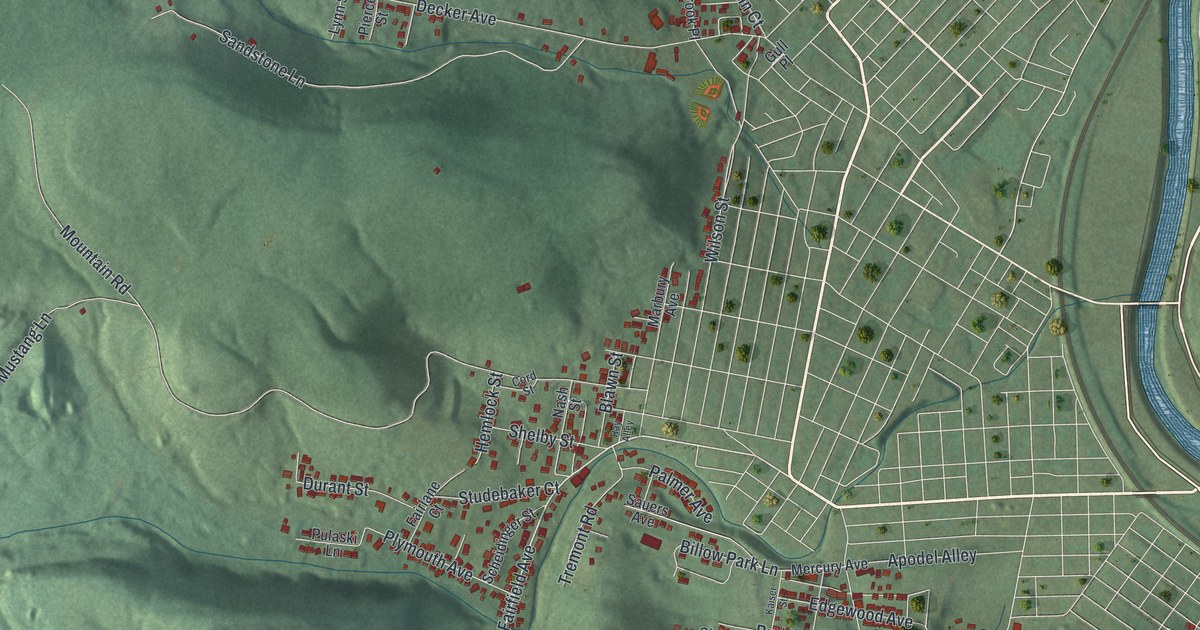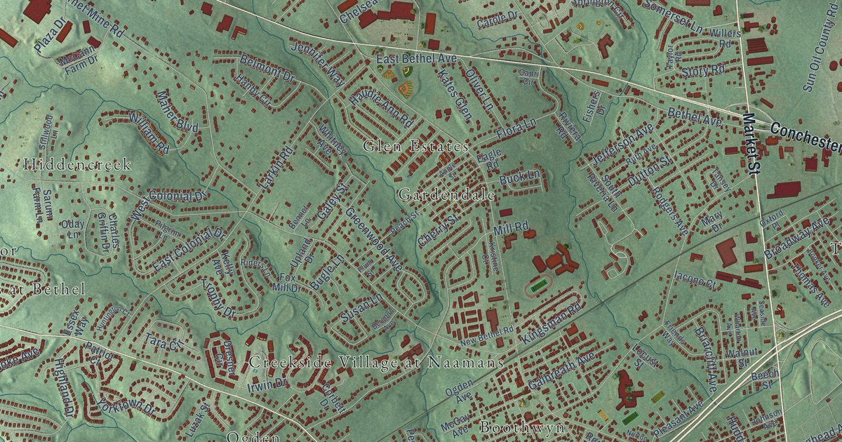
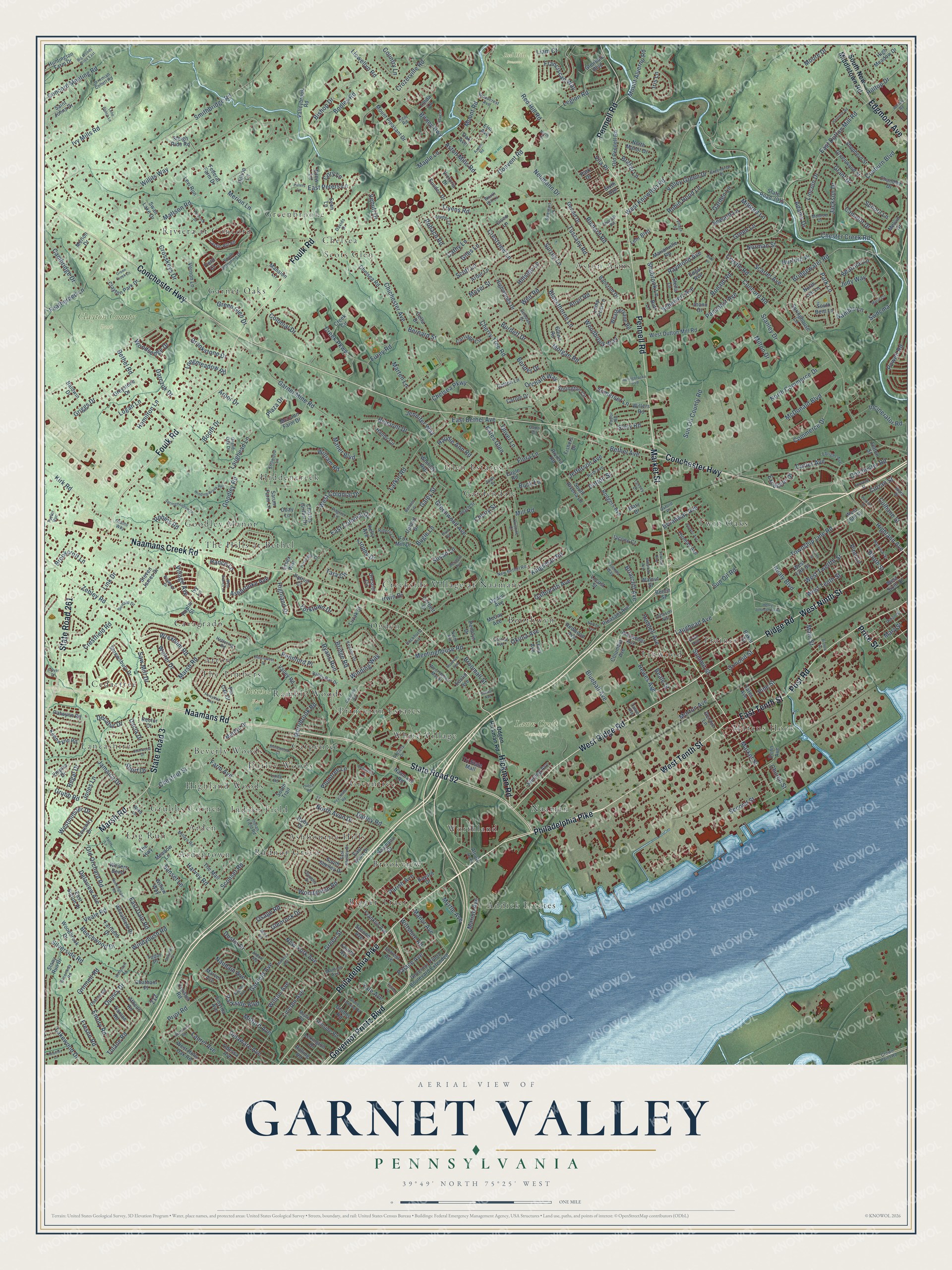
This beautifully detailed map of Garnet Valley, Pennsylvania was created in 2026 using aerial imagery combined with modern topographical, census, street and landmark data. It’s a one-of-a-kind view of Garnet Valley that combines accurate data with a vintage aesthetic. The map shows every building in its true location, many of the roads carry their names, and the shaded topographic relief shows the shape of the land.
Explore an aerial view of Garnet Valley, Pennsylvania
On the map you’ll find Betchel Park, Clayton County Park, Lawn Croft Cemetery, Red Hill Preserve, Glen Estates, Addick Estates, Goodley Manor, Riviera at Concord, Twin Oaks, Log Run, Boothwyn, Scots Glen, and more. If you look closely you can even find your house accurately drawn in its correct location. Zoom in on the preview to look for yours.
Take a closer look at the Garnet Valley map
Names on this map
These names are printed on this map.
Places: Betchel Park, Clayton County Park, Lawn Croft Cemetery, Red Hill Preserve, Glen Estates, Addick Estates, Goodley Manor, Riviera at Concord, Twin Oaks, Log Run, Boothwyn, Scots Glen, Naaman, Hiddencreek, Creekside Village at Naamans, Aston Arms, Princeton Estates, Ashbourne Hills, Greentree, Garnet Oaks, Trainer, Worthland, Darley Woods, Cedartree, Cavagrado, Grubbs Corner, Bigger Tract, Marcus Hook, Radnor Green, Brookview, Ardentown, Greenbrooke, Indian Field, Lancashire, Ogden, Beverly Woods, Carpenter, Ramble Woods, Afton, White Village, Chelsea, Gardendale, Linwood, The Hills at Bethel, Arden, Highland Woods and The Timbers.
Streets and roads: Philadelphia Pike, Market Street, West Ninth Street, West Tenth Street, East Tenth Street, Ridge Road, Post Road, West Ridge Road, Conchester Highway, Naamans Road, State Road 92, Foulk Road.
More street names, A to Z
Adams Drive, Alcott Avenue, Aldon Road, Alexander Avenue, Anvil Road, Apple Street, Arbor Drive, Arbor Lane, Ashbrooke Avenue, Aspen Road, Aston Mills Road, Athens Road, Avery Lane, Baker Street, Baldwin Drive, Bancroft Drive, Bayard Drive, Beale Street, Beatrice Lane, Beech Street, Beechwood Drive, Belmont Drive, Bender Drive, Bennet Lane, Bergdoll Avenue, Bernard Street, Bethel Avenue, Bethel Road, Big Woods Drive East, Birney Highway, Bishop Drive, Bishop Street, Bittersweet Drive, Blackthorne Lane, Blair Place, Blueball Avenue, Bodley Road, Booker Avenue, Booth Drive, Booth Street, Boudwin Avenue, Brakel Lane, Briarcliff Avenue, Bridge Road, Bridgewater Road, Broadway Avenue, Brookcroft Lane, Brookstone Drive, Broomall Street, Buckingham Road, Buck Lane, Bugle Lane, Burdett Drive, Butt Lane, Cambridge Drive, Camelot Drive, Capri Circle, Carlton Avenue, Carole Drive, Carpenter Road, Carriage Circle, Carson Road, Carter Avenue, Cassin Hill Road, Cathy Lane, Cedartree Lane, Cella Drive, Central Avenue, Chandler Drive, Charles Griffin Drive, Charwood Drive, Chatham Place, Chelsea Parkway, Chelsea Road, Cherry Street, Cherry Tree Road, Chester Creek Road, Chestnut Street, Chichester Avenue, Chichester Road, Church Street, Cisco Lane, Clayton Park Drive, Cloister Road, Coeburn Boulevard, Colonial Drive, Columbia Avenue, Commerce Drive, Concord Meeting Road, Concord Road, Convent Road, Corbett Drive, Cory Lane, Cotton Lane, Country Lane, Coventry Drive, Creek Circle, Creek Parkway, Crestfield Road, Crestview Lane, Crosskeys Drive, Crown Point Road, Crozerville Road, Crystle Road, Culhane Street, Culver Drive, Curran Street, Dacia Drive, Darczuk Drive, Darley Road, Davids Drive, Decatur Drive, Delaview Avenue, Delaware Avenue, Delview Drive, Dogwood Drive, Donald Drive, Dresner Circle, Drew Lane, Dustin Drive, Dutton Street, Eagle Road, East Avon Drive, East Bethel Avenue, East Colonial Drive, East Dale Road, East Dutton Mill Road, East Peters Lane, East Shelley Drive, East Sutton Place, Ebright Avenue, Edgar Avenue, Edgmont Avenue, Elm Avenue, Emory Road, Empire Drive, Ervin Avenue, Essex Way, Euclid Avenue, Eusden Drive, Excelsior Drive, Fairfield Drive, Farm Avenue, Featherbed Lane, Federal Farm Drive, Felton Street, Field Court, Fishers Drive, Flora Lane, Forrest Avenue, Forsythia Avenue, Forwood Street, Fourth Avenue, Fox Mill Drive, Franciscan Way, Franklin Avenue, Fresno Road, Friends Way, Furey Road, Galbreath Avenue, Galey Street, Gamble Lane, Garden Lane, Garfield Avenue, Garnet Mine Road, Gerald Drive, Giles Lane, Glendale Boulevard, Glenn Road, Glenrock Drive, Goodale Drive, Goodley Road, Governor Printz Boulevard, Governor Printz Boulevard Extended, Grams Way, Grand Oak Drive, Grant Drive, Greenbriar Place, Green Creek Lane, Green Glen Drive, Green Lane, Green Street, Greenway Road, Greenwood Avenue, Greenwood Street, Greystone Drive, Griggs Drive, Grinnell Road, Grubb Road, Grubbs Landing Road, Grubbs Road, Hamilton Lane, Hanby Circle, Hance Lane, Harbor Drive, Harrison Road, Harvey Road, Harwick Street, Haudie Ann Road, Heather Lane, Henry Johnson Parkway, Hettering Road, Hewes Avenue, Hickman Road, Highland Avenue, Highland Drive, High Meadow Drive, Highwoods Drive, Hillside Lane, Hillside Road, Hilltop Drive, Hilltop Lane, Hoag Lane, Huddell Avenue, Hughes Avenue, Huntington Court, Huntington Farm Drive, Hurford Place, Iacono Court, Incinerator Road, Indian Field Road, Iris Lane, Irwin Drive, Ivy Lane, Ivy Mills Road, Jackson Drive, Jamaica Drive, Jefferson Avenue, Jennifer Way, Jeremiah Collett Road, Joann Drive, Johnson Avenue, Jones Lane, Judy Way, Kates Glen, Keanon Drive, Kelly Avenue, Kennwynn Road, Kent Road, Kingsman Road, Kirk Road, Kristine Court, Lakewood Drive, Lamp Post Lane, Larkin Road, Laughead Avenue, Laughead Lane, Laurel Avenue, Legion Road, Lehr Boulevard, Levi Run, Lexington Drive, Liam Court, Lincoln Avenue, Lincoln Drive, Linda Lane, Linda Road, Link Drive, Llewellyn Road, Locust Street, Logan Lane, Lone Beech Lane, Longmeadow Road, Luzak Street, Madison Avenue, Maher Boulevard, Main Street, Manor Avenue, Mansion Avenue, Mansion Lane, Maple Lane, Maple Road, Marianville Road, Marie Circle, Marilyn Drive, Marion Avenue, Marsh Road, Marten Lane, Marvel Avenue, Mary Drive, Mary Street, Mattson Road, McCann Farm Drive, McCay Avenue, McDonald Boulevard, Meadow Lane, Meetinghouse Road, Melvin Drive, Merion Drive, Merion Lane, Merribrook Road, Mildred Lane, Miles Road, Milford Avenue, Millers Road, Mill Road, Milton Drive, Monroe Drive, Moore Drive, Morgan Road, Morton Avenue, Moser Street, Mount Alverno Road, Mount Pleasant Drive, Mount Road, Myrtle Avenue, Naamans Creek Road, Naamans Drive, Naudain Avenue, Nealy Boulevard, Neumann Drive, New Bethel Road, New York Avenue, Ninth Avenue, Norman Street, North Avon Drive, North Commerce Drive, North Drive, North Lee Lane, North Manor Drive, Norton Avenue, Oak Avenue, Oberlin Road, Oday Lane, Odessa Avenue, Odgen Hickman Road, Ogden Avenue, Okiola Avenue, Old Orchard Road, Old Pennell Road, Oliver Lane, Olympia Drive, Orchard Way, Ormond Street, Osage Road, Oxford Place, Palace Avenue, Pancoast Avenue, Parish Avenue, Park Drive, Park Lane, Parkside Boulevard, Patriot Court, Patwynn Road, Peach Street, Peachtree Road, Penn Avenue, Pennell Road, Pennford Place, Pennlyn Drive, Pennock Drive, Pennrock Road, Perkins Street, Peters Lane, Pilgrim Lane, Pine Lane, Pine Street, Pin Oak Drive, Plaza Drive, Pleasant Avenue, Plum Street, Plumtree Lane, Poplar Street, Powell Road, Price Street, Prince Road, Prior Road, Quincy Drive, Raymond Avenue, Rector Court, Red Hill Road, Redwood Avenue, Regal Drive, Rennie Lane, Richard Road, Riders Lane, Riviera Road, Robin Hood Lane, Robins Road, Rockhurst Avenue, Rodgers Avenue, Rohach Road, Rolling Road, Ronald Road, Ruby Drive, Ruth Avenue, Ryans Run, Saint Johns Drive, Sarum Farm Lane, Saw Mill Drive, Scarlet Avenue, Scheivert Avenue, School Lane, Sconset Road, Scott Lane, Sean Lane, Seaside Avenue, Second Avenue, Second Street, Seward Lane, Shepherd Street, Short Drive, Shrewsbury Drive, Shubrook Lane, Silverside Road, Sixth Avenue, Sleigh Ride Road, Smithbridge Road, Smyrna Avenue, Snyder Lane, Society Drive, Somerset Lane, South Bent Lane, South New Middletown Road, South Riveria Lane, South Shelley Drive, South Trail, South Valentine Drive, Springbrooke Boulevard, Springhouse Lane, Springmeadow Lane, Springton Circle, Stanley Drive, State Road 3, State Road 261, State Road 3015, Stella Lane, Sterling Avenue, Steven James Drive, Stillwood Lane, Stonewood Court, Stony Run Drive, Story Road, Summit Street, Sun Oil County Road, Sun Oil Road, Sunset Lane, Surrey Lane, Susan Lane, Swan Lake Drive, Swdcma, Sweigart Lane, Tallyn Avenue, Tansey Drive, Tara Circle, Taylor Road, Taylor Run, The Highway, The Mall, Third Avenue, Thomas Avenue, Thomas Road, Township Line Road, Tri State Mall, Trophy Drive, Tryens Road, Tudor Place, Tulane Road, Tuscany Road, Union Street, Upland Drive, Valleybrook Road, Valley Green Drive, Valley Road, Valley Run Drive, Veale Road, Venuti Drive, Vernon Lane, Victoria Drive, Vila Place, Village Avenue, Village Drive, Walnut Street, Walter Drive, Ward Street, Weathervane Road, Weilers Bend, Weir Road, West 13th Street, West 15th Street, West Branch Lane, West Colonial Drive, West Dutton Mill Road, West Helms Manor, West Holly Oak Road, West Knowlton Road, Westminster Drive, West Sixth Street, West Twelfth Street, Wharton Avenue, Wheatfield Drive, Whitely Road, Whitney Avenue, Willers Road, William Road, Willits Way, Willow Way, Wilson Avenue, Wiltshire Road, Winding Brook Run, Winding Way, Wind Lane, Windybush Road, Wollaston Road, Woodbrook Drive, Woodbrook Way, Woodcrest Avenue, Woodgreen Road, Woodsedge Drive, Worth Hill Lane, Wrexham Road, Yale Avenue, Yates Avenue, Yorktown Drive, Zebley Road.
See it on a wall
The Garnet Valley map as a framed print. Swipe for more.


This beautifully detailed map of Garnet Valley makes an attractive addition to your office, library, or den, and it can even be used to teach children the geography and history of the area. It also makes a great gift for anyone who grew up in Garnet Valley or moved away. When you’re done exploring, click here to get your copy of the Garnet Valley map.