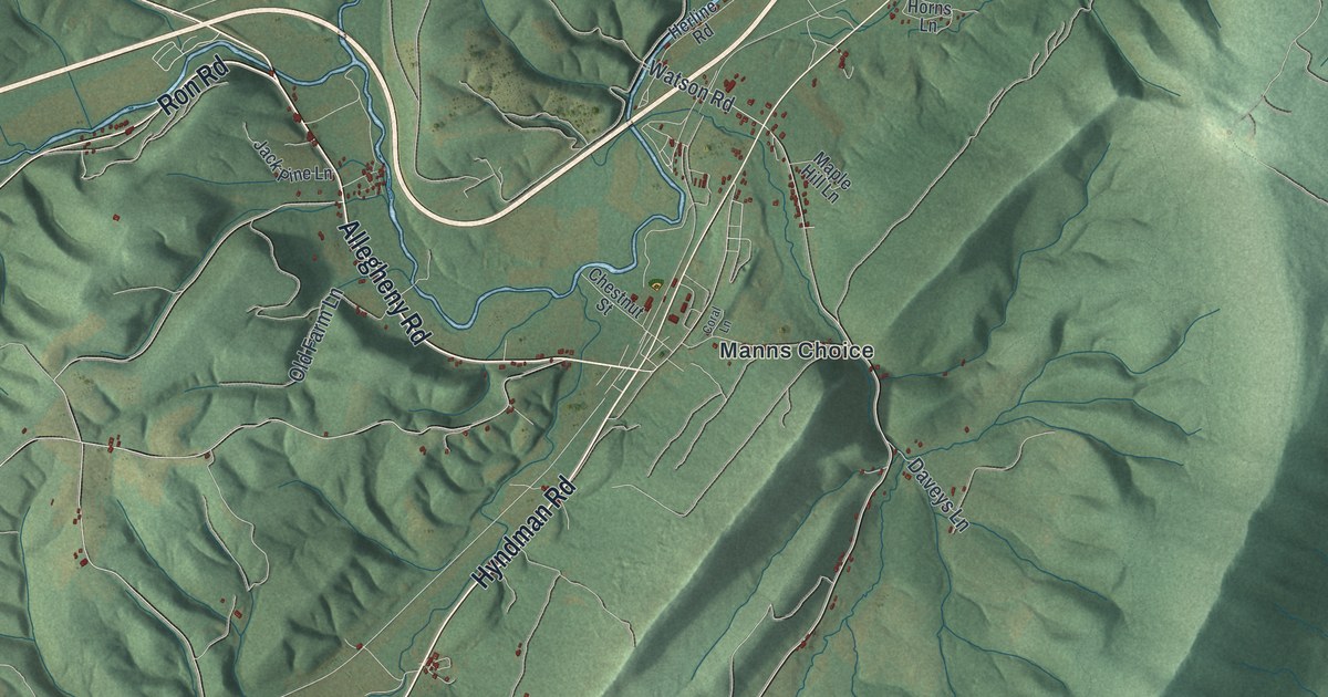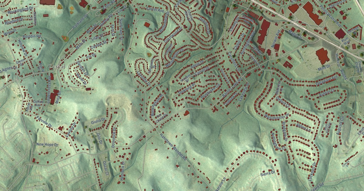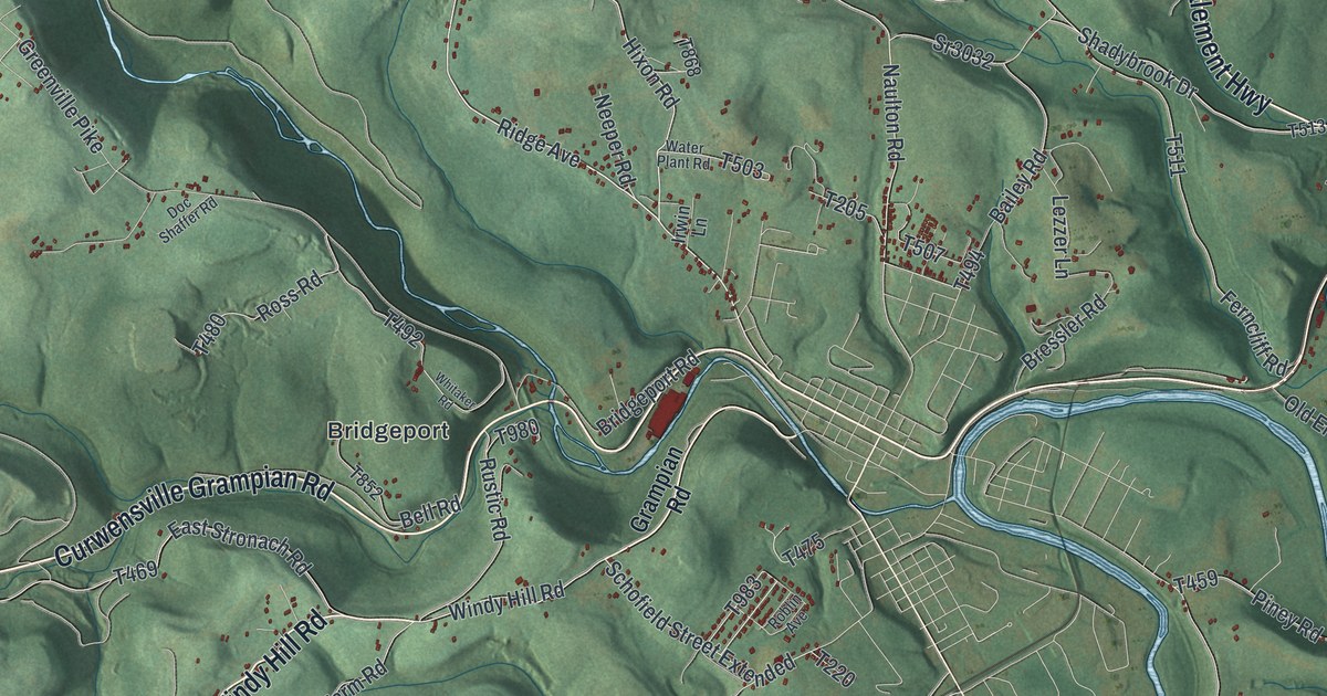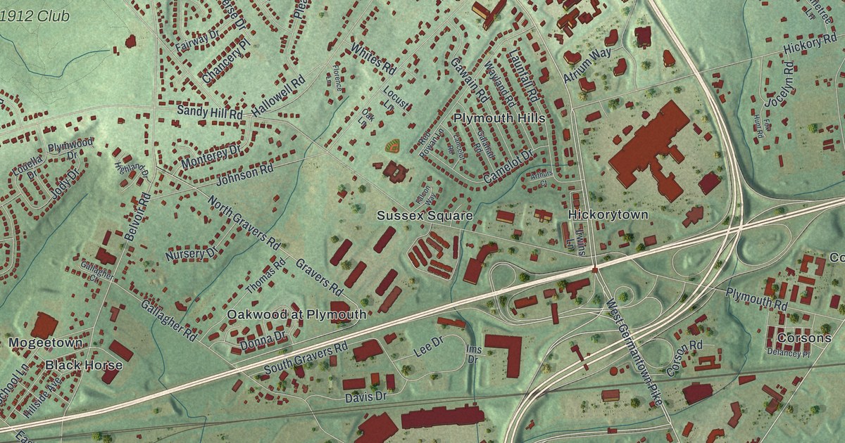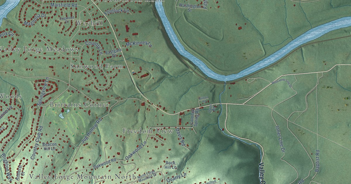
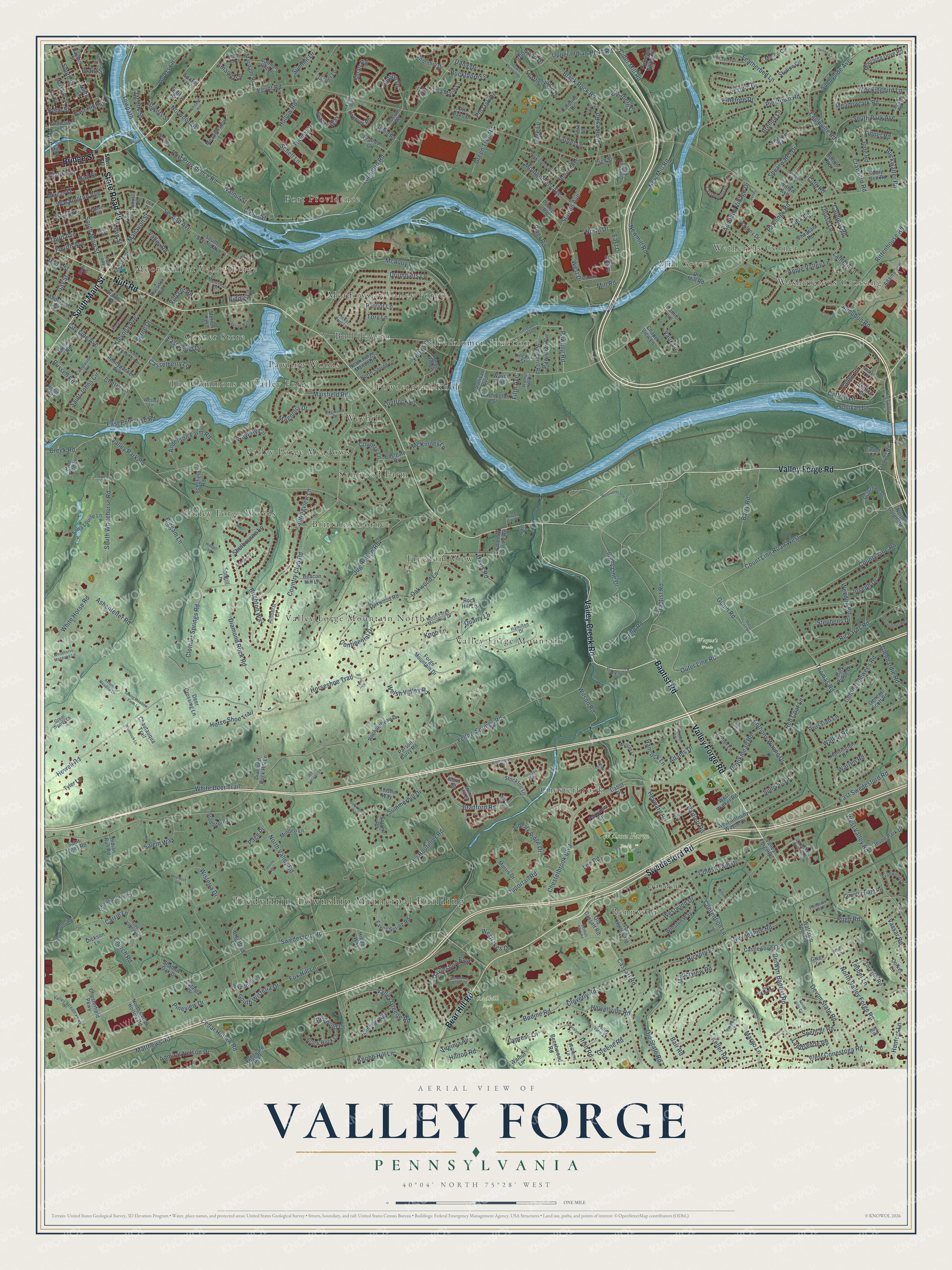
This beautifully detailed map of Valley Forge, Pennsylvania was created in 2026 using aerial imagery combined with modern topographical, census, street and landmark data. It’s a one-of-a-kind view of Valley Forge that combines accurate data with a vintage aesthetic. The map shows every building in its true location, many of the roads carry their names, and the shaded topographic relief shows the shape of the land.
Explore an aerial view of Valley Forge, Pennsylvania
On the map you’ll find Tredyffrin Township Municipal Building, Radbill Park, Wayne’s Woods, Wilson Farm Park, Meadows at Valley Forge, Mill Grove, Valley Forge Woods, Valley Forge Mountain, Weyhill, Moorehall at Valley Forge, Washingtons Crossing, Brittains Corner, and more. If you look closely you can even find your house accurately drawn in its correct location. Zoom in on the preview to look for yours.
Did You Know?
From Internet Archive: "At Valley Forge it was determined whether or not the Republic should die in its childhood; at Gettysburg it was settled whether or not the Republic should exist in its manhood."
Valley Forge is a community in Chester County.
Take a closer look at the Valley Forge map
Names on this map
These names are printed on this map.
Places: Tredyffrin Township Municipal Building, Radbill Park, Wayne's Woods, Wilson Farm Park, Meadows at Valley Forge, Mill Grove, Valley Forge Woods, Valley Forge Mountain, Weyhill, Moorehall at Valley Forge, Washingtons Crossing, Brittains Corner, Valley Forge Mountain North, Rennyson, Corner Store, Port Providence, Bull Tavern, Valley Forge Meadows, Powderhorn Knoll, Wetherills Corner, Sunwood Farm, Chesterbrook, Perkiomen Junction, Garden, The Commons at Valley Forge, Freedom View and Pawling Woods.
Streets and roads: Valley Forge Road, Swedesford Road, South Main Street, Valley Creek Road, State Road 29, Bridge Street, Bear Hill Road, Nutt Road, Baptist Road, Outer Line Road, Horseshoe Trail, Pawlings Road.
More street names, A to Z
Adams Avenue, Adams Drive, Admiral Nelson Drive, Allen Lane, Amanda Lane, Amherst Court, Anderson Avenue, Anderson Farm Road, Anna Louise Lane, Ann Street, Anthony Wayne Drive, Apple Valley Lane, Argyle Lane, Ashenfelter Road, Audubon Road, Audubon Village Drive, Autumn Meadow Lane, Avonwood Drive, Bair Road, Barry Road, Bartlett Road, Beacon Hill Lane, Beechwood Road, Berwyn Baptist Road, Berwyn Park Road, Biddle Lane, Biggam Lane, Black Rock Lane, Black Rock Road, Bodine Road, Bond Street, Borton Road, Bradford Road, Brandon Circle, Bratton Drive, Brenda Lane, Brentford Lane, Brighton Way, Britton Road, Brookmead Road, Brower Avenue, Buckthorn Lane, Buckwalter Road, Bulls Corner Road, Byrne Drive, Cabot Drive, Camiel Lane, Camp Road, Campwood Road, Canal Street, Cannon Hill Lane, Cardinal Road, Caroline Drive, Carrie Lane, Carson Street, Cassatt Road, Casselberry Drive, Casselberry Lane, Castlewood Lane, Catalpa Drive, Catfish Lane, Cedar Hollow Road, Chapel View Lane, Chase Road, Chautauqua Trail, Cherry Lane, Chesterbrook Boulevard, Chesterfield Parkway, Church Road, Church Street, Cider Mill Road, Cinder Lane, City Line Avenue, Clothier Springs Road, Cloverly Road, Coldstream Drive, Colket Lane, Coll Drive, Colonel Dewees Road, Colonial Spring Road, Colony Drive, Contention Lane, Continental Drive, Cool Valley Road, Count Line Road West, Country Club Road, Country Gate Road, Country Lane, County Line Road, Crawford Road, Creek Road, Cressm Boulevard, Culp Road, Cypress Lane, Dana Drive, Davis Road, Daylesford Boulevard, Dayton Street, Deer Crossing Lane, Denise Court, Devon Park Drive, Devonshire Road, Devon State Road, Diamond Rock Hill Lane, Diamond Rock Road, Dianna Drive, Dickson Lane, Dogwood Drive, Donalyn Lane, Dorchester Way, Drummers Lane, Duportail Road, Eagleville Road, East Anderson Avenue, East Circle Drive, East Drive, Eastgate Drive, East High Street, East Philip Drive, East Pothouse Road, East Swedesford Road, Eaves Spring Road, Eden Boulevard, Egypt Road, Elisabeth Lane, Elysia Lane, Falcon Road, Featherbed Lane, Fegley Street, Fern Lane, Ferry Lane, Fifth Avenue, First Avenue, Flintlock Lane, Forest Hills Circle, Forge Hill Lane, Forge Mountain Drive, Fourth Avenue, Fox Hill Lane, Freedom Valley Drive, Gail Road, Gay Street, General Scott Road, Gertrude Avenue, Glenhardie Road, Glenwold Drive, Grant Street, Great Woods Lane, Greene Lane, Greene Road, Green Road, Green Tree Road, Grover Street, Gulph Road, Gumbes Road, Gwen Lane, Hall Street, Hamilton Drive, Hancock Lane, Hanover Road, Harrison Road, Hawkweed Way, Heckle Street, Hedge Road, Heyward Road, Hickory Lane, Hidden Lane, Hidden Way, High Street, Hilltop Road, Hollow Road, Horse Shoe Trail, Howell Road, Howellville Road, Hudson Drive, Hunters Lane, Huntington Drive, Indian Run Road, Inner Line Drive, Irish Road, Ironwood Drive, Jacobs Street, Jasper Lane, Jennifer Lane, Jennings Way, Jode Road, Joseph Drive, Jug Hollow Road, Keller Road, Kenalcon Drive, Kleyona Avenue, Knobb Hill Lane, Knob Lane, Knox Tindle Lane, Landsende Road, Lantern Lane, Lark Lane, Laurel Lane, Lean Street, Leatherwood Drive, Le Boutillier Road, Lee Road, Liberty Ridge Drive, Lincoln Street, Linnet Road, Lisa Marie Lane, Locust Drive, Longford Road, Longspur Road, Loramar Lane, Lovers Lane, Macdade Road, Magnolia Drive, Main Street, Maisfield Road, Manavon Street, Margo Lane, Marshall Street, Mary Bell Road, Matthews Road, McAvoy Lane, McKinney Lane, Meadowlark Road, Meadowview Lane, Melvin Road, Merion Terrace, Merlin Circle, Militia Hill Drive, Mill Road, Mill Street, Minden Lane, Mockingbird Lane, Montgomery Avenue, Moorehall Drive, Morgan Lane, Morgan Street, Morris Drive, Morris Street, Mountview Road, Mourning Dove Road, Needle Street, Nester Drive, New Mill Road, Newmill Road, North Cedar Hollow Road, North Drive, North Forge Manor Drive, North Forge Mountain Drive, North Gulph Road, North Spring Lane, North Street, North Valley Forge Road, North Valley Road, Norwood Street, Oaks School Drive, Oakwood Lane, Oakwood Road, Old Cassatt Road, Old Forge Crossing, Old Mill Road, Old State Road, Outerline Drive, Outer Line Drive, Owen Road, Page Lane, Page Place, Park Alley, Park Drive, Park Ridge Drive, Parkview Circle, Parson Curry Road, Patriot Lane, Pawling Road, Pawlings Circle, Peddrick Road, Pennco Road, Penn Street, Pennypacker Avenue, Perkiomen Avenue, Peters Way, Pheasant Hill Lane, Pheasant Road, Picket Post Lane, Pine Street, Pinetown Road, Pinetree Drive, Pine Tree Lane, Pineview Drive, Pin Oak Drive, Pin Oaks Drive, Port Providence Road, Potter Lane, Prussian Lane, Pugh Road, Quarry Lane, Red Coat Lane, Richards Road, Rittenhouse Road, River Road, Rochambeau Drive, Rock Hill Lane, Rossiter Avenue, Rue Neuville, Russell Road, Saint Johns Circle, Saint Johns Road, Salem Way, Salomon Lane, Sandpiper Road, Sangill Lane, Scarlet Oak Drive, Schell Lane, Schofield Road, Second Avenue, Shadow Oak Drive, Shearwater Drive, Sheffield Court, Shelbourne Lane, Shoreline Drive, Signal Hill Drive, Skyline Circle, Skyline Drive, Sloan Road, Sorrell Road, South Drive, South Park Avenue, South Second Avenue, South Street, South Whitehorse Road, South Wisteria Drive, Sowers Street, Spares Lane, Spencer Road, Spring Meadow Farm Lane, Springview Lane, Standiford Drive, Starr Street, Station Avenue, Stephens Drive, Stirling Drive, Stockton Lane, Sullivan Boulevard, Sullivan Drive, Sullivan Lane, Summerhill Drive, Summit Drive, Sunnyside Avenue, Surrey Lane, Third Avenue, Thistle Way, Thomas Road, Thoms Drive, Thornhill Drive, Thrush Lane, Timber Lane, Tory Hill Road, Tory Hollow Road, Tory Lane, Towpath, Treaty Drive, Treeline Drive, Trooper Road, Tyler Drive, Tyler Lane, Unity Way, Upper Indian Head Road, Valley Greene Road, Valley Lane, Valley Park Road, Valley Road, Valley Stream Parkway, Valley View Lane, Vanderslice Street, Vanguard Boulevard, Vassar Road, Vaux Lane, Vincent Road, Virginia Avenue, Walker Road, Walnut Hill Circle, Walnut Lane, Walnut Street, Warren Road, Washington Avenue, Washington Place, Washington Street, Waterloo Spur Road, Waverly Circle, Wayne Avenue, Weedon Road, Wellfleet Road, Well Springs Lane, Welsh Valley Road, Wesley Lane, West Anthony Wayne Drive, West Conestoga Road, West County Line Road, West Drive, West Inner Line Drive, Westlakes Drive, West Valley Road, West Walker Road, Westwind Drive, Wetherill Road, Wheelock Lane, Whitaker Avenue, White Deer Trail, Whitehorse Meadows Lane, White Horse Road, Williams Lane, Willow Avenue, Wilson Road, Winston Way, Wisteria Drive, Woodlea Lane, Woodsedge Road, Worthington Road, Wyndtree Lane, Yellow Springs Road, Yocum Road.
See it on a wall
The Valley Forge map as a framed print. Swipe for more.


This beautifully detailed map of Valley Forge makes an attractive addition to your office, library, or den, and it can even be used to teach children the geography and history of the area. It also makes a great gift for someone who left Valley Forge and still calls it home. When you’re done exploring, click here to get your copy of the Valley Forge map.