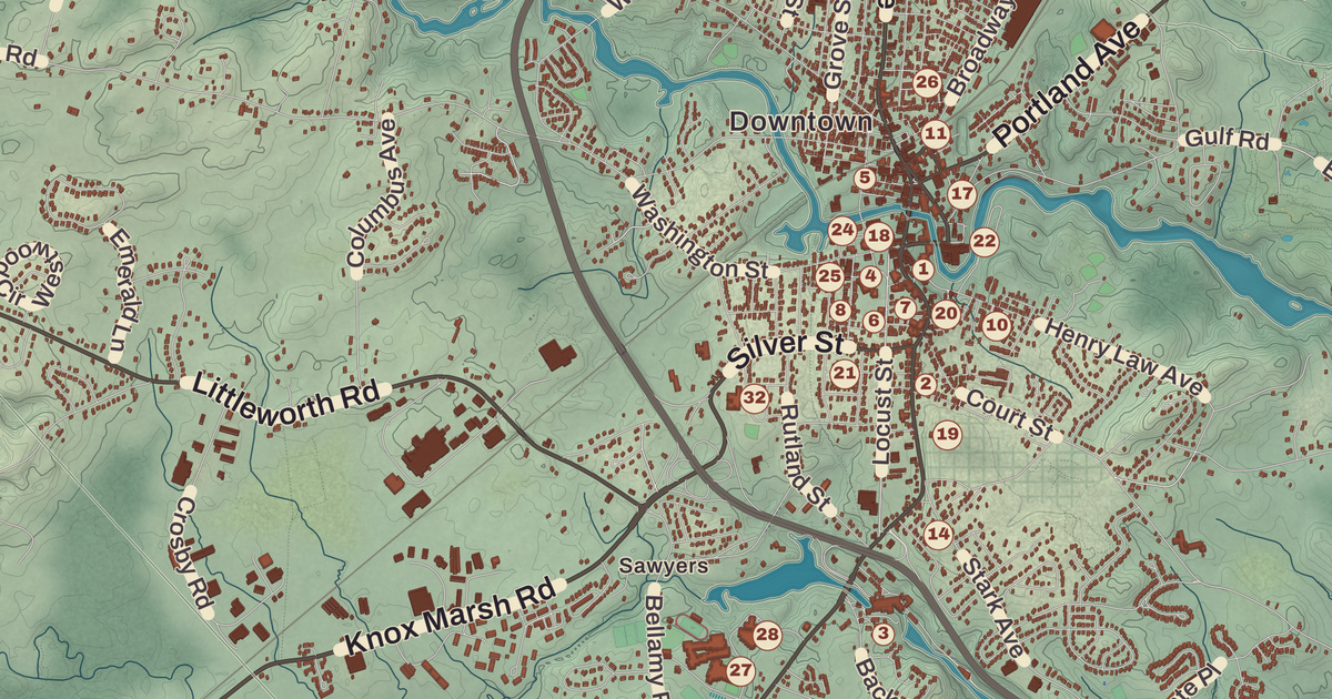
Dover grew up where the Cochecho River drops over its falls at the head of navigation, and the brick mills on that bend of the river still stand in the heart of the city. Garrison Hill Park and Tower, the Woodman Museum, the Children’s Museum of New Hampshire, Dover City Hall and the Dover Public Library are all printed by name on this map, along with Cocheco, Wentworth Terrace and Gates Corner.
Dover is in Strafford County, and it’s the county seat.
KNOWOL made this map in 2026 from public survey data and gave it the look of an old atlas. The shaded ground, from the tidal Piscataqua up to Long Hill, the city’s highest point at a little over 300 feet, comes from United States Geological Survey elevation data, and the roads and the city line come from the Census Bureau, right down to roads like Henry Law Avenue. The Woodman Museum and Garrison Hill Park and Tower are on the National Register of Historic Places, and we checked them against National Park Service records. Dover had 32,741 people at the 2020 census, the most of any city on the New Hampshire Seacoast.
See it on a wall
The Dover map as a framed print. Swipe for more.


Hilton’s Point
In 1623 the brothers William and Edward Hilton settled at Pomeroy Cove on Dover Point, near where the Bellamy meets the Piscataqua. That settlement makes Dover the oldest permanent settlement in New Hampshire and the seventh in the United States. The Hiltons were fish dealers sent from London by the Laconia Company to start a colony and fishery, and William built a salt works, salt making being the main trade of his hometown, Northwich in England. Even so, the colony had only three houses in 1631. Puritan investors bought it in 1633, and the newcomers built a meetinghouse inside an entrenchment on a nearby hill. The name Dover was given in 1637, and in 1640 the property owning men signed the Combination, setting up their own government. The Hiltons’ name lives on at Hilton Park on Dover Point.
Because it was an early settlement in Abenaki land, settlers built fortified log houses called garrisons, and Dover is still called the Garrison City. In July 1676 Major Richard Waldron and the Pennacook leader Wannalancet signed the Treaty of Cocheco. That September Waldron tricked about 400 Native people into a mock battle near Cochecho Falls and took them captive after they’d fired their guns. Some were hanged and others sold into slavery, and the Native people who were let go saw it as a dishonorable breach of hospitality. Thirteen years later, in June 1689, they struck back, and fifty-two colonists, a quarter of the town, were killed or captured.
The Mills at the Falls
The town’s business moved from Dover Point to Cochecho Falls, where the river drops 34 feet. Cochecho, in the Abenaki language, means “the rapid foaming water,” and the falls first ran sawmills and gristmills. Cotton manufacturing came down from the Dover Cotton Factory upstream, and in 1827 the Cocheco Manufacturing Company was founded, its odd spelling a clerk’s error in the incorporation act. Women at the mill walked out over cuts in their pay in one of the country’s early strikes by women workers. Big brick mills went up downtown, the railroad arrived in 1842, and Dover became a city in 1855, for a time one of the country’s leading textile makers, with 2,000 workers in the mills. On the Bellamy River, Alfred I. Sawyer’s woolen mills, founded in 1824, grew to be the largest woolen maker in the state by 1883.
Pacific Mills of Lawrence bought the Cocheco mills in 1909 and tore down the old print works in 1913. Their site is now Henry Law Park. The millyard shut in 1937, and in 1941 the city bought it at auction for $54,000; there were no other bids. The oldest building left, the 1825 mill number 5, still has its Gothic Revival tower. Now called the Cocheco Falls Millworks, the mills hold offices, restaurants and a brewery, and the Children’s Museum of New Hampshire moved into a disused mill building for $1 a year.
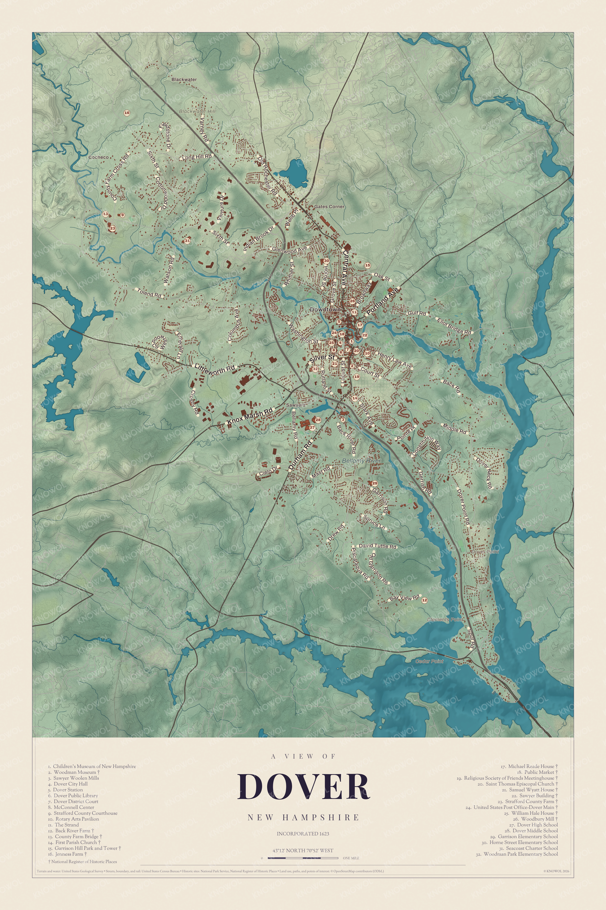
Click to explore a larger preview. The digital watermark does not appear on printed maps.
Names on this map
These names are printed on this map.
Places: Downtown, Blackwater, Cocheco, Gates Corner, Sawyers, Blackwater Hill, Cedar Point, Clements Point, Dover Point, Bellamy River, Children's Museum of New Hampshire, Woodman Museum, Sawyer Woolen Mills, Dover City Hall, Dover Station, Dover Public Library, Dover District Court, McConnell Center, Strafford County Courthouse, Rotary Arts Pavilion, The Strand, Back River Farm, County Farm Bridge, First Parish Church, Garrison Hill Park and Tower, Jenness Farm, Michael Reade House, Public Market, Religious Society of Friends Meetinghouse, Saint Thomas Episcopal Church, Samuel Wyatt House, Sawyer Building, Strafford County Farm, United States Post Office-Dover Main, William Hale House, Woodbury Mill, Dover High School, Dover Middle School, Garrison Elementary School, Horne Street Elementary School, Seacoast Charter School and Woodman Park Elementary School.
Streets and roads: Central Avenue, Littleworth Road, Knox Marsh Road, Durham Road, Silver Street, Portland Avenue, Dover Point Road, Sixth Street, Tolend Road, Spur Road, Middle Road, Back Road.
More street names, A to Z
Back River Road, Bay View Road, Bellamy Road, Broadway, Cielo Drive, Columbus Avenue, Constitution Way, Cottonwood Drive, County Farm Cross Road, Court Street, Crosby Road, David Tuttle Road, Dover Neck Road, Drew Road, Eliot Bridge Road, Emerald Lane, Fieldstone Drive, Garrison Road, Gerrish Road, Glenwood Avenue, Grove Street, Gulf Road, Henry Law Avenue, Horne Street, Indian Brook Drive, Locust Street, Long Hill Road, Mast Road, Oak Street, Old Garrison Road, Old Rochester Road, Piscataqua Road, Pointe Place, Rutland Street, Spruce Lane, Stark Avenue, Varney Road, Venture Drive, Washington Street, Watson Road, Webb Place, Westwood Circle, Whittier Street.
Around the City
Garrison Hill rises directly above the center of the city, a round glacial drumlin north of downtown with a park on about 8.5 acres at the top. Joseph Ham and Harrison Haley bought the summit in 1880 and opened it as a public park with a wooden observatory, and the city took it over in 1888. The wooden tower burned in 1911, Abbey Sawyer paid for a steel one in her husband’s memory, and when that came down in 1990, volunteers built the present 76-foot tower, finished in 1993. On a clear day you can see the White Mountains and the Isles of Shoals from the top.
The Woodman Museum, on Central Avenue, opened in 1916 with a bequest of $100,000 from Annie Woodman. Its three Federal style brick houses include the home of the abolitionist senator John P. Hale, and its collections run from the saddle Abraham Lincoln rode to review troops shortly before his death to a 10-foot polar bear. On the grounds is the William Damm Garrison of 1675, the oldest house in Dover and one of the oldest intact garrison houses in the state, which came through the 1689 attack and was later moved here under a shelter. In 2024 the museum added exhibits on the Teenage Mutant Ninja Turtles, a franchise that began in Dover. The Dover Public Library, Dover City Hall, Wentworth Terrace and Gates Corner are printed on the map too.
This map of Dover makes a handsome addition to a living room, office, library or den, and it can even help teach children the geography and history of New Hampshire’s oldest settlement. It’s a thoughtful gift for anyone who calls Dover home, climbed the Garrison Hill tower as a kid, or worked in the mills by the falls. Created by KNOWOL in 2026, it’s printed on museum quality archival paper. Zoom in on the preview above to explore the details, then click here to get your copy of the Dover map.

Sources