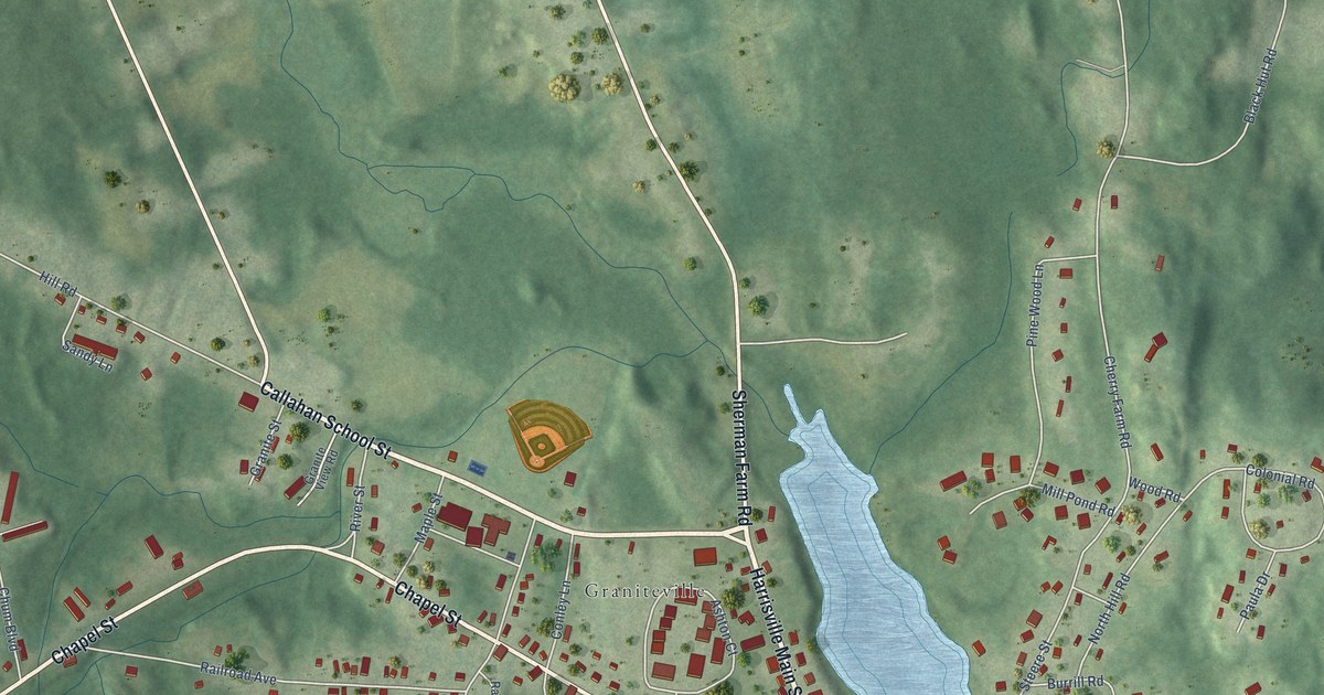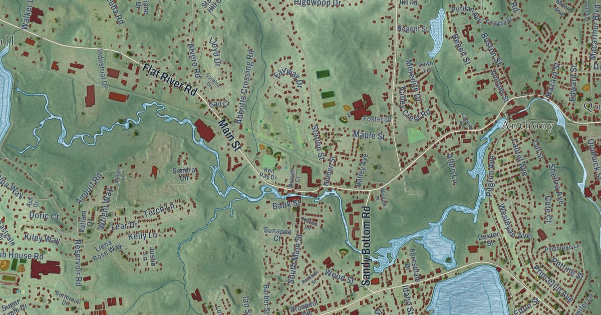
This beautifully detailed map of Coventry, Rhode Island was created in 2026 using aerial imagery combined with modern topographical, census, street and landmark data. It’s a one-of-a-kind view of Coventry that combines accurate data with a vintage aesthetic. The map shows every building in its true location, many of the roads carry their names, and the shaded topographic relief shows the shape of the land.
See the Coventry, Rhode Island map on a wall
The Coventry map as an 18 x 24 inch print in a black frame.

Explore an aerial view of Coventry, Rhode Island
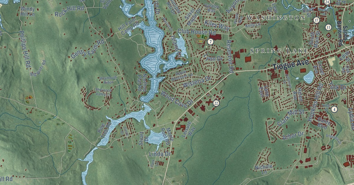
On the map you’ll find Coventry Town Hall, Quidnick, Arkwright, Anthony, Beaudoin Conservation Area, Hopkins Hollow, Rice City, Vernon, Potterville, Summit, Greene, Colvintown, and more. If you look closely you can even find your house accurately drawn in its correct location. Zoom in on the preview to look for yours.
Did you know this piece of Coventry, Rhode Island history?
Nathanael Greene was a Coventry resident during the Revolutionary War. He became one of the top generals in the American army. When the war ended, only George Washington outranked him. His 1770 homestead still survives.
Take a closer look at the Coventry map
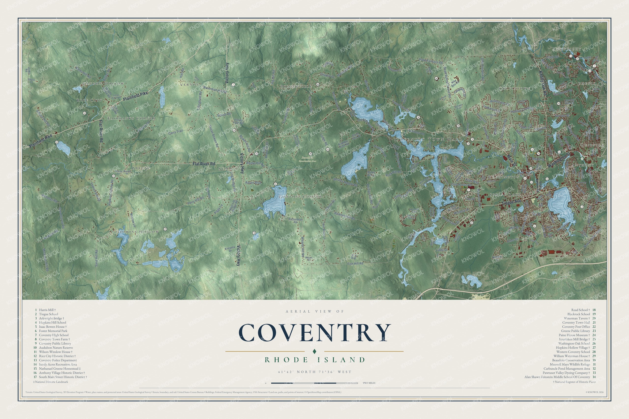
Click to explore a larger preview. The digital watermark does not appear on printed maps.
Street and place names on the Coventry, Rhode Island map
These names are printed on the map of Coventry, Rhode Island.
Places: Coventry Town Hall, Quidnick, Arkwright, Anthony, Beaudoin Conservation Area, Hopkins Hollow, Rice City, Vernon, Potterville, Summit, Greene, Colvintown, Spring Lake, Gortons Corner, Washington, Phenix, Fairbanks Corner and Vaughn Hollow.
Streets and roads: Plainfield Pike, Flat River Road, Victory Highway, Tiogue Avenue, Knotty Oak Road, Main Street, Washington Street, Perry Hill Road, Hill Street, Kiley Way, Arbor Drive, Island Drive.
More street names, A to Z
Abbotts Crossing Road, Airport Road, Allison Avenue, Alvero Road, Ames Street, Angelina Drive, Angus Street, Apple Blossom Lane, Arnold Road, Aster Lane, Audubon Lane, Bank Street, Barbs Hill Road, Bates Avenue, Battey Avenue, Benefit Street, Benoit Street, Big River Road, Blackrock Road, Black Walnut Drive, Boston Street, Bowen Hill Road, Bramble Bush Road, Cahoone Road, Camp Westwood Road, Carrs Trail, Casey Lane, Catalpa Way, Chaplin Drive, Circle Drive, Clark Mill Street, Clark Road, Clover Drive, Club House Road, Cobblestone Terrace, Colvintown Road, Country View Drive, Dante Boulevard, David Drive, Doe Run, East Shore Drive, Edith Street, Fairview Avenue, Fairway Drive, Fen Way, Fieldstone Drive, Fish Hill Road, Franklin Road, Gareau Drive, Gay Street, Gentry Farm Road, Gervais Street, Gibson Hill Road, Gibson Lane, Ginger Trail, Grant Drive, Great Road, Greenhouse Road, Hall Road, Hammet Road, Harkney Hill Road, Harrington Road, Harris Street, Helen Avenue, Highwood Drive, Hill Farm Camp Road, Hill Farm Road, Hillside Avenue, Hope Furnace Road, Hopkins Hill Road, Hopkins Hollow Road, Hornbeam Road, Howard Avenue, Hunters Crossing, Idaho Street, Indian Trail, Industrial Drive, Ironwood Drive, Jade Road, Jefferson Drive, Jenks Road, John Franklin Road, Juniper Hill Drive, Kelly Lane, King Street, Kivranta Drive, Lane East, Laurel Avenue, Lear Drive, Ledge Road, Leisure Way, Leslie Lane, Leuba Road, Lewis Farm Road, Linda Drive, Lionel Avenue, Lionel Pierson Road, Log Bridge Road, Lori Lane, Lydia Road, Lynn Drive, Macarthur Boulevard, Maple Root Road, Maple Street, Maple Valley Road, Marion Drive, Mason Street, Matteson Road, Meredith Drive, Metro Drive, Mile Road, Molasses Hill Road, Narrow Lane, New Dam Road, New London Turnpike, Newport Road, Nicholas Road, Nichole Lane, Nike Site Road, Northup Plat Road, Oak Road, October Trail, Old Carriage Drive, Old Flat River Road, Old North Road, Paige Drive, Park Avenue, Parker Street, Park Lane, Pembroke Lane, Phillips Hill Road, Piggy Lane, Pig Hill Road, Pilgrim Avenue, Pinehaven Road, Pine Street, Pine Tree Road, Poor Farm Road, Potter Court, Potter Road, Princeton Avenue, Provident Place, Quidnick Street, Railroad Avenue, Rainone Court, Raven Boulevard, Read Avenue, Read School House Road, Red Oak Drive, Regent Street, Remington Farm Drive, Reservoir Road, Rhema Way, Rice City Road, Richardson Road, Rock Hill Road, Rock Pine Road, Sand Hill Road, Sandy Bottom Road, Scott Hollow Road, Shady Valley Road, Sharon Drive, Sheltra Avenue, Sherwood Valley Lane, Shippee Plat Road, Silver Maple Drive, Sisson Road, South Main Street, South Pond Drive, Station Street, Stone Gate Drive, Stuart Drive, Sunset Lake Circle, Susan Bowen Road, Teakwood Drive, Tiffany Road, Tillinghast Road, Town Farm Road, Twin Brook Lane, Vaughn Hollow Road, Victory Falls Road, Vine Street, Viola Street, Walker Lane, Watercress Court, Waterman Hill Road, Weaver Hill Road, Weeks Hill Road, West Log Bridge Road, Weymouth Ridge, Whaley Hollow Road, Williams Crossing Road, Wilshire Way, Windy Hill Lane, Wisteria Drive, Wood Cove Drive, Woodmist Circle, Wright Way, York Drive.
This beautifully detailed map of Coventry makes an attractive addition to your office, library, or den, and it can even be used to teach children the geography and history of the area. It also makes a great gift for anyone with Coventry roots. When you’re done exploring, click here to get your copy of the Coventry map.