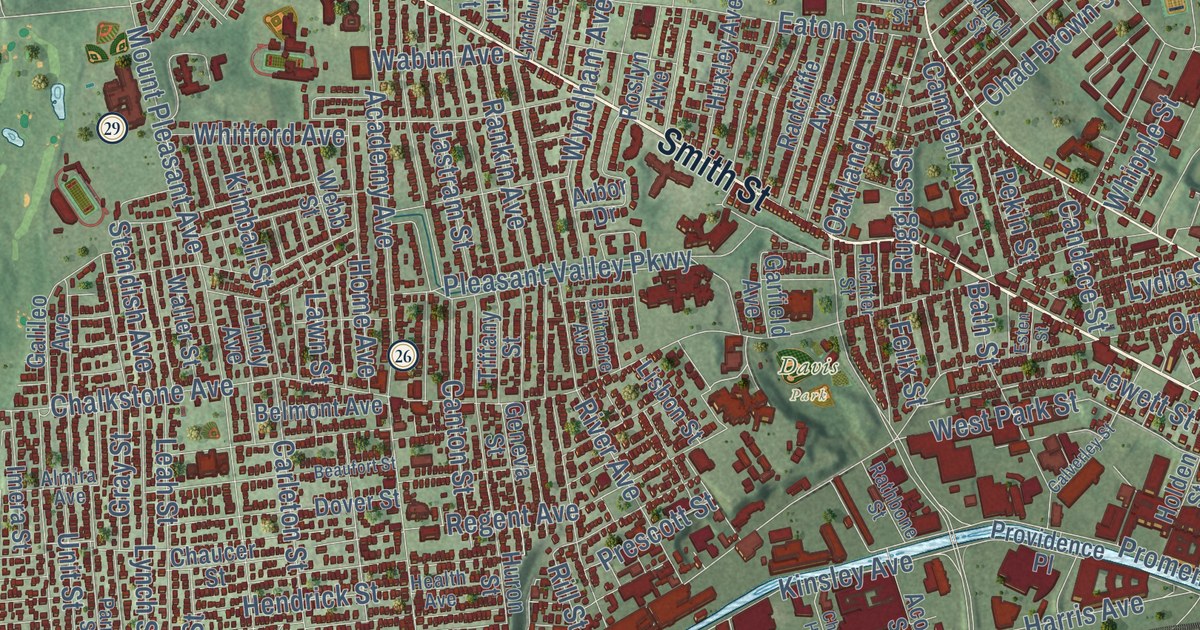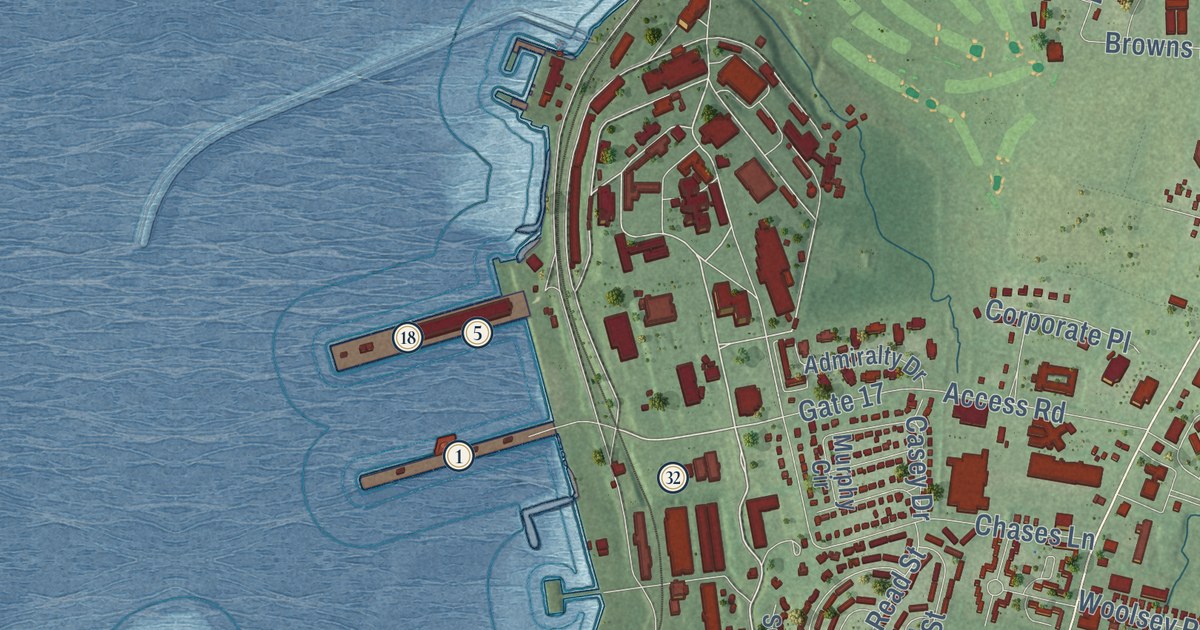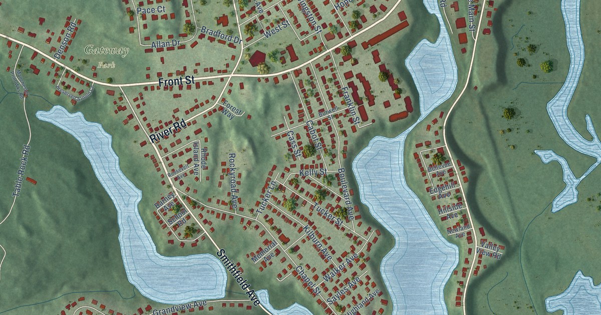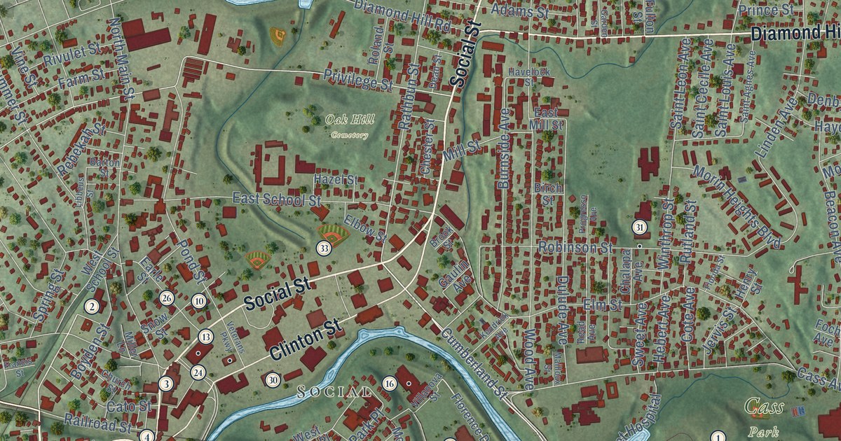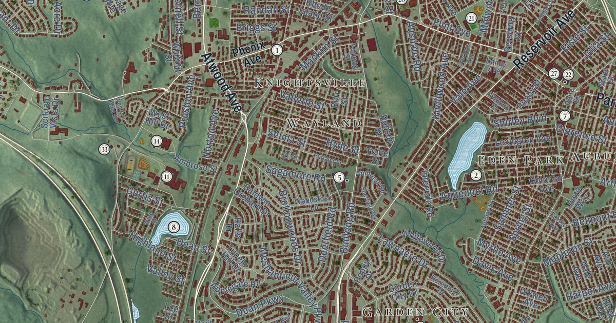
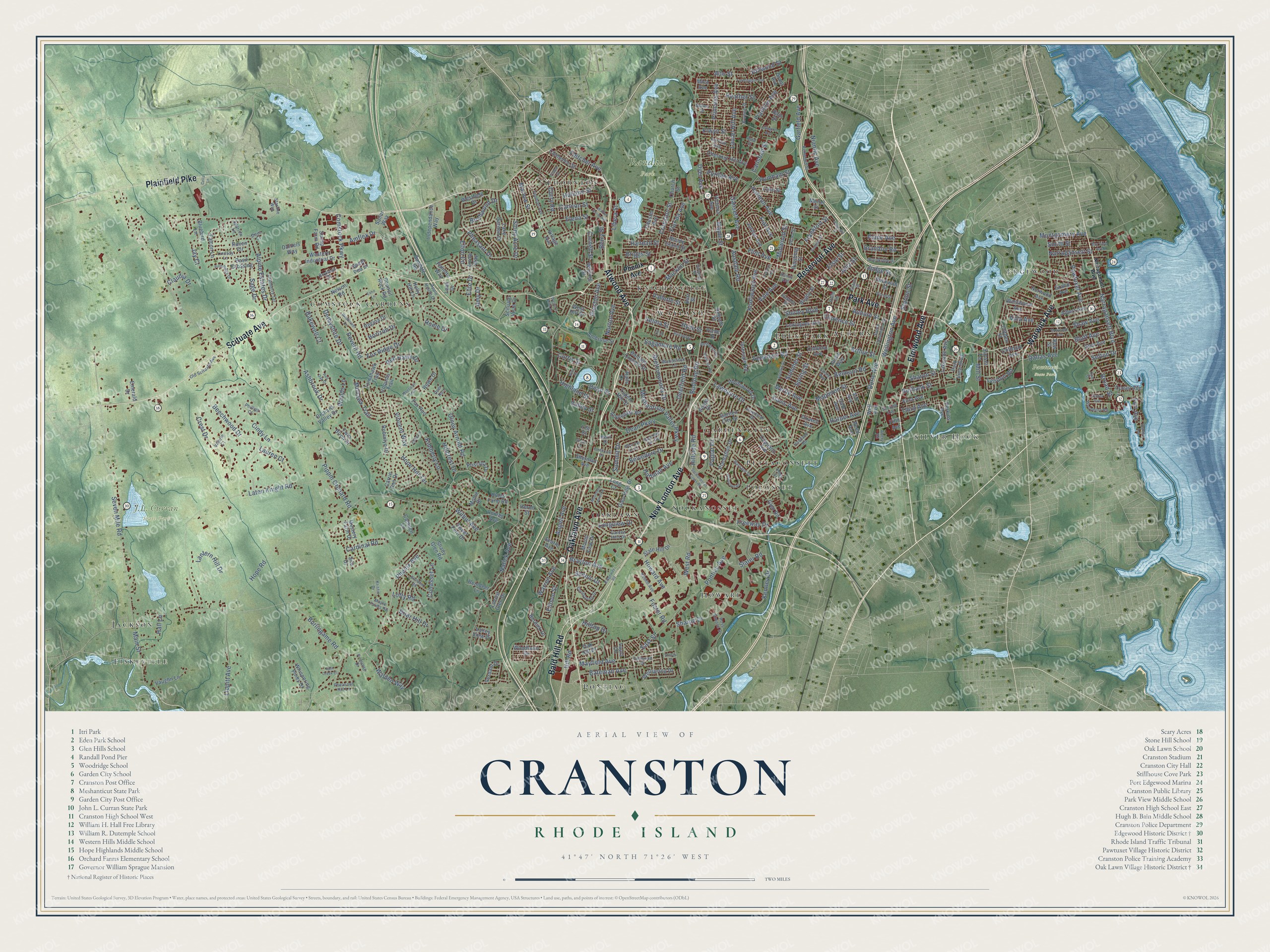
This beautifully detailed map of Cranston, Rhode Island was created in 2026 using aerial imagery combined with modern topographical, census, street and landmark data. It’s a one-of-a-kind view of Cranston that combines accurate data with a vintage aesthetic. The map shows every building in its true location, many of the roads carry their names, and the shaded topographic relief shows the shape of the land.
See the Cranston, Rhode Island map on a wall
The Cranston map as an 18 x 24 inch print in a black frame.

Explore an aerial view of Cranston, Rhode Island
On the map you’ll find Pawtuxet State Park, Randall Park, Howard, Comstock Gardens, Pontiac, Garden City, Fiskeville, Silver Hook, Edgewood, Knightsville, Oaklawn, Sockanosset, and more. If you look closely you can even find your house accurately drawn in its correct location. Zoom in on the preview to look for yours.
Did you know this piece of Cranston, Rhode Island history?
Many Italian Americans in Cranston descend from immigrants of Itri, Italy. They settled mostly in the Knightsville section in the early 1900s. Since 1905, the city has held the week-long St. Mary’s Feast each July. Cranston and Itri became sister cities in 2000.
Take a closer look at the Cranston map
Click to explore a larger preview. The digital watermark does not appear on printed maps.
Street and place names on the Cranston, Rhode Island map
These names are printed on the map of Cranston, Rhode Island.
Places: J.L. Curran State Park, Pawtuxet State Park, Randall Park, Howard, Comstock Gardens, Pontiac, Garden City, Fiskeville, Silver Hook, Edgewood, Knightsville, Oaklawn, Sockanosset, Eden Park, Thornton, Wayland, Pocasset, Auburn, Jackson and Pettaconsett.
Streets and roads: Oaklawn Avenue, Atwood Avenue, Elmwood Avenue, Warwick Avenue, Scituate Avenue, New London Avenue, Park Avenue, Plainfield Pike, Reservoir Avenue, Bald Hill Road, Dyer Avenue, Budlong Road.
More street names, A to Z
Aetna Street, Albert Avenue, Alpine Estates Drive, Alto Street, Ambrose Street, Amflex Drive, Amherst Road, Amy Drive, Angell Avenue, Applegate Road, Apple House Drive, Aqueduct Road, Arlington Avenue, Arrow Way, Arthur Street, Ash Avenue, Ashbrook Drive, Asia Street, Auburn Street, Ausdale Road, Autumn Street, Avery Road, Bain Street, Bakewell Court, Baldwin Orchard Drive, Basil Crossing, Bateman Avenue, Bay View Avenue, Beckwith Street, Beechwood Drive, Belmont Road, Belvedere Drive, Berry Street, Birchwood Drive, Bluebird Lane, Bluff Avenue, Bow Street, Boylston Drive, Brandon Road, Brayton Avenue, Brettonwoods Drive, Briar Hill Drive, Briggs Street, Broad Street, Brookside Drive, Browne Street, Burbank Street, Burdick Drive, Burlingame Road, Burr Street, Camden Lane, Cannon Street, Capuano Avenue, Cardinal Road, Carlsbad Street, Carrie Ann Drive, Cella Lane, Chester Avenue, Chestnut Hill Avenue, Church Street, Cindy Lane, Clarence Street, Claudia Drive, Clemence Street, Clifden Street, Cliffdale Avenue, Cohasset Lane, Colonial Avenue, Comstock Parkway, Conley Avenue, Coolspring Drive, Cornell Street, Council Rock Road, Cranberry Terrace, Cranston Street, Crest Drive, Crothers Avenue, Curry Road, Curtis Street, Dale Avenue, Dallas Avenue, Daniels Way, Davis Avenue, Dean Parkway, Dean Street, Deerfield Road, Deer Run, Dellwood Road, Derbyshire Drive, Dixwell Avenue, Doric Avenue, Douglas Street, Dove Court, East Bel Air Road, East Street, Echo Lane, Eddy Street, Elena Street, Elite Drive, Ellen Lane, Ellison Street, Elsie Street, Elton Circle, Elwyn Street, Emerald Drive, Fairwood Drive, Falcon Lane, Farmington Avenue, Fernbrook Drive, Fiat Avenue, Fifth Avenue, First Avenue, Fletcher Avenue, Flint Avenue, Florida Avenue, Forest Avenue, Fort Avenue, Foster Road, Fox Ridge Drive, Fox Run, Frankfort Street, Franklin Avenue, Freeway Drive, Furlong Street, Gansett Avenue, Garden City Drive, Garden Hills Drive, Garfield Avenue, Glen Avenue, Glenham Road, Glen Hills Drive, Glen Road, Grace Street, Grand Avenue, Grant Avenue, Hall Lane, Handy Avenue, Harmon Avenue, Harper Avenue, Harvard Street, Heather Street, Herod Street, Highland Street, Hillcrest Drive, Hill Road, Hillside Road, Hilltop Drive, Hillwood Street, Hines Farm Road, Hoffman Avenue, Holland Street, Holly Hill Lane, Hope Hill Terrace, Hope Road, Horizon Drive, Howard Avenue, Howland Road, Hyde Street, Independance Way, Intervale Road, Iroquois Trail, Ivanhoe Street, Jay Court, Jordan Avenue, Judge Street, Julia Street, Justin Way, Keene Avenue, Kenney Drive, Kenwood Street, Kimberly Lane, Knollwood Avenue, Kristin Drive, Lake Garden Drive, Lakeside Avenue, Lake Street, Lantern Hill Drive, Laten Knight Road, Laura Circle, Laurel Hill Avenue, Lauren Court, Lawnacre Drive, Leah Drive, Lee Street, Lexington Avenue, Libera Street, Lily Drive, Lindsay Lane, Lippitt Avenue, Locust Glen Drive, Lofty Road, Long Court, Longview Drive, Lyndon Road, Macklin Street, Main Street, Maple Farms Road, Maple Street, Mapleton Street, Marlow Street, Mayfield Avenue, Merit Drive, Meshanticut Valley Parkway, Mica Avenue, Midwood Street, Mill Street, Moccasin Trail, Mohawk Trail, Mollie Drive, Molter Street, Montgomery Avenue, Moorland Avenue, Mountain Laurel Drive, Mount View Drive, Myrtle Avenue, Mystery Farm Drive, Narragansett Boulevard, Narragansett Street, Natick Avenue, Nelson Road, Niantic Avenue, Norton Avenue, Norwood Avenue, Oak Hill Drive, Ocean Avenue, Old Oak Avenue, Old Scituate Avenue, Olney Arnold Road, Opal Street, Orchard Valley Drive, Paine Avenue, Paliotta Way, Park View Boulevard, Pawtuxet Avenue, Perennial Drive, Perkins Avenue, Pershing Street, Peveril Road, Pheasant Drive, Pheasant Hill Lane, Phenix Avenue, Phillips Court, Pine Ridge Drive, Pippin Orchard Road, Plantation Drive, Pleasant Street, Pomham Street, Pond Street, Pontiac Avenue, Poplar Drive, Poppy Drive, Preston Avenue, Primrose Drive, Princess Avenue, Priscilla Drive, Puritan Avenue, Ralls Drive, Randall Street, Raven Circle, Red Hawk Drive, Red Oak Drive, Reed Avenue, Regina Drive, Reindeer Lane, Rhode Island Street, Ridgeway Road, Robinlyn Drive, Robson Street, Rolfe Square, Rome Drive, Ross Simons Drive, Rowe Drive, Rugby Street, Rutland Street, Sagamore Road, Sage Drive, Sailor Way, Scenic Drive, Scituate Vista Drive, Searle Avenue, Seaview Avenue, Second Avenue, Sefton Drive, Selma Street, Seven Mile Road, Shady Glen Road, Sharon Street, Sharpe Drive, Shaw Avenue, Shean Street, Sheffield Road, Sherman Avenue, Shirley Boulevard, Silo Drive, Slate Hill Drive, Slater Road, Smith Street, Sockanosset Cross Road, South Clarendon Street, Sparrow Lane, Split Creek Court, Spring Street, Stacey Drive, Stamp Farm Road, Starline Way, Station Street, Stony Acre Drive, Summer Street, Summit Drive, Sundale Road, Sunset Terrace, Sweet Fern Drive, Sweet Pea Drive, Third Avenue, Tilden Street, Tomahawk Trail, Tome Street, Tucker Avenue, Tupelo Hill Drive, Twin Birch Drive, Vale Avenue, Valerie Court, Vallette Street, Valley Street, Valley View Drive, Vaughn Lane, Verdant Drive, Victoria Avenue, Villa Avenue, Village Avenue, Vincent Way, Walden Way, Wales Street, Walnut Grove Avenue, Warren Avenue, Well Avenue, Wellington Avenue, Wellspring Drive, West Bel Air Road, Western Hills Lane, Western Industrial Drive, Westfield Drive, West Hill Drive, West Road, Westwood Avenue, Whispering Pines Drive, Whitewood Drive, Whiting Street, Wilbur Avenue, Wildflower Drive, Wine Street, Woodbury Road, Woodlawn Drive, Woods Lane, Woodstock Lane, Yeoman Avenue.
This beautifully detailed map of Cranston makes an attractive addition to your office, library, or den, and it can even be used to teach children the geography and history of the area. It also makes a great gift for someone who left Cranston and still calls it home. When you’re done exploring, click here to get your copy of the Cranston map.