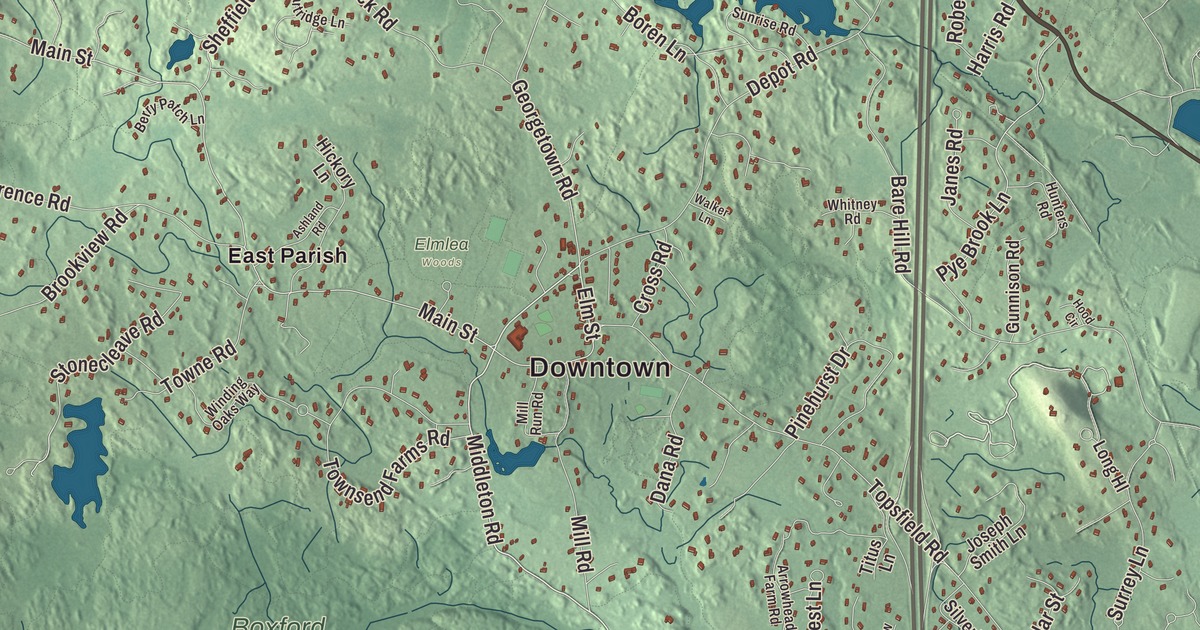
Boxford is two villages: East Boxford, around the old center, and West Boxford, with woods, ponds and stone walls in between. This map prints Washington Street, Killam Hill Road, Willow Road, Endicott Road, Ipswich Road and Middleton Road, with Cedar Pond, Johnsons Pond, Berry Pond, Lake Cochichewick, Aslebe Hill, Austin Hill, Bald Hill and Killam Hill. Click here to purchase a print of this map for your wall.
Boxford is in Essex County, near the county’s geographic center and 24 miles north of Boston.
KNOWOL made this map in 2026 from public survey data and gave it the look of an old atlas. The roads and the town line come from the Census Bureau, and the relief from United States Geological Survey elevation data. The highest ground is Bald Hill, at 243 feet, in a corner of the Boxford State Forest near Interstate 95 and the Middleton line. Boxford covers 24.4 square miles, heavily wooded and crossed by streams, many of them running down to the Ipswich River on its southern border, and it had 8,203 people in 2020.
Rowley Village
When the English arrived, this land was under the Agawam sachem Masconomet, whose people had been devastated by epidemics in 1617 to 1619. The Town of Boxford’s recorded history, in the Secretary of the Commonwealth’s list, dates European settlement to 1645; the town page says Abraham Redington settled here in 1646, when it was part of Rowley Village. Boxford was incorporated as a town in 1685, when about forty families lived here, and the town remains part of Essex County today. It wasn’t until 1700 that the selectmen paid Masconomet’s grandson, Samuel English, nine pounds for the rights to the town’s land.
Most early settlers farmed, with some craftsmen among them, and small farms still dot the town. The First Church went up in East Boxford in 1701. As West Boxford grew, the legislature made it a separate parish in 1735, and from then on town meetings took turns between the East and West parishes; West Boxford built its first church in 1774. The town’s largest industry was a match factory on Lawrence Road, which ran from 1866 to 1905.
The old center
The Boxford Village Historic District takes in the early center along Main Street and Topsfield Road, with stretches of Middleton Road, Elm Street, Depot Road and Cross Street, and holds a remarkable number of buildings from the late 18th century or earlier. It joined the National Register of Historic Places in 1973. Among them is the Holyoke-French House, a First Period house that the Boxford Historical Society runs as a museum.
In 1975, for the American Bicentennial, Boxford people went to England to visit two villages named Boxford and find where their town’s name came from. They settled on Boxford in the Babergh district of Suffolk as the likely source. The next summer, villagers from Boxford, Suffolk, came over for two-week homestays with local families, an exchange that the Evening Standard and the BBC’s Nationwide program both covered.
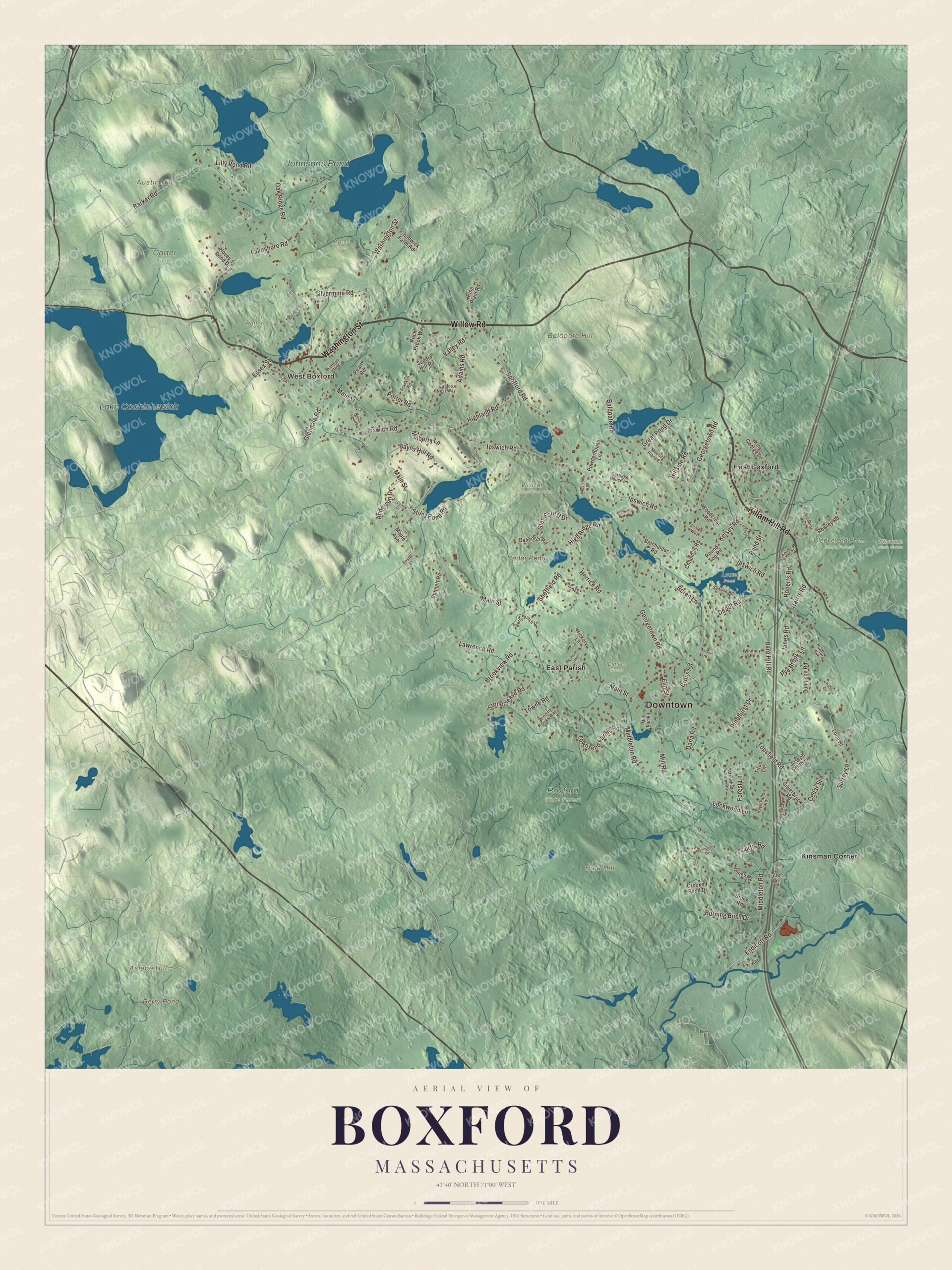
Click to explore a larger preview. The digital watermark does not appear on printed maps.
Names on this map
These names are printed on this map.
Places: Downtown, West Boxford, Aslebe Hill, Austin Hill, Bald Hill, Baldpate Hill, Berry Pond, Cedar Pond, Lake Cochichewick, Johnsons Pond, Boxford State Forest, Carter Fields, Cleaveland Farm State Forest, Elmlea Woods, Lowe Pond, Morss Farm, Potters Farm, Wildcat Conservation Area, Willowdale State Forest, East Boxford, East Parish and Kinsman Corner.
Streets and roads: Washington Street, Killam Hill Road, Willow Road, Endicott Road, Ipswich Road, Middleton Road, Elm Street, Barker Road, Main Street, Georgetown Road, Pye Brook Lane, Kelsey Road.
More street names, A to Z
Adams Road, Allen Circle, Andersen Drive, Andrews Farm Road, Appleton Lane, Arrowhead Farm Road, Ashland Road, Azalea Way, Baldpate Road, Balmoral Road, Bare Hill Road, Batchelder Road, Bayns Hill Road, Belvedere Road, Bennett Road, Berry Patch Lane, Boren Lane, Brookview Road, Burning Bush Drive, Camelot Drive, Carriage House Lane, Cedar Street, Chadwick Farm Road, Chandler Road, Chapman Road, Cole Drive, Crooked Pond Drive, Cross Road, Curtis Road, Dana Road, Deer Run Road, Depot Road, Dole Hill Lane, Eagles Nest Way, Essex Street, Forest Lane, Foster Street, Franklin Road, Fuller Lane, Gina Way, Glendale Road, Glen Forest Drive, Great Pond Drive, Gunnison Road, Harris Road, Haymeadow Road, Herrick Road, Hickory Lane, Highland Road, High Ridge Road, Hillside Road, Holmes Road, Hood Circle, Hovey's Pond Drive, Hunters Road, Janes Road, Joseph Smith Lane, Kimball Road, King George Drive, Lakeshore Road, Lawrence Road, Lilly Pond Road, Lockwood Lane, Long Hl, Maple Avenue, Meeting Place Circle, Mill Road, Mill Run Road, Moonpenny Drive, Mount Vernon Road, Mulberry Lane, Oak Ridge Road, Partridge Lane, Pearl Road, Pinehurst Drive, Pine Plain Road, Pond Street, Porter Road, Powderhouse Lane, Roberts Road, Rock Brook Way, Round Top Road, Rowley Road, Saddle Hill Road, School Street, Sheffield Road, Silverbrook Road, Silvermine Road, Spofford Road, Stiles Pond Road, Stonecleave Road, Stone Road, Sunrise Road, Surrey Lane, Titus Lane, Topsfield Road, Towne Road, Townsend Farms Road, Trask Road, Valley Road, Walker Lane, Whitney Road, Winding Oaks Way, Woodcrest Road.
See it on a wall
The Boxford map as a framed print. Swipe for more.


Around the map
Start in West Boxford, then follow Washington Street, Killam Hill Road, Willow Road, Endicott Road, Ipswich Road and Middleton Road across town, and look outward toward East Boxford, East Parish and Kinsman Corner. Stiles Pond, in the middle of town, has the town beach, and Camp Rotary, a summer boarding camp, sits on the pond off Ipswich Road. Baldpate Pond and its state recreation area are good for swimming, fishing and boating, and the Boxford State Forest’s trails wind through thick woods near Topsfield and Middleton. Each fall the town holds its Apple Festival. Lake Cochichewick is North Andover’s water supply, in the neighboring town to the west. Berry Pond, Cedar Pond, Lake Cochichewick, Johnsons Pond, Aslebe Hill, Austin Hill, Bald Hill and Killam Hill are all printed on the map.
Boxford’s map makes a fine addition to an office, library or den, and it can help teach children the geography and history of the town that went looking for its name in Suffolk. It’s made for people who call Boxford home, from West Boxford to Kinsman Corner, and it shows the town as it looks today. Zoom in on the preview above to explore the details, then click here to get your copy of the Boxford, Massachusetts map.

Sources