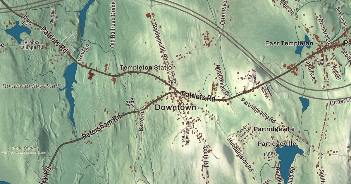
This aerial map of Templeton, Massachusetts was created in 2026 using real geographic data to bring the town’s streets, buildings, neighborhoods, ponds and waterways, mountains and ridgelines, and terrain together in one highly detailed view. Look closer and you can pick out the familiar places that make Templeton feel like home. Start with the street you know, then see how it connects to the rest of the Templeton you call home. Click here to purchase a print of this map for your wall.
Explore an aerial view of Templeton, Massachusetts
Start with Downtown and Baldwinville. Follow Patriots Road, Dudley Road, Petersham Road, Winchendon Road, Elm Street, and State Road across town. Then look outward toward Brooks Village, East Templeton, Otter River, Partidgeville, and Templeton Station.
Beagle Pond, Bourn-Hadley Pond, Queen Lake, Perley Brook Reservoir, Canesto Hill, Church Hill, and Crow Hill are all labeled on the map. Every one of those names is printed directly on the artwork, giving you plenty to explore.
The Town of Templeton’s recorded history dates European settlement to 1751. Templeton was incorporated as a town in 1762. The town remains part of Worcester County today. Click the image below to see the area as it looked in 2026.
Take a closer look at the Templeton map
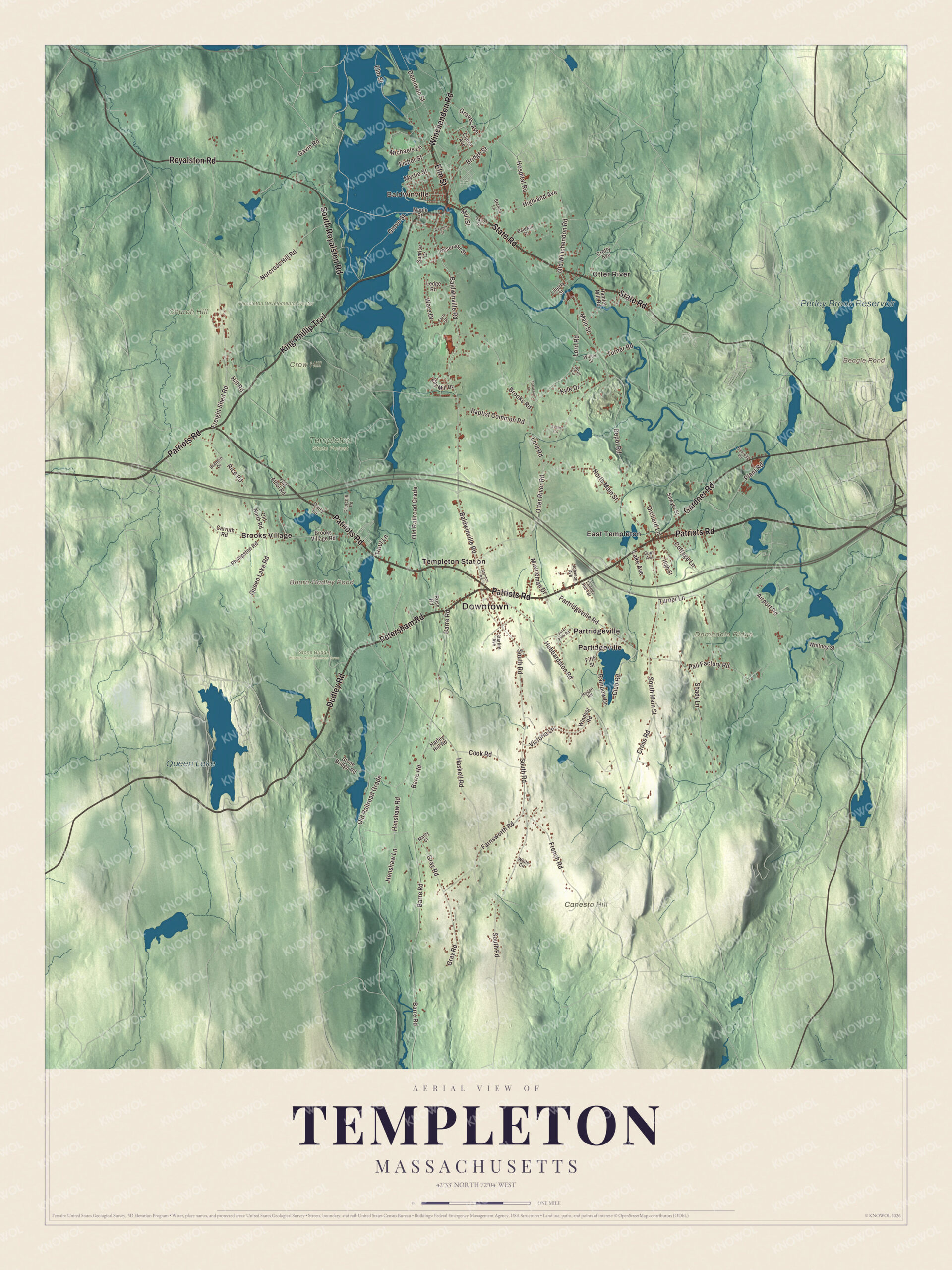
Click to explore a larger preview. The digital watermark does not appear on printed maps.
Names on this map
These names are printed on this map.
Places: Downtown, Baldwinville, Canesto Hill, Church Hill, Crow Hill, Demadale Ridge, Beagle Pond, Bourn-Hadley Pond, Queen Lake, Perley Brook Reservoir, Stone Bridge Wildlife Management Area, Templeton State Forest, Templeton Develpmental Center, Brooks Village, East Templeton, Otter River, Partidgeville, Partridgeville and Templeton Station.
Streets and roads: Patriots Road, Dudley Road, Petersham Road, Winchendon Road, Elm Street, State Road, Gardner Road, King Phillip Trail, Royalston Road, South Royalston Road, Baldwinville Road, South Road.
More street names, A to Z
Airport Road, April Circle, Baldwin Drive, Baptist Common Road, Barre Road, Boynton Road, Brandin Drive, Brenda Lane, Bridge Street, Brooks Road, Brooks Village Road, Carruth Road, Churchill Road, Claire Avenue, Club Road, Conti Avenue, Cook Road, Cottage Lane, Cross Road, Crotty Avenue, Davis Street, Day Mill Drive, Dennison Street, Depot Road, Drury Lane, Evans Circle, Farnsworth Road, Fern Street, Fifth Street, Fisher Street, Freight Shed Road, French Road, Gavin Road, Graves Avenue, Gray Road, Grove Street, Hamlet Mill Road, Harley Hill Road, Haskell Road, Henshaw Lane, Henshaw Road, Highland Avenue, High Street, Hill Road, Hogan Road, Hospital Road, Hubbardston Road, Johnson Avenue, Kyle Drive, Ladder Hill Terrace, Lake Avenue, Laurel View Road, Ledge Road, Liberty Street, Lord Road, Main Street, Manty Court, Maple Street, Michaels Lane, Mill Street, Minuteman Drive, Myrtle Street, Norcross Hill Road, North Main Street, Old Athol Road, Old North Road, Old Railroad Grade, Old Winchendon Road, Orchard Lane, Otter River Road, Pail Factory Road, Partridgeville Road, Pheasant Lane, Phillipston Road, Plant Road, Queen Lake Road, Rainbow Drive, Reservoir Street, Rice Road, Riverside Road, Ross Road, Sawyer Street, Shady Lane, South Main Street, Starfire Avenue, Stone Bridge Road, Sunrise Drive, Trout Lane, Turner Lane, Turner Road, Vernon Street, Victoria Lane, Ware Drive, White Circle, Whitney Street, Willow Street, Windsor Road.
See it on a wall
The Templeton map as a framed print. Swipe for more.


We designed the artwork at KNOWOL using Templeton’s real streets, buildings, neighborhoods, ponds and waterways, mountains and ridgelines, and terrain, the town boundary, and the way buildings spread across the town. Then we chose the color, relief, lettering, and layout that make the map look great on the wall.
This beautifully detailed map of Templeton makes an attractive addition to your office, library, or den and can even be used to teach children the geography and history of the area. When you’re done exploring, click here to get your copy of the Templeton, Massachusetts map.