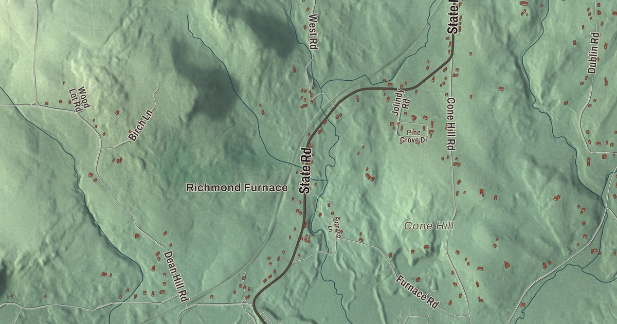
For close to a century, from 1829 to 1923, an iron furnace on Furnace Brook in the south end of Richmond turned local ore into iron, and what’s left of the works lies in a historic district along State Road. This map of the town prints State Road, Canaan Road, Lenox Road, Swamp Road, Dublin Road and East Road, with Richmond Pond, Fairfield Pond, Crystal Lake and Lenox Mountain. Click here to purchase a print of this map for your wall.
Richmond is in Berkshire County.
KNOWOL made this map in 2026 from public survey data and gave it the look of an old atlas. United States Geological Survey elevation data raises the ridges, and the roads and the town line come from the Census Bureau. Richmond covers 19.0 square miles on the New York line, with Hancock and Pittsfield to the north, Lenox to the east, Stockbridge and West Stockbridge to the south and Canaan, New York, to the west. Route 41 runs through it from north to south, and Route 295, the highest-numbered state route in Massachusetts, leaves it for New York. The town had 1,407 people at the 2020 census.
Richmont
The town page says Richmond was first settled in 1759 by Micah Mudge, who came up the Housatonic River from Connecticut, and Ichabod Wood, who came from Rehoboth near the coast; their homes were about three miles apart, through thick woods, and the two may not have met until after their first winter. The Town of Richmond’s recorded history, in the Secretary of the Commonwealth’s list, dates European settlement to 1760. Under an act of 1762, the land that’s now Richmond and Lenox was bought from two sachems, Yokun and Ephraim, and two villages grew up on either side of the mountain ridge between them, Yokuntown to the east and Mount Ephraim to the west.
Richmond was incorporated as a town in 1765, when the two villages were joined as one town named Richmont. The mountain made it hard for the two villages to stay in touch, and in 1767 the eastern part split off as Lenox. Richmont became Richmond in 1785. Who chose the names is disputed, but it was likely Francis Bernard, the province’s captain general, and some think he had Charles Lennox, Duke of Richmond, in mind; the change from “t” to “d” was almost certainly made in the Duke’s honor. Richmond stayed a farm town until iron ore was found in 1829.
Richmond Furnace
That year the brothers John H., Charles and George Coffing, who had worked at the Salisbury Iron Works in Connecticut, set up the Richmond Iron Works and built the first stone furnace to smelt the hematite ore found nearby. The furnace was rebuilt in 1863 and overhauled for more capacity in 1905, and by 1908 it could make 5,000 tons a year of pig iron for car wheels and machinery. Iron production ended in 1923. The Richmond Furnace Historical and Archeological District now covers about 290 acres of what’s almost entirely countryside again, along Furnace Brook east of Route 41, with the main furnace on private land, a water-filled quarry, houses built for workers and managers, and the Cone Hill Cemetery, where people of the works are buried.
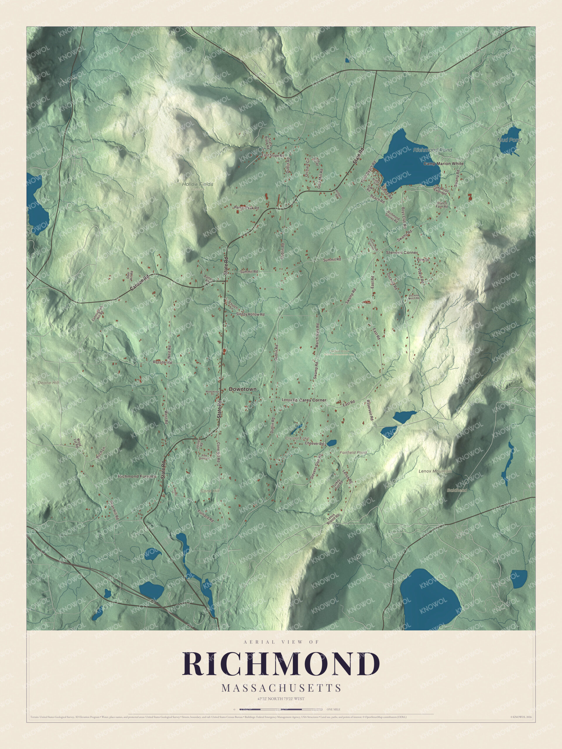
Click to explore a larger preview. The digital watermark does not appear on printed maps.
Names on this map
These names are printed on this map.
Places: Downtown, Richmond Furnace, Stevens Corner, Baldhead, Cone Hill, Deane Hill, Lenox Mountain, Crystal Lake, Fairfield Pond, Richmond Pond, Mud Pond, Fairfield Brook Wildlife Management Area, Hollow Fields Reserve, Camp Marion White and Carey Corner.
Streets and roads: State Road, Canaan Road, Lenox Road, Swamp Road, Dublin Road, East Road, West Road, Summit Road, Sleepy Hollow Road, Rossiter Road, Osceola Road, Dean Hill Road.
More street names, A to Z
Anthony Road, Beach Road, Birch Lane, Boys Club Road, Branch Farm Road, Bridge Street, Cheever Road, Church Lane, Cone Hill Road, Cunningham Hill Road, Deer Hill Road, East Slope Road, Furnace Lane, Furnace Road, Grist Mill Road, Jolindy Road, Lake Road Extended, Lenox Branch Road, March Hare Road, Meadowview Lane, Oak Road, Old Post Road, Orchard Circle, Osceola Notch Road, Osceola Road Extended, Patton Road, Perrys Peak Road, Pine Grove Drive, Reservoir Road, Richmond Shores Road, Scace Brook Road, Shore Road, Stevens Glen Road, Town Beach Road, Turkey Trot Road, View Drive, Wood Lot Road, Yokun Road.
See it on a wall
The Richmond map as a framed print. Swipe for more.


Around the map
Start with Richmond Furnace. Follow State Road, Canaan Road, Lenox Road, Swamp Road, Dublin Road and East Road across town. The furnace district lies along State, Cone Hill and Furnace roads. Then look outward toward Stevens Corner and Carey Corner. Crystal Lake, Fairfield Pond, Richmond Pond, Mud Pond, Cone Hill, Deane Hill and Lenox Mountain are all printed on the map. Lenox Mountain is part of Yokun Ridge, a stretch of the Taconic Mountains that runs through Richmond, Lenox, Stockbridge, West Stockbridge and Pittsfield; its main summit reaches 2,139 feet. The ridge’s northwest side drains into Richmond Pond, and Fairfield Pond is one of the ridge’s water bodies. The ridge’s name honors Jehoiakim Yokun, a Mahican man of the mid-1700s, and about a third of the ridge is protected open space, watershed or sanctuary. Former Governor Deval Patrick and his family own a home in Richmond.
The Richmond map makes a fine addition to an office, library or den, and it can help teach children the geography and history of a Berkshire iron town. It’s made for people who call Richmond home, from Richmond Furnace to Lenox Mountain, and it shows the town as it looks today. Zoom in on the preview above to explore the details, then click here to get your copy of the Richmond, Massachusetts map.

Sources