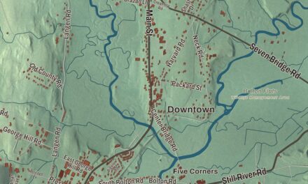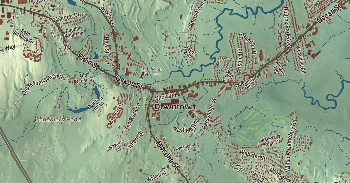
Marshfield takes its name from the salt marshes along its three rivers, and its five miles of seashore run from Rexhame down to Green Harbor. This map prints Ocean Street, Dyke Road, Plain Street, Moraine Street, Careswell Street and Main Street, with Brant Rock, Arnold Reservoir, Chandlers Pond, Stump Pond and Wright Reservoir. Click here to purchase a print of this map for your wall.
Marshfield is in Plymouth County.
KNOWOL made this map in 2026 from public survey data and gave it the look of an old atlas. The relief comes from United States Geological Survey elevation data, and the streets and the town line come from the Census Bureau. Marshfield covers 31.74 square miles on the South Shore, about where Cape Cod Bay meets Massachusetts Bay, with Scituate to the north, Norwell to the northwest, Pembroke to the west and Duxbury to the south. The North River runs along the northern line, the South River turns south through town, and the Green Harbor River flows just west of Brant Rock. Boston is 29 miles to the northwest, and the town had 25,825 people at the 2020 census.
A Pilgrim town
The Wampanoag called this place Missacautucket, and Native roads became the town’s main roads. Ocean Street, the main road through Brant Rock and Ocean Bluff, is one of them, likely very ancient. The Town of Marshfield’s recorded history, in the Secretary of the Commonwealth’s list, dates European settlement to 1632, when Edward Winslow, a Mayflower Pilgrim and the third signer of the Mayflower Compact, set up a separate settlement here. He started the town’s first church and first school, near the cemetery that still carries the Winslow name. William Green ran a fishing business at what was first called Green’s Harbor, and the town was at first named Rexhame before it became Marshfield. Marshfield was incorporated as a town in 1640, set off from Plymouth Colony, and the town remains part of Plymouth County today.
Peregrine White, the first English child born in New England, born on the Mayflower in 1620, grew up on Winslow’s land south of the Green Harbor River after his mother married Winslow. He built a farm on the South River, served as a selectman and militia lieutenant, and became known for planting European fruit trees around the colony. His mother, Susanna, was the first English bride married in New England. The Isaac Winslow House, built around 1699 on land granted to Edward Winslow, still stands as a museum. Briton Hammon, who served in General John Winslow’s household, wrote the story of his life at sea and his escape from captivity, and the house’s page counts him among the first African Americans to publish their work in the New World.
Webster, the fair and the first broadcasts
The statesman Daniel Webster bought a 150-acre estate in Marshfield in 1831 and made it his home in 1837. He died there in 1852 and is buried in the Winslow Cemetery near his estate. His last words were “I still live.” Part of his farm is now the Daniel Webster Wildlife Sanctuary, 507 acres of grassland, swamp, Webster Pond and a stretch of the Green Harbor River, owned by Mass Audubon. The Marshfield Fair has been held at the end of August since 1867, on 62 acres of fairgrounds, with farm exhibits and 4-H shows.
Brant Rock is named for the big rock outcrop on the beach where brant geese liked to rest. In January 1906, Reginald Fessenden made the first two-way radiotelegraph exchange across the Atlantic, trading Morse code between his station at Brant Rock and one in Machrihanish, Scotland. In a 1932 letter, Fessenden said that on Christmas Eve 1906 he had also broadcast music from Brant Rock to ships at sea, playing “O Holy Night” on the violin and reading from the Bible, and the Brant Rock page calls it the first radio broadcast of music and entertainment in history. The beach belongs to everyone, too: in 1832 the state’s Supreme Judicial Court ruled that the Marshfield seashore, Rexhame Beach included, was common land open to the public.
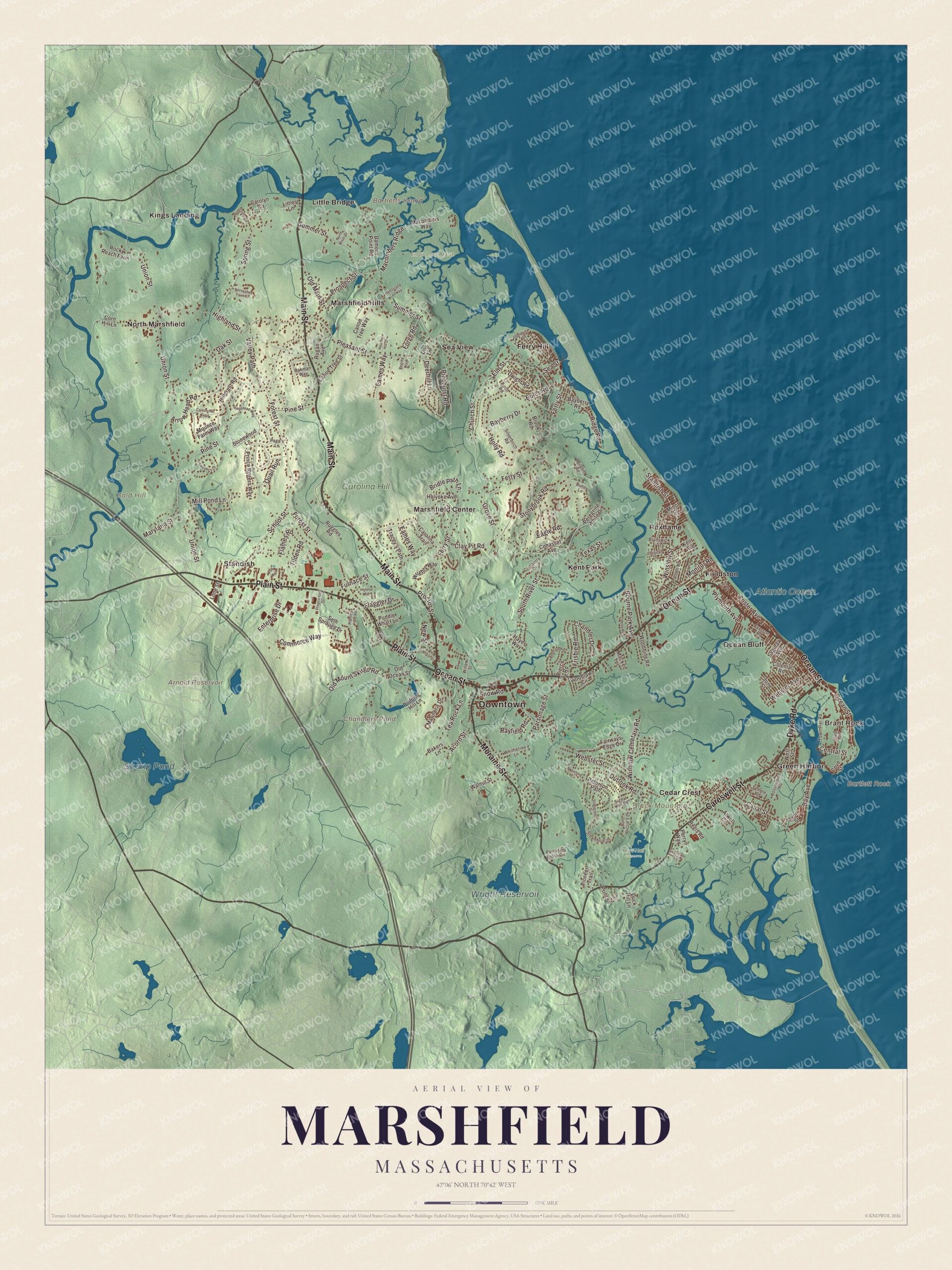
Click to explore a larger preview. The digital watermark does not appear on printed maps.
Names on this map
These names are printed on this map.
Places: Downtown, Brant Rock, Bald Hill, Bartlett Rock, Bartletts Island, Black Mountain, Arnold Reservoir, Chandlers Pond, Stump Pond, Wright Reservoir, Atlantic Ocean, Carolina Hill, English Salt Marsh, Hoyt-Hall Preserve, Pratt Farm, Cedar Crest, Ferry Hill, Fieldston, Green Harbor, Kent Park, Kings Landing, Little Bridge, Marshfield Center, Marshfield Hills, North Marshfield, Ocean Bluff, Rexhame, Sea View and Standish.
Streets and roads: Ocean Street, Dyke Road, Plain Street, Moraine Street, Careswell Street, Main Street, Union Street, Ferry Street, South River Street, Forest Street, Summer Street, Webster Street.
More street names, A to Z
13th Road, Acorn Street, Alden Road, Anderson Drive, Arrow Head Road, Assumption Road, Atwell Circle, Aunt Lizzie's Lane, Avon Street, Bakers Lane, Bay Avenue, Bayberry Drive, Bayberry Road, Birch Road, Boles Road, Bourne Park Avenue, Bridle Path Lane, Brook Road, Brunswick Street, Bunny Lane, Canal Street, Canoe Tree Street, Canoe Tree Way, Canonchet Trail, Carolina Trail, Carolyn Circle, Central Street, Chandler Drive, Church Street, Clay Pit Road, Cohasset Avenue, Colonial Road, Commerce Way, Corn Hill Lane, Cove Street, Cranberry Cv, Damons Point Road, Deerhill Lane, Dog Lane, Duck Hill Lane, Dwight Road, Eagle Road, Eames Way, Elm Street, Enterprise Drive, Everson Road, Fairways Edge Drive, Flaggler Drive, Flames Road, Forge Road, Foster Avenue, Fox Run, Frisbie Road, Furnace Street, Grandview Avenue, Grove Street, Hampstead Way, Hayes Way, Heather Hill Drive, Helena Road, Hen Island Cartway, Highland Street, Hillcrest Road, Holly Road, Holyoke Avenue, Horseshoe Farm Lane, Island Street, June Street, Kent Avenue, Liberty Road, Littles Lane, Lone Street, Macker Terrace, Macombers Ridge, Macombers Way, Mariner's Drive, Maryland Street, Mill Pond Lane, Minot Street, Monitor Road, Mounce Farm Way, New Street, North River Drive, Oakman Way, Oak Street, Old Main Street, Old Mount Skirgo Road, Old Ocean Street, Old Plain Street, Outlook Road, Page's Lane, Parsonage Street, Partridge Brook Circle, Peregrine White Drive, Perryn Way, Peterson Path, Pierce Road, Pilgrim Road, Pinehurst Road, Pine Street, Pioneer Trail, Planting Field Road, Pleasant Street, Plymouth Avenue, Prince Circle, Prince Rogers Way, Proctor Street, Proprietors Drive, Prospect Street, Pudding Hill Lane, Puddle Wharf Lane, Quail Run, Rayfield Road, Regina Way, Regis Road, Ridge Road, Riverside Circle, River Street, Rocky Reach Farm, Rugani Avenue, Ruggles Road, Saginaw Avenue, Sandy Hill Drive, Sawyer's Lane, School Street, Seaflower Lane, Sea Street, Seth Sprauge Drive, Sheridan Drive, Signal Hill Road, Silverbirch Road, Snow Road, Spring Street, Stagecoach Drive, Standish Street, Steamboat Drive, Stonewood Lane, Stonybrook Road, Tea Rock Lane, Temple Road, Texas Street, Tilden Road, Town Pier Road, Tracey's Path, Valley Path, Walnut Street, Webster Avenue, West Street, Whiffletree Lane, Whitford Circle, Willow Street, Winslow Cemetary Road, Winslow Street, Woodbine Road, Woodlawn Circle, Wrights Way.
See it on a wall
The Marshfield map as a framed print. Swipe for more.


Around the map
Start with Brant Rock, then follow Ocean Street, Dyke Road, Plain Street, Moraine Street, Careswell Street and Main Street across town. Then look outward toward Cedar Crest, Ferry Hill, Fieldston, Green Harbor and Kent Park. Cedar Crest is named for a hill on the north side of Careswell Street, once called Gotham Hill, that took the new name from a 1920s camp and a crown of small cedars. Green Harbor is named for William Green, and Marshfield shares it with Duxbury as a census-designated place. Arnold Reservoir, Chandlers Pond, Stump Pond, Wright Reservoir, Bald Hill, Black Mountain and Bartletts Island are all printed on the map, and every one of those names is right there on the artwork. The Rexhame and Humarock barrier beach rises to an 84-foot moraine, and the town page calls it one of only two barrier beach moraines on the east coast.
The Marshfield map makes a fine addition to an office, library or den, and it can help teach children the geography and history of a South Shore Pilgrim town. It’s made for people who call Marshfield home, from Rexhame to Green Harbor, and it shows the town as it looks today. Zoom in on the preview above to explore the details, then click here to get your copy of the Marshfield, Massachusetts map.

Sources
- Marshfield, Massachusetts, Wikipedia
- History of Marshfield, Massachusetts, Wikipedia
- Isaac Winslow House, Wikipedia
- Daniel Webster, Wikipedia
- Daniel Webster Wildlife Sanctuary, Wikipedia
- Marshfield Fair, Wikipedia
- Ocean Bluff-Brant Rock, Massachusetts, Wikipedia
- Reginald Fessenden, Wikipedia
- Cedar Crest, Massachusetts, Wikipedia
- Green Harbor, Massachusetts, Wikipedia
- City and Town Incorporation and Settlement Dates, Secretary of the Commonwealth of Massachusetts (archived copy)