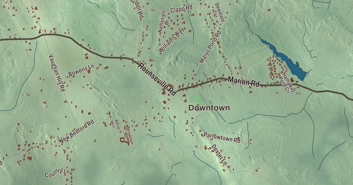
Every Memorial Day since 1934, boats have raced down the Mattapoisett River from Rochester to Mattapoisett, and the river begins at Snipatuit Pond in Rochester. This map of the town prints Rounseville Road, Marion Road, Robinson Road, Braley Hill Road, North Avenue and Cranberry Highway, with Snipatuit Pond, Great Quittacas Pond, Wolf Lake and Anuxanon Island. Click here to purchase a print of this map for your wall.
Rochester is in Plymouth County.
KNOWOL made this map in 2026 from public survey data and gave it the look of an old atlas. United States Geological Survey elevation data shapes the land, and the Census Bureau supplied the roads and the town line. Rochester lies on the western edge of Plymouth County, about 10 miles northeast of New Bedford, and covers 36.4 square miles, 2.5 of them water. Lakeville and Middleborough border it to the north, Wareham and Marion to the east, Mattapoisett to the south, and Acushnet and Freetown to the west. It had 5,717 people at the 2020 census.
Sippican
The land was called Sippican, after the Wampanoag people who lived here along Buzzards Bay. The Town of Rochester’s recorded history, in the Secretary of the Commonwealth’s list, dates European settlement to 1638, while the town page says it was settled in 1679. Rochester was incorporated as a town in 1686, on June 4, and named for Rochester in England, where some of its early settlers had come from. At first it took in what are now Mattapoisett, Marion and part of Wareham, and the town did well from shipbuilding and whaling in Mattapoisett Harbor. Wareham took its share in 1739, Marion left in 1852 and Mattapoisett in 1857, and with them went the coast, leaving Rochester without a shore. Since then it has been mostly rural and residential, with some farms, and it’s a “Right to Farm” community.
Joseph Bates was born in Rochester in 1792. He went to sea as a cabin boy, rose to captain a ship, and later became a co-founder of Sabbatarian Adventism, whose followers went on to establish the Seventh-day Adventist Church. Tristam Burges, born here in 1770, graduated first in his class at the college that’s now Brown University, served briefly as chief justice of the Rhode Island Supreme Court and spent ten years in Congress.
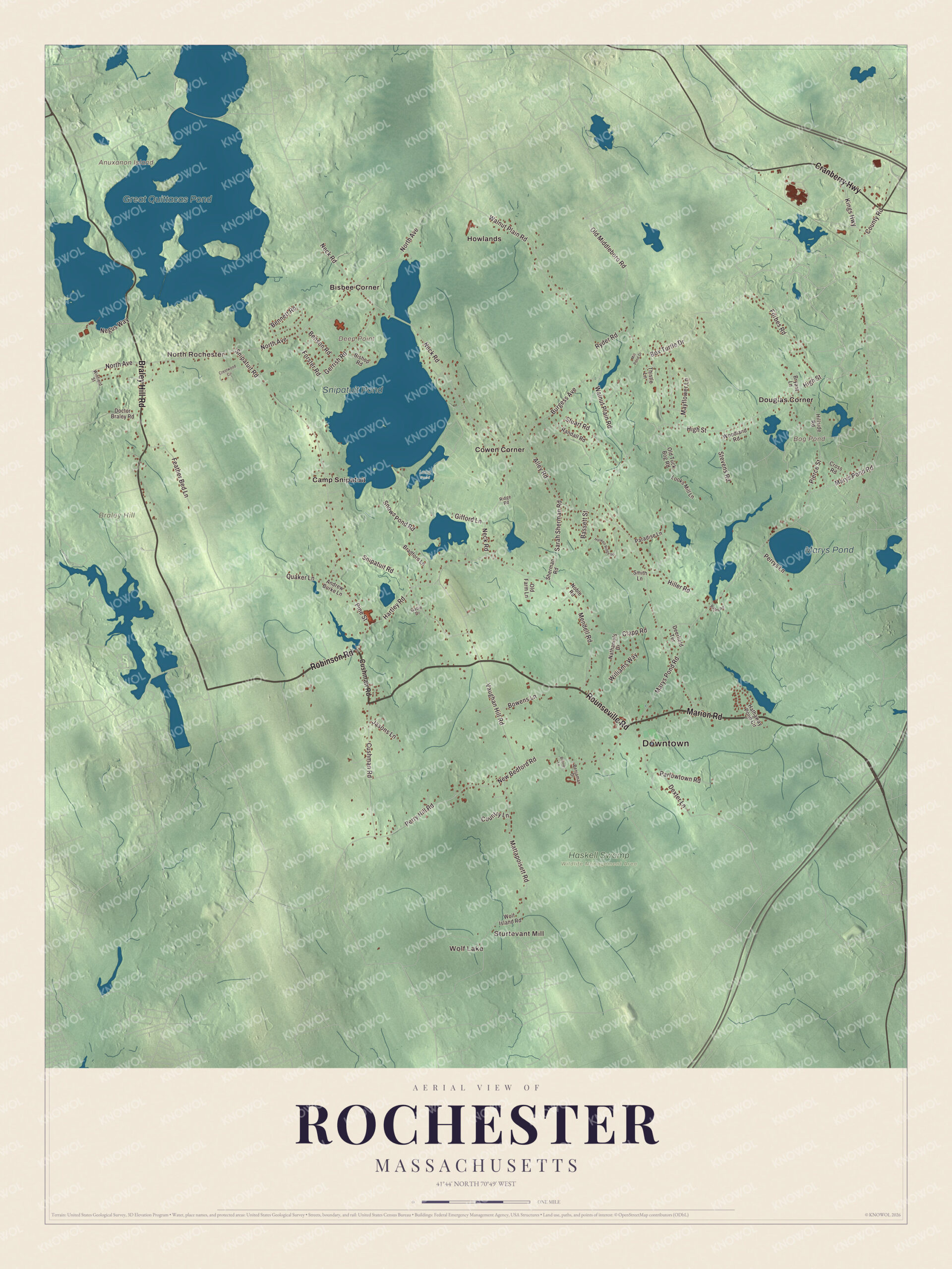
Click to explore a larger preview. The digital watermark does not appear on printed maps.
Names on this map
These names are printed on this map.
Places: Downtown, Wolf Lake, Sturtevant Mill, North Rochester, Anuxanon Island, Braley Hill, Deep Point, Bog Pond, Great Quittacas Pond, Snipatuit Pond, Marys Pond, Haskell Swamp Wildlife Management Area, Long Pond, Bisbee Corner, Camp Snipatuit, Cowen Corner, Douglas Corner and Howlands.
Streets and roads: Robinson Road, Marion Road, Rounseville Road, Braley Hill Road, Cranberry Highway, North Avenue, Hartley Road, Perry Hill Road, Neck Road, Marys Pond Road, Mattapoisett Road, Walnut Plain Road.
More street names, A to Z
Alley Road, Andrew Burke Lane, Bassett Street, Bates Road, Benjaman Drive, Benner Lane, Bennett Road, Benson Road, Bishop Road, Bowens Lane, Box Turtle Drive, Bradford Lane, Bryant Lane, Burgess Avenue, Clapp Road, Country Lane, County Road, Crestwood Circle, Cross Road, Cushman Road, Deerfield Terrace, Dexter Lane, Doctor Braley Road, Feather Bed Lane, Forbes Road, Forster Road, Gabie Drive, Gerrish Road, Gifford Lane, Haskell Ridge Road, Hathaway Pond Circle, High Street, Hiller Road, Hillside Road, Jasons Lane, Kings Highway, Looks Mill Lane, Mayflower Lane, Mendell Road, Mill Pond Drive, Nathaniels Drive, Negus Way, New Bedford Road, Noble Road, Old Farm Lane, Old Middleboro Road, Old Tuck Bog Road, Paradise Lane, Parlowtown Road, Perrys Lane, Pierce Street, Pine Street, Quaker Lane, Randall Road, Ridge Road, Ryder Road, Sarah Sherman Road, Sherman Road, Smith Lane, Snipatuit Road, Snows Pond Road, Stevens Road, Stuart Road, Thistle Lane, Vaughan Hill Road, Williams Way, Winfield Street, Wolf Island Road, Woodland Road.
See it on a wall
The Rochester map as a framed print. Swipe for more.


Around the map
Start with Wolf Lake. Follow Robinson Road, Marion Road, Rounseville Road, Braley Hill Road, Cranberry Highway and North Avenue across town. The town hall stands on the Town Common along Route 105, with the police department, the post office and the Joseph H. Plumb Memorial Library nearby. Then look outward toward Sturtevant Mill, North Rochester, Bisbee Corner, Cowen Corner and Douglas Corner. High school students attend Old Rochester Regional, shared with Marion and Mattapoisett, or can choose Old Colony Regional Vocational Technical High School in North Rochester.
Anuxanon Island, Bog Pond, Great Quittacas Pond, Snipatuit Pond and Braley Hill are all printed on the map. Snipatuit Pond is a shallow 710-acre pond, about five feet deep on average, fed by Cedar Swamp and by Great Quittacas Pond, and it’s the headwaters of the Mattapoisett River. The river runs 11.6 miles south through Mattapoisett to Buzzards Bay, and older residents still call it the Herring Run. Great Quittacas Pond lies on the line where Rochester meets Lakeville and Middleborough and is part of New Bedford’s drinking water supply. The Sippican River also rises partly in Rochester and flows through cranberry bogs and reservoirs on its way to Buzzards Bay.
The Rochester map makes a fine addition to an office, library or den, and it can help teach children the geography and history of an old Plymouth County farm town. It’s made for people who call Rochester home, from Wolf Lake to North Rochester, and it shows the town as it looks today. Zoom in on the preview above to explore the details, then click here to get your copy of the Rochester, Massachusetts map.

Sources
- Rochester, Massachusetts, Wikipedia
- Joseph Bates (Adventist), Wikipedia
- Tristam Burges, Wikipedia
- Snipatuit Pond, Wikipedia
- Mattapoisett River, Wikipedia
- Great Quittacas Pond, Wikipedia
- Sippican River, Wikipedia
- City and Town Incorporation and Settlement Dates, Secretary of the Commonwealth of Massachusetts (archived copy)