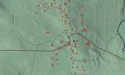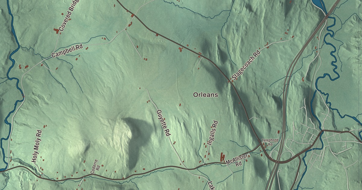
For more than seventy years Irasburg was a county seat, and the town hall on Irasburg Square still stands where the old Orleans County courthouse did. This map prints Main Street, Kidder Hill Road, Burton Hill Road, West Glover Road, Back Coventry Road and Simino Lane, with Kidder Pond, Mud Pond and Orleans. That last one is the village in the northwest corner of Barton, 4 miles east of Irasburg village.
Irasburg is a town in Orleans County, Vermont.
KNOWOL made this map in 2026 from public survey data and gave it the look of an old county atlas, shading the hills from United States Geological Survey elevation data and drawing the roads and town line from the Census Bureau. Irasburg covers 40.6 square miles, nearly all of it land, and the Black River flows north through the town on its way to Lake Memphremagog. Click here to purchase a print of this map for your wall.
A wedding gift
Vermont granted the town on February 23, 1781, to Ira Allen, members of the Enos family and others. Allen later bought up the other proprietors’ rights and deeded the whole town to Jerusha Enos, his bride, as a wedding gift. The first settler, Caleb Leach, came in 1798. The town organized on March 21, 1803, with Leach as its first representative from 1804. That same year Captain James Richardson settled here, and he’s believed to have opened Irasburg’s first tavern.
In the early 1800s the town’s main business was making salts and pearl ash. Mills were running by 1810, and by the 1820s Irasburg had a woolen mill, a tannery and factories turning out stoves and plows. In 1812 the legislature made Irasburg the shire town of Orleans County, and residents built the first courthouse and jail at their own expense in 1815. The county seat moved to Newport in the 1880s.
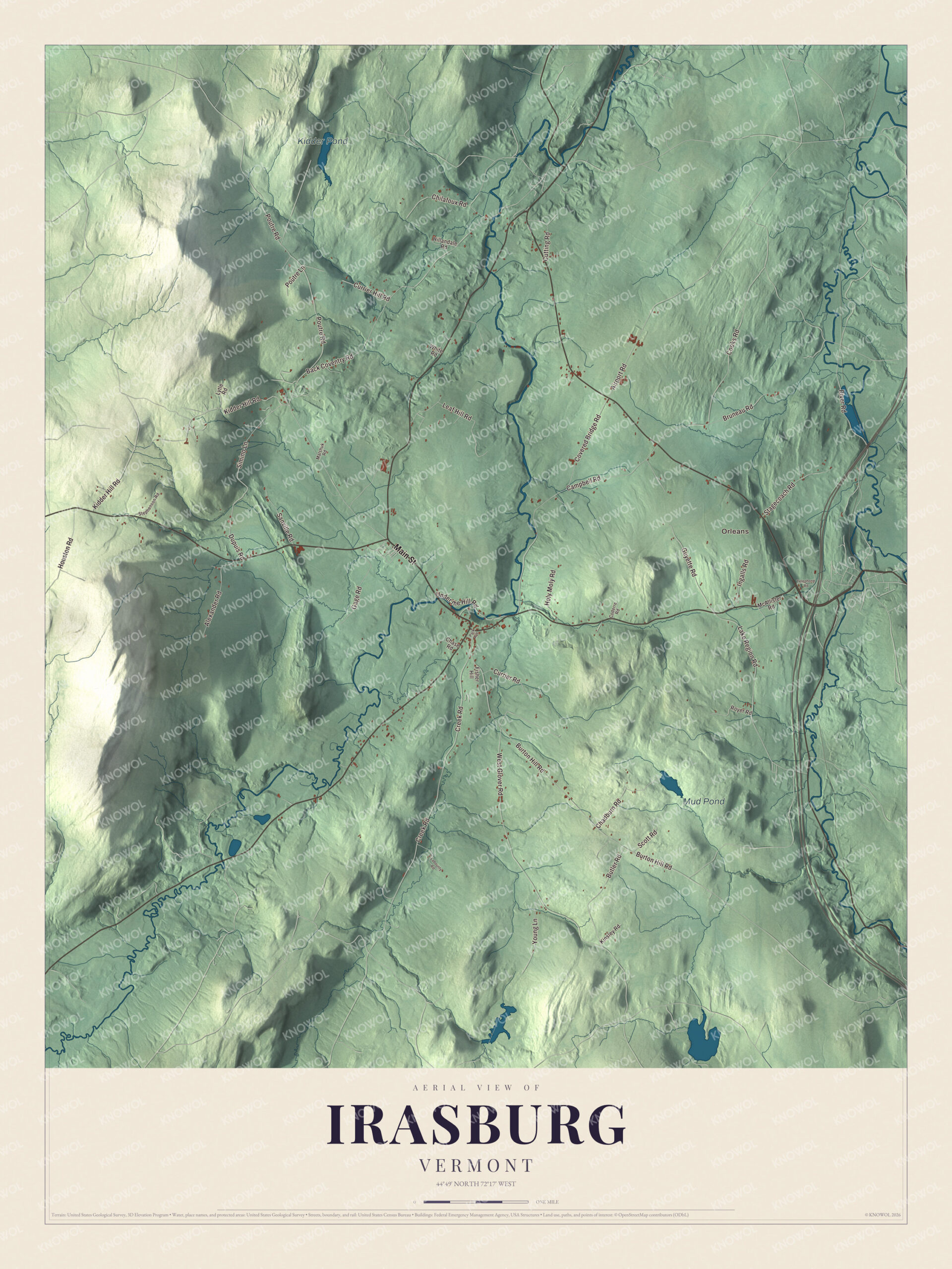
Click to explore a larger preview. The digital watermark does not appear on printed maps.
Names on this map
These names are printed on this map.
Places: Orleans, Kidder Pond and Mud Pond.
Streets and roads: Main Street, Kidder Hill Road, Simino Lane, Back Coventry Road, Burton Hill Road, West Glover Road, Creek Road, Covered Bridge Road, Poutre Road, Cooks Road, Leaf Hill Road, River Road.
More street names, A to Z
Airport Road, Alexander Road, Bruneau Road, Butler Road, Campbell Road, Chadburn Road, Chase Road, Chilafoux Road, Coderre Road, Currier Hill Road, Currier Road, Cutting Road, Dupuis Road, Fisher Hill, Gage Road, Guyette Road, Hillandale Road, Holy Moly Road, Houston Road, Ingalls Road, Kinsley Road, Labounty Road, Lake Region Road, Lytle Road, Malshuk Road, McAllister Road, Park Avenue, Poutre Lane, Royer Road, Sanville Road, Scott Road, Stagecoach Road, Stephenson Road, Telephone Road, Under the Hill Road, White Road, Young Lane.
See it on a wall
The Irasburg map as a framed print. Swipe for more.


The village and the square
The village sits on a hilltop south of the center of town, with the Black River passing just north of it. Irasburg Town Hall, built in 1911 on the site of the old courthouse after a fire, faces Irasburg Square between the public library and the general store. Upstairs is an auditorium with a stage and five painted backdrops, made by local artists, showing scenes of northern Vermont. The hall has hosted traveling and local shows, weddings and dinners, and it’s been on the National Register since 1994. The Kingdom Run foot race starts and finishes on the town common each summer, and the Irasburg Church Fair has been held every year since 1952.
Irasburg’s people
The painter Theodore Robinson was born in Irasburg in 1852. He was one of the first American artists to take up Impressionism, and by 1888 he was living next door to Claude Monet at Giverny, where the two became close friends. Elinor Langton-Boyle, born here in 1865, moved to Honolulu and for four decades published the magazine Paradise of the Pacific, choosing color covers that a contemporary called pioneering. The novelist Howard Frank Mosher lived in Irasburg and set all of his fiction in Vermont’s Northeast Kingdom. His novel A Stranger in the Kingdom won the New England Book Award for Fiction in 1991 and became a feature film.
Around the map
Back Coventry Road heads north toward Coventry, and in the far north of town it crosses the Black River on the Orne Covered Bridge. The bridge there now is a replica, finished in 2000. The 19th-century bridge it replaced, a Paddleford truss listed on the National Register in 1974, was destroyed by arson in 1997.
On the map, follow Main Street, then take Kidder Hill Road, Burton Hill Road and West Glover Road. Back Coventry Road and Simino Lane are printed too, and so are Kidder Pond, Mud Pond and Orleans. Irasburg dates to 1781.
This map of Irasburg is made for everyone who calls Irasburg home, and it shows the town as it looks today, from Main Street to Kidder Pond. Hang it in an office, library or den, or use it to teach children the geography and history of their town. It’s printed on museum quality archival paper. Zoom in on the preview above to explore the details, then click here to get your copy of the Irasburg, Vermont map.

Sources
- Irasburg, Vermont, Wikipedia
- Town histories and representatives, I towns, Vermont Legislature
- Irasburg (CDP), Vermont, Wikipedia
- Ira Allen, Wikipedia
- Irasburg Town Hall, Wikipedia
- Orne Covered Bridge, Wikipedia
- Black River (Lake Memphremagog), Wikipedia
- Orleans, Vermont, Wikipedia
- Theodore Robinson, Wikipedia
- Elinor Langton-Boyle, Wikipedia
- Howard Frank Mosher, Wikipedia