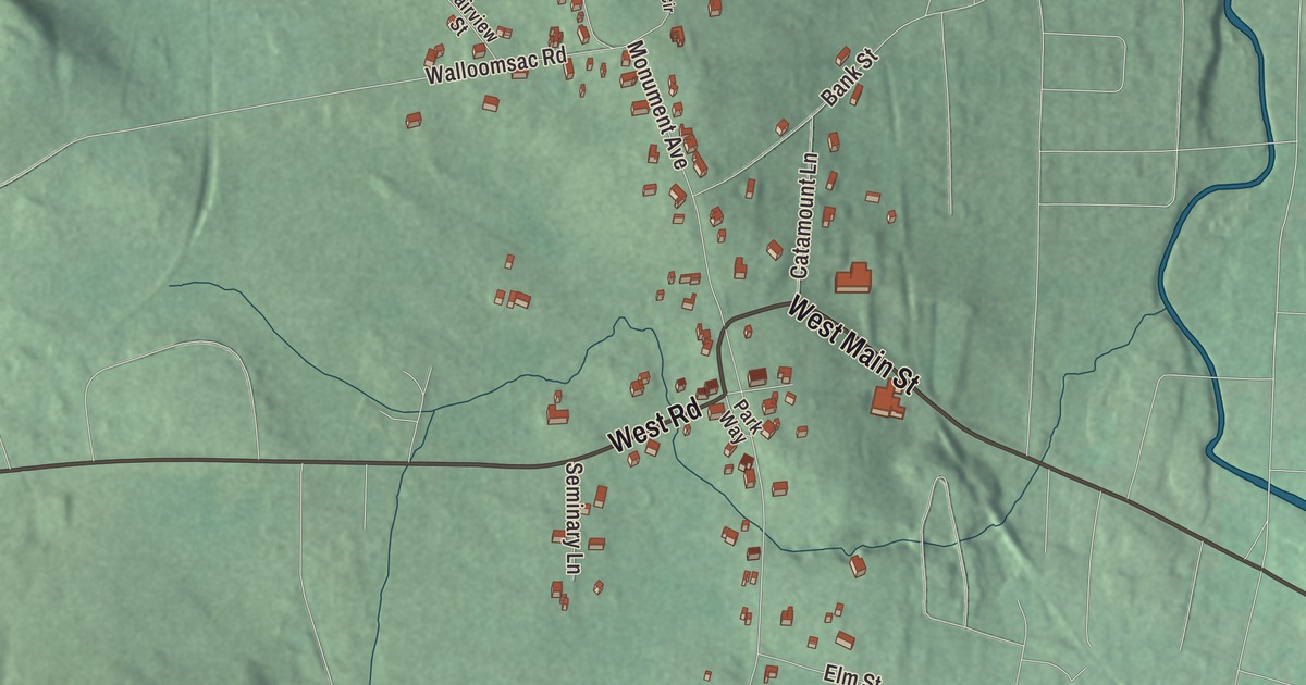
Old Bennington sits on a hill near the geographic center of the town of Bennington, looking east over downtown, with the Bennington Battle Monument just to its north. This map prints West Main Street, West Road, Monument Avenue, Bank Street, Walloomsac Road and Catamount Lane across the village.
Old Bennington is a village in Bennington County, Vermont.
KNOWOL made this map in 2026 from public survey data and gave it the look of an old county atlas, shading the hills from United States Geological Survey elevation data and drawing the streets and village line from the Census Bureau. Old Bennington is an incorporated village within the town of Bennington, and it has its own incorporated-place boundary, 0.37 square miles, all of it land. At the 2020 census 156 people lived here. Click here to purchase a print of this map for your wall.
Where Bennington began
Old Bennington is the town’s original settlement. Congregational Separatists from Connecticut and from Amherst and Hardwick, Massachusetts, arrived here in 1761, and the village and the land around it were listed on the National Register of Historic Places in 1984 as the Old Bennington Historic District. The district is noted for its well-kept houses from the Revolutionary War years and counted as one of the earliest settlements in Vermont, and it runs roughly between the old Rutland railroad bed, Monument Avenue, West Road, Seminary Lane, Elm Street and Fairview Street. West Road is Route 9, which takes a pair of sharp curves through the village on its way between downtown Bennington and the New York line. The village remains active today, and the green in front of the Old First Church is still at its center.
The Old First Church
The Bennington congregation was gathered in 1762 and built its first meeting house in 1766. The present Old First Church faces the green at the corner of Monument Avenue and Church Lane. It went up in the first years of the 1800s with seats for 650, paid for by selling pews and by local levies, and its builder, Lavius Fillmore, seems to have borrowed heavily from a plate in Asher Benjamin’s The Country Builder’s Assistant. Its page calls it one of the state’s best examples of Federal period religious architecture, and it was restored in 1937. The Vermont legislature named the burying ground beside the church “Vermont’s Sacred Acre,” and the poet Robert Frost is buried there. William Ellery Channing, the Unitarian theologian, died in Old Bennington, and a cenotaph here keeps his memory, though he’s buried in Cambridge, Massachusetts.
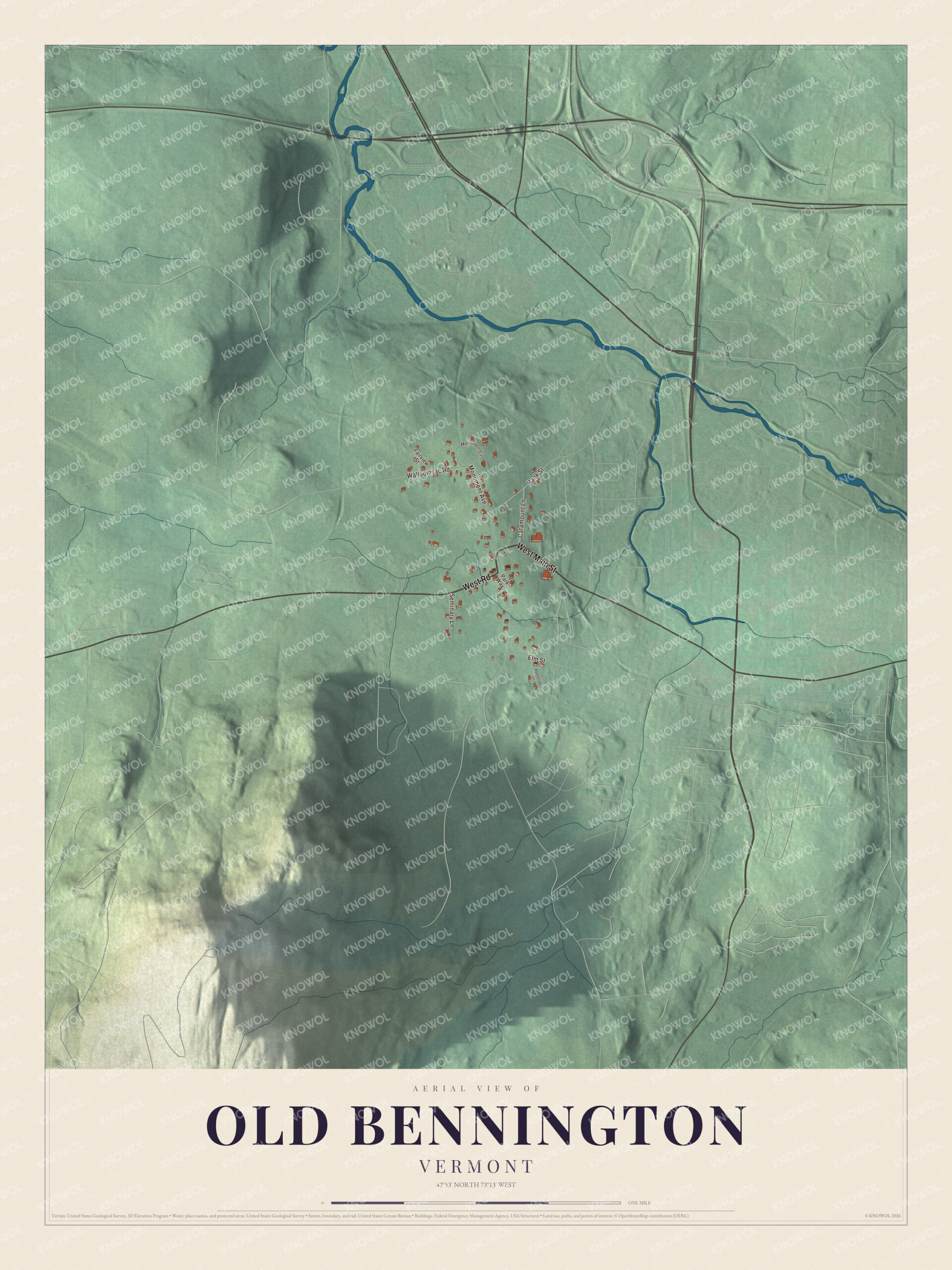
Click to explore a larger preview. The digital watermark does not appear on printed maps.
Names on this map
These names are printed on this map.
Streets and roads: West Main Street, West Road, Monument Avenue, Bank Street, Walloomsac Road, Catamount Lane, Elm Street, Seminary Lane, Fairview Street, Park Way, Monument Circle and Appletree Lane.
See it on a wall
The Old Bennington map as a framed print. Swipe for more.


The monument and the Catamount Tavern
The Bennington Battle Monument, one of the centerpieces of the historic district, is a stone obelisk 306 feet high, built of blue-gray dolomite from Hudson Falls, New York, with its cornerstone laid in 1887 and the work finished in November 1889. It marks the Battle of Bennington of August 16, 1777, when General John Stark and 1,400 New Hampshire men, with Colonels Warner and Herrick of Vermont and other militia, beat two detachments of John Burgoyne’s British army that had come to seize a store of weapons and food kept where the monument now stands. The fighting itself took place about 5 miles away, in Walloomsac, New York. An elevator runs to the observation level at 200 feet, where the view takes in Vermont, Massachusetts and New York, and statues of Stark and Seth Warner stand on the grounds.
Close by stood the Catamount Tavern, built in 1769, where Ethan Allen and the Green Mountain Boys planned the capture of Fort Ticonderoga in 1775 and where the Vermont Council of Safety met. It took its name from the stuffed catamount settlers set on its signpost as a warning to the New Yorkers who claimed their land. The tavern burned in 1871, and a granite and copper statue placed in 1896 marks the site.
On the map, start on West Main Street, then follow West Road, Monument Avenue, Bank Street, Walloomsac Road and Catamount Lane across the village; every one of those streets is printed. The Old First Church stands where Monument Avenue meets Church Lane.
This map of Old Bennington is made for everyone who calls Old Bennington home, and it shows the village as it looks today, from the Old First Church on its green to Monument Avenue. Hang it in an office, library or den, or use it to teach children the geography and history of their village. It’s printed on museum quality archival paper. Zoom in on the preview above to explore the details, then click here to get your copy of the Old Bennington, Vermont map.

Sources