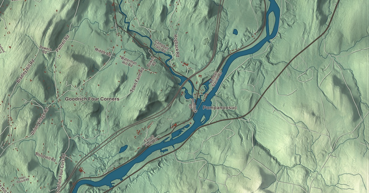
Norwich sits on the west bank of the Connecticut River, across from its companion town of Hanover, New Hampshire, with the Ledyard Bridge between them. This map prints Church Street, Main Street, Stowell Road, Bragg Hill Road, Illsley Road and New Boston Road, with Pompanoosuc, Bragg, Goodrich Four Corners and West Norwich.
Norwich is a town in Windsor County, Vermont.
KNOWOL made this map in 2026 from public survey data and gave it the look of an old county atlas, shading the hills from United States Geological Survey elevation data and drawing the roads and town line from the Census Bureau. The town covers 44.7 square miles, and 3,612 people lived here at the 2020 census. Click here to purchase a print of this map for your wall.
Norwhich, then Norwich
Governor Benning Wentworth of New Hampshire set the town’s bounds on July 4, 1761. The charter spelled the name “Norwhich,” and the extra h was dropped soon after; the name came from Norwich, Connecticut, the state the first settlers came from, and it was first pronounced “Norritch,” as in England. Those settlers arrived in 1763, cleared land along the Ompompanoosuc River, and wintered here for the first time in 1765. The first town meeting came in April 1768, and the Congregational church, founded in 1770, built its meeting house in 1778. The town grew from 206 people in 1771 to 2,316 in 1830. Abel Curtis and Joseph Hatch represented Norwich in the legislature in 1778. Peter Olcott, who came from Connecticut in the early 1770s, became the first lieutenant governor of the state of Vermont, and his Georgian farmhouse of about 1789 still stands at Maple Hill Farm. Paul Brigham, who moved his family here in 1782, was lieutenant governor for 16 straight years and governor for seven weeks in 1797, and three farmsteads of his family make up the Brigham Hill Historic District.
Alden Partridge’s academy
Alden Partridge, born and raised on a Norwich farm and a former superintendent of West Point, founded the American Literary, Scientific and Military Academy here in 1819. In its first four years it drew 480 students from 21 of the 24 states, and Partridge, an avid hiker, led 27 cadets with packs on a 150-mile hike from Norwich to Manchester in four days in 1822. He took the academy to Middletown, Connecticut, for a time in the 1820s and then brought it back to Norwich, where it stayed until a fire destroyed its barracks in 1866 and the school moved to Northfield as Norwich University. Partridge died in Norwich in 1854 and is buried in Fairview Cemetery. The academy helped the present village grow in the first half of the 1800s, and the Norwich Village Historic District, listed on the National Register of Historic Places in 1991, runs along Route 5 and Main Street, with the Late Victorian Norwich Inn and, beside it on Main Street, the general store, Dan and Whit’s.
Corners and hamlets
Goodrich Four Corners, in the north of town, grew up in the 1780s when John Slafter, one of the town’s first permanent residents and the son of a proprietor, moved there from the early town center. Its farms raised wool until demand fell in the late 1800s, then turned to dairy, and around 1900 the Goodrich family took over one of the original farms; the 232-acre historic district, centered on the meeting of Union Village Road, Goodrich Four Corners Road and Pattell Road, was listed in 2019. Pompanoosuc is the village where the 25-mile Ompompanoosuc River runs into the Connecticut. Just west of the crossroads village of West Norwich, the Beaver Meadow Union Chapel of 1915, built by its own future congregation, is where the Home Prayers program began, a ministry by mail inspired by the Sears, Roebuck catalogs.
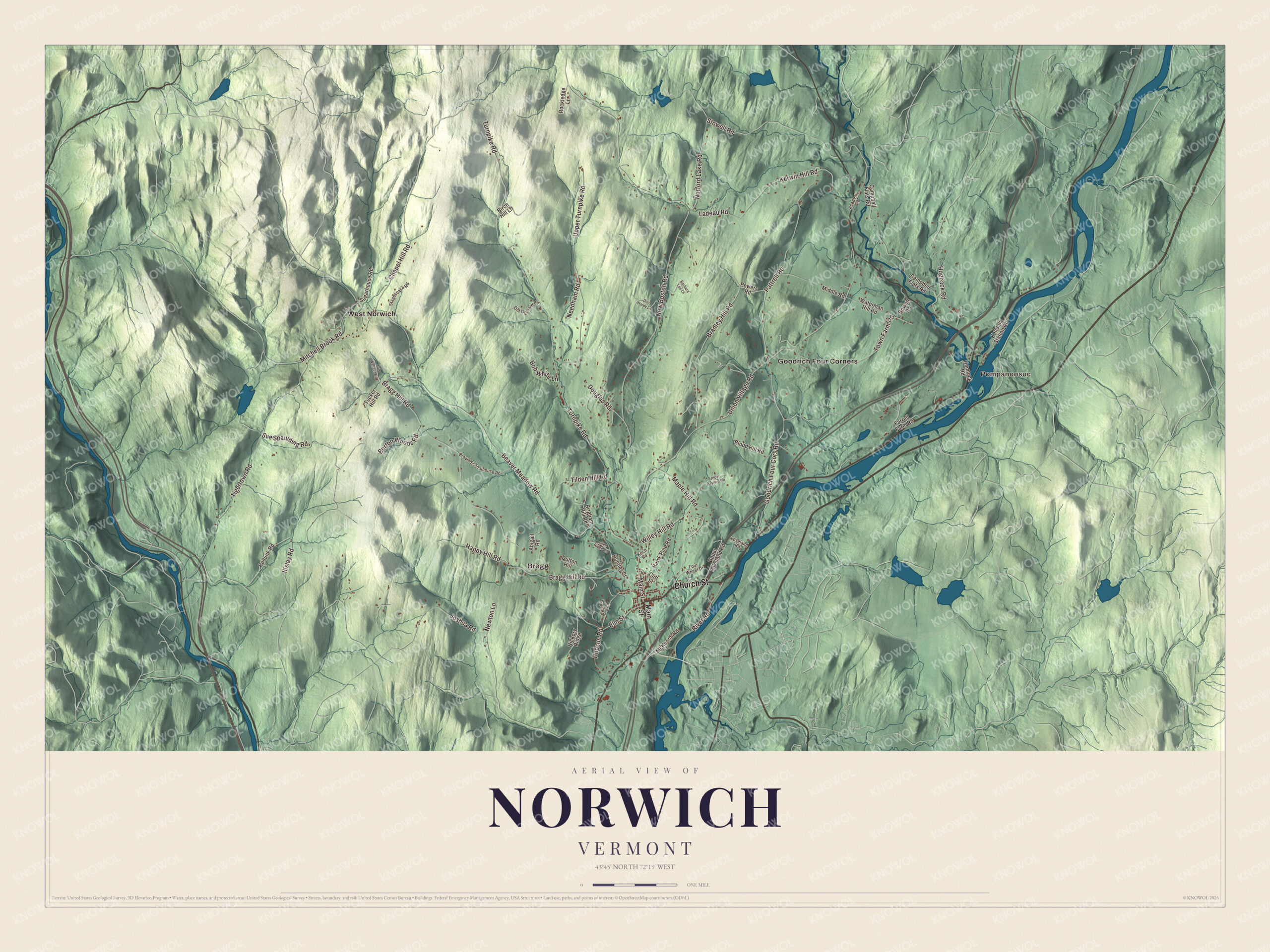
Click to explore a larger preview. The digital watermark does not appear on printed maps.
Names on this map
These names are printed on this map.
Places: Pompanoosuc, Bragg, Goodrich Four Corners and West Norwich.
Streets and roads: Church Street, Main Street, Stowell Road, Bragg Hill Road, Illsley Road, New Boston Road, Turnpike Road, Beaver Meadow Road, Union Village Road, Burton Woods Road, Tigertown Road, Upper Turnpike Road.
More street names, A to Z
Abigail Road, Academy Road, Barbara Lee Lane, Birch Hill Lane, Blood Hill Road, Bob White Lane, Bowen Road, Bradley Hill Road, Brigham Hill Road, Brown Schoolhouse Road, Campbell Flats Road, Chapel Hill Road, Cliff Street, Doc Hardy Lane, Douglas Road, Dutton Hill, Elm Street, Farrell Farm Road, Four Wheel Drive, Glen Ridge Road, Goodrich Four Cors Road, Happy Hill Road, Hawk Pine Road, Hemlock Road, Hickory Ridge, Hogback Road, Hopson Road, Huntley Street, Joshua Road, Kate Wallace Road, Kendall Station Road, Kerwin Hill Road, Koch Road, Ladeau Road, Loveland Road, Maple Hill Road, McKenna Road, Middle Road, Mitchell Brook Road, Needham Road, Newton Lane, Norford Lake Road, Old Orchard Lane, Pattrell Road, Pine Tree Road, Podunk Road, Powers Road, River Road, Rockledge Lane, Stagecoach Road, Sue Spaulding Road, Sugarhouse Road, Tilden Hill Road, Town Farm Road, Tucker Hill Road, Upper Loveland Road, Upper Pasture Road, Waterman Hill Road, Willey Hill Road.
See it on a wall
The Norwich map as a framed print. Swipe for more.


Modern Norwich
In 1951 Keith and Edna Warner bought land on Hopson Road and built one of the town’s first Mid-Century Modern houses, then sold lots to others who built more, and fourteen of those houses now form the Norwich Mid-Century Modern Historic District, listed in 2018. Norwich shares the Dresden School District with Hanover, the first interstate school district in the United States. The Montshire Museum of Science moved across the river from Hanover to a building of its own in Norwich in 1989, and King Arthur Baking, founded in Boston in 1790, has its headquarters here, with a bakery, café, store and baking school that opened in 2000. A fire tower stands on the summit of Gile Mountain, reached by Turnpike Road, and the Appalachian Trail passes through town on its way from Hartford to Hanover.
Norwich people
Hannah Kearney, raised in Norwich, won the gold medal in moguls at the 2010 Winter Olympics and a bronze in 2014. Zerah Colburn, a child prodigy at mental arithmetic, settled in Norwich in 1835 and taught Latin, Greek, French and Spanish at Norwich University until his death in 1839. Bob Keeshan, television’s Captain Kangaroo, spent the last 14 years of his life in Norwich, working as a children’s advocate and author.
On the map, start at Pompanoosuc and Bragg, then follow Church Street, Main Street, Stowell Road, Bragg Hill Road, Illsley Road and New Boston Road, and look out toward Goodrich Four Corners and West Norwich. Norwich dates to 1761.
This map of Norwich is made for everyone who calls Norwich home, and it shows the town as it looks today, from Main Street to Pompanoosuc. Hang it in an office, library or den, or use it to teach children the geography and history of their town. It’s printed on museum quality archival paper. Zoom in on the preview above to explore the details, then click here to get your copy of the Norwich, Vermont map.

Sources
- Norwich, Vermont, Wikipedia
- Town histories and representatives, N towns, Vermont Legislature
- Peter Olcott, Wikipedia
- Maple Hill Farm, Wikipedia
- Paul Brigham, Wikipedia
- Brigham Hill Historic District, Wikipedia
- Alden Partridge, Wikipedia
- Norwich Village Historic District, Wikipedia
- Goodrich Four Corners Historic District, Wikipedia
- Ompompanoosuc River, Wikipedia
- Beaver Meadow Union Chapel, Wikipedia
- Norwich Mid-Century Modern Historic District, Wikipedia
- Dresden School District, Wikipedia
- Montshire Museum of Science, Wikipedia
- King Arthur Baking, Wikipedia
- Gile Mountain, Wikipedia
- Hannah Kearney, Wikipedia
- Zerah Colburn (mental calculator), Wikipedia
- Bob Keeshan, Wikipedia