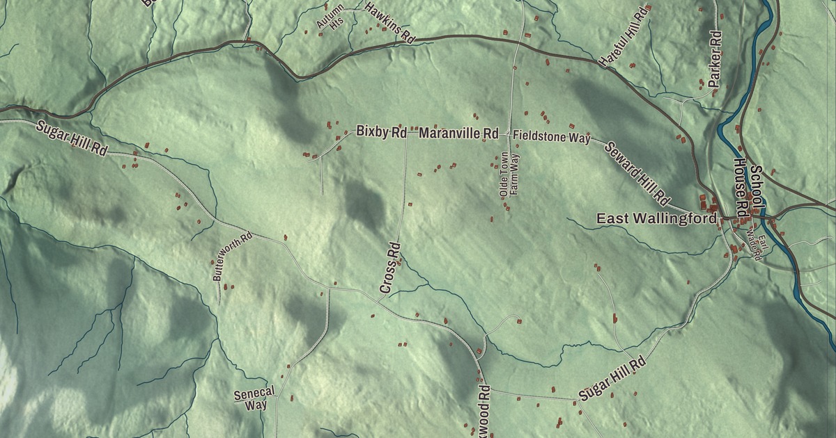
Wallingford sits in the Otter Creek valley along Route 7, between the Taconic Mountains and the Green Mountains, ten miles south of Rutland. This map prints East Wallingford and South Wallingford, School Street, Clarendon Avenue, Seward Hill Road, Maranville Road, Dawson Hill Road and Dugway Road, and four bodies of water: Wallingford Pond, Elfin Lake, Little Rock Pond and Fifield Pond.
Wallingford is a town in Rutland County, Vermont.
KNOWOL made this map in 2026 from public survey data and gave it the look of an old county atlas, with the valley and the mountains shaded from United States Geological Survey elevation data and the roads and town line drawn from the Census Bureau. The town covers 43.5 square miles, and 2,129 people lived here at the 2020 census. Click here to purchase a print of this map for your wall.
A stagecoach stop and a fork shop
On November 27, 1761, New Hampshire’s Governor Wentworth granted Wallingford to Captain Hall and 63 associates, 23,040 acres in a tract about six miles square. The town says that size was chosen so that anyone inside it could reach market, church or town meeting and get home between the morning and evening chores. Settlers came in the 1770s, and the town was organized on March 10, 1778. Its main village grew up on Roaring Brook, a stream running to Otter Creek, and served the farms around it as a stop on the north-south stagecoach road that’s now Route 7, with sawmills, tanneries and a blacksmith. School Street, Route 140, later became a major cross street.
In 1835 Lyman Batcheller opened a pitchfork factory in the village, and it grew after the railroad arrived in 1852. The town calls Batcheller and Sons, which worked out of the Old Stone Shop, the oldest fork company in America. American Fork and Hoe, or True Temper, took it over in 1902, and the town says ash logs are still brought to Wallingford for True Temper handles. The village’s industries and its farming declined in the early 1900s, and summer visitors partly took farming’s place. Most building after 1920 went onto the side streets, leaving Main Street looking much as it did around 1900. It’s been a National Register historic district since 1984, with the town hall and the Baptist church on School Street, the Renaissance Revival library, the Italianate Odd Fellows block and the Georgian Revival True Temper Inn.
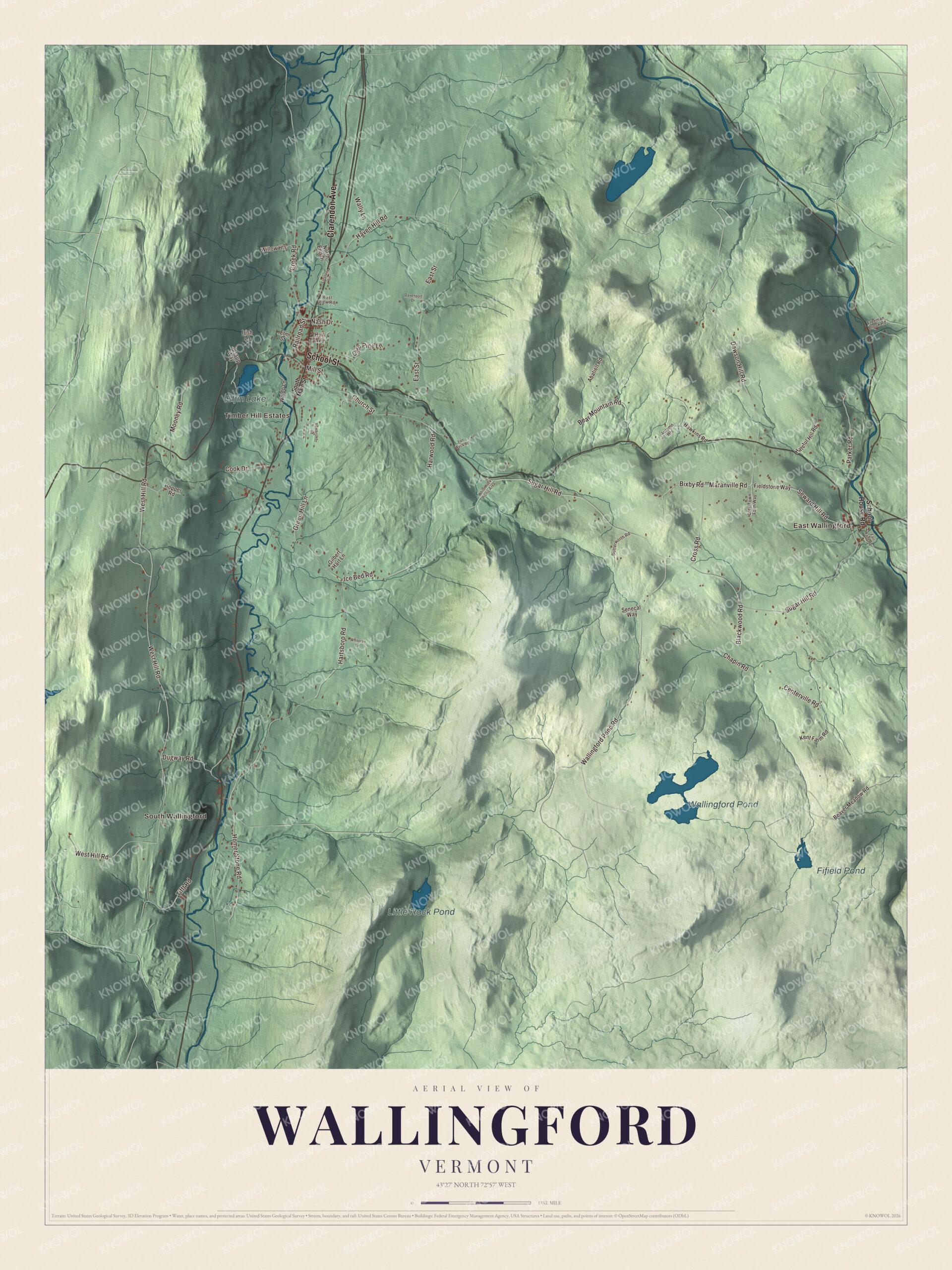
Click to explore a larger preview. The digital watermark does not appear on printed maps.
Names on this map
These names are printed on this map.
Places: East Wallingford, South Wallingford, Timber Hill Estates, Wallingford Pond, Elfin Lake, Little Rock Pond and Fifield Pond.
Streets and roads: School Street, Clarendon Avenue, Seward Hill Road, Maranville Road, Dawson Hill Road, Dugway Road, Wallingford Pond Road, Hartsboro Road, Sugar Hill Road, West Hill Road, Church Street, Centerville Road.
More street names, A to Z
Abatiell Road, Autumn Heights, Bear Mountain Road, Beaver Meadow Road, Bixby Road, Blackwood Road, Butterworth Road, Chapin Road, Cook Drive, Creek Road, Cross Road, Davenport Drive, Earl Wade Road, East Street, Elm Street, Fieldstone Way, Freeman Brook Road, Gilbert Hart Lane, Green Hill Lane, Harwood Road, Hateful Hill Road, Haven Hill Road, Hawkins Road, Homer Stone Road, Hopper Road, Hull Avenue, Ice Bed Road, Irish Lane, Jessup Way, Kent Farm Road, Lidstone Lane, Mill Street, Mooney Road, Nash Drive, North End Drive, Olde Pine Lane, Olde Town Farm Way, Parker Road, Pembroke Road, Railroad Street, School House Road, Senecal Way, South Main Street, Tifft Road, Van Wyck Road, Waldo Lane, Wally Lane, West View Road, White Rock Picnic Area, Whitetail Lane, Willow Heights.
See it on a wall
The Wallingford map as a framed print. Swipe for more.


Farms of the Otter Creek valley
South of the village, Route 7 follows Otter Creek past farms that go back to the first decades of the 1800s. Nine of them, five tied to the wealthy Munson family, make up the Rural Otter Creek Valley Historic District, listed in 1987. Around 1830 a brick house with marble sills and steps went up just north of South Wallingford for General Robinson Hall, a militia officer who married Isaac Munson’s daughter Sarah and helped promote the railroad through the valley. The Hager Farm’s house of about 1800, with its regionally unusual gambrel roof, stands near the site of the first known house in Wallingford, built around 1770. The Fox-Cook Farm dates to the 1790s, and the Hulett Farm’s Federal farmhouse of about 1810 stands about a mile north of Dugway Road.
Matthew Lyon moved here in 1774, farmed and organized a militia company, served in Seth Warner’s regiment in the Revolution and later went to Congress from both Vermont and Kentucky. Daniel Roberts, born here in 1811, was a lawyer active in the abolitionist movement and president of the Vermont Bar Association. Samuel T. Douglass, born in Wallingford in 1814, became a justice of the Michigan Supreme Court. Ella Maria Ballou, born here in 1852 and schooled at Wallingford’s high school, became the official reporter of the Rutland County Court in 1885, the first woman to hold such a post in Vermont and, it’s believed, in the country. The town is also the boyhood home of Paul Harris, who founded Rotary International. Hikers reach the Long Trail, the Appalachian Trail and the Robert T. Stafford White Rocks National Recreation Area from town.
On the map, start in East Wallingford or South Wallingford, then follow School Street, Clarendon Avenue, Seward Hill Road, Maranville Road, Dawson Hill Road and Dugway Road. Wallingford Pond, Elfin Lake, Little Rock Pond and Fifield Pond are printed too. Wallingford dates to 1761.
This map of Wallingford is made for everyone who calls Wallingford home, and it shows the town as it looks today, from School Street to Elfin Lake and Little Rock Pond. Hang it in an office, library or den, or use it to teach children the geography and history of their town. It’s printed on museum quality archival paper. Zoom in on the preview above to explore the details, then click here to get your copy of the Wallingford, Vermont map.

Sources
- Wallingford, Vermont, Wikipedia
- About Wallingford, Town of Wallingford
- Town histories and representatives, W towns, Vermont Legislature
- Wallingford Main Street Historic District, Wikipedia
- Rural Otter Creek Valley Historic District, Wikipedia
- Gen. Robinson Hall House, Wikipedia
- Hager Farm, Wikipedia
- Fox-Cook Farm, Wikipedia
- Hulett Farm, Wikipedia
- Matthew Lyon, Wikipedia
- Daniel Roberts (attorney), Wikipedia
- Samuel T. Douglass, Wikipedia
- Ella Maria Ballou, Wikipedia