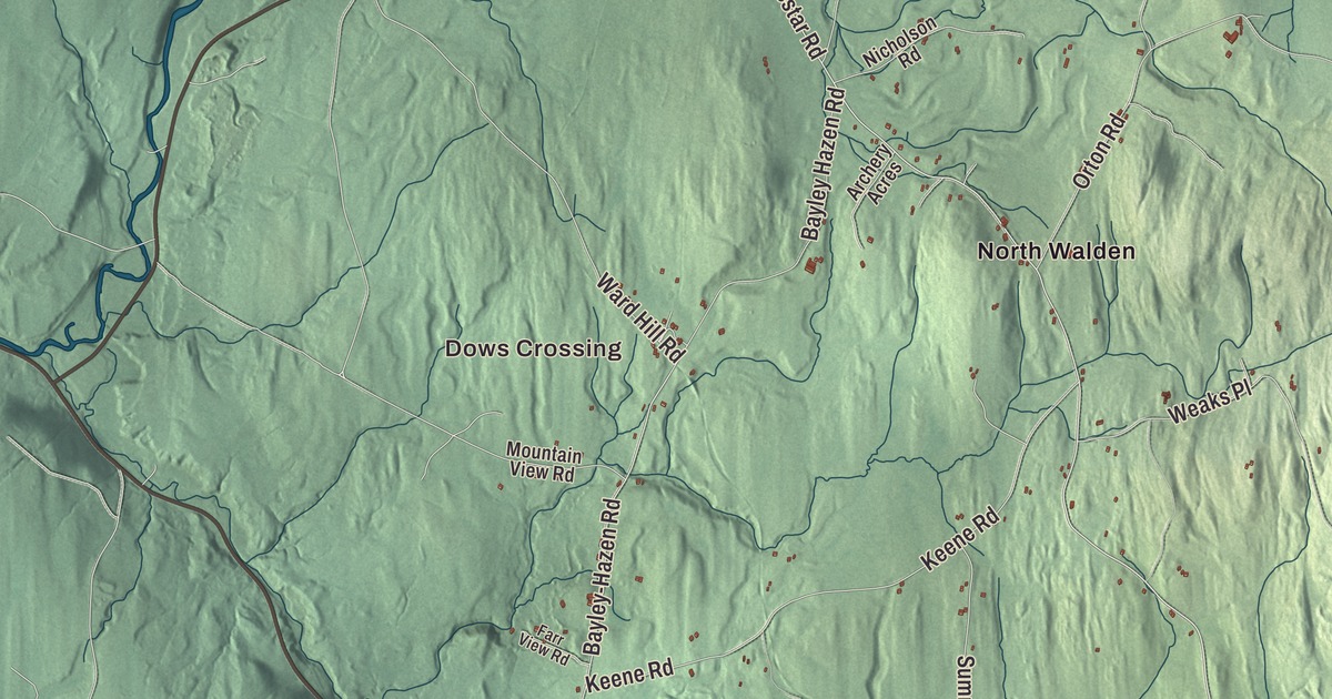
Walden is high country on the height of land in western Caledonia County, where the water on one side runs toward the Connecticut and on the other toward Lake Champlain. This map prints South Walden, Dows Crossing, Taylor Bridge, Goslants Mill and Nevesville, with the Bayley-Hazen Road, Cabot Road, Coles Pond and Lyford Pond.
Walden is a town in Caledonia County, Vermont.
KNOWOL made this map in 2026 from public survey data and gave it the look of an old county atlas, shading the hills from United States Geological Survey elevation data and drawing the roads and town line from the Census Bureau. The town covers 39.0 square miles, and 956 people lived here at the 2020 census. Click here to purchase a print of this map for your wall.
Named at a blockhouse
Walden’s story starts with a road built for war. In 1779, during the Revolution, General Moses Hazen’s troops cut the Bayley-Hazen Military Road north through Peacham, Cabot, Walden and Hardwick toward Hazen’s Notch, and they built a blockhouse in Walden and left a small garrison there into the next year. According to the town’s history, the officer in command was named Walden, and he asked that the town be given his name, which it was. The blockhouse stood for years after. Early settlers lived in it for a time, and it saw the town’s first school, first sermon and first birth. One family named Sabin, with 26 children, once lived within its walls.
Vermont granted Walden on November 6, 1780, and chartered it on August 18, 1781, to Moses Robinson and 64 others. Each grantee had to clear five acres and build a house at least 18 feet square within three years after the war. Nathaniel Perkins brought his family to Walden in 1789, and for three years they were the only family in town. Others followed, mostly from New Hampshire, and most settled near the Hazen road. By 1800 there were 152 people. The town was organized on March 24, 1794, and Perkins became its first representative the next year.
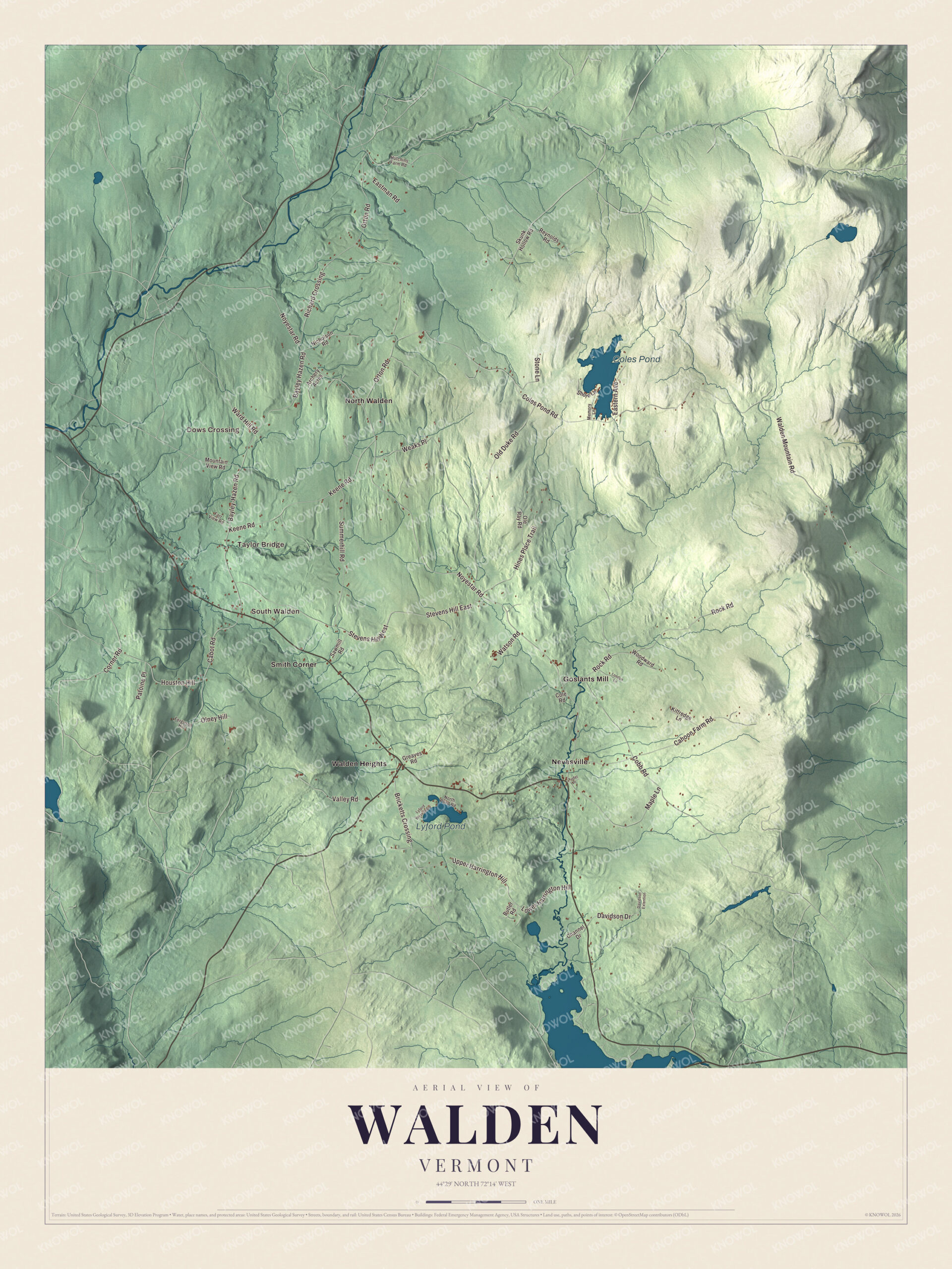
Click to explore a larger preview. The digital watermark does not appear on printed maps.
Names on this map
These names are printed on this map.
Places: Dows Crossing, Taylor Bridge, South Walden, Coles Pond, Lyford Pond, Goslants Mill, Nevesville, North Walden, Smith Corner and Walden Heights.
Streets and roads: Noyestar Road, Stevens Hill West, Cabot Road, Bayley-Hazen Road, Walden Mountain Road, Coles Pond Road, Orton Road, Cobb Road, Old Duke Road, Cahoon Farm Road, Rock Road, Keene Road.
More street names, A to Z
Archery Acres, Audet Place, Bayley Hazen Road, Bricketts Crossing, Butler Road, Channel Drive, Cole Road, Corner Road, Davidson Drive, Davidson Extention, Eastern Avenue, Eastman Road, Farr View Road, Ferguson Hill, Greaves Road, Hines Place Trail, Houston Hill, Hutchins Farm Road, Kittredge Lane, London Lane, Lower Harrington Hill, Lyford West Shore, Maple Lane, Memory Lane, Mountain View Road, Nicholson Road, North Pond Road, Ole Ray Road, Olney Hill, Patoine Place, Reynolds Road, Richard Crossing, Sawmill Road, Shore Lane, Skunk Hollow Road, Stevens Hill East, Stone Lane, Summerhill Road, Upper Harrington Hill, Valley Road, Ward Hill Road, Watson Road, Weaks Place, Woodward Road.
See it on a wall
The Walden map as a framed print. Swipe for more.


Ponds, snow and a meetinghouse
The names on the water go back to the first years. Coles Pond, in the north of town, was named for a hunter from St. Johnsbury called Cole who found it, and Joe’s Brook runs out of it south toward Joe’s Pond in Cabot. Lyford Pond, in the south, is said to have been found by one of Hazen’s soldiers of that name. The brook and Joe’s Pond were named for Captain Joe, a man of the St. Francis tribe who hunted and fished here, kept a cabin in town with his wife Molly, and helped the early settlers find their way through the wilderness. In his old age the Vermont legislature granted him a pension. Winters here were long. As one early resident put it, Walden was a first-rate place for sleigh rides, with “nine months winter and the other three months were very late in the fall.” The highest point, Stannard Mountain near the northern line, rises more than 2,579 feet.
In the 1860s the town’s historian noted that Walden had no village of its own, and today it still has no ZIP code of its own. The Christian Union Society Meetinghouse, built in the mid-1820s on the Bayley-Hazen Road just north of the crossroads of South Walden, was the town’s first church. Four denominations shared it during a religious revival in the Northeast Kingdom known as the Age of Benevolence, and it later became the South Walden United Methodist Church. It was listed on the National Register of Historic Places in 1980. Charles J. Bell, a native of Walden and a Civil War veteran, served as governor of Vermont from 1904 to 1906 and is buried in North Walden Cemetery. Josiah O. Livingston, born here, received the Medal of Honor for personally setting fire to a railroad bridge at Newport Barracks, North Carolina, in 1864, while a small force held back the enemy. George P. Foster, a Walden schoolteacher, rose to brevet brigadier general in the Civil War. Frank Livingston Underwood, born here in 1844, became a banker and built railroads in the West, and Carrie Breck, born in Walden in 1855, wrote the hymn “Face to Face with Christ, My Saviour.”
On the map, start at Dows Crossing, then follow Noyestar Road, Cabot Road, the Bayley-Hazen Road, Walden Mountain Road, Coles Pond Road and Orton Road across town. Then look outward toward Taylor Bridge, South Walden, Goslants Mill and Nevesville. Coles Pond and Lyford Pond are printed too. Walden dates to 1781.
This map of Walden is made for everyone who calls Walden home, and it shows the town as it looks today, from South Walden and the Bayley-Hazen Road to Coles Pond. Hang it in an office, library or den, or use it to teach children the geography and history of their town. It’s printed on museum quality archival paper. Zoom in on the preview above to explore the details, then click here to get your copy of the Walden, Vermont map.

Sources
- Walden, Vermont, Wikipedia
- Town histories and representatives, W towns, Vermont Legislature
- Walden, by James P. Bell, Vermont Historical Gazetteer, volume 1
- Bayley-Hazen Military Road, Wikipedia
- Christian Union Society Meetinghouse, Wikipedia
- Charles J. Bell, Wikipedia
- Josiah O. Livingston, Wikipedia
- George P. Foster, Wikipedia
- Frank Livingston Underwood, Wikipedia
- Carrie Breck, Wikipedia