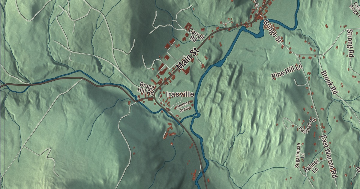
Waitsfield lies in the Mad River Valley, between the main range of the Green Mountains on the west and the Northfield Mountains on the east, with Route 100 running through the valley. This map prints Irasville and Waitsfield Common, Main Street, Common Road, East Road, Joslin Hill Road, North Road and Center Fayston Road, along with the Mad River and Shepard Brook.
Waitsfield is a town in Washington County, Vermont.
KNOWOL made this map in 2026 from public survey data and gave it the look of an old county atlas, with the mountains shaded from United States Geological Survey elevation data and the roads and town line drawn from the Census Bureau. The town covers 26.9 square miles, and 1,844 people lived here at the 2020 census. Click here to purchase a print of this map for your wall.
General Wait’s town
Vermont chartered Waitsfield on February 25, 1782, to the militia generals Benjamin Wait and Roger Enos and their associates, and named it for Wait. He settled here, and the town was organized on March 25, 1794. Wait himself was its first representative, and until Washington County was formed in 1811 the town belonged to Chittenden County. Dr. Simeon Stoddard came with Wait in 1794 and started a farm by the Mad River; part of the barn he built survives at what’s now Lareau Farm on Route 100.
The first town center wasn’t in the valley at all. Waitsfield Common, about a mile from today’s village, was laid out on a hilltop in the 1790s at the meeting of Joslin Hill Road, Common Road, East Road and North Road. Its common was laid out in 1798, the cemetery beside it was in use by 1797, and the town’s first church stood there until the 1870s. The hilltop didn’t suit 19th-century trade, though, and by 1841 the village down by the river had passed it in importance. The Common still keeps seven historic houses, stone walls and open fields that slope away to the west and south.
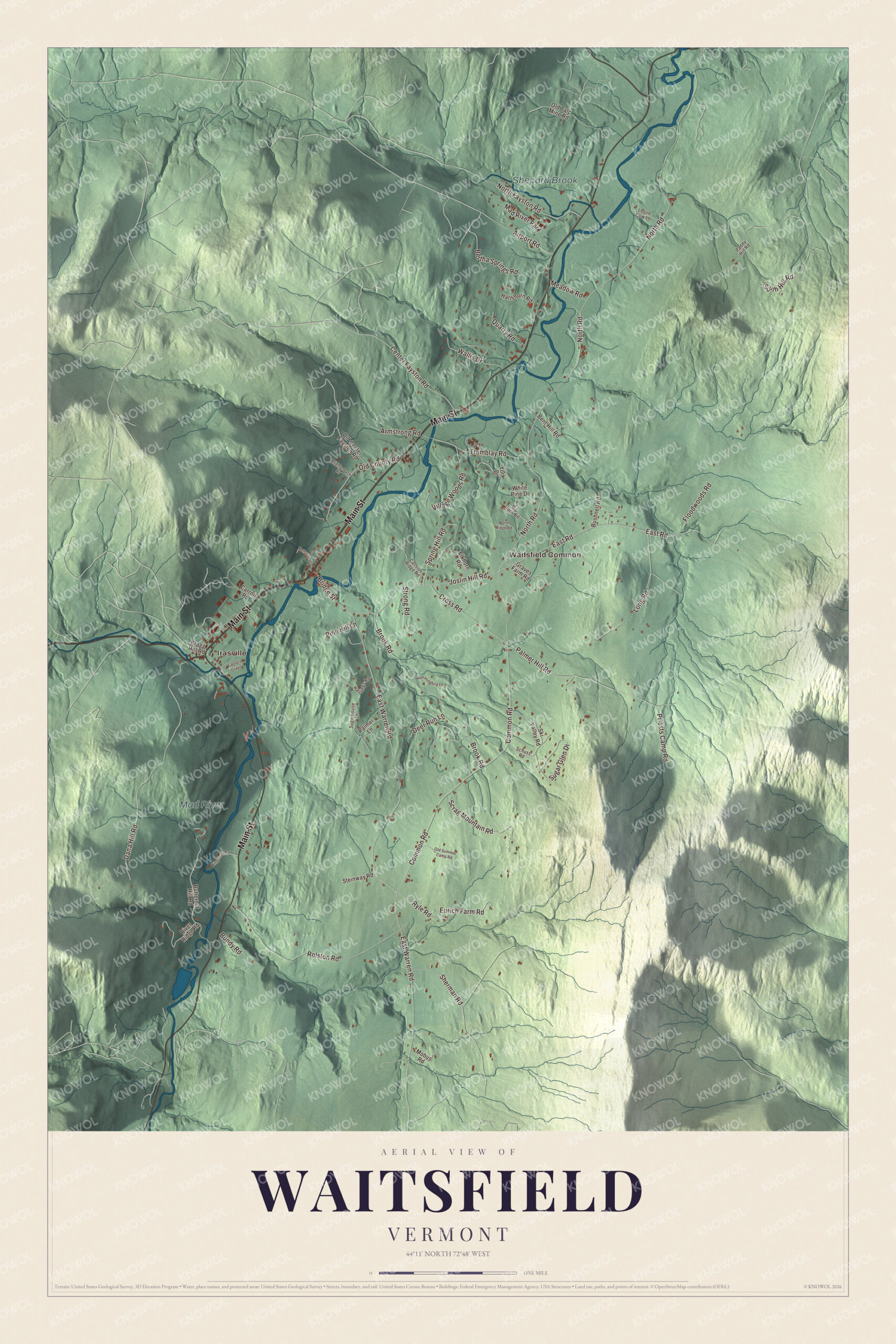
Click to explore a larger preview. The digital watermark does not appear on printed maps.
Names on this map
These names are printed on this map.
Places: Irasville, Waitsfield Common, Mad River, Shepard Brook and Mad River Park.
Streets and roads: Main Street, Common Road, East Road, Joslin Hill Road, North Road, Center Fayston Road, Bridge Street, Palmer Hill Road, East Warren Road, Dana Hill Road, Rolston Road, Brook Road.
More street names, A to Z
Airport Road, Armstrong Road, Bent Hill Road, Bertha Springs Road, Big Rock Road, Bragg Hill Road, Brightenback Lane, Bundy Road, Bushnell Road, Butternut Hill Road, Carroll Road, Cassius Ridge Road, Cross Road, Deer Run Lane, Elkhorn Road, Eurich Farm Road, Fiddlers Green, Floodwoods Road, Graves Farm Road, Hartshorn Road, Hastings Road, Hummingbird Lane, Kingsbury Road, Long Road, Loose Cow Lane, Meadow Road, Mehuron Drive, Mobus Road, North Fayston Road, North Ridge Road, Old Center Fayston Road, Old County Road, Old Summer Camp Road, Old Talc Mine Road, Paddy Hill Road, Palmer Lane, Pine Hill Lane, Priests Camp Road, Quarry Road, River Ridge Road, Ryle Road, Schuss Road, Scrag Mountain Road, Sherman Road, Ski Valley Road, South Hill Road, Spring Hill Road, Steinway Road, Strong Road, Sugar Glen Drive, Sugarhouse Lane, Tremblay Road, Village Woods Road, Wallis Drive, White Pine Drive, York Drive.
See it on a wall
The Waitsfield map as a framed print. Swipe for more.


The village by the river
In 1817 the Richardson family laid out the present village at the crossroads of Bridge Street and today’s Route 100, opening a store and building mills to use the river’s water power. With no railroad nearby, the village never became a manufacturing center, and it remains a well-preserved 19th-century village. It’s been a National Register historic district since 1983, with the Joslin Library at its center. A bridge crossed the Mad River at Bridge Street as early as 1797, and the Great Eddy Covered Bridge that stands there now was built in 1833. It’s one of Vermont’s oldest covered bridges and the state’s longest single-span Burr truss bridge. On North Road, the Pine Brook Covered Bridge of 1872 is one of only two historic king post covered bridges left in the state.
In northern Waitsfield and southern Moretown, about 1,400 acres of river bottomland between North Road and Route 100 make up the Mad River Valley Rural Historic District, farmed since the late 1700s. The Mad River Turnpike opened through the valley in 1807, and by the middle of the 1800s the farmers here were raising cattle and Morgan horses, then turned to butter. South of the village, the Joslin Farm on East Warren Road keeps a twelve-sided round barn, probably built in 1910, that’s now part of an inn. Today the town’s economy is largely supported by two nearby ski resorts, Sugarbush and Mad River Glen. A long-running Christmas commercial for Miller High Life was filmed in Waitsfield in 1976.
Henry Mower Rice, born here in 1816, was a fur trader who became prominent in Minnesota’s statehood and later a United States senator from Minnesota, and his brother Edmund Rice, born here in 1819, represented Minnesota in Congress. Charles W. Waterman, born in Waitsfield in 1861, was a United States senator from Colorado. Grace Potter, of Grace Potter and the Nocturnals, was born in Waitsfield in 1983, and Shaina Taub, the Tony Award-winning composer and lyricist, was born here and graduated from Harwood Union High School. Bill Parker, who invented the modern plasma globe as a student at MIT, keeps a studio in town.
On the map, start at Irasville or Waitsfield Common, then follow Main Street, Common Road, East Road, Joslin Hill Road, North Road and Center Fayston Road. The Mad River and Shepard Brook are printed too. Waitsfield dates to 1782.
This map of Waitsfield is made for everyone who calls Waitsfield home, and it shows the town as it looks today, from Irasville and Main Street to Waitsfield Common and North Road. Hang it in an office, library or den, or use it to teach children the geography and history of their town. It’s printed on museum quality archival paper. Zoom in on the preview above to explore the details, then click here to get your copy of the Waitsfield, Vermont map.

Sources
- Waitsfield, Vermont, Wikipedia
- Town histories and representatives, W towns, Vermont Legislature
- Lareau Farmstead, Wikipedia
- Waitsfield Common Historic District, Wikipedia
- Waitsfield Village Historic District, Wikipedia
- Great Eddy Covered Bridge, Wikipedia
- Pine Brook Covered Bridge, Wikipedia
- Mad River Valley Rural Historic District, Wikipedia
- Joslin Farm, Wikipedia
- Henry M. Rice, Wikipedia
- Edmund Rice (politician), Wikipedia
- Charles W. Waterman, Wikipedia
- Grace Potter, Wikipedia
- Shaina Taub, Wikipedia
- Bill Parker (inventor), Wikipedia