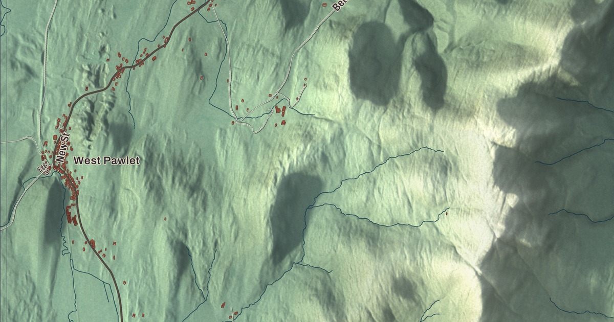
Pawlet lies in the Taconic Mountains on the New York line, and the Mettawee River runs north through the farmland of its valley toward Lake Champlain. This map prints Herrick Brook Road, Danby Pawlet Road, Rupert Hill Road, Waite Hill Road, Betts Bridge Road and Chet Clark Road, with West Pawlet, North Pawlet and Butternut.
Pawlet is a town in Rutland County, Vermont.
KNOWOL made this map in 2026 from public survey data and gave it the look of an old county atlas, shading the hills from United States Geological Survey elevation data and drawing the roads and town line from the Census Bureau. The town covers 42.9 square miles, and 1,424 people lived here at the 2020 census. Click here to purchase a print of this map for your wall.
Named for the river
Benning Wentworth, governor of New Hampshire, granted the charter on August 26, 1761, to Jonathan Willard and 61 other shareholders. The town took its name from the Mettawee River, which the earliest maps of the region called the “Paulet” or “Paulette.” Nine families lived here when Pawlet organized in 1769, and the first town meeting on record, called by the town clerk Simeon Burton on December 22, 1775, shows the town was already settled by then. Zadock Everest and Gideon Adams represented Pawlet in the legislature in 1778. The town belonged to Bennington County until Rutland County was created in 1781. In 1777 Pawlet was a gathering place for Revolutionary forces harrying General John Burgoyne’s army, and many soldiers liked the valley so well that they came straight back to settle once they left the army.
The Mettawee Valley
The Mettawee rises on the southern slopes of Dorset Mountain and runs 47 miles north past Granville, New York, to Lake Champlain. Where the valley opens out at North Rupert it becomes the Pawlet Flats, rich land for hay and corn, and rock-faced Haystack Mountain stands at the valley’s northern end; nearly 5,000 acres of valley land have been conserved with the Vermont Land Trust. The town has two villages. Pawlet, in the center, sits on Route 30 in the Mettawee valley, and West Pawlet lies on the western border along the Indian River, with Route 153 running through it.
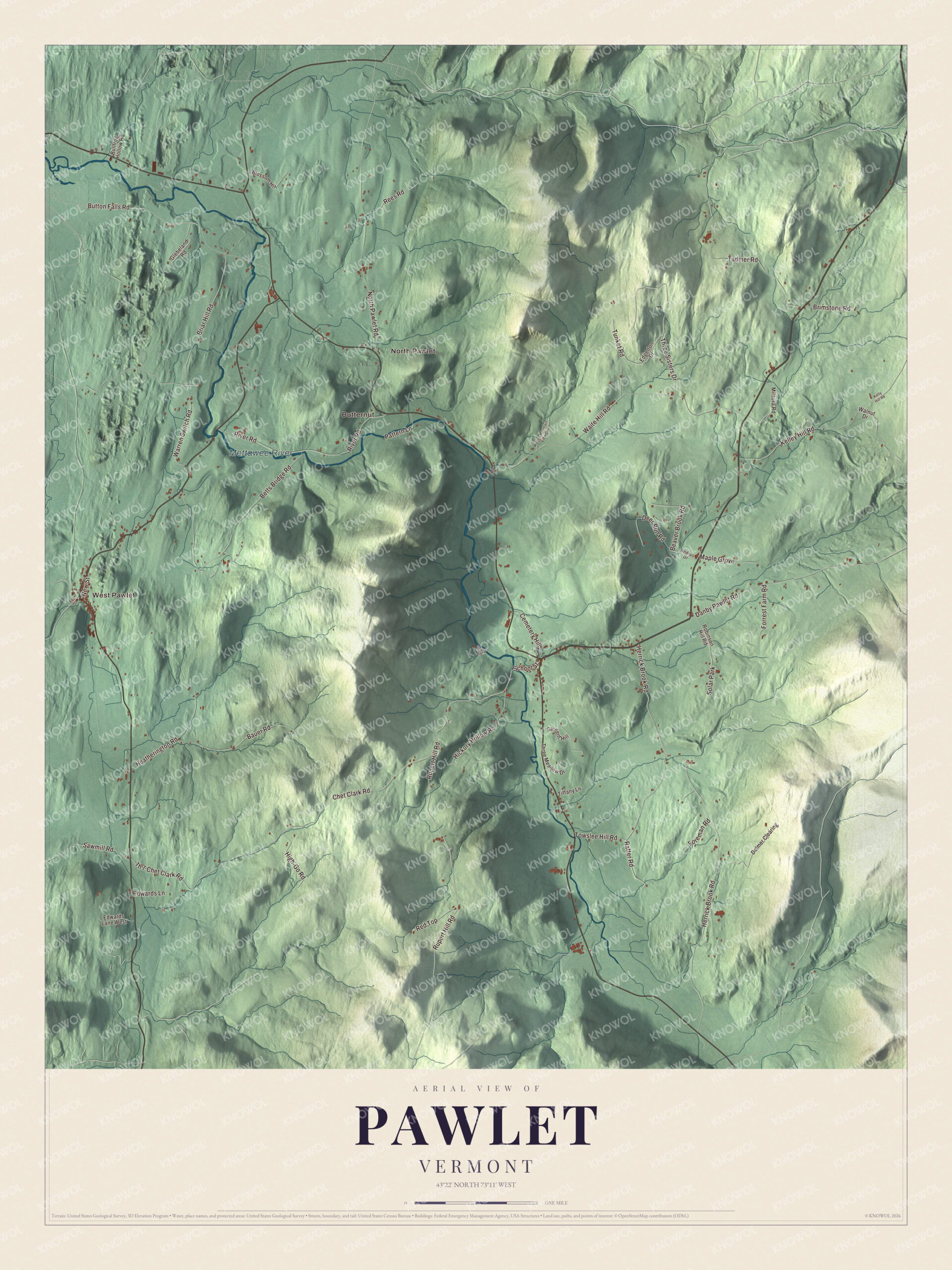
Click to explore a larger preview. The digital watermark does not appear on printed maps.
Names on this map
These names are printed on this map.
Places: West Pawlet, North Pawlet, Butternut, Mettawee River and Solar Park.
Streets and roads: Herrick Brook Road, Danby Pawlet Road, Rupert Hill Road, Waite Hill Road, Betts Bridge Road, Chet Clark Road, Tadmer Road, Warren Switch Road, North Pawlet Road, Button Falls Road, River Road, Three Sisters Drive.
More street names, A to Z
Andrus Drive, Bauer Road, Beaver Brook Road, Blossom Hill, Briar Hill Road, Brimstone Road, Bullfrog Hollow Road, Cemetery Hill, Deer Run Road, Delmer Clearing, Edgerton Drive, Edwards Lane, Edwards Lane West, Egg Street, Foreman Road, Forrest Farm Road, Glebeland Road, Heatherington Road, Hickory Hollow Road, High-Go Road, Kelley Hill Road, Kelly Hill Road, Maple Grove, Mary Lane, Milaura Road, New Street, Pattern Lane, Rafter Road, Red Top, Rees Road, Robinson Hill Road, Sargent Hill, Sawmill Road, School Street, Th 7 Chet Clark Road, Three Meadow Drive, Tiffany Lane, Towslee Hill Road, Tunket Road, Waites Mountain View Co, Walnut Drive.
See it on a wall
The Pawlet map as a framed print. Swipe for more.


Town hall and schoolhouses
Before 1881 the town met in taverns and churches. That year’s town meeting voted to build the Pawlet Town Hall at 122 School Street, on a terrace above Flower Brook near where it joins the Mettawee, and a local businessman, Marcellus Wheeler, gave the land and built most of the ground floor; for years a general store, the post office, a millinery shop and the Grange shared that floor, and the town bought the commercial part in 1943. Upstairs is an auditorium with a stage. Pawlet replaced most of its wooden district schools with brick ones between the 1840s and 1860s, and the Braintree School of 1852, at Warren Switch Road and Route 153, taught children until 1934 and now belongs to the Pawlet Historical Society. North of the village on Route 30, the brick Nathan Allen House of about 1834 is a late Federal farmhouse, one of two nearly identical houses built for Nathan and his brother Elisha.
Pawlet people
Joshua C. Stoddard, born in Pawlet in 1814, was a beekeeper and inventor who patented the steam calliope on October 9, 1855; his first one, fifteen steam whistles played from a pinned cylinder, could reportedly be heard 5 miles away, and Worcester, Massachusetts, banned him from playing it inside the city. He later invented the Stoddard horse-rake, and more than 100,000 were made. Frederick W. Adams, born here in 1786, was a physician who made 140 violins from wood he chose himself in the forests of Vermont and Canada. Aaron Clark grew up in Pawlet from the age of 2 and became mayor of New York City from 1837 to 1839, and the classicist Kirby Flower Smith, born in Pawlet in 1862, taught at Johns Hopkins University for the rest of his life.
On the map, start at West Pawlet, then follow Herrick Brook Road, Danby Pawlet Road, Rupert Hill Road, Waite Hill Road, Betts Bridge Road and Chet Clark Road, and look out toward North Pawlet and Butternut. The Mettawee River is printed. Pawlet dates to 1761.
This map of Pawlet is made for everyone who calls Pawlet home, and it shows the town as it looks today, from West Pawlet to the Mettawee River. Hang it in an office, library or den, or use it to teach children the geography and history of their town. It’s printed on museum quality archival paper. Zoom in on the preview above to explore the details, then click here to get your copy of the Pawlet, Vermont map.

Sources
- Pawlet, Vermont, Wikipedia
- Town histories and representatives, P towns, Vermont Legislature
- Mettawee Valley, Wikipedia
- Mettawee River, Wikipedia
- Pawlet (CDP), Vermont, Wikipedia
- West Pawlet, Vermont, Wikipedia
- Pawlet Town Hall, Wikipedia
- Braintree School, Wikipedia
- Nathan Allen House, Wikipedia
- Joshua C. Stoddard, Wikipedia
- Frederick W. Adams, Wikipedia
- Aaron Clark, Wikipedia
- Kirby Flower Smith, Wikipedia