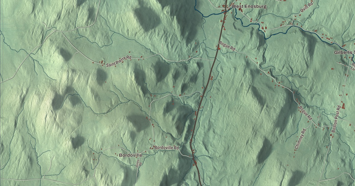
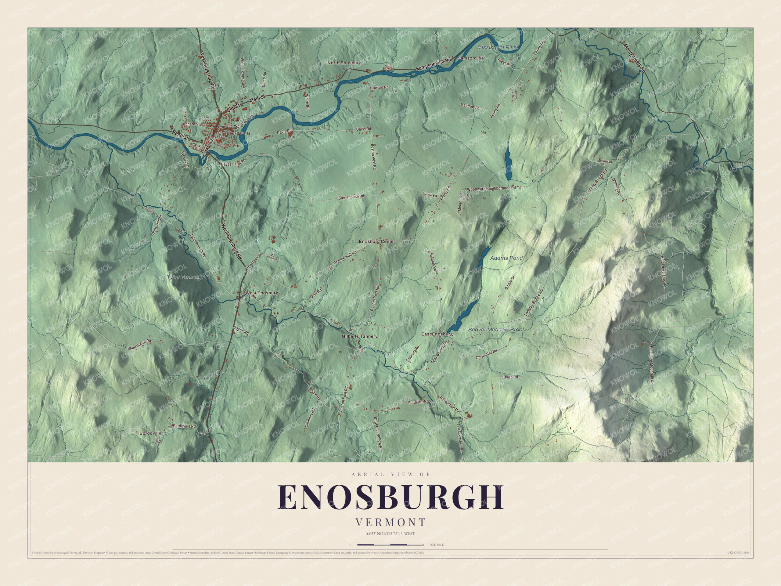
The name is spelled two ways, and both are right: the town is Enosburgh, with an h, and its village is Enosburg Falls, without one. This map prints the whole town around that village, from Bordoville, North Enosburg and East Enosburg to Samsonville, Adams Pond, Beaver Meadow Brook and the Missisquoi River, with roads like Montgomery Road, West Enosburg Road and West Berkshire Road.
Enosburgh is a town in Franklin County, Vermont.
KNOWOL made this map in 2026 from public survey data, styled after the county atlases of the 1800s. Its hills are shaded from United States Geological Survey elevation data, and its roads and town line come from the Census Bureau. Enosburgh covers 48.7 square miles in the eastern part of Franklin County and had 2,810 people at the 2020 census. Click here to purchase a print of this map for your wall.
Named for General Enos
Vermont granted the town on March 12, 1780, and chartered it that May; it organized on March 19, 1798, and William Barber was its first representative in the legislature. The name honors Roger Enos, who was born in Simsbury, Connecticut, in 1729, fought at Bunker Hill in 1775, and later rose to command the Vermont Militia, made a brigadier general in 1781. He was also the father-in-law of Ira Allen, a founder of Vermont.
Besides Enosburg Falls, the town takes in the settlements of Bordoville, East Enosburgh, North Enosburgh, Sampsonville, West Enosburgh and Enosburgh Center, and it’s the commercial center for the eastern half of the county. The Missisquoi River runs through on its way west to Lake Champlain. It’s a river that crosses borders: it rises in Vermont and Quebec, flows about 15 miles through Quebec, and comes back into Vermont at Richford before reaching Missisquoi Bay.
A church and two bridges
At the crossroads of Enosburg Center stands the Enosburg Congregational Memorial Church. The congregation formed in 1811 and built its first meeting house on this spot in 1820, sharing it for a year with the Episcopalians. By 1870 the church had grown too small, and for about $10,000 it was enlarged and given its belfry and steeple in the Italianate style.
Click to explore a larger preview. The digital watermark does not appear on printed maps.
Names on this map
These names are printed on this map.
Places: Bordoville, Enosburg Falls, Samsonville, North Enosburg, Adams Pond, Missisquoi River, Tyler Branch, Beaver Meadow Brook, East Enosburg, Enosburg Center, Gilberts Tannery and West Enosburg.
Streets and roads: West Enosburg Road, West Berkshire Road, Elm Street, Main Street, Sampsonville Road, Montgomery Road, Pearl Street, Nichols Road, Tyler Branch Road, Horseshoe Circle, Woodward Neighborhood Road, Enosburg Mountain Road.
More street names, A to Z
Alan Drive, Birch Lane, Bluto Road, Bogue Road, Bordoville Road, Boston Post Road, Butternut Hollow Road, Camp Road, Carpenter Road, Chimney Road, Courser Road, Daigle Drive, Dairy Ctr Lane, Davis Road, Deming Road, Depot Street, Dickinson Avenue, Duffy Hill Road, East Bakersfield Road, East Sheldon Road, Grange Hall Road, Hayes Farm Road, Hidden Heights Road, Howard Road, Howrigan Road, Jones Road, Laporte Drive, Longley Bridge Road, McGowan Road, Meadow Lane, Melanie Lane, Missisquoi Street, Miss Vermont Drive, Olivia Lane, Orchard Street, Ovitt Road, Perley Road, Pine Lane, Raven Ridge, River Road, Saint Albans Street, Saint Pierre Road, Sand Hill Road, Stonehouse Road, Water Tower Road, Weeds Lane, White Road.
See it on a wall
The Enosburgh map as a framed print. Swipe for more.


In the northeast corner of town, the Hopkins Covered Bridge crosses the Trout River. Brothers Sheldon and Savannah Jewett of Montgomery built it in 1875; they’re credited with all six of Montgomery’s surviving covered bridges. After it was closed as over-stressed in 1993, the bridge was fully restored and reopened in 1999. On the Missisquoi, Bridge 12 carries Boston Post Road across the river on a steel Parker truss built in 1929, after the floods of 1927 washed out more than 1,200 bridges in Vermont, and it’s one of a small number of truss bridges still standing on the river.
Susan Tolman Mills was born in Enosburgh on November 18, 1826. She taught at Mount Holyoke while Emily Dickinson was a student there, taught in Ceylon and Hawaii with her husband, Cyrus Mills, and in 1865 the two bought a girls’ seminary in California that grew into Mills College. She served as the college’s president from 1890 until 1909.
On the map, follow Montgomery Road, West Enosburg Road, West Berkshire Road, Sampsonville Road, Elm Street and Main Street. Bordoville, Enosburg Falls, Samsonville, North Enosburg and East Enosburg are printed too, along with Adams Pond, Beaver Meadow Brook and the Missisquoi River.
This map is made for everyone who calls Enosburgh home, and it shows the town as it looks today, from Bordoville to the river. Use it to teach children the geography and history of the town, or hang it in an office, library or den. KNOWOL created it in 2026, and it’s printed on museum quality archival paper. Zoom in on the preview above to explore the details, then click here to get your copy of the Enosburgh, Vermont map.

Sources