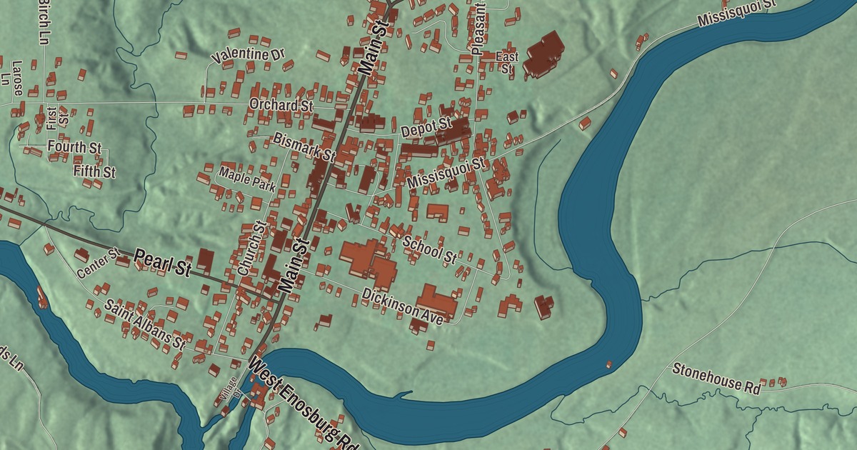
In Enosburg Falls, a horse liniment left its mark all over the village. Dr. B.J. Kendall’s spavin cure was made in a factory where North Main Street meets Sampsonville Road, and his company built the opera house that still holds the town meeting. This map prints the village streets around them: Main Street, Sampsonville Road, Elm Street, Pearl Street, West Enosburg Road and West Berkshire Road.
Enosburg Falls is an incorporated village within the town of Enosburgh, in Franklin County, Vermont.
KNOWOL made this map in 2026 from public survey data, and it’s drawn like a page from an old county atlas. Its relief is shaded from United States Geological Survey elevation data. The streets come from the Census Bureau, and so does the village line: Enosburg Falls has its own incorporated-place boundary. The village covers 3.7 square miles in the northwest corner of Enosburgh, along the Missisquoi River and its falls, and it had 1,356 people at the 2020 census. Click here to purchase a print of this map for your wall.
Kendall’s Spavin Cure
B.J. Kendall grew up in Enosburg Falls and came home in the 1870s to run a drug store. There he worked out a liniment for bone spavin, an ailment that lames horses, and when it sold well around here he raised money from local investors and in 1880 built a factory on North Main Street at its junction with Sampsonville Road. “Kendall’s Spavin Cure” was sold from the east coast to the Rocky Mountains. Kendall and his partners built fine houses in the village, and Kendall also built the Quincy Hotel on Depot Street around 1876, soon after the railroad arrived. The company closed in 1957, as cars took the place of horses.
In 1892 the B.J. Kendall Company built the Enosburg Opera House on Depot Street and gave it to the town, formally, in 1894. It has hosted Enosburg’s town meetings ever since, and in its early days it brought in performers as famous as John Philip Sousa. Its square tower, three and a half stories tall, is a landmark in the village.
Main Street
Vermont Routes 105 and 108 run through the village together as Main Street. The village center sits north of the river, though the village line reaches south of it too. William Billado, who came from Canada and opened a general store here in 1876, put up the brick Billado Block at 371 Main Street around 1885, and it’s the town’s oldest surviving brick commercial building. Nearby, the Perley Block at 366 Main Street opened in early 1909 for the merchant Moses Perley, whose stores across northern Vermont made up one of the largest such businesses in the state. His Shingle and Colonial Revival house of 1903, farther north at 527 Main Street, is now a bed and breakfast.
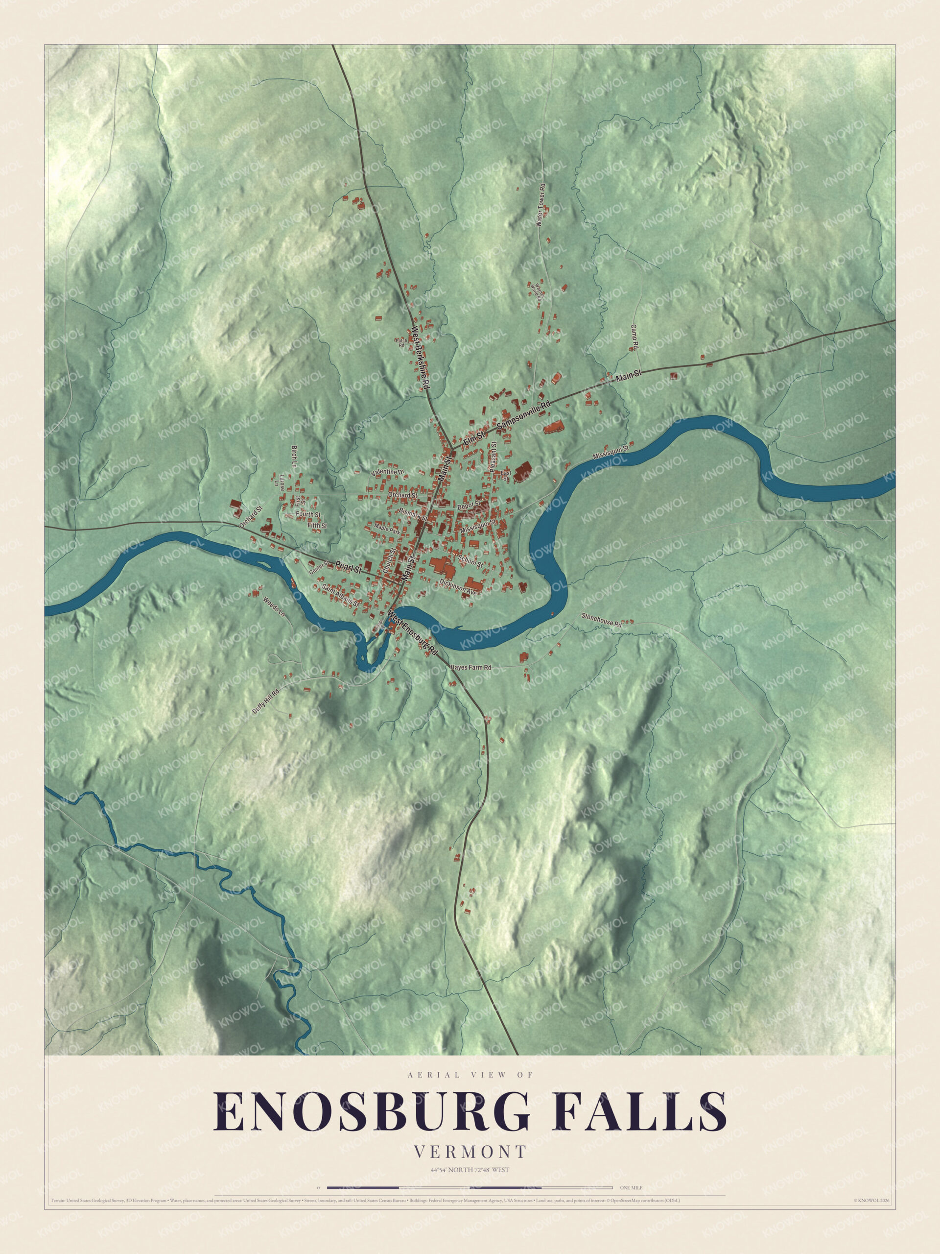
Click to explore a larger preview. The digital watermark does not appear on printed maps.
Names on this map
These names are printed on this map.
Places: Maple Park.
Streets and roads: West Enosburg Road, West Berkshire Road, Main Street, Sampsonville Road, Elm Street, Pearl Street, Water Tower Road, Missisquoi Street, Orchard Street, Duffy Hill Road, Pleasant Street, Hayes Farm Road.
More street names, A to Z
Birch Lane, Bismark Street, Camp Road, Center Street, Church Street, Depot Street, Dickinson Avenue, East Street, Fifth Street, First Street, Fourth Street, Larose Lane, Patch Road, Saint Albans Street, School Street, Stonehouse Road, Valentine Drive, Village Drive, Waynes World Road, Weeds Lane.
See it on a wall
The Enosburg Falls map as a framed print. Swipe for more.


Who came from the Falls
Larry Gardner, born in Enosburg in 1886, went to Enosburg High School and played third base in the major leagues for 17 seasons. He won the World Series four times, three with the Boston Red Sox and one with Cleveland, and he drove in the winning run of the 1912 Series with a sacrifice fly in the tenth inning. Olin M. Jeffords, born in Enosburg Falls in 1890, worked in his father’s drug store before law school and became chief justice of the Vermont Supreme Court; his son was United States Senator Jim Jeffords. And Juan Babauta came from the Northern Mariana Islands to live with a host family on a dairy farm, graduated from Enosburg Falls High School in 1972 as student body president, and later served as governor of the Northern Mariana Islands.
Enosburg Falls is the home of the Vermont Dairy Festival, and it even turns up in Ian Fleming’s James Bond story “For Your Eyes Only,” where Bond goes after a villain in a house outside the village. Main Street, Sampsonville Road, Elm Street, Pearl Street, West Enosburg Road and West Berkshire Road are all printed on the map. The village remains active today, and Main Street is still its center.
This map of Enosburg Falls is made for everyone who calls Enosburg Falls home, and it shows the village as it looks today, from the falls to Sampsonville Road. KNOWOL created it in 2026, and it’s printed on museum quality archival paper. Hang it in an office, library or den, or use it to teach children the geography and history of their village. Zoom in on the preview above to explore the details, then click here to get your copy of the Enosburg Falls, Vermont map.

Sources