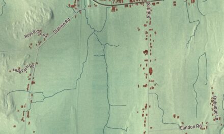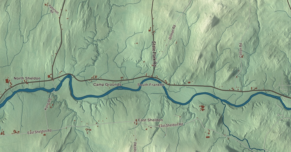
Sheldon straddles the Missisquoi River in the middle of Franklin County, with Route 105 following the water from Sheldon Springs past Sheldon Junction toward Enosburg Falls. This map prints East Sheldon, North Sheldon, Shawville, Sheldon Junction and South Franklin, with State Park Road, Central Street, Pleasant Street and Black Creek.
Sheldon is a town in Franklin County, Vermont.
KNOWOL made this map in 2026 from public survey data and gave it the look of an old county atlas, shading the hills from United States Geological Survey elevation data and drawing the roads and town line from the Census Bureau. The town covers 39.5 square miles, and 2,136 people lived here at the 2020 census. Click here to purchase a print of this map for your wall.
From Hungerford to Sheldon
New Hampshire granted the town on August 18, 1763, as Hungerford, after its charter holder, Samuel Hungerford. It organized in 1791 and took the name Sheldon on November 8, 1792, honoring Colonel Elisha Sheldon of the Revolutionary War. Born in Lyme, Connecticut, Sheldon commanded the 2nd Continental Light Dragoons, known as “Sheldon’s Horse,” at George Washington’s request, and after the war he moved to Franklin County, where he held a grant of land. He died in St. Albans in 1805. Samuel B. Sheldon was the town’s first representative in the legislature, in 1791.
The town lies on both sides of the Missisquoi, a west-flowing river that empties into Lake Champlain, and Black Creek joins it as a tributary in Sheldon and Fairfield. Heber C. Kimball was born in Sheldon on June 14, 1801, the son of a blacksmith who also kept a farm, and the family moved to western New York around 1811. He became one of the original twelve apostles of the early Latter Day Saint movement and served as first counselor to Brigham Young from 1847 until his death in 1868.
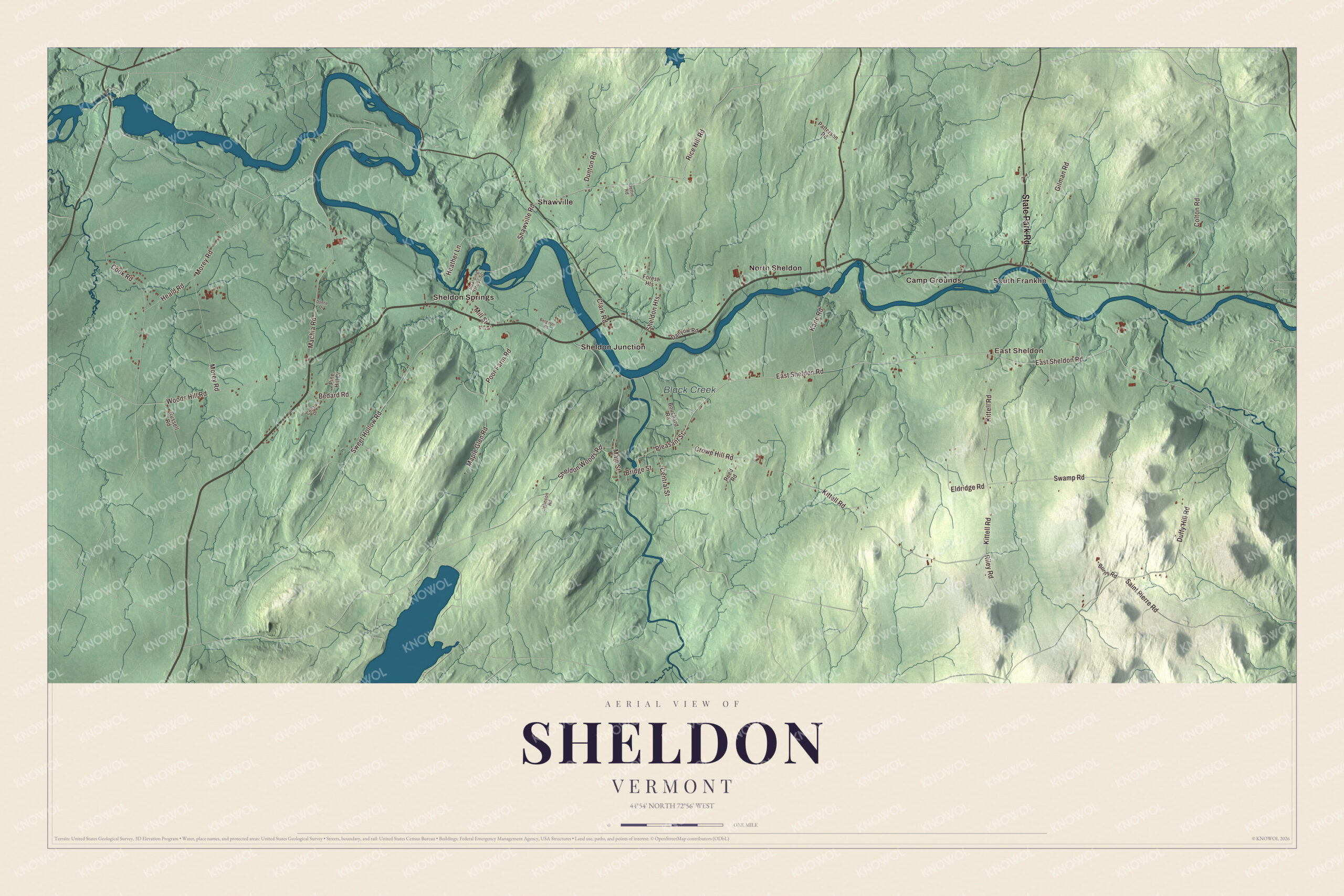
Click to explore a larger preview. The digital watermark does not appear on printed maps.
Names on this map
These names are printed on this map.
Places: South Franklin, East Sheldon, Black Creek, Camp Grounds, North Sheldon, Shawville, Sheldon Junction and Sheldon Springs.
Streets and roads: State Park Road, East Sheldon Road, Central Street, Pleasant Street, Rice Hill Road, Machia Road, Shawville Road, Kittell Road, Duffy Hill Road, Main Street, Sweet Hollow Road, Morey Road.
More street names, A to Z
Bedard Road, Bergeron Road, Boarding House Street, Bouchard Road, Bridge Street, Burns Road, Cedar Drive, Clark Road, Colton Road, Cook Road, Crowe Hill Road, Danyow Road, Donna Drive, Dunton Road, Eldridge Road, Forest Heights, Gilman Road, Heald Road, Heather Lane, Jettie Road, Johnson Road, Kane Road, Maple Glen Road, Mill Street, Patterson Road, Pine Hill Drive, Poor Farm Road, Reed Road, Riley Road, Russell Road, Saint Pierre Road, Sheldon Heights, Sheldon Woods Road, Swamp Road, Woods Hill Road.
See it on a wall
The Sheldon map as a framed print. Swipe for more.


Along the river
Sheldon Springs, in the west part of town along Route 105 south of the river, was once known as Olmstead Falls, and it got a post office in 1871. Just northeast of the village, Bridge 9 carries Shawville Road across the Missisquoi to the hamlet of Shawville, just above Bancroft Falls. Built in 1928 after Vermont’s 1927 floods, it’s a single Parker truss span 250 feet long, one of the few left on the Missisquoi, and some kind of bridge has stood at the site since the late 1700s.
Route 105 crosses the river again just west of Sheldon Junction, on a bridge of four steel girder spans built in 1947 and just over 600 feet long. It was the longest steel girder bridge in Vermont until 1960, and it’s now the state’s oldest surviving four-span girder bridge. At Sheldon Junction, Route 78 heads northwest down the Missisquoi to Highgate Center and Swanton. Route 120 runs north from North Sheldon to Franklin, and State Park Road, Route 236, leaves Route 105 and leads north from South Franklin, in the eastern part of Sheldon, to East Franklin.
On the map, start with South Franklin, then follow State Park Road, East Sheldon Road, Central Street, Pleasant Street, Rice Hill Road and Machia Road across town. Then look outward toward East Sheldon, North Sheldon, Shawville and Sheldon Junction. Black Creek is printed too. Sheldon dates to 1763.
This map of Sheldon is made for everyone who calls Sheldon home, and it shows the town as it looks today, from Sheldon Junction and Shawville to East Sheldon and Black Creek. Hang it in an office, library or den, or use it to teach children the geography and history of their town. It’s printed on museum quality archival paper. Zoom in on the preview above to explore the details, then click here to get your copy of the Sheldon, Vermont map.

Sources
- Sheldon, Vermont, Wikipedia
- Town histories and representatives, S towns, Vermont Legislature
- Elisha Sheldon, Wikipedia
- Missisquoi River, Wikipedia
- Heber C. Kimball, Wikipedia
- Sheldon Springs, Vermont, Wikipedia
- Bridge 9 (Sheldon, Vermont), Wikipedia
- Bridge Number VT105-10, Wikipedia
- Vermont Route 105, Wikipedia